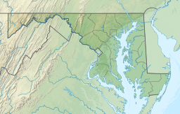
Garrett County is the westernmost county of the U.S. state of Maryland completely within the Appalachian Mountains. As of the 2020 census, the population was 28,806, making it the third-least populous county in Maryland. Its county seat is Oakland. The county was named for John Work Garrett (1820–1884), president of the Baltimore and Ohio Railroad. Created from Allegany County in 1872, it was the last county to be formed in the state.

The National Road was the first major improved highway in the United States built by the federal government. Built between 1811 and 1837, the 620-mile (1,000 km) road connected the Potomac and Ohio Rivers and was a main transport path to the West for thousands of settlers. When improved in the 1830s, it became the second U.S. road surfaced with the macadam process pioneered by Scotsman John Loudon McAdam.

The Kankakee River is a tributary of the Illinois River, approximately 133 miles (214 km) long, in the Central Corn Belt Plains of northwestern Indiana and northeastern Illinois in the United States. At one time, the river drained one of the largest wetlands in North America and furnished a significant portage between the Great Lakes and the Mississippi River. Significantly altered from its original channel, it flows through a primarily rural farming region of reclaimed cropland, south of Lake Michigan.

The Hennepin Canal State Trail, also just called the Hennepin Canal, is an abandoned waterway in northwest Illinois, between the Mississippi River at Rock Island and the Illinois River near Hennepin. The entire canal is listed on the National Register of Historic Places.

Poquessing Creek is a 10.3-mile-long (16.6 km) creek, a right tributary of the Delaware River, that forms the boundary between Philadelphia and Bensalem Township, which borders it to the northeast along the Delaware. It has defined this boundary between Bucks and Philadelphia counties since 1682.

Split Rock Creek State Park is a state park of Minnesota, USA, located in Ihlen, or just south of Pipestone.

The Casselman River is a 56.5-mile-long (90.9 km) tributary of the Youghiogheny River in western Maryland and Pennsylvania in the United States. The Casselman River drains an area of 576 square miles.

Black Moshannon State Park is a 3,480-acre (1,410 ha) Pennsylvania state park in Rush Township, Centre County, Pennsylvania, United States. It surrounds Black Moshannon Lake, formed by a dam on Black Moshannon Creek, which has given its name to the lake and park. The park is just west of the Allegheny Front, 9 miles (14 km) east of Philipsburg on Pennsylvania Route 504, and is largely surrounded by Moshannon State Forest. A bog in the park provides a habitat for diverse wildlife not common in other areas of the state, such as carnivorous plants, orchids, and species normally found farther north. As home to the "largest reconstituted bog in Pennsylvania", it was chosen by the Pennsylvania Department of Conservation and Natural Resources for its "25 Must-see Pennsylvania State Parks" list.

Kooser State Park is a 250-acre (101 ha) Pennsylvania state park in Jefferson Township, Somerset County, Pennsylvania, in the United States. The park, which borders Forbes State Forest, was built in the 1930s by the Civilian Conservation Corps, who also built the 4-acre (1.6 ha) Kooser Lake by damming Kooser Run. Kooser State Park is on Pennsylvania Route 31 a one-hour drive from Pittsburgh. The park is surrounded by Forbes State Forest.

Pennsylvania Route 669 (PA 669) is a 5.82-mile-long (9.37 km) state highway located in Somerset County in Pennsylvania. The southern terminus is at the Maryland state line in Elk Lick Township, where Maryland Route 669 and Springs Road cross the state line from U.S. Route 40 Alternate. The route heads along Springs Road and Ord Street through its rural and residential alignment. The northern terminus is at the intersection with US 219 in the borough of Salisbury. The route was designated in 1963, and a renumbered MD 417 was soon matched up over the state line in Maryland.

Maryland Route 495 is a state highway in the U.S. state of Maryland. Known for most of its length as Bittinger Road, the state highway runs 23.02 miles (37.05 km) from MD 135 in Altamont north to U.S. Route 40 Alternate in Grantsville. MD 495 passes through rural areas of central Garrett County, connecting Bittinger with the northern and southern parts of the county. The state highway also provides an alternate route to US 219 between Interstate 68 (I-68) and resorts around Deep Creek Lake. MD 495 was constructed from both ends starting in the mid-1930s. By the late 1940s, the state highway was complete except for a 5 miles (8.0 km) gap south of Bittinger; this gap was filled in the mid-1950s. The southern terminus of MD 495 was extended to Altamont in 1956.

The Casselman Bridge is a historic transportation structure on the Casselman River, located immediately east of Grantsville in Garrett County, Maryland. The bridge was built in 1813-1814 as part of the National Road. Historic markers posted at each end read:
Erected 1813 by David Shriver Jr.,
Sup't of the "Cumberland Road". This 80 foot span
was the largest stone arch in America
at the time. It was continuously
used from 1813 to 1933.

U.S. Route 40 Alternate is the U.S. Highway designation for a former segment of U.S. Route 40 (US 40) through Garrett and Allegany counties in Maryland. The highway begins at US 40 near exit 14 on Interstate 68 (I-68) and runs 31.80 miles (51.18 km) eastward to Cumberland, where it ends at exit 44 on I-68. Alt US 40 is maintained by the Maryland State Highway Administration (MDSHA).

Savage River State Forest is located in the north and northeastern part of Garrett County, in the U.S. state of Maryland. The state forest has many waterways, including Savage River Reservoir, which was built in 1952 by the U.S. Army. The dam was built as an emergency water supply for Washington, D.C. Savage River State Forest is known for its hunting, fishing, camping, and hiking trails.

Stanton's Mill is a historic grist mill complex located at Grantsville, Garrett County, Maryland, consisting of five interrelated buildings and structures. The Stanton's Mill building dates from about 1797. It is two stories and constructed of heavy timber frame with a gable roof; an addition was constructed in 1890. The complex includes a stone-faced, mid-19th-century timber crib dam and raceway, natural earthen tailrace, and a small, single-span stone arch bridge, dating to 1813, constructed as part of the National Road. Also on the property is a frame storage building, constructed about 1900.

Savage Mountain is an anticline extending from Bedford County, Pennsylvania southwest into Western Maryland. It is the western side of the Ridge-and-Valley Appalachians, and the eastern portion of the ridge forms the border of Garrett and Allegany Counties of Maryland.
The Devils River is a small 15.8-mile-long (25.4 km) river in the state of Wisconsin in the United States. The Devils River flows primarily through Brown and Manitowoc counties and joins with the Neshota River to form the West Twin River. It is part of the 176-square-mile (460 km2) West Twin River watershed.

Trail Creek is a 7.3-mile-long (11.7 km) north- by northwest-flowing stream whose main stem begins at the confluence of the West Branch Trail Creek and the East Branch Trail Creek in LaPorte County, Indiana, United States. Its mouth is a Lake Michigan harbor and marina adjacent to Washington Park in Michigan City, Indiana.

Brule Glacial Spillway is a Wisconsin Department of Natural Resources-designated State Natural Area that encompasses the valley of the upper reaches of the Bois Brule River. This valley was carved by the outlet of Glacial Lake Duluth, which occupied what is now the western portion of Lake Superior, during the retreat of the Superior lobe of Wisconsin glaciation. This outlet flowed southwestward through the valley, to what is now the St. Croix River. As the glacier melted, and the level of Lake Superior dropped, the direction of flow shifted to its present northeastward course, towards Lake Superior. A high point in a vast bog near Solon Springs marks the Saint Lawrence River Divide between the watersheds of the Gulf of Mexico and the Atlantic Ocean. This divide was used for thousands of years, by Native Americans, European explorers, fur traders, and settlers as a portage between the two watersheds.