Background
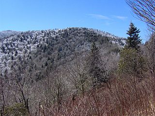
While the northern ridge is 35 miles (56 km) long, it rarely reaches a width of more than 3 miles (4.8 km) or 4 miles (6.4 km). Little River cuts a large gap in the middle of the mountain (near Walland), dividing it into eastern and western sections. The highest point on the western section is 2,650 ft (808 m) at a knob known as Look Rock. The highest point on the eastern section, known as The Three Sisters, rises to 2,843 ft (867 m), and is visible from nearby Maryville, Tennessee.
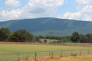
The southern ridge is about 15 miles (24 km) long and sits entirely within the Cherokee National Forest. The Ocoee River passes along its southern base, along with the Ocoee Scenic Byway, part of U.S. Route 64. The mountain is separated from Oswald Dome to the north by a saddle, although both are technically part of the same ridge. The highest point on this section is 2,618 feet (798 m). [1] The mountain is accessible from US 64 via a paved forest service road, which contains multiple overlooks. A campground with an artificial lake, operated by the Forest Service, is located atop the mountain. Benton Falls is a waterfall on the eastern escarpment of the mountain and is accessible via a trail that begins at the campground.
Name
Chilhowee Mountain derives its name from Chilhowee, a Cherokee village in the 18th century. The etymology of the Cherokee name is unclear, [2] and may be derived from the Muscogean name Chalahume, an earlier Creek name for the village. In English it has also been written "Chilhoe".
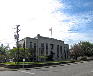
Polk County is a county located in the southeastern corner of the U.S. state of Tennessee. As of the 2020 United States census, its population was 17,544. Its county seat is Benton. The county was created on November 28, 1839, from parts of Bradley and McMinn counties, after final removal of most Cherokee from the region that year. The county was named after then-governor James K. Polk. Polk County is included in the Cleveland, Tennessee Metropolitan Area Statistical Area, which is also included in the Chattanooga–Cleveland–Dalton, TN–GA–AL Combined Statistical Area.

The Little Tennessee River is a 135-mile (217 km) tributary of the Tennessee River that flows through the Blue Ridge Mountains from Georgia, into North Carolina, and then into Tennessee, in the southeastern United States. It drains portions of three national forests— Chattahoochee, Nantahala, and Cherokee— and provides the southwestern boundary of the Great Smoky Mountains National Park.

The Great Smoky Mountains are a mountain range rising along the Tennessee–North Carolina border in the southeastern United States. They are a subrange of the Appalachian Mountains and form part of the Blue Ridge Physiographic Province. The range is sometimes called the Smoky Mountains, and the name is commonly shortened to the Smokies. The Smokies are best known as the home of the Great Smoky Mountains National Park, which protects most of the range. The park was established in 1934 and, with over 11 million visits per year, is the most visited national park in the United States.

The Cherokee National Forest is a United States National Forest located in the U.S. states of Tennessee and North Carolina that was created on June 14, 1920. The forest is maintained and managed by the United States Forest Service. It encompasses an estimated area of 655,598 acres (2,653.11 km2).

Clingmans Dome is a mountain in the Great Smoky Mountains of Tennessee and North Carolina in the Southeastern United States. Its name in Cherokee is Kuwahi or Kuwohi, meaning "mulberry place."

The Unicoi Mountains are a mountain range rising along the border between Tennessee and North Carolina in the southeastern United States. They are part of the Blue Ridge Mountain Province of the Southern Appalachian Mountains. The Unicois are located immediately south of the Great Smoky Mountains and immediately west of the Cheoah Mountains. Most of the range is protected as a national forest, namely the Cherokee National Forest on the Tennessee side and the Nantahala National Forest on the North Carolina side— although some parts have been designated as wilderness areas and are thus more strictly regulated.

The Foothills Parkway is a national parkway which traverses the foothills of the northern Great Smoky Mountains in East Tennessee, located in the southeastern United States. The 72.1-mile (114 km) parkway will connect U.S. Route 129 along the Little Tennessee River in the west with Interstate 40 (I-40) along the Pigeon River in the east.

Frozen Head State Park and Natural Area is a state park in Morgan County, Tennessee, in the southeastern United States. The park, situated in the Crab Orchard Mountains between the city of Wartburg and the community of Petros, contains some of the highest mountains in Tennessee west of the Blue Ridge Mountains.

Western North Carolina is the region of North Carolina which includes the Appalachian Mountains; it is often known geographically as the state's Mountain Region. It contains the highest mountains in the Eastern United States, with 125 peaks rising to over 5,000 feet in elevation. Mount Mitchell at 6,684 feet, is the highest peak of the Appalachian Mountains and mainland eastern North America. The population of the region, as measured by the 2010 U.S. Census, is 1,473,241, which is approximately 15% of North Carolina's total population.
Old Black is a mountain in the Great Smoky Mountains, located in the Southeastern United States. While often overshadowed by Mount Guyot, its higher neighbor to the south, Old Black is the 5th-highest mountain in Tennessee and the 7th-highest in the Great Smoky Mountains National Park. The Appalachian Trail crosses its western slope, connecting the Cosby-area trail system with the heart of the Eastern Smokies.

Mount Guyot is a mountain in the Great Smoky Mountains, located in the southeastern United States. At 6,621 feet (2,018 m) in elevation, Guyot is the fourth-highest summit in the Eastern U.S., and the second-highest in the Great Smoky Mountains National Park. While the mountain is remote, the Appalachian Trail crosses its south slope, passing to within 1,000 feet (300 m) of the summit.
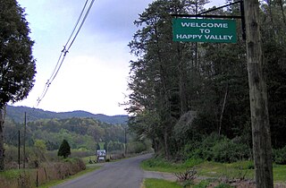
Happy Valley is an unincorporated community in Blount County, Tennessee, near the Great Smoky Mountains National Park. Although it is not a census-designated place, the ZIP Code Tabulation Area for the ZIP Code (37878) that serves Happy Valley had a population of 529 as of the 2000 U.S. Census.

Tricorner Knob is a mountain in the Great Smoky Mountains, located in the Southeastern United States. It has an elevation of 6,120 feet, with 160 feet of clean prominence. The Appalachian and Balsam Mountain trails intersect near the mountain's summit, making Tricorner Knob the great crossroads of the Eastern Smokies.

Mount Chapman is a mountain in the Great Smoky Mountains, located in the Southeastern United States. It has an elevation of 6,417 feet above sea level. While the mountain is located deep within the Great Smokies, the Appalachian Trail crosses its eastern slope, coming to within 200 feet (61 m) of the summit. Mount Chapman is among the 10 highest mountains in the Appalachian range, if subpeaks are not included.

Walland is an unincorporated community and census-designated place (CDP) in Blount County, Tennessee. Its population was 281 as of the 2020 census. Walland is the site of a post office and is the place name associated with zip code 37886, which covers an area beyond the Walland community.

The Snake Den Ridge Trail is an American hiking trail in the Great Smoky Mountains National Park of Cocke County, Tennessee. Winding its way up the backbone-like crest of Snake Den Ridge, the trail connects the Cosby Campground to the Appalachian Trail and provides the quickest access to the high peaks of the Eastern Smokies. The trail passes through three forest types— a mixed deciduous forest at its lower elevations, a substantial stand of heath bald on the more narrow sections of the ridge crest, and an old growth northern-style coniferous forest at its higher elevations.

The Ocoee Scenic Byway is a 26-mile (42 km) National Forest Scenic Byway and Tennessee Scenic Byway that traverses through the Cherokee National Forest in East Tennessee. It is part of both U.S. Route 64 and U.S. Route 74 and features the Ocoee Whitewater Center and scenic bluffs along Ocoee River and Gorge.
Oswald Dome, also known as Bean Mountain, is a mountain located in the Cherokee National Forest in Polk County, Tennessee. It is part of the Blue Ridge Mountains, which is part of the larger Appalachian Mountains.
Little Frog Mountain is a mountain located in southeastern Tennessee in the United States. It is located in the Blue Ridge province of the Appalachian Mountains, and has an elevation of 3,337 feet (1,017 m).


