Edmonton, Kentucky

Last updated

Edmonton, Kentucky
Metcalfe County Kentucky courthouse.jpg
Metcalfe County courthouse in Edmonton
Metcalfe County Kentucky Incorporated and Unincorporated areas Edmonton Highlighted 2123968.svg
Location in Metcalfe County, Kentucky
Coordinates: 36°58′49″N85°37′13″W / 36.98028°N 85.62028°W / 36.98028; -85.62028
Country United States
State Kentucky
County Metcalfe
Area
[1]
  Total3.84 sq mi (9.96 km2)
  Land3.81 sq mi (9.86 km2)
  Water0.04 sq mi (0.10 km2)
Elevation
827 ft (252 m)
Population
 (2020) [2]
  Total1,671
  Estimate 
(2022) [3]
1,689
  Density438.93/sq mi (169.47/km2)
Time zone UTC-6 (Central (CST))
  Summer (DST) UTC-5 (CDT)
ZIP code
42129
Area code(s) 270 & 364
FIPS code 21-23968
GNIS feature ID0491570
Website cityofedmontonky.com

Edmonton is a home rule-class city [4] in and the county seat of Metcalfe County, Kentucky, United States. [5] It is part of the Glasgow Micropolitan Statistical Area. The population was 1,671 at the 2020 census. [2]

Contents

History

The area was first surveyed in 1800. The city was established by the Kentucky legislature as a trading post in 1818 and was named the county seat in 1860. The post office first opened on February 18, 1830, and was named (though incorrectly spelled) for Edmund Rogers. [6]

Geography

Edmonton is located in central Metcalfe County at 36°58′49″N85°37′13″W / 36.98028°N 85.62028°W / 36.98028; -85.62028 (36.980191, -85.620338). [7] It is 18 miles (29 km) east of Glasgow, 21 miles (34 km) north of Tompkinsville, 21 miles (34 km) southwest of Columbia, and 31 miles (50 km) south of Greensburg. U.S. Route 68 and Kentucky Route 80 pass through the center of Edmonton, and the Cumberland Parkway runs along the city's northern border, with access from exits 27 and 29 (US 68).

According to the United States Census Bureau, the city has a total area of 3.85 square miles (9.97 km2), of which 0.04 square miles (0.10 km2), or 0.99%, are water. [1] The South Fork of the Little Barren River passes through the city, east and north of the center. It is a north-flowing tributary of the Little Barren River, part of the Green River watershed.

Climate

The climate in this area is characterized by hot, humid summers and generally mild to cool winters. According to the Köppen Climate Classification system, Edmonton has a humid subtropical climate, abbreviated "Cfa" on climate maps. [8]

Demographics

Historical population
CensusPop.Note
1860 70
1870 146108.6%
1880 21547.3%
1920 284
1930 237−16.5%
1940 40370.0%
1950 51928.8%
1960 74944.3%
1970 95827.9%
1980 1,44851.1%
1990 1,4772.0%
2000 1,5867.4%
2010 1,5950.6%
2020 1,6714.8%
2022 (est.)1,689 [9] 1.1%
U.S. Decennial Census [10]

As of the census [11] of 2000, there were 1,586 people, 686 households, and 410 families residing in the city. The population density was 557.7 inhabitants per square mile (215.3/km2). There were 776 housing units at an average density of 272.9 per square mile (105.4/km2). The racial makeup of the city was 96.72% White, 1.95% African American, 0.06% Native American, 0.13% Asian, 0.25% from other races, and 0.88% from two or more races. Hispanic or Latino of any race were 0.50% of the population.

There were 686 households, out of which 28.7% had children under the age of 18 living with them, 39.1% were married couples living together, 17.5% had a female householder with no husband present, and 40.1% were non-families. 37.2% of all households were made up of individuals, and 20.7% had someone living alone who was 65 years of age or older. The average household size was 2.13 and the average family size was 2.77.

In the city, the population was spread out, with 22.6% under the age of 18, 8.3% from 18 to 24, 22.6% from 25 to 44, 21.6% from 45 to 64, and 24.8% who were 65 years of age or older. The median age was 42 years. For every 100 females, there were 73.9 males. For every 100 females age 18 and over, there were 69.8 males.

The median income for a household in the city was $18,807, and the median income for a family was $27,763. Males had a median income of $24,671 versus $18,646 for females. The per capita income for the city was $14,384. About 29.0% of families and 31.8% of the population were below the poverty line, including 43.5% of those under age 18 and 25.6% of those age 65 or over.

Education

Edmonton has a lending library, the Metcalfe County Public Library. [12]

Notable people

Related Research Articles

<span class="mw-page-title-main">Metcalfe County, Kentucky</span> County in Kentucky, United States

Metcalfe County is a county located in the U.S. state of Kentucky. Its county seat and only municipality is Edmonton. The county was founded in May 1860 and named for Thomas Metcalfe, Governor of Kentucky from 1828 to 1832. Metcalfe County is part of the Glasgow, KY Micropolitan Statistical Area, which is also included in the Bowling Green-Glasgow, KY Combined Statistical Area.

<span class="mw-page-title-main">Carrollton, Kentucky</span> City in Kentucky, United States

Carrollton is a home rule-class city in—and the county seat of—Carroll County, Kentucky, United States, at the confluence of the Ohio and Kentucky rivers. The population was 3,938 at the 2010 census.

<span class="mw-page-title-main">Liberty, Kentucky</span> City in Kentucky, United States

Liberty is a home rule-class city in Casey County, Kentucky, in the United States. It is the seat of its county. Its population was 2,168 at the 2010 U.S. census.

<span class="mw-page-title-main">Albany, Kentucky</span> City in Kentucky, United States

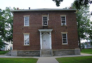
Albany is a home rule-class city in Clinton County, Kentucky, in the United States. The population was 2,033 at the 2010 census. It is the county seat of Clinton County. It is located on U.S. Route 127, about 6 miles (10 km) north of the Tennessee border.

<span class="mw-page-title-main">Dry Ridge, Kentucky</span> City in Kentucky, United States

Dry Ridge is a home rule-class city in Grant County, Kentucky, in the United States. The population was 2,191 at the 2010 census, up from 1,995 at the 2000 census. From around 1910 to 1960, the city's economy was dominated by business related to its mineral water wells, purported to have healing properties.

<span class="mw-page-title-main">Greensburg, Kentucky</span> City in Kentucky, United States

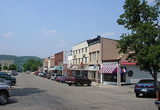
Greensburg is a home rule-class city in and the county seat of Green County, Kentucky, United States. The population was 2,163 at the 2010 census, down from 2,396 at the 2000 census.

<span class="mw-page-title-main">Sonora, Kentucky</span> City in Kentucky, United States

Sonora is a home rule-class city in Hardin County, Kentucky, United States. The population was 513 at the 2010 census, up from 350 at the 2000 census. It is included in the Elizabethtown, Kentucky Metropolitan Statistical Area.

<span class="mw-page-title-main">Creekside, Kentucky</span> City in Kentucky, United States

Creekside is a home rule-class city in Jefferson County, Kentucky, United States. The population was 305 at the 2010 census.

Fairmeade is a neighborhood of St. Matthews, Kentucky. The population was 264 at the 2000 census.

<span class="mw-page-title-main">Forest Hills, Kentucky</span> City in Kentucky, United States

Forest Hills is a home rule-class city in Jefferson County, Kentucky, United States. It was formally incorporated by the state assembly in 1959. The population was 444 at the 2010 census.

<span class="mw-page-title-main">Manor Creek, Kentucky</span> City in Kentucky, United States

Manor Creek is a home rule-class city in Jefferson County, Kentucky, United States. The population was 140 at the 2010 census, down from 221 at the 2000 census.

Plymouth Village is a neighborhood of St. Matthews, Kentucky a city in Jefferson County, Kentucky, United States. The population was 201 at the 2000 census.

<span class="mw-page-title-main">Poplar Hills, Kentucky</span> City in Kentucky, United States

Poplar Hills is a home rule-class city in Jefferson County, Kentucky, United States. It is a part of the Louisville Metro government, but operates as a city under the Mayor to Commissioner form of government. Per the 2020 census, the population was 380, but the city administration has made several annexation ordinances that have passed and awaits updated information. The current city population is estimated to be 2380. It currently has the highest population density for any city in Kentucky.

Whipps Millgate is a former city in Jefferson County, Kentucky, United States. The population was 415 at the 2000 census. The City of Whipps Millgate was incorporated on April 26, 1969, it was dissolved and annexed by the City of Lyndon, Kentucky on July 1, 2001.

<span class="mw-page-title-main">Raywick, Kentucky</span> City in Kentucky, United States

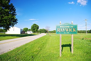
Raywick is a home rule-class city in Marion County, Kentucky, United States. The population was 155 at the 2020 census.

<span class="mw-page-title-main">Stearns, Kentucky</span> Census-designated place in Kentucky, United States

Stearns is an unincorporated community and census-designated place (CDP) in McCreary County, Kentucky, United States. The population was 1,365 at the 2020 census. It was founded by Justus Smith Stearns.

<span class="mw-page-title-main">Calhoun, Kentucky</span> City in Kentucky, United States

Calhoun is a home rule-class city in McLean County, Kentucky, United States. The population was 725 at the 2020 census. It is the county seat of McLean County. It is included in the Owensboro, Kentucky Metropolitan Statistical Area.

<span class="mw-page-title-main">Gamaliel, Kentucky</span> City in Kentucky, United States

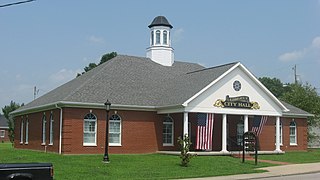
Gamaliel is a home rule-class city in Monroe County, Kentucky, in the United States. The population was 391 at the 2020 census.

<span class="mw-page-title-main">Elkton, Kentucky</span> City in Kentucky, United States

Elkton is a home rule-class city in and the county seat of Todd County, Kentucky, United States. The population was 2,062 at the 2010 census.

<span class="mw-page-title-main">Williamstown, Kentucky</span> City in Kentucky, United States

Williamstown is a home-rule-class city in Grant and Pendleton counties in the U.S. state of Kentucky. The population was 3,925 at the 2010 census, up from 3,227 as of the 2000 census. It is the county seat of Grant County.

References

  1. 1 2 "2022 U.S. Gazetteer Files: Kentucky". United States Census Bureau. Retrieved May 18, 2023.
  2. 1 2 "P1. Race – Edmonton city, Kentucky: 2020 DEC Redistricting Data (PL 94-171)". U.S. Census Bureau. Retrieved May 18, 2023.
  3. "Annual Estimates of the Resident Population for Incorporated Places in Kentucky: April 1, 2020 to July 1, 2022". United States Census Bureau. Retrieved May 26, 2023.
  4. "Summary and Reference Guide to House Bill 331 City Classification Reform" (PDF). Kentucky League of Cities. Retrieved December 30, 2014.
  5. "Find a County". National Association of Counties. Archived from the original on July 12, 2012. Retrieved June 7, 2011.
  6. Rennick, Robert M. (1987). Kentucky Place Names. University Press of Kentucky. p. 89. ISBN   0813126312 . Retrieved April 28, 2013.
  7. "US Gazetteer files: 2010, 2000, and 1990". United States Census Bureau. February 12, 2011. Retrieved April 23, 2011.
  8. Climate Summary for Edmonton, Kentucky
  9. "Annual Estimates of the Resident Population for Incorporated Places in Kentucky: April 1, 2020 to July 1, 2022". United States Census Bureau. Retrieved May 26, 2023.
  10. "Census of Population and Housing". Census.gov. Retrieved June 4, 2015.
  11. "U.S. Census website". United States Census Bureau . Retrieved January 31, 2008.
  12. "Kentucky Public Library Directory". Kentucky Department for Libraries and Archives. Archived from the original on January 11, 2019. Retrieved June 7, 2019.