Hawesville, Kentucky

Last updated

Hawesville, Kentucky
Hancock County Court House.JPG
Hancock County courthouse in Hawesville
Flag of Hawesville, Kentucky.png
Seal of Hawesville, Kentucky.png
Hancock County Kentucky Incorporated and Unincorporated areas Hawesville Highlighted 2135200.svg
Location of Hawesville in Hancock County, Kentucky.
Coordinates: 37°54′4″N86°44′58″W / 37.90111°N 86.74944°W / 37.90111; -86.74944
Country United States
State Kentucky
County Hancock
Established1836
Incorporated1847
Named for Richard Hawes Sr. (land donor)
Government
  MayorRob McCormick
Area
[1]
  Total1.63 sq mi (4.22 km2)
  Land1.62 sq mi (4.20 km2)
  Water0.01 sq mi (0.01 km2)
Elevation
410 ft (158 m)
Population
 (2020)
  Total1,023
  Density630.31/sq mi (243.30/km2)
Time zone UTC-6 (Central (CST))
  Summer (DST) UTC-5 (CDT)
ZIP code
42348
Area code(s) 270 & 364
FIPS code 21-35200
GNIS feature ID0493884
Website www.hawesville.us

Hawesville is a home rule-class city on the south bank of the Ohio River in Hancock County, Kentucky, in the United States. It is the seat of its county. [2] The population was 945 at the 2010 census. [3] It is included in the Owensboro metropolitan area.

Contents

Geography

Hawesville is located in northern Hancock County at 37°53′56″N86°45′20″W / 37.89889°N 86.75556°W / 37.89889; -86.75556 (37.898865, -86.755570), [4] on the south bank of the Ohio River and on the hills that rise south of the river. The Lincoln Trail Bridge carries Kentucky Route 69 across the Ohio at Hawesville, connecting the city with Cannelton, Indiana. U.S. Route 60 passes through the southwest part of Hawesville, leading southeast 10 miles (16 km) to Cloverport and southwest 25 miles (40 km) to Owensboro.

According to the United States Census Bureau, Hawesville has a total area of 1.2 square miles (3.2 km2), all land. [3]

History

Upon the establishment of Hancock County in 1829, local landowner Richard Hawes Sr. (father of Rep. Richard Hawes Jr.) donated land for a county seat, free to any homesteaders who settled there. The Hawesville post office was established later that year. [5] The city was formally established in 1836 and incorporated by the state assembly in 1847. [6] [7]

Despite the Immaculate Conception Church's listing on the National Register of Historic Places, it was demolished and replaced with a modern structure.

Demographics

Historical population
CensusPop.Note
1860 1,128
1870 855−24.2%
1880 8722.0%
1890 1,01316.2%
1900 1,0412.8%
1910 1,002−3.7%
1920 829−17.3%
1930 790−4.7%
1940 89613.4%
1950 9253.2%
1960 882−4.6%
1970 1,26243.1%
1980 1,036−17.9%
1990 998−3.7%
2000 971−2.7%
2010 945−2.7%
2020 1,0238.3%
U.S. Decennial Census [8]

As of the census [9] of 2000, there were 971 people, 409 households, and 271 families residing in the city. The population density was 747.3 inhabitants per square mile (288.5/km2). There were 441 housing units at an average density of 339.4 per square mile (131.0/km2). The racial makeup of the city was 98.25% White, 1.44% African American, 0.10% Native American, and 0.21% from two or more races. Hispanic or Latino of any race were 0.21% of the population.

There were 409 households, out of which 34.7% had children under the age of 18 living with them, 51.3% were married couples living together, 12.2% had a female householder with no husband present, and 33.7% were non-families. 32.3% of all households were made up of individuals, and 17.4% had someone living alone who was 65 years of age or older. The average household size was 2.35 and the average family size was 2.98.

In the city, the population was spread out, with 26.6% under the age of 18, 8.4% from 18 to 24, 27.5% from 25 to 44, 22.0% from 45 to 64, and 15.4% who were 65 years of age or older. The median age was 36 years. For every 100 females, there were 88.5 males. For every 100 females age 18 and over, there were 83.3 males.

The median income for a household in the city was $33,929, and the median income for a family was $45,000. Males had a median income of $39,318 versus $22,750 for females. The per capita income for the city was $18,985. About 12.1% of families and 11.9% of the population were below the poverty line, including 12.6% of those under age 18 and 10.1% of those age 65 or over.

Education

Hawesville has a lending library, a branch of the Hancock County Public Library. [10]

See also

Related Research Articles

<span class="mw-page-title-main">Ohio County, Kentucky</span> County in Kentucky, United States

Ohio County is a county located in the U.S. state of Kentucky. As of the 2020 census, the population was 23,772. Its county seat is Hartford, and its largest city is Beaver Dam. The county is named after the Ohio River, which originally formed its northern boundary. It is a moist county, which means that the sale of alcohol is only legal within certain city limits.

<span class="mw-page-title-main">McLean County, Kentucky</span> County in Kentucky, United States

McLean County is a county located in the U.S. state of Kentucky. As of the 2020 census, the population was 9,152. Its county seat is Calhoun and its largest city is Livermore. McLean is a prohibition or dry county. McLean County is part of the Owensboro, KY Metropolitan Statistical Area, which has a population of some 114,752.

<span class="mw-page-title-main">Hancock County, Kentucky</span> County in Kentucky, United States

Hancock County is a county located in the U.S. state of Kentucky. As of the 2020 census, the population was 9,095. Its county seat is in the city of Hawesville located in the Northern part of the county, and its largest city of Lewisport is located in the Northwestern part of the county.

<span class="mw-page-title-main">Grayson County, Kentucky</span> County in Kentucky, United States

Grayson County is a county located in the U.S. state of Kentucky. As of the 2020 census, the population was 26,420. Its county seat is Leitchfield. The county was formed in 1810 and named for William Grayson (1740-1790), a Revolutionary War colonel and a prominent Virginia political figure. Grayson County was formerly a prohibition or dry county, but Leitchfield allowed limited alcohol sales in restaurants in 2010 and voted "wet" in 2016.

<span class="mw-page-title-main">Daviess County, Kentucky</span> County in Kentucky, United States

Daviess County ( "Davis"), is a county in Kentucky. As of the 2020 census, the population was 103,312. Its county seat is Owensboro. The county was formed from part of Ohio County on January 14, 1815.

<span class="mw-page-title-main">Owensboro, Kentucky</span> City in Kentucky, United States

Owensboro is a home rule-class city in and the county seat of Daviess County, Kentucky, United States. It is the fourth-most populous city in the state. Owensboro is located on U.S. Route 60 and Interstate 165 about 107 miles (172 km) southwest of Louisville, and is the principal city of the Owensboro metropolitan area. The 2020 census had its population at 60,183. The metropolitan population was estimated at 116,506. The metropolitan area is the sixth largest in the state as of 2018, and the seventh largest population center in the state when including micropolitan areas.

<span class="mw-page-title-main">Rockport, Indiana</span> City in Indiana, United States

Rockport is a city in Ohio Township and the county seat of Spencer County, Indiana, along the Ohio River. The population was 2,270 at the 2010 census. Once the largest community in Spencer County, the city has recently been surpassed by the town of Santa Claus. At 37°53'1" north, Rockport is also the southernmost city in the state, located slightly south of Evansville, Cannelton, or Mount Vernon.

<span class="mw-page-title-main">Hardinsburg, Kentucky</span> City in Kentucky, United States

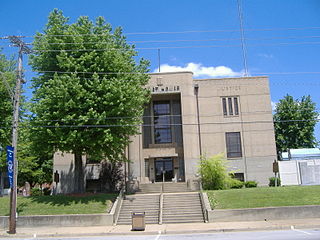
Hardinsburg is a home rule-class city in Breckinridge County, Kentucky, in the United States. It is the seat of its county. The population was 2,343 at the 2010 census. Hardinsburg was named after Captain William Hardin.

<span class="mw-page-title-main">Irvington, Kentucky</span> City in Kentucky, United States

Irvington is a home rule-class city in Breckinridge County, Kentucky, in the United States. The population was 1,181 at the 2010 census.

<span class="mw-page-title-main">Morgantown, Kentucky</span> City in Kentucky, United States

Morgantown is a home rule-class city in, and the seat of Butler County, Kentucky, United States. The population was 2,471 at the time of the 2020 Census.

<span class="mw-page-title-main">Whitesville, Kentucky</span> City in Kentucky, United States

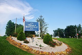
Whitesville is a home rule-class city in Daviess County, Kentucky, United States. The population was 580 as of the 2020 Census, up from 552 as of the 2010 census,. It is included in the Owensboro, Kentucky Metropolitan Statistical Area. The city was founded in 1844 by Dr. William White, and named for him. The current mayor of Whitesville is Patsy Mayfield.

<span class="mw-page-title-main">Lewisport, Kentucky</span> City in Kentucky, United States

Lewisport is a home rule-class city in the floodplain of the Ohio River in Hancock County, Kentucky, in the United States. The population was 1,670 at the 2010 census, and is also the most populous community in the county. It is included in the Owensboro metropolitan area.

<span class="mw-page-title-main">Lewisburg, Kentucky</span> City in Kentucky, United States

Lewisburg is a home rule-class city in Logan County, Kentucky, in the United States. The population was 810 at the 2010 census, down from 903 at the 2000 census.

<span class="mw-page-title-main">Calhoun, Kentucky</span> City in Kentucky, United States

Calhoun is a home rule-class city in McLean County, Kentucky, United States. The population was 725 at the 2020 census. It is the county seat of McLean County. It is included in the Owensboro, Kentucky Metropolitan Statistical Area.

<span class="mw-page-title-main">Island, Kentucky</span> City in Kentucky, United States

Island is a home rule-class city in McLean County, Kentucky, in the United States. The population was 429 at the 2020 census. It is included in the Owensboro metropolitan area.

<span class="mw-page-title-main">Livermore, Kentucky</span> City in Kentucky, United States

Livermore is a home rule-class city located at the confluence of the Green and Rough rivers in McLean County in the U.S. state of Kentucky. The population was 1,230 as of the 2020 census, down from 1,365 in 2010. It is included in the Owensboro metropolitan area.

<span class="mw-page-title-main">Brandenburg, Kentucky</span> City in Kentucky, United States

Brandenburg is a home rule-class city on the Ohio River in Meade County, Kentucky, in the United States. The city is 40 miles (64 km) southwest of Louisville. It is the seat of its county. The population was 2,894 at the 2020 census.

<span class="mw-page-title-main">Camargo, Kentucky</span> City in Kentucky, United States

Camargo is a home rule-class city in Montgomery County, Kentucky, in the United States. The population was 1,020 at the 2020 census. It is part of the Mount Sterling Micropolitan Statistical Area.

<span class="mw-page-title-main">Hartford, Kentucky</span> City in Kentucky, United States

Hartford is a home rule-class city in Ohio County, Kentucky, in the United States. It is the seat of its county. The population was 2,668 at the 2020 census. The town slogan, "Home of 2,000 happy people and a few soreheads", welcomes visitors when they enter the community. The Hartford, Kentucky website explains that "soreheads are community-minded, progressive citizens who work to promote civic pride".

<span class="mw-page-title-main">Owensboro metropolitan area</span> Metropolitan statistical area in Kentucky, United States

The Owensboro Metropolitan Statistical Area, as defined by the United States Census Bureau, is an area consisting of three counties in Kentucky, anchored by the city of Owensboro. As of the 2000 census, the MSA had a population of 109,875. In the 2010 Census the population was 114,752. Owensboro is part of the Illinois–Indiana–Kentucky tri-state area and sometimes, albeit seldom, referred to as Kentuckiana.

References

  1. "2020 U.S. Gazetteer Files". United States Census Bureau. Retrieved March 18, 2022.
  2. "Find a County". National Association of Counties. Retrieved June 7, 2011.
  3. 1 2 "Geographic Identifiers: 2010 Demographic Profile Data (G001): Hawesville city, Iowa". American Factfinder. U.S. Census Bureau. Retrieved June 23, 2017.[ dead link ]
  4. "US Gazetteer files: 2010, 2000, and 1990". United States Census Bureau. February 12, 2011. Retrieved April 23, 2011.
  5. Rennick, Robert M. (1987). Kentucky Place Names. University Press of Kentucky. p. 134. Retrieved April 28, 2013.
  6. Commonwealth of Kentucky. Office of the Secretary of State. Land Office. "Hawesville, Kentucky". Accessed 29 July 2013.
  7. "Dictionary of Places: Hawesville". Encyclopedia of Kentucky. New York, New York: Somerset Publishers. 1987. ISBN   0-403-09981-1.
  8. "Census of Population and Housing". Census.gov. Retrieved June 4, 2015.
  9. "U.S. Census website". United States Census Bureau . Retrieved January 31, 2008.
  10. "Kentucky Public Library Directory". Kentucky Department for Libraries and Archives. Archived from the original on January 11, 2019. Retrieved June 5, 2019.