Mount Sterling, Kentucky

Last updated

Mount Sterling, Kentucky
Downtown Mount Sterling, Kentucky.JPG
Downtown Mt. Sterling
Motto(s): 
"Ringing with Unity and Pride"
Montgomery County Kentucky Incorporated and Unincorporated areas Mount Sterling Highlighted 2154084.svg
Location in Montgomery County, Kentucky
Coordinates: 38°3′24″N83°56′40″W / 38.05667°N 83.94444°W / 38.05667; -83.94444
Country United States
State Kentucky
County Montgomery
Established1792 [1]
Incorporated1852 [1]
Area
[2]
  Total4.51 sq mi (11.68 km2)
  Land4.49 sq mi (11.62 km2)
  Water0.02 sq mi (0.06 km2)
Elevation
974 ft (297 m)
Population
 (2020) [3]
  Total7,558
  Estimate 
(2022) [4]
7,555
  Density1,684.05/sq mi (650.19/km2)
Time zone UTC-5 (Eastern (EST))
  Summer (DST) UTC-4 (EDT)
ZIP code
40353
Area code 859
FIPS code 21-54084
GNIS feature ID0498865
Website mtsterling.ky.gov

Mount Sterling, often written as Mt. Sterling, [5] is a home rule-class city [6] in Montgomery County, Kentucky, United States. The population was 7,558 as of the 2020 census, [3] up from 6,895 in 2010. It is the county seat of Montgomery County and the principal city of the Mount Sterling micropolitan area.

Contents

History

Mount Sterling is named for an ancient burial mound called "Little Mountain", and for the town of Stirling in Scotland. It was named by the first developer of the area, Hugh Forbes. The Kentucky Assembly passed an act in 1792 establishing the town as Mt. Sterling, a misspelling which was retained. [7]

The area was originally part of the thick wilderness of central Kentucky. Explorers, hunters, and surveyors traveling along a trail called Old Harper's Trace noted a 125-foot-high (38 m) tree-covered mound which they called "the Little Mountain". Later excavations showed it to be a burial site. The site of the mound is now the intersection of Queen and Locust streets in Mt. Sterling.

The first cabin in the area was built in 1779. The first permanent settlement was established around 1790, when Forbes began to sell lots and laid out a road, now Locust Street. In 1796 the town was established as the county seat of newly created Montgomery County. At that time the town consisted of 33 town lots, four retail stores, and three taverns. A courthouse was built, the first of seven to be housed in Mt. Sterling. A jail and a town pump were also installed. A large brick market house where farm produce was bought and sold confirmed the town as the commercial center of the surrounding area. Baptist, Presbyterian and Methodist churches were established during the town's first decade.

During the Civil War the town was occupied alternately by Union and Confederate troops on multiple occasions. The Battle of Mount Sterling in June 1864, which ended in a Confederate defeat, was the last of the fighting in Montgomery County. [7]

Geography

Mt. Sterling is located northwest of the center of Montgomery County at 38°3′24″N83°56′40″W / 38.05667°N 83.94444°W / 38.05667; -83.94444 (38.056613, -83.944500). [8] It is 34 miles (55 km) east of Lexington and 91 miles (146 km) west of Huntington, West Virginia. U.S. Route 60 passes through the city as Main Street, leading northeast 14 miles (23 km) to Owingsville and west-southwest 16 miles (26 km) to Winchester. U.S. Route 460 crosses US 60 in the center of Mt. Sterling, leading northwest 23 miles (37 km) to Paris and southeast 21 miles (34 km) to Frenchburg. Kentucky Route 11 joins US 460 through the center of Mt. Sterling but leads north 31 miles (50 km) to Flemingsburg and south 15 miles (24 km) to Clay City. Interstate 64 passes through the northern part of Mt. Sterling, with access from exits 110 (US 460) and 113 (US 60), and connecting Mt. Sterling with Lexington and Huntington.

According to the United States Census Bureau, Mt. Sterling has a total area of 4.52 square miles (11.71 km2), of which 0.02 square miles (0.05 km2), or 0.49%, are water. [2] Hinkston Creek runs through the city center, flowing north and then west to the South Fork of the Licking River in northern Bourbon County.

Climate

The climate in this area is characterized by hot, humid summers and generally mild to cool winters. According to the Köppen Climate Classification system, Mt. Sterling has a humid subtropical climate, abbreviated "Cfa" on climate maps. [9]

Climate data for Mount Sterling, Kentucky (1991–2020 normals, extremes 1892–present)
MonthJanFebMarAprMayJunJulAugSepOctNovDecYear
Record high °F (°C)80
(27)
80
(27)
89
(32)
92
(33)
98
(37)
104
(40)
110
(43)
105
(41)
104
(40)
97
(36)
83
(28)
78
(26)
110
(43)
Mean maximum °F (°C)65.2
(18.4)
69.5
(20.8)
75.7
(24.3)
82.4
(28.0)
87.9
(31.1)
92.8
(33.8)
94.8
(34.9)
93.5
(34.2)
91.6
(33.1)
84.2
(29.0)
74.3
(23.5)
66.3
(19.1)
96.6
(35.9)
Mean daily maximum °F (°C)41.8
(5.4)
45.6
(7.6)
55.7
(13.2)
66.8
(19.3)
75.6
(24.2)
83.4
(28.6)
86.5
(30.3)
85.7
(29.8)
80.1
(26.7)
68.5
(20.3)
55.9
(13.3)
45.4
(7.4)
65.9
(18.8)
Daily mean °F (°C)31.7
(−0.2)
34.5
(1.4)
43.1
(6.2)
53.3
(11.8)
63.1
(17.3)
71.2
(21.8)
74.8
(23.8)
73.1
(22.8)
66.6
(19.2)
55.0
(12.8)
43.6
(6.4)
35.2
(1.8)
53.8
(12.1)
Mean daily minimum °F (°C)21.6
(−5.8)
23.5
(−4.7)
30.5
(−0.8)
39.8
(4.3)
50.6
(10.3)
59.0
(15.0)
63.1
(17.3)
60.6
(15.9)
53.1
(11.7)
41.6
(5.3)
31.3
(−0.4)
25.0
(−3.9)
41.6
(5.3)
Mean minimum °F (°C)2.1
(−16.6)
4.6
(−15.2)
13.3
(−10.4)
24.3
(−4.3)
35.6
(2.0)
46.4
(8.0)
53.5
(11.9)
49.7
(9.8)
40.3
(4.6)
27.7
(−2.4)
16.4
(−8.7)
9.6
(−12.4)
−1.9
(−18.8)
Record low °F (°C)−20
(−29)
−27
(−33)
−12
(−24)
18
(−8)
26
(−3)
39
(4)
42
(6)
43
(6)
25
(−4)
15
(−9)
−8
(−22)
−20
(−29)
−27
(−33)
Average precipitation inches (mm)3.52
(89)
3.66
(93)
4.36
(111)
4.40
(112)
4.53
(115)
4.80
(122)
5.38
(137)
3.36
(85)
3.61
(92)
3.22
(82)
3.38
(86)
4.28
(109)
48.50
(1,232)
Average snowfall inches (cm)3.3
(8.4)
2.0
(5.1)
2.2
(5.6)
0.0
(0.0)
0.0
(0.0)
0.0
(0.0)
0.0
(0.0)
0.0
(0.0)
0.0
(0.0)
0.0
(0.0)
0.2
(0.51)
1.1
(2.8)
8.8
(22)
Average precipitation days (≥ 0.01 in)11.711.312.912.812.511.911.69.48.99.29.712.0133.9
Average snowy days (≥ 0.1 in)2.11.71.00.00.00.00.00.00.00.00.20.75.7
Source: NOAA [10] [11]

Demographics

Historical population
CensusPop.Note
1800 83
1810 325291.6%
1830 561
1840 5854.3%
1850 533−8.9%
1860 74439.6%
1870 1,04039.8%
1880 2,087100.7%
1890 3,62973.9%
1900 3,561−1.9%
1910 3,93210.4%
1920 3,9951.6%
1930 4,3508.9%
1940 4,7829.9%
1950 5,29410.7%
1960 5,3701.4%
1970 5,083−5.3%
1980 5,82014.5%
1990 5,362−7.9%
2000 5,8769.6%
2010 6,89517.3%
2020 7,5589.6%
2022 (est.)7,555 [12] 0.0%
U.S. Decennial Census [13]

As of the census [14] of 2000, there were 5,876 people, 2,478 households, and 1,536 families residing in the city. The population density was 1,708.9 inhabitants per square mile (659.8/km2). There were 2,768 housing units at an average density of 805.0 per square mile (310.8/km2). The racial makeup of the city was 89.09% White, 8.73% African American, 0.22% Native American, 0.19% Asian, 0.75% from other races, and 1.02% from two or more races. Hispanic or Latino people of any race were 1.68% of the population.

There were 2,478 households, out of which 28.9% had children under the age of 18 living with them, 44.8% were married couples living together, 14.2% had a female householder with no husband present, and 38.0% were non-families. 33.3% of all households were made up of individuals, and 17.4% had someone living alone who was 65 years of age or older. The average household size was 2.28 and the average family size was 2.89.

In the city, the population was spread out, with 22.7% under the age of 18, 10.6% from 18 to 24, 28.4% from 25 to 44, 21.0% from 45 to 64, and 17.4% who were 65 years of age or older. The median age was 37 years. For every 100 females, there were 86.0 males. For every 100 females age 18 and over, there were 83.1 males.

The median income for a household in the city was $27,050, and the median income for a family was $54,074. Males had a median income of $30,584 versus $21,081 for females. The per capita income for the city was $17,585. About 17.1% of families and 19.4% of the population were below the poverty line, including 29.4% of those under age 18 and 17.8% of those age 65 or over.

Arts and culture

Beginning in the eighteenth century, Court Day quickly became the annual trading day for the area. It remains a big event today, held on the third Monday in October and the weekend prior. Approximately 130,000 people from all parts of the country gather for the four-day event that specializes in many different arts and crafts, food and music. [15]

The Gateway Regional Arts Center holds classes and exhibitions in the former First United Methodist Church, a historic building listed on the National Register of Historic Places.

List of Registered Historical Places

Education

Mount Sterling has a lending library, a branch of the Montgomery County Public Library. [16]

The city is served by Montgomery County Public Schools and is home to Montgomery County High School. [17]

Notable people

Related Research Articles

<span class="mw-page-title-main">Montgomery County, Kentucky</span> County in Kentucky, United States

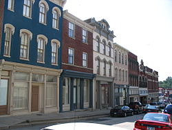
Montgomery County is a county located in the U.S. state of Kentucky. As of the 2020 census, the population was 28,114. Its county seat is Mount Sterling. With regard to the sale of alcohol, it is classified as a moist county—a county in which alcohol sales are prohibited, but containing a "wet" city where package alcohol sales are allowed, in this case Mount Sterling. Montgomery County is part of the Mount Sterling, KY Micropolitan Statistical Area, which is also included in the Lexington-Fayette–Richmond–Frankfort, KY combined statistical area.

<span class="mw-page-title-main">Bath County, Kentucky</span> County in Kentucky, United States

Bath County is a county located in the U.S. state of Kentucky. As of the 2020 census, the population was 12,750. The county seat is Owingsville. The county was formed in 1811. Bath County is included in the Mount Sterling, KY Micropolitan Statistical Area, which is also included in the Lexington-Fayette–Richmond–Frankfort, KY combined statistical area.

<span class="mw-page-title-main">Mount Washington, Kentucky</span> City in Kentucky, United States

Mount Washington is a home rule-class city in northeast Bullitt County, Kentucky, in the United States. The population was 18,090 at the 2020 census. The city is one of several surrounding Louisville that have experienced a sharp rise in population in the past three decades, becoming a commuter town.

<span class="mw-page-title-main">Shepherdsville, Kentucky</span> City in Kentucky, United States

Shepherdsville is a home rule-class city on the Salt River in Bullitt County, Kentucky, in the United States. It is the second largest city and seat of its county, located just south of Louisville. The population was 14,201 during the 2020 U.S. Census.

<span class="mw-page-title-main">Morgantown, Kentucky</span> City in Kentucky, United States

Morgantown is a home rule-class city in, and the seat of Butler County, Kentucky, United States. The population was 2,471 at the time of the 2020 Census.

<span class="mw-page-title-main">Liberty, Kentucky</span> City in Kentucky, United States

Liberty is a home rule-class city in Casey County, Kentucky, in the United States. It is the seat of its county. Its population was 2,168 at the 2010 U.S. census.

<span class="mw-page-title-main">Winchester, Kentucky</span> City in Kentucky, United States

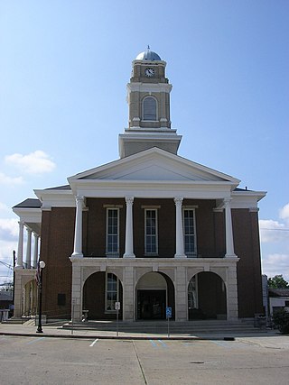
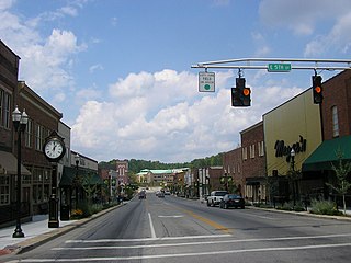
Winchester is a home rule-class city in and the county seat of Clark County, Kentucky, United States. The population was 19,134 at the 2020 census. It is part of the Lexington-Fayette, KY Metropolitan Statistical Area. Winchester is located roughly halfway between Lexington and Mt. Sterling.

<span class="mw-page-title-main">Flemingsburg, Kentucky</span> City in Kentucky, United States

Flemingsburg is a home rule-class city in Fleming County, Kentucky, in the United States. The population was 2,953 at the 2020 census, up from 2,658 at the 2010 census. It is the seat of Fleming County.

<span class="mw-page-title-main">Lancaster, Kentucky</span> City in Kentucky, United States

Lancaster is a home rule-class city in Garrard County, Kentucky, in the United States. It is the seat of its county. As of the year 2020 U.S. census, the city population was 3,901.

<span class="mw-page-title-main">Harlan, Kentucky</span> City in Kentucky, United States

Harlan is a home rule-class city in and the county seat of Harlan County, Kentucky, United States. The population was 1,745 at the 2010 census, down from 2,081 at the 2000 census.

<span class="mw-page-title-main">London, Kentucky</span> City in Kentucky, United States

London is a home rule-class city in Laurel County, Kentucky, in the United States. It is the seat of its county. The population was 8,053 at the time of the 2020 census. It is the second-largest city named "London" in the United States and the fourth-largest in the world. It is part of the London, Kentucky micropolitan area. Of the seventeen micropolitan areas in Kentucky, London is the largest; the London micropolitan area's 2010 Census population was 126,368. London is also home to the annual World Chicken Festival that celebrates the life of Colonel Sanders and features the world's largest skillet.

<span class="mw-page-title-main">Stanford, Kentucky</span> City in Kentucky, United States

Stanford is a home rule-class city in Lincoln County, Kentucky, United States. It is one of the oldest settlements in Kentucky, having been founded in 1775. Its population was 3,487 at the 2010 census and an estimated 3,686 in 2018. It is the county seat of Lincoln County. Stanford is part of the Danville Micropolitan Statistical Area.

<span class="mw-page-title-main">Kuttawa, Kentucky</span> City in Kentucky, United States

Kuttawa is a home rule-class city in Lyon County, Kentucky, in the United States. The population was 649 as of the 2010 census, up from 596 in 2000.

<span class="mw-page-title-main">Calhoun, Kentucky</span> City in Kentucky, United States

Calhoun is a home rule-class city in McLean County, Kentucky, United States. The population was 725 at the 2020 census. It is the county seat of McLean County. It is included in the Owensboro, Kentucky Metropolitan Statistical Area.

<span class="mw-page-title-main">Frenchburg, Kentucky</span> City in Kentucky, United States

Frenchburg is a home rule-class city in Menifee County, Kentucky, in the United States. The population was 601 at the 2020 census, up from 486 in 2010. It is the seat and only incorporated city in its rural county. It is located at the junction of U.S. Route 460 and Kentucky Route 36. Logging is the primary industry.

<span class="mw-page-title-main">Camargo, Kentucky</span> City in Kentucky, United States

Camargo is a home rule-class city in Montgomery County, Kentucky, in the United States. The population was 1,020 at the 2020 census. It is part of the Mount Sterling Micropolitan Statistical Area.

<span class="mw-page-title-main">Jeffersonville, Kentucky</span> City in Kentucky, United States

Jeffersonville is a home rule-class city in Montgomery County, Kentucky, in the United States. The population was 1,708 as of the 2020 census, up from 1,506 in 2010. It is part of the Mount Sterling micropolitan area.

<span class="mw-page-title-main">Livingston, Kentucky</span> City in Kentucky, United States

Livingston is a home rule-class city in Rockcastle County, Kentucky, in the United States. The population was 226 during the 2010 U.S. census. It is part of the Richmond-Berea micropolitan area.

<span class="mw-page-title-main">Mount Vernon, Kentucky</span> City in Kentucky, United States

Mount Vernon is a home rule-class city and the seat of Rockcastle County in southeastern Kentucky. The intersection of U.S. Routes 25 and 150 is located here. The population was 2,477 at the time of the 2010 U.S. census. Mount Vernon is part of the Richmond-Berea micropolitan area.

<span class="mw-page-title-main">Midway, Kentucky</span> City in Kentucky, United States

Midway is a home rule-class city in Woodford County, Kentucky, in the United States. Its population was 1,741 at the time of the year 2020 U.S. census. It is part of the Lexington-Fayette Metropolitan Statistical Area.

References

  1. 1 2 Commonwealth of Kentucky. Office of the Secretary of State. Land Office. "Mt. Sterling, Kentucky". Accessed 26 August 2013.
  2. 1 2 "2022 U.S. Gazetteer Files: Kentucky". United States Census Bureau. Retrieved May 19, 2023.
  3. 1 2 "P1. Race – Mount Sterling city, Kentucky: 2020 DEC Redistricting Data (PL 94-171)". U.S. Census Bureau. Retrieved May 19, 2023.
  4. "Annual Estimates of the Resident Population for Incorporated Places in Kentucky: April 1, 2020 to July 1, 2022". United States Census Bureau. Retrieved May 26, 2023.
  5. The Commonwealth of Kentucky's Land Office lists the city as "Mount Sterling" but has a note: "Actual name of city is Mt. Sterling."
  6. "Summary and Reference Guide to House Bill 331 City Classification Reform" (PDF). Kentucky League of Cities. Retrieved December 30, 2014.
  7. 1 2 "History". Mt. Sterling, KY. Archived from the original on July 25, 2014. Retrieved July 19, 2014.
  8. "US Gazetteer files: 2010, 2000, and 1990". United States Census Bureau. February 12, 2011. Retrieved April 23, 2011.
  9. Climate Summary for Mt. Sterling, Kentucky
  10. "NOWData – NOAA Online Weather Data". National Oceanic and Atmospheric Administration. Retrieved November 18, 2023.
  11. "Summary of Monthly Normals 1991–2020". National Oceanic and Atmospheric Administration. Retrieved November 18, 2023.
  12. "Annual Estimates of the Resident Population for Incorporated Places in Kentucky: April 1, 2020 to July 1, 2022". United States Census Bureau. Retrieved May 26, 2023.
  13. "Census of Population and Housing". Census.gov. Retrieved June 4, 2015.
  14. "U.S. Census website". United States Census Bureau . Retrieved January 31, 2008.
  15. "Court Day". www.mtsterlingtourism.com. Archived from the original on May 5, 2016. Retrieved May 5, 2016.
  16. "Kentucky Public Library Directory". Kentucky Department for Libraries and Archives. Archived from the original on January 11, 2019. Retrieved June 7, 2019.
  17. "Montgomery County High School". National Center for Education Statistics. Retrieved December 17, 2019.
  18. Tom Eblen. "New location fitting for black history museum", Lexington Herald-Leader, February 8, 2012. Retrieved August 8, 2013.
  19. Copley, Rich (July 27, 2015). "James L. White, 'Ray' screenwriter and Kentuckian, dies at 67". Lexington Herald-Leader . Retrieved July 29, 2015.