Brownsville, Kentucky

Last updated

Brownsville, Kentucky
Brownsville Kentucky Aerial.jpg
Aerial photograph of Brownsville
Edmonson County Kentucky Incorporated and Unincorporated areas Brownsville Highlighted 2110324.svg
Location of Brownsville in Edmonson County, Kentucky.
Coordinates: 37°11′28″N86°15′40″W / 37.19111°N 86.26111°W / 37.19111; -86.26111
Country United States
State Kentucky
County Edmonson
Established1826 [1]
Government
Area
[2]
  Total2.62 sq mi (6.78 km2)
  Land2.61 sq mi (6.77 km2)
  Water0.01 sq mi (0.02 km2)
Elevation
[3]
541 ft (165 m)
Population
 (2020)
  Total875
  Density334.99/sq mi (129.33/km2)
Time zone UTC-6 (Central (CST))
  Summer (DST) UTC-5 (CDT)
ZIP code
42210
Area code(s) 270 & 364
FIPS code 21-10324
GNIS feature ID0488045 [3]

Brownsville is a home rule-class city in Edmonson County, Kentucky, in the United States. It is the county seat and is a certified Kentucky Trail Town. [4] The population was 836 at the time of the 2010 census, [5] down from 921 at the 2000 census. It is included in the Bowling Green metropolitan area. [6] It is just outside Mammoth Cave National Park. [7]

Contents

Geography

Brownsville is located near the center of Edmonson County at 37°11′28″N86°15′40″W / 37.191169°N 86.261098°W / 37.191169; -86.261098 . [8] The city limits border the western edge of Mammoth Cave National Park, with access to Houchin Ferry Campground.

State Routes 70 and 259 pass through the city together as Main Street. KY 70 leads east 20 miles (32 km) to Cave City and west 27 miles (43 km) to U.S. Route 231 at Aberdeen, while KY 259 leads southeast 12 miles (19 km) to U.S. Route 31W and north 25 miles (40 km) to Leitchfield.

According to the United States Census Bureau, Brownsville has a total area of 2.6 square miles (6.8 km2), of which 0.01 square miles (0.02 km2), or 0.26%, is water. [5] The city is located on the Green River, a tributary of the Ohio River. [1]

Demographics

Historical population
CensusPop.Note
1830 229
1840 112−51.1%
1880 116
1890 113−2.6%
1900 234107.1%
1910 31333.8%
1920 294−6.1%
1930 35922.1%
1940 45125.6%
1950 447−0.9%
1960 4735.8%
1970 54214.6%
1980 67424.4%
1990 89733.1%
2000 9212.7%
2010 836−9.2%
2020 8754.7%
U.S. Decennial Census [9]

As of the census of 2000, there were 921 people, 387 households, and 229 families residing in the city. The population density was 581.0 inhabitants per square mile (224.3/km2). There were 421 housing units at an average density of 265.6 per square mile (102.5/km2). The racial makeup of the city was 98.37% White, 0.11% African American, 0.43% Native American, 0.11% Asian, 0.11% from other races, and 0.87% from two or more races. Hispanic or Latino of any race were 0.76% of the population.

There were 387 households, out of which 26.4% had children under the age of 18 living with them, 40.6% were married couples living together, 16.8% had a female householder with no husband present, and 40.6% were non-families. 37.5% of all households were made up of individuals, and 15.8% had someone living alone who was 65 years of age or older. The average household size was 2.15 and the average family size was 2.81.

In the city, the population was spread out, with 20.3% under the age of 18, 8.6% from 18 to 24, 22.8% from 25 to 44, 24.4% from 45 to 64, and 23.9% who were 65 years of age or older. The median age was 43 years. For every 100 females, there were 72.5 males. For every 100 females age 18 and over, there were 71.1 males.

The median income for a household in the city was $15,370, and the median income for a family was $21,250. Males had a median income of $26,125 versus $14,583 for females. The per capita income for the city was $15,711. About 30.8% of families and 32.6% of the population were below the poverty line, including 45.2% of those under age 18 and 24.5% of those age 65 or over.

Plain community

There is a Plain, horse and buggy community with about 40 to 50 people in Peace Valley, Brownsville. It is closely affiliated with Caneyville.

Education

Brownsville is served by the Edmonson County Schools. [10] Schools in the district located in Brownsville are:

Brownsville has a lending library, the Edmonson County Public Library. [17]

Notable residents

Music promoter Denver D. Ferguson was born in Brownsville. [18]

Related Research Articles

<span class="mw-page-title-main">Rockcastle County, Kentucky</span> County in Kentucky, United States

Rockcastle County is a county located in the southeastern part of the U.S. state of Kentucky. As of the 2020 census, the population was 16,037. Its county seat is Mt. Vernon. The county was founded in 1810 and named for the Rockcastle River, which runs through it. The river, in turn, is named for its majestic rock cliffs. Rockcastle County is part of the Richmond–Berea, KY Micropolitan Statistical Area, which is also included in the Lexington-Fayette-Richmond-Frankfort, KY Combined Statistical Area.

<span class="mw-page-title-main">Morgan County, Kentucky</span> County in Kentucky, United States

Morgan County is a county located in the U.S. state of Kentucky. As of the 2020 census, the population was 13,726. Its county seat is West Liberty. The county is among the dry counties, which means that the sale of alcohol is restricted or prohibited.

<span class="mw-page-title-main">Hart County, Kentucky</span> County in Kentucky, United States

Hart County is a county located in the south central portion of the Commonwealth of Kentucky. As of the 2020 census, the population was 19,288. Its county seat is Munfordville, its largest city is Horse Cave. Hart County is a prohibition or dry county.

<span class="mw-page-title-main">Edmonson County, Kentucky</span> County in Kentucky, United States

Edmonson County is a county located in the south central portion of the U.S. state of Kentucky. As of the 2020 census, the population was 12,126. Its county seat and only municipality is Brownsville. The county was formed in 1825 and named for Captain John "Jack" Edmonson (1764–1813), who was killed at the Battle of Frenchtown during the War of 1812. This is a dry county where the sale of alcohol is prohibited. Edmonson County is included in the Bowling Green, Kentucky Metropolitan Statistical Area.

<span class="mw-page-title-main">Barren County, Kentucky</span> County in Kentucky, United States

Barren County is a county located in the south-central portion of the U.S. state of Kentucky. As of the 2020 census, the population was 44,485. Its county seat is Glasgow. The county was founded on December 20, 1798, from parts of Warren and Green Counties. It was named for the Barrens, meadowlands that cover the northern third, though actually the soil is fertile. Barren County is part of the Glasgow, KY Micropolitan Statistical Area, which is also included in the Bowling Green-Glasgow, KY Combined Statistical Area. In 2007 Barren County was named the "Best Place to Live in Rural America" by Progressive Farmer Magazine.

<span class="mw-page-title-main">Kevil, Kentucky</span> City in Kentucky, United States

Kevil is a home rule-class city in Ballard County, Kentucky, United States. The population was 376 at the 2010 census, down from 574 in 2000. It is part of the Paducah micropolitan area.

<span class="mw-page-title-main">Cave City, Kentucky</span> City in Kentucky, United States

Cave City is a home rule-class city in Barren County, Kentucky, in the United States. The population was 2,240 at the 2010 census. It is part of the Glasgow Micropolitan Statistical Area.

<span class="mw-page-title-main">Glasgow, Kentucky</span> City in Kentucky, United States

Glasgow is a home rule-class city in Barren County, Kentucky, United States. It is the seat of its county. Glasgow is the principal city of the Glasgow micropolitan area, which comprises Barren and Metcalfe counties. The population was 15,014 at the 2020 U.S. census.

<span class="mw-page-title-main">Park City, Kentucky</span> City in Kentucky, United States

Park City is a home rule-class city in Barren County, Kentucky, United States. The population was 537 at the 2010 census. It is the entrance to nearby Mammoth Cave National Park and to Diamond Caverns, a privately owned cave attraction. Exit 48 off I-65 is the only direct access exit to the Mammoth Cave National Park.

<span class="mw-page-title-main">Munfordville, Kentucky</span> City in Kentucky, United States

Munfordville is a home rule-class city in, and the county seat of, Hart County, Kentucky, United States. The population was 1,615 at the 2010 U.S. census.

<span class="mw-page-title-main">Carrsville, Kentucky</span> City in Kentucky, United States

Carrsville is a home rule-class city beside the Ohio River in Livingston County, Kentucky, in the United States. The population was 50 at the 2010 census, declining from 64 as of 2000. It is part of the Paducah, KY-IL Micropolitan Statistical Area. It is situated just west of the junction of where Buck Creek empties into the Ohio River.

<span class="mw-page-title-main">Jeffersonville, Kentucky</span> City in Kentucky, United States

Jeffersonville is a home rule-class city in Montgomery County, Kentucky, in the United States. The population was 1,708 as of the 2020 census, up from 1,506 in 2010. It is part of the Mount Sterling micropolitan area.

<span class="mw-page-title-main">Carlisle, Kentucky</span> City in Kentucky, United States

Carlisle is a home rule-class city in Nicholas County, Kentucky, United States. The population was 2,010 at the 2010 census. It is the county seat of Nicholas County. It is located at the junction of Kentucky Route 32 and Kentucky Route 36, about halfway between Lexington and Maysville.

<span class="mw-page-title-main">Morganfield, Kentucky</span> City in Kentucky, United States

Morganfield is a home rule-class city in Union County, Kentucky, in the United States. It is the seat of its county. The population was 3,285 as of the year 2010 U.S. census.

<span class="mw-page-title-main">Edmonson, Texas</span> Town in Texas, United States

Edmonson is a town in Hale County, Texas, United States. The population was 111 at the 2010 census.

<span class="mw-page-title-main">Upton, Kentucky</span> City in Kentucky, United States

Upton is a home rule-class city in Hardin and LaRue counties in the U.S. state of Kentucky. The population was 683 at the 2010 census. Its entire area is included in the Elizabethtown–Fort Knox Metropolitan Statistical Area.

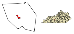
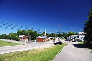
Sweeden is an unincorporated community in north-central Edmonson County, Kentucky, United States. The population of Sweeden's ZCTA was 171 at the 2000 census. It is part of the Bowling Green, Kentucky Metropolitan Statistical Area. The ZIP Code for Sweeden is 42285.

<span class="mw-page-title-main">Bowling Green metropolitan area, Kentucky</span> Metropolitan statistical area in Kentucky, United States

The Bowling Green Metropolitan Statistical Area, as defined by the United States Census Bureau, is an area consisting of four counties in Kentucky, anchored by the city of Bowling Green. As of 2014, the MSA had an estimated population of 165,732.

Houchin's Ferry Road is a secondary roadway located in Edmonson County in west-central Kentucky. County road logs list this road as CR-1004 and CR-1005.

Kyrock is a ghost town in Edmonson County in south central Kentucky. The ghost town is located about 2.4 miles (3.9 km) east of Sweeden, or about 5 miles (8.0 km) north-northeast of the county seat of Brownsville. It was once a referred to as a “company town” along the Nolin River during much of the first half of the 20th century, but the industrial town was disincorporated in 1966, about nine years after the closure of the company that created the town.

References

  1. 1 2 Kentucky, University of. "Brownsville, Kentucky". Gazetteer, Kentucky Atlas and. Retrieved April 15, 2010.
  2. "2020 U.S. Gazetteer Files". United States Census Bureau. Retrieved March 18, 2022.
  3. 1 2 U.S. Geological Survey Geographic Names Information System: Brownsville, Kentucky
  4. "Find a County". National Association of Counties. Archived from the original on May 31, 2011. Retrieved June 7, 2011.
  5. 1 2 "Geographic Identifiers: 2010 Demographic Profile Data (G001): Brownsville city, Kentucky". American Factfinder. U.S. Census Bureau. Archived from the original on February 13, 2020. Retrieved January 29, 2016.
  6. Management and Budget, Office of (November 20, 2008). "OMB BULLETIN NO. 09-01" (PDF). the President, Executive Office of. Retrieved April 15, 2010.
  7. Service, National Park. "Mammoth Cave National Park Map" (PDF). Retrieved April 15, 2010.
  8. "US Gazetteer files: 2010, 2000, and 1990". United States Census Bureau. February 12, 2011. Retrieved April 23, 2011.
  9. "Census of Population and Housing". Census.gov. Retrieved June 4, 2015.
  10. Education, Kentucky Department of (October 29, 2009). "County & Independent School Districts" (PDF). Kentucky, Commonwealth of. Archived from the original (PDF) on January 10, 2010. Retrieved April 15, 2010.
  11. "Once a Wildcat...Always a Wildcat". echs.edmonson.kyschools.us. Retrieved September 14, 2023.
  12. "Once a Wildcat...Always a Wildcat - Faculty & Staff". echs.edmonson.kyschools.us. Retrieved September 14, 2023.
  13. "Edmonson County Middle School". ecms.edmonson.kyschools.us. Retrieved September 14, 2023.
  14. "Edmonson County Middle School - Principal Prunty". ecms.edmonson.kyschools.us. Retrieved September 14, 2023.
  15. "Edmonson County 5/6 Center". ec56c.edmonson.kyschools.us. Retrieved September 14, 2023.
  16. 5th/6th Center, Edmonson County (September 23, 2009). "Teachers". Archived from the original on April 18, 2010. Retrieved April 15, 2010.
  17. "Kentucky Public Library Directory". Kentucky Department for Libraries and Archives. Archived from the original on January 11, 2019. Retrieved June 5, 2019.
  18. Lauterbach, Preston (March 7, 2011). "Denver Ferguson". Preston Lauterbach. Retrieved November 19, 2019.