Middlesex is a historic county in southeast England. Its area is almost entirely within the wider urbanised area of London and mostly within the ceremonial county of Greater London, with small sections in neighbouring ceremonial counties. Three rivers provide most of the county's boundaries; the Thames in the south, the Lea to the east and the Colne to the west. A line of hills forms the northern boundary with Hertfordshire.

St Pancras was a civil parish and metropolitan borough in London, England. It was an ancient parish in the county of Middlesex, governed by an administrative vestry. The parish was included in the area of responsibility of the Metropolitan Board of Works in 1855 and became part of the County of London in 1889. The parish of St Pancras became a metropolitan borough in 1900, following the London Government Act 1899, with the parish vestry replaced by a borough council. In 1965 the borough was abolished and its former area became part of the London Borough of Camden in Greater London.
The Metropolitan Borough of Fulham was a Metropolitan borough in the County of London between 1900 and 1965, when it was merged with the Metropolitan Borough of Hammersmith to form the London Borough of Hammersmith and Fulham. It was a riverside borough, and comprised the many centuries-long definition of Fulham so included parts often considered of independent character today Walham Green, Parsons Green, Hurlingham, Sands End and that part of Chelsea Harbour west of Counter's Creek. The SW6 postal district approximately follows this as does the direct, though less empowered, predecessor Fulham civil parish.

Barnes was a local government district in north west Surrey from 1894 to 1965, when its former area was absorbed into the London Borough of Richmond upon Thames.

Hendon was an ancient civil parish of around 8,250 acres (33 km2) which included Mill Hill on the border of Hertfordshire, as well as Golders Green and Childs Hill on the border of what became the County of London. In 1894 it was created an urban district of Middlesex and in 1932 it became a municipal borough. The municipal borough was abolished in 1965 and the area became part of the London Borough of Barnet.
Bexley was a local government district in north west Kent from 1879 to 1965 around the town of Old Bexley.

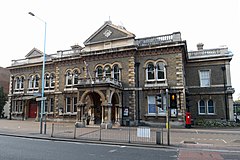
Willesden was a local government district in the county of Middlesex, England from 1874 to 1965. It formed part of the Metropolitan Police District and London postal district. Willesden was part of the built-up area of London and bordered the County of London to the east and south.
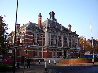
Tottenham was a local government district in north east Middlesex from 1850 to 1965. It was part of the London postal district and Metropolitan Police District.
Ealing was a local government district from 1863 to 1965 around the town of Ealing which formed part of the built up area of London until 1965, where it became part of Greater London.

Enfield was a local government district in Middlesex, England from 1850 to 1965.

Southgate was a local government district of Middlesex from 1881 to 1965. It was part of the London postal district and Metropolitan Police District.

Edmonton was a local government district in north-east Middlesex, England, from 1850 to 1965.

Uxbridge was a local government district in north west Middlesex, England, from 1849 to 1965, seated in the town of Uxbridge.

Surbiton was a local government district in northeast Surrey, United Kingdom from 1855 to 1965.
Staines was a local government district from 1894 to 1974 named after the English town of Staines.
Rhondda was a local government district in the geographical area of the Rhondda Valley, south Wales, from 1877 until 1996, with various statuses through its history.
Heston and Isleworth was a local government district of Middlesex, England from 1894 to 1965.

Chiswick was a local government district in the county of Middlesex, England from 1858 to 1927. It was part of the London postal district and the Metropolitan Police District.
Hayes and Harlington was a local government, urban district in west Middlesex, England from 1904 to 1965.

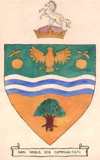
The Coat of arms of the London Borough of Brent is the official arms of the London Borough of Brent. It was granted on 1 September 1965.