Aspermont, Texas

Last updated

Aspermont, Texas
Aspermont South of Courthouse.jpg
A row of buildings south of the Stonewall County Courthouse in Aspermont, Texas
TXMap-doton-Aspermont.PNG
Location of Aspermont, Texas
Stonewall County Aspermont.svg
Coordinates: 33°8′21″N100°13′42″W / 33.13917°N 100.22833°W / 33.13917; -100.22833
CountryUnited States
State Texas
County Stonewall
Area
[1]
  Total2.07 sq mi (5.37 km2)
  Land2.05 sq mi (5.32 km2)
  Water0.02 sq mi (0.05 km2)
Elevation
1,781 ft (543 m)
Population
 (2020) [2]
  Total789
  Density384.13/sq mi (148.31/km2)
Time zone UTC−6 (Central (CST))
  Summer (DST) UTC−5 (CDT)
ZIP code
79502
Area code 940
FIPS code 48-04408 [3]
GNIS feature ID1372350 [4]

Aspermont is a town and the county seat of Stonewall County, Texas. [5] The population was 789 at the 2020 census. [2]

Contents

History

The town was established in 1889. [6] Aspermont means "rough mountain" in Latin, and is probably a reference to the nearby Double Mountains. The city was founded by A. L. Rhomberg of Swiss-Austrian descent, who might have been a descendant of the noble family Aspermont from Graubünden, which is known to have relocated to Dornbirn in the Austrian part of the Rhine Valley and changed the name to Rhomberg. Marshall Formby, later a Texas state senator, operated the Aspermont Star weekly newspaper in the middle 1930s. The paper is now known as the Double Mountain Chronicle .

Geography

According to the United States Census Bureau, the town has a total area of 2.1 square miles (5.4 km2), all land.

Demographics

Historical population
CensusPop.Note
1890 205
1920 436
1930 76976.4%
1940 1,04135.4%
1950 1,0622.0%
1960 1,28621.1%
1970 1,198−6.8%
1980 1,35713.3%
1990 1,214−10.5%
2000 1,021−15.9%
2010 919−10.0%
2020 789−14.1%
U.S. Decennial Census [7]

2020 census

Aspermont racial composition [8]
(NH = Non-Hispanic) [lower-alpha 1]
RaceNumberPercentage
White (NH)54669.2%
Black or African American (NH)162.03%
Native American or Alaska Native (NH)30.38%
Asian (NH)50.63%
Some Other Race (NH)20.25%
Mixed/Multi-Racial (NH)182.28%
Hispanic or Latino 19925.22%
Total789

As of the 2020 United States census, there were 789 people, 372 households, and 277 families residing in the town.

2000 census

At the 2000 census, 1,021 people, 418 households, and 282 families were living in the town. The population density was 493.2 people/sq mi (190.4/km2). The 507 housing units averaged 244.9/sq mi (94.6/km2). The racial makeup of the town was 85.99% White, 4.31% African American, 0.10% Native American, 0.39% Asian, 7.25% from other races, and 1.96% from two or more races. Hispanics or Latinos of any race were 13.12%. [3]

Of the 418 households, 27.5% had children under 18 living with them, 52.4% were married couples living together, 11.7% had a female householder with no husband present, and 32.3% were not families. About 30.1% of households were one person, and 15.6% were one person aged 65 or older. The average household size was 2.34, and the average family size was 2.90.

The age distribution was 23.4% under 18, 7.2% from 18 to 24, 23.4% from 25 to 44, 23.5% from 45 to 64, and 22.4% 65 or older. The median age was 41 years. For every 100 females, there were 82.6 males. For every 100 females age 18 and over, there were 81.0 males.

The median household income was $25,893.89 and the median family income was $31,172. Males had a median income of $24,904 versus $13,971 for females. The per capita income for the town was $14,060. About 17.1% of families and 22.3% of the population were below the poverty line, including 37.5% of those under age 18 and 11.5% of those age 65 or over. Senior Citizens over the age of 85 have a median income of $7,937.07.

Education

The Town of Aspermont is served by the Aspermont Independent School District and home to the Aspermont High School Hornets.

Climate

According to the Köppen Climate Classification system, Aspermont has a humid subtropical climate, abbreviated "Cfa" on climate maps. The hottest temperature recorded in Aspermont was 117 °F (47.2 °C) on June 28, 1994, while the coldest temperature recorded was −10 °F (−23.3 °C) on December 23, 1989. [10]

Climate data for Aspermont, Texas, 1991–2020 normals, extremes 1962–present
MonthJanFebMarAprMayJunJulAugSepOctNovDecYear
Record high °F (°C)87
(31)
94
(34)
101
(38)
111
(44)
113
(45)
117
(47)
114
(46)
112
(44)
109
(43)
108
(42)
92
(33)
89
(32)
117
(47)
Mean maximum °F (°C)78.6
(25.9)
82.9
(28.3)
89.8
(32.1)
95.5
(35.3)
101.1
(38.4)
103.2
(39.6)
105.2
(40.7)
104.4
(40.2)
100.2
(37.9)
94.6
(34.8)
84.5
(29.2)
78.4
(25.8)
107.3
(41.8)
Mean daily maximum °F (°C)56.3
(13.5)
60.4
(15.8)
68.9
(20.5)
78.0
(25.6)
85.8
(29.9)
92.9
(33.8)
96.8
(36.0)
96.0
(35.6)
87.9
(31.1)
78.3
(25.7)
66.0
(18.9)
57.3
(14.1)
77.1
(25.0)
Daily mean °F (°C)42.9
(6.1)
46.4
(8.0)
54.5
(12.5)
63.0
(17.2)
72.2
(22.3)
80.3
(26.8)
84.0
(28.9)
83.1
(28.4)
75.2
(24.0)
64.5
(18.1)
52.5
(11.4)
44.2
(6.8)
63.6
(17.5)
Mean daily minimum °F (°C)29.4
(−1.4)
32.3
(0.2)
40.1
(4.5)
47.9
(8.8)
58.5
(14.7)
67.7
(19.8)
71.3
(21.8)
70.1
(21.2)
62.4
(16.9)
50.7
(10.4)
38.9
(3.8)
31.1
(−0.5)
50.0
(10.0)
Mean minimum °F (°C)15.6
(−9.1)
18.0
(−7.8)
23.3
(−4.8)
32.6
(0.3)
42.8
(6.0)
57.7
(14.3)
64.0
(17.8)
62.1
(16.7)
48.8
(9.3)
33.8
(1.0)
22.8
(−5.1)
16.9
(−8.4)
11.2
(−11.6)
Record low °F (°C)0
(−18)
−5
(−21)
9
(−13)
23
(−5)
33
(1)
45
(7)
56
(13)
48
(9)
34
(1)
17
(−8)
11
(−12)
−10
(−23)
−10
(−23)
Average precipitation inches (mm)0.98
(25)
1.22
(31)
1.65
(42)
1.70
(43)
3.07
(78)
3.39
(86)
2.06
(52)
2.71
(69)
2.48
(63)
1.89
(48)
1.33
(34)
1.12
(28)
23.60
(599)
Average snowfall inches (cm)0.8
(2.0)
1.6
(4.1)
0.0
(0.0)
0.1
(0.25)
0.0
(0.0)
0.0
(0.0)
0.0
(0.0)
0.0
(0.0)
0.0
(0.0)
0.1
(0.25)
0.8
(2.0)
0.7
(1.8)
4.1
(10.4)
Average precipitation days (≥ 0.01 in)4.34.94.84.87.16.94.96.15.85.14.23.962.8
Average snowy days (≥ 0.1 in)0.40.60.10.00.00.00.00.00.00.10.30.52.0
Source 1: NOAA [11]
Source 2: National Weather Service [10]

Related Research Articles

<span class="mw-page-title-main">Stonewall County, Texas</span> County in Texas, United States

Stonewall County is a county located in the U.S. state of Texas. As of the 2020 census, its population was 1,245. Its county seat is Aspermont. The county was created in 1876 and organized in 1888. It is named for Stonewall Jackson, a general of the Confederate States Army.

<span class="mw-page-title-main">Kent County, Texas</span> County in Texas, United States

Kent County is a county located in the U.S. state of Texas. As of the 2020 census, its population was 753, making it the sixth-least populous county in Texas. Its county seat is Jayton. The county was created in 1876 and later organized in 1892. It is named for Andrew Kent, who died at the Battle of the Alamo. Kent County is a prohibition or entirely dry county, one of four remaining in the state.

<span class="mw-page-title-main">Pomona Park, Florida</span> Town in the state of Florida, United States

Pomona Park is a town in Putnam County, Florida, United States. The Town of Pomona Park is part of the Palatka Micropolitan Statistical Area. The population was 784 at the 2020 census.

<span class="mw-page-title-main">Cimarron, Kansas</span> City in Gray County, Kansas

Cimarron is a city in and the county seat of Gray County, Kansas, United States. As of the 2020 census, the population of the city was 1,981. It is located along Highway 50.

<span class="mw-page-title-main">China Grove, Texas</span> Town in Texas, United States

China Grove is a town in Bexar County, Texas, United States, located on the far east side of San Antonio. The population was 1,141 at the 2020 census. It is part of the San Antonio Metropolitan Statistical Area.

<span class="mw-page-title-main">Paint Rock, Texas</span> Town in Texas, United States

Paint Rock is a town in and the county seat of Concho County, Texas, United States. The population was 237 at the 2020 census.

<span class="mw-page-title-main">Paducah, Texas</span> Town in Texas, United States

Paducah is a town in Cottle County, Texas, United States. The population was 1,186 at the 2010 census, down from 1,498 in 2000. It is the county seat of Cottle County. It is just south of the Texas Panhandle and east of the Llano Estacado.

<span class="mw-page-title-main">Stonewall, Texas</span> Census-designated place in Texas, United States

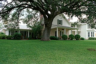
Stonewall is an unincorporated community and census-designated place (CDP) in Gillespie County, Texas, United States. The population was 525 at the 2010 census. It was named for Confederate General Thomas J. (Stonewall) Jackson, by Israel P. Nunez, who established a stage station near the site in 1870.

<span class="mw-page-title-main">Rule, Texas</span> Town in Texas, United States

Rule is a town in Haskell County, Texas, United States. The population was 636 at the 2010 census, down from 698 at the 2000 census.

<span class="mw-page-title-main">Stinnett, Texas</span> City in Texas, United States

Stinnett is a city in and the county seat of Hutchinson County, Texas, United States. The population was 1,881 at the 2010 census, a decrease from 1,936 at the 2000 census.

<span class="mw-page-title-main">Anson, Texas</span> City in Texas, United States

Anson is a city in and the county seat of Jones County, Texas, United States. The population was 2,294 at the 2020 census. It is part of the Abilene, Texas metropolitan area. Originally named "Jones City", the town was renamed "Anson" in 1882 in honor of Anson Jones, the last president of the Republic of Texas.

<span class="mw-page-title-main">Jayton, Texas</span> City in Texas, United States

Jayton is a city in and the county seat of Kent County, Texas, United States. It is located in the northeastern portion of the county, and the population was 511 as of the 2020 census.

<span class="mw-page-title-main">Madisonville, Texas</span> City in Texas, United States

Madisonville is a city in Madison County, Texas, United States. The population was 4,420 at the 2020 census. It is the county seat of Madison County. Both the City of Madisonville and the County of Madison were named for U.S. President James Madison, the fourth chief executive.

<span class="mw-page-title-main">Goldthwaite, Texas</span> City in Texas, United States

Goldthwaite is a town and the county seat of Mills County, Texas, United States. The population was 1,878 at the 2010 census.

<span class="mw-page-title-main">Garrison, Texas</span> City in Texas, United States

Garrison is a small town in Nacogdoches County, Texas, United States. The population was 789 at the 2020 census.

<span class="mw-page-title-main">Trent, Texas</span> Town in Texas, United States

Trent is a town in Taylor County, Texas, United States, that was established in 1881. The population was 337 at the 2010 census. It is part of the Abilene, Texas Metropolitan Statistical Area. Trent, Texas was named in honor of West Texas pioneer and cattleman, Isaac Riley Trent.

<span class="mw-page-title-main">Woodville, Texas</span> Town in Texas, United States

Woodville is a town and county seat of Tyler County, Texas, United States. The town is intersected by three U.S. highways: U.S. Highway 69, U.S. Highway 190, and U.S. Highway 287. The population was 2,403 at the 2020 census. It is the county seat of Tyler County. The town was named after George Tyler Wood, governor of Texas from 1847 to 1849.

<span class="mw-page-title-main">Wheeler, Texas</span> City in Texas, United States

Wheeler is a city, and the county seat of Wheeler County, Texas, United States, located on the eastern border of the Texas Panhandle. The population was last reported at 1,592 in the 2010 census.

<span class="mw-page-title-main">Hamlin, Texas</span> City in Texas, United States

Hamlin is a city in Jones and Fisher Counties in the U.S. state of Texas. The population was 2,124 at the 2010 census, and in 2018, the estimated population was 1,997. The Jones County portion of Hamlin is part of the Abilene, Texas metropolitan area.

<span class="mw-page-title-main">Waller, Texas</span> City in Texas, United States

Waller is a city in Texas, United States, partly in Waller County and partly in Harris County within the Houston–Cypress metropolitan area. Its population was 2,682 at the 2020 U.S. census. The Waller area is located along U.S. Route 290 41 miles (66 km) northwest of downtown Houston.

References

  1. "2020 U.S. Gazetteer Files". United States Census Bureau. Retrieved February 9, 2024.
  2. 1 2 "Profile of General Population and Housing Characteristics: 2020 Demographic Profile Data (DP-1): Aspermont town, Texas". United States Census Bureau . Retrieved February 9, 2024.
  3. 1 2 "U.S. Census website". United States Census Bureau . Retrieved January 31, 2008.
  4. "US Board on Geographic Names". United States Geological Survey. October 25, 2007. Retrieved January 31, 2008.
  5. National Association of Counties. "NACo County Explorer" . Retrieved February 9, 2024.
  6. "Aspermont, Texas". Texas State Historical Association. Retrieved February 6, 2012.
  7. "Census of Population and Housing". Census.gov. Retrieved June 4, 2015.
  8. "Explore Census Data". data.census.gov. Retrieved May 19, 2022.
  9. "About the Hispanic Population and its Origin". www.census.gov. Retrieved May 18, 2022.
  10. 1 2 "NOAA Online Weather Data – NWS Lubbock". National Weather Service. Retrieved May 2, 2023.
  11. "U.S. Climate Normals Quick Access – Station: Aspermont, TX". National Oceanic and Atmospheric Administration. Retrieved May 2, 2023.
  1. Note: the US Census treats Hispanic/Latino as an ethnic category. This table excludes Latinos from the racial categories and assigns them to a separate category. Hispanics/Latinos can be of any race. [9]