Channing, Texas

Last updated

Channing, Texas
Revised XIT Ranch office, Channing, TX IMG 4935.JPG
XIT Ranch General Office in Channing
TXMap-doton-Channing.PNG
Location of Channing, Texas
Hartley County Channing.svg
Coordinates: 35°40′55″N102°19′56″W / 35.68194°N 102.33222°W / 35.68194; -102.33222
Country United States
State Texas
County Hartley
Area
[1]
  Total0.99 sq mi (2.57 km2)
  Land0.99 sq mi (2.57 km2)
  Water0.00 sq mi (0.00 km2)
Elevation
[2]
3,803 ft (1,159 m)
Population
 (2010)
  Total363
  Estimate 
(2019) [3]
344
  Density346.77/sq mi (133.87/km2)
Time zone UTC-6 (Central (CST))
  Summer (DST) UTC-5 (CDT)
ZIP code
79018
Area code 806
FIPS code 48-14260 [4]
GNIS feature ID2409436 [2]
Channing, Texas Channing aerial photo.jpg
Channing, Texas

Channing is a town in Hartley County, Texas, in the United States. It is the county seat of Hartley County. [5] As of the 2020 United States census, the town's population was 281. [6]

Contents

History

The XIT Ranch office is listed on the National Register of Historic Places. XIT Ranch office plaque IMG 4934.JPG
The XIT Ranch office is listed on the National Register of Historic Places.

Channing was founded in 1888 by George Channing Rivers, a paymaster for the Fort Worth and Denver City Railway. [7] The settlement was originally called Rivers. Since the name Rivers duplicated another community in Texas, the name was changed to Channing later that year. [8] Channing developed directly from its association with the XIT Ranch, a property that once included land in as many as 10 counties in the Texas Panhandle.

In 1891, Willis D. Twitchell platted Channing's business district. At that time, Channing was the headquarters of the XIT. [9] Albert Boyce, the ranch's general manager and one of the most prominent early citizens, built the first house in the community. By 1900, Channing had two stores, a post office, lumber yard, and school. [7]

Two elections, one in November 1896 and the other in 1903, were required for Channing to replace Hartley as county seat. [8] [10] The frame courthouse was pulled to Channing on wheels by mounted XIT cowboys in 1903. A brick courthouse was completed in 1906 and the original courthouse was converted into the once-famous Hotel Rivers. [9] One of the first public libraries in the Panhandle was established in 1908 by a local women's club. The estimated population at this time was about 600.

The XIT, which conducted most of its business from Channing, was the town's chief customer until liquidation of the ranch in 1911. The local economy was severely impacted, although the real-estate market temporarily thrived from the sale of XIT lands. [10] A fire swept through the business district on September 6, 1931, destroying seven buildings, including Hotel Rivers. By 1940, Channing had an estimated population of 475 with several businesses, a high school, and three churches. A restored XIT office building is located in Channing as a museum.

Channing was incorporated in 1960. At the time of incorporation, the population was 390. [8] The number of inhabitants declined to 336 in 1970, 304 in 1980, and 277 in 1990, mainly because of its accessibility to the larger communities of Dalhart and Amarillo. By 2000, the population rose to 356, a 28.5% increase over the 1990 figure.

Government services

City government consists of a mayor and two city council members. Mayor Troy Williams was elected in May 2021. Current council members are Preston Mead and Jacob Vincent.

Law enforcement is provided by the Hartley County Sheriff's Office, as the city does not have a police force of its own. Fire protection for the city and much of southern Hartley County is provided by an all-volunteer fire department, headquartered in the city.

As of October 2009, a limited number of businesses operated in the city: a cafe, a mercantile, and a rendering plant. Most citizens were either involved in ranching, dairy, or other agricultural professions, or were employed in businesses in surrounding communities.

Geography

Channing is situated at the junction of U.S. Highway 385, State Highway 354, and FM 767 in southeastern Hartley County, approximately 30 miles south of Dalhart. [10] According to the United States Census Bureau, the city has a total area of 0.3  sq mi (2.6 km2), all land.

Climate

According to the Köppen climate classification, Channing has a semiarid climate, BSk on climate maps. [11]

Demographics

Historical population
CensusPop.Note
1960 351
1970 336−4.3%
1980 304−9.5%
1990 277−8.9%
2000 35628.5%
2010 3632.0%
2019 (est.)344 [3] −5.2%
U.S. Decennial Census [12]

2020 census

Channing racial composition [13]
(NH = Non-Hispanic) [lower-alpha 1]
RaceNumberPercentage
White (NH)22479.72%
Black or African American (NH)20.71%
Native American or Alaska Native (NH)41.42%
Mixed/Multi-Racial (NH)103.56%
Hispanic or Latino 4114.59%
Total281

As of the 2020 United States census, there were 281 people, 124 households, and 91 families residing in the city.

2000 census

As of the census [4] of 2000, 356 people, 135 households, and 103 families were living in the city. The population density was 357.9 people/sq mi (138.8/km2). The 154 housing units had an average density of 154.8/sq mi (60.1/km2). The racial makeup of the city was 94.94% White, 1.12% African American, 0.56% Native American, 1.69% from other races, and 1.69% from two or more races. Hispanics or Latinos of any race were 7.02% of the population.

Of the 135 households, 38.5% had children under 18 living with them, 74.1% were married couples living together, 2.2% had a female householder with no husband present, and 23.0% were not families. About 23.0% of all households were made up of individuals, and 11.9% had someone living alone who was 65 or older. The average household size was 2.63, and the average family size was 3.07.

In the city, the age distribution was 29.5% under 18, 4.8% from 18 to 24, 27.5% from 25 to 44, 22.8% from 45 to 64, and 15.4% who were 65 or older. The median age was 40 years. For every 100 females, there were 89.4 males. For every 100 females age 18 and over, there were 93.1 males.

The median income for a household in the city was $34,167, and for a family was $42,188. Males had a median income of $29,250 versus $22,679 for females. The per capita income for the city was $16,824. About 3.5% of families and 5.5% of the population were below the poverty line, including 5.6% of those under age 18 and 9.5% of those age 65 or over.

Education

The City of Channing is served by the Channing Independent School District. One building, Channing School, houses all grades and is located in the western part of the city.

Notable person

Related Research Articles

<span class="mw-page-title-main">Potter County, Texas</span> County in Texas, United States

Potter County is a county located in the U.S. state of Texas. As of the 2020 census, its population was 118,525. Its county seat is Amarillo. The county was created in 1876 and organized in 1887. It is named for Robert Potter, a politician, signer of the Texas Declaration of Independence, and the Texas Secretary of the Navy. Potter County is included in the Amarillo metropolitan area.

<span class="mw-page-title-main">Oldham County, Texas</span> County in Texas, United States

Oldham County is a county located in the U.S. state of Texas. As of the 2020 census, its population was 1,758. Its county seat is Vega. The county was created in 1876 and organized in 1881. Oldham County is included in the Amarillo, TX Metropolitan Statistical Area.

<span class="mw-page-title-main">Hartley County, Texas</span> County in Texas, United States

Hartley County is a county located in the U.S. state of Texas. As of the 2020 census, its population was 5,382. The county seat is Channing. The county was created in 1876 and later organized in 1891. It is named for Oliver C. Hartley and his brother, Rufus K. Hartley, two early Texas legislators and lawyers.

<span class="mw-page-title-main">Hale County, Texas</span> County in Texas, United States

Hale County is a county located in the U.S. state of Texas. As of the 2020 census, its population was 32,522. Its county seat is Plainview. The county was created in 1876 and organized in 1888. It is named for Lt. John C. Hale, a hero of the Battle of San Jacinto. Hale County comprises the Plainview, Texas micropolitan statistical area.

<span class="mw-page-title-main">Dallam County, Texas</span> County in Texas, United States

Dallam County is the north-westernmost county in the U.S. state of Texas. As of the 2020 Census, its population was 7,115. Its county seat is Dalhart. The county was founded in 1876 and later organized in 1891. It is named for James Wilmer Dallam, a lawyer and newspaper publisher.

<span class="mw-page-title-main">Carson County, Texas</span> County in Texas, United States

Carson County is a county located in the U.S. state of Texas. As of the 2020 census, its population was 5,807. The county seat is Panhandle. The county was founded in 1876 and later organized in 1888. It is named for Samuel Price Carson, the first secretary of state of the Republic of Texas.

<span class="mw-page-title-main">Armstrong County, Texas</span> County in Texas, United States

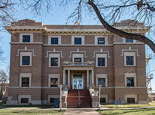
Armstrong County is a county located in the U.S. state of Texas. As of the 2020 census, the population of Armstrong County was 1,848. It is in the Texas Panhandle and its county seat is Claude.

<span class="mw-page-title-main">Claude, Texas</span> City in Texas, United States

Claude is a city in and the county seat of Armstrong County, Texas, United States. The population was 1,196 at the 2010 census. It is located east of Amarillo in the south Texas Panhandle. Claude is part of the Amarillo Metropolitan Statistical Area but is some thirty miles east of Amarillo.

<span class="mw-page-title-main">Panhandle, Texas</span> Town in Texas, United States

Panhandle is the county seat of Carson County, Texas, United States. The population of the town was 2,452 at the 2010 census. Panhandle is part of the Amarillo metropolitan statistical area.

<span class="mw-page-title-main">Wellington, Texas</span> City in Texas, United States

Wellington is a city and county seat of Collingsworth County, Texas, United States. The population was 2,189 at the 2010 census.

<span class="mw-page-title-main">Paducah, Texas</span> Town in Texas, United States

Paducah is a town in Cottle County, Texas, United States. The population was 1,186 at the 2010 census, down from 1,498 in 2000. It is the county seat of Cottle County. It is just south of the Texas Panhandle and east of the Llano Estacado.

<span class="mw-page-title-main">Pampa, Texas</span> City in Texas, United States

Pampa is a city in Gray County, Texas, United States. Its population was 16,867 as of the 2020 census. Pampa is the county seat of Gray County and is the principal city of the Pampa micropolitan statistical area, which includes both Gray and Roberts Counties. Pampa is named after the Pampas Lowlands in Argentina, Uruguay, and southern Brazil.

<span class="mw-page-title-main">George West, Texas</span> City in Texas, United States

George West is a city in Live Oak County, Texas, United States, and named for cattle rancher George Washington West. The population was 2,445 at the 2010 census. It is the county seat of Live Oak County. George West was named the "storytelling capital of Texas" in 2005 by the Texas Senate; and it hosts the George West Storyfest, a festival that features storytelling, cowboy poetry, and music. Numerous ranches surround George West.

<span class="mw-page-title-main">Sunray, Texas</span> City in Texas, United States

Sunray is a city in northeastern Moore County, Texas, United States. The population was 1,926 at the 2010 census.

<span class="mw-page-title-main">Vega, Texas</span> City in Texas, United States

Vega is a city and county seat of Oldham County, Texas, United States. The population was 884 at the 2010 census, down from 936 at the 2000 census.

<span class="mw-page-title-main">Bovina, Texas</span> City in Texas, United States

Bovina is a city in Parmer County, Texas, United States. The population was 1,868 at the 2010 census.

<span class="mw-page-title-main">Farwell, Texas</span> City in Texas, United States

Farwell is a city in and the county seat of Parmer County, Texas, United States. Its population was 1,363 at the 2010 census. The city is located on the Texas-New Mexico border with the city of Texico, New Mexico across the border.

<span class="mw-page-title-main">Friona, Texas</span> City in Texas, United States

Friona is a city in Parmer County, Texas, United States. The population was 4,171 at the 2020 census. Friona was established as a small community in 1898 by XIT Ranch, originally called Frio, which is also the word for "cold" in Spanish.

<span class="mw-page-title-main">Dalhart, Texas</span> City in Texas, United States

Dalhart is a city in Dallam and Hartley counties in the U.S. state of Texas, and the county seat of Dallam County. The population was 8,447 at the 2020 census.

<span class="mw-page-title-main">Texas panhandle</span> Region in Texas, United States

The Texas panhandle is a region of the U.S. state of Texas consisting of the northernmost 26 counties in the state. The panhandle is a square-shaped area bordered by New Mexico to the west and Oklahoma to the north and east. It is adjacent to the Oklahoma Panhandle, land which Texas previously claimed. The 1820 Missouri Compromise declared no slavery would be allowed in states admitted from the Louisiana Purchase above 36°30′ north latitude. Texas was annexed in 1845 from still more westerly land. The Compromise of 1850 removed territory north of this line from Texas, and set the border between the Texas Pandhandle and the New Mexico Territory at the 103rd meridian west. The eastern border at the 100th meridian west was inherited from the Adams–Onís Treaty of 1819, which defined the border between the United States and New Spain. The Handbook of Texas defines the southern border of Swisher County as the southern boundary of the Texas Panhandle region.

References

  1. "2019 U.S. Gazetteer Files". United States Census Bureau. Retrieved August 7, 2020.
  2. 1 2 U.S. Geological Survey Geographic Names Information System: Channing, Texas
  3. 1 2 "Population and Housing Unit Estimates". United States Census Bureau. May 24, 2020. Retrieved May 27, 2020.
  4. 1 2 "U.S. Census website". United States Census Bureau . Retrieved January 31, 2008.
  5. "Find a County". National Association of Counties. Archived from the original on May 31, 2011. Retrieved June 7, 2011.
  6. "Explore Census Data".
  7. 1 2 "The History of Channing". Kade Kistner (Channing Independent School District). Archived from the original on April 26, 2010. Retrieved July 20, 2009.
  8. 1 2 3 "Channing, Texas". The Handbook of Texas online. Retrieved July 20, 2009.
  9. 1 2 "Out West in the Cowboys' Land". Dalhart Chamber of Commerce. Archived from the original on July 23, 2007. Retrieved July 20, 2009.
  10. 1 2 3 "Channing, Texas". Texas Escapes Online Magazine. Retrieved July 20, 2009.
  11. Climate Summary for Channing, Texas
  12. "Census of Population and Housing". Census.gov. Retrieved June 4, 2015.
  13. "Explore Census Data". data.census.gov. Retrieved May 19, 2022.
  14. "About the Hispanic Population and its Origin". www.census.gov. Retrieved May 18, 2022.
  1. Note: the US Census treats Hispanic/Latino as an ethnic category. This table excludes Latinos from the racial categories and assigns them to a separate category. Hispanics/Latinos can be of any race. [14]