Sonora, Texas

Last updated

Sonora, Texas
Sonora, TX, welcome sign IMG 1381.JPG
Sonora entrance sign
Nickname: 
"Home of the Caverns of Sonora"
TXMap-doton-Sonora.PNG
Location in the state of Texas
Sutton County Sonora.svg
Coordinates: 30°34′5″N100°38′39″W / 30.56806°N 100.64417°W / 30.56806; -100.64417
Country United States
State Texas
County Sutton
Government
   Mayor Wanda Shurley
Area
[1]
  Total2.22 sq mi (5.75 km2)
  Land2.22 sq mi (5.75 km2)
  Water0.00 sq mi (0.00 km2)
Elevation
2,129 ft (649 m)
Population
 (2010)
  Total3,027
  Estimate 
(2019) [2]
2,786
  Density1,256.09/sq mi (484.90/km2)
Time zone UTC-6 (CST)
  Summer (DST) UTC-5 (CDT)
ZIP code
76950
Area code Area code 325
FIPS code 48-68756 [3]
GNIS feature ID1368606 [4]
Website City of Sonora
The Sutton County Courthouse is perched on a hill overlooking Sonora. Sutton County courthouse May 2020.jpg
The Sutton County Courthouse is perched on a hill overlooking Sonora.
Sonora City Hall Sonora, TX, City Hall IMG 1361.JPG
Sonora City Hall
A glimpse of the eastern side of downtown Sonora Downtown Sonora, TX IMG 1376.JPG
A glimpse of the eastern side of downtown Sonora
Sonora Bank at 102 E. Main St. in Sonora Sonora Bank, TX DSCN0931.JPG
Sonora Bank at 102 E. Main St. in Sonora
First Methodist Church of Sonora First Methodist Church, Sonora, TX IMG 1371.JPG
First Methodist Church of Sonora
Presbyterian Church of the Good Shepherd in Sonora Presbyterian Church, Sonora, TX IMG 1374.JPG
Presbyterian Church of the Good Shepherd in Sonora
First Baptist Church Fellowship Hall in Sonora is named for J. C. Hancock, the pastor there from 1968 to 1983. First Baptist Church, Sonora, TX IMG 1378.JPG
First Baptist Church Fellowship Hall in Sonora is named for J. C. Hancock, the pastor there from 1968 to 1983.

Sonora is a city in and the county seat of Sutton County, Texas, United States. [5] The population was 3,027 at the 2010 census. [6]

Contents

Geography and climate

Sonora is located at 30°34′5″N100°38′39″W / 30.56806°N 100.64417°W / 30.56806; -100.64417 (30.568166, –100.644163). [7]

According to the United States Census Bureau, the city has a total area of 2.0 square miles (5.1 km2), all land.

The area lies in the western portions of the Texas Hill Country, a region of limestone outcrops and rolling terrain dotted with areas of live oaks ( Quercus fusiformis ) and juniper ( Juniperus ashei ) in the form of a woodland or savanna, alternating with a blend of various grasses and other shrubs and cacti.

Sonora's climate is subhumid and subtropical, though periods of long drought are not uncommon due to the proximity of deserts and steppes nearby, to the west. The upland location allows some of the periodic Gulf of Mexico moisture to interact with frontal systems and elevated terrain to create more clouds and precipitation than locations in the brush country to the south, or the steppes and deserts to the west and northwest. Thunderstorms with heavy rainfall are most frequent during spring and fall months, though some lighter, steady precipitation and low clouds can occur during the winter, due in large part to frontal systems originating on the plains and prairies to the north.

Summers are long and hot, often with higher humidity, though a good breeze often moderates the heat. Fall through spring months are often pleasant, though winter can experience brief periods of cold or cloudy weather.

Demographics

Historical population
CensusPop.Note
1920 1,009
1930 1,94292.5%
1940 2,52830.2%
1950 2,6334.2%
1960 2,619−0.5%
1970 2,149−17.9%
1980 3,85679.4%
1990 2,751−28.7%
2000 2,9246.3%
2010 3,0273.5%
2019 (est.)2,786 [2] −8.0%
U.S. Decennial Census [8]

2020 census

Sonora racial composition [9]
(NH = Non-Hispanic) [lower-alpha 1]
RaceNumberPercentage
White (NH)78931.53%
Black or African American (NH)60.24%
Native American or Alaska Native (NH)20.08%
Asian (NH)40.16%
Some Other Race (NH)120.48%
Mixed/Multi-Racial (NH)311.24%
Hispanic or Latino 1,65866.27%
Total2,502

As of the 2020 United States census, there were 2,502 people, 1,085 households, and 799 families residing in the city.

2000 census

As of the census [3] of 2000, 2,924 people, 1,043 households, and 808 families resided in the city. The population density was 1,488.8 inhabitants per square mile (574.8/km2). There were 1,264 housing units at an average density of 643.6 per square mile (248.5/km2). The racial makeup of the city was 74.18% White, 0.34% African American, 0.34% Native American, 0.24% Asian, 23.36% from other races, and 1.54% from two or more races. Hispanics or Latinos of any race were 53.35% of the population.

Of the 1,043 households, 42.9% had children under the age of 18 living with them, 64.0% were married couples living together, 8.5% had a female householder with no husband present, and 22.5% were not families. About 20.6% of all households were made up of individuals, and 8.5% had someone living alone who was 65 years of age or older. The average household size was 2.77 and the average family size was 3.23.

In the city, the population was distributed as 31.1% under the age of 18, 7.4% from 18 to 24, 28.7% from 25 to 44, 22.2% from 45 to 64, and 10.7% who were 65 years of age or older. The median age was 34 years. For every 100 females, there were 98.8 males. For every 100 females age 18 and over, there were 95.2 males.

The median income for a household in the city was $36,272, and for a family was $38,106. Males had a median income of $31,728 versus $17,935 for females. The per capita income for the city was $16,128. About 13.0% of families and 16.7% of the population were below the poverty line, including 23.9% of those under age 18 and 11.2% of those age 65 or over.

Local government

The city government of Sonora uses the aldermanic form of government. It is led by an elected mayor and four other council members. [12]

As of February 24, 2016 the mayor of Sonora was Wanda Shurley and the four council members were Doug Chandler, Todd Munn, Jeremy Dawson, and Terri Johnson. [13] The Sonora police department is headed by Chief Matthew Routh.

Education

The City of Sonora is served by the Sonora Independent School District. Sonora exhibits a proud tradition of both academic and athletic success in its long history. The Sonora High School Broncos have won the most football state championships in their division (2A) with five, the most recent having been won in 2000 against the Blanco Panthers.

The latest championship team was coached by Jason Herring. 2000 was the first of two State Championships for him, his second coming in 2011 (beating the Broncos on the way there) with the Refugio Bobcats.

History

On the night of April 2, 1901, William Carver, a member of Butch Cassidy's Wild Bunch, was shot and killed in Jack Owen's Bakery by Sheriff E.S. Briant and his deputies. Briant was trying to arrest Carver on suspicion of the murder of Oliver Thornton in Concho County.

Notable people

Attractions

Related Research Articles

<span class="mw-page-title-main">Sutton County, Texas</span> County in Texas, United States

Sutton County is a county located on the Edwards Plateau in the U.S. state of Texas. As of the 2020 census, the population was 3,372. Its county seat is Sonora. The county was created in 1887 and organized in 1890. Sutton County is named for John S. Sutton, an officer in the Confederate Army.

<span class="mw-page-title-main">Schleicher County, Texas</span> County in Texas, United States

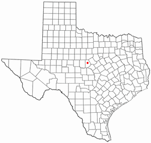
Schleicher County is a county located on the Edwards Plateau in the U.S. state of Texas. As of the 2020 census, its population was 2,451. Its county seat is Eldorado. The county was created in 1887 and organized in 1901. It is named for Gustav Schleicher, a German immigrant who became a surveyor and politician.

<span class="mw-page-title-main">Collingsworth County, Texas</span> County in Texas, United States

Collingsworth County is a county in the U.S. state of Texas. As of the 2020 census, its population was 2,652. Its county seat is Wellington. The county was created in 1876 and later organized in 1890. It is named for James Collinsworth, a signer of the Texas Declaration of Independence and first chief justice of the Republic of Texas. Collingsworth County was one of 30 prohibition, or entirely dry, counties in Texas, but a vote in 2017 changed this law.

<span class="mw-page-title-main">Dennison, Ohio</span> Village in Ohio, United States

Dennison is a village in Tuscarawas County, Ohio, United States. The population was 2,709 at the 2020 census.

<span class="mw-page-title-main">Olmos Park, Texas</span> City in Texas, United States

Olmos Park is a city in Bexar County, Texas, United States. The population was 2,180 at the 2020 census. The town is noted for its park-like setting, oak-tree lined streets, and large estates, many of which were constructed during the 1920s. The town is four miles north of downtown San Antonio and is surrounded by the city of San Antonio on the west, north, and south side.

<span class="mw-page-title-main">Lake Brownwood, Texas</span> Census-designated place in Texas, United States

Lake Brownwood is a census-designated place (CDP) located in Brown County in central Texas, United States. The population was 1,532 at the 2010 census.

<span class="mw-page-title-main">Robert Lee, Texas</span> City in Texas, United States

Robert Lee is a city in and the county seat of Coke County, Texas, United States. The population was 1,049 at the 2010 census.

<span class="mw-page-title-main">Comanche, Texas</span> Community in Texas, United States

Comanche is a city located in Comanche County in the U.S. state of Texas. The population was 4,335 at the 2010 census. It is the county seat of Comanche County.

<span class="mw-page-title-main">Rocksprings, Texas</span> Town in Texas, United States

Rocksprings is a town in Edwards County, Texas, in the United States. As of the 2010 census, the town population was 1,182, down from 1,285 at the 2000 census. It is the county seat of Edwards County. The town received its name from natural springs associated with the porous limestone rocks in the area.

<span class="mw-page-title-main">Haskell, Texas</span> City in Texas, United States

Haskell is a city in central Haskell County, Texas, United States. As of the 2010 census, the city population was 3,322. It is the Haskell county seat.

<span class="mw-page-title-main">Keene, Texas</span> City in Texas, United States

Keene is a city in Johnson County, Texas, United States. The population was 6,387 in 2020.

<span class="mw-page-title-main">Devine, Texas</span> City in Texas, United States

Devine is a city in Medina County, Texas, United States. The population was 4,350 at the 2010 census. It is part of the San Antonio Metropolitan Statistical Area.

<span class="mw-page-title-main">St. Jo, Texas</span> City in Texas, United States

Saint Jo is a city in Montague County, Texas, United States, along the northern border of the state. The population was 1,043 at the 2010 census.

<span class="mw-page-title-main">Canyon, Texas</span> City in Texas, United States

Canyon is a city in, and the county seat of, Randall County, Texas, United States. The population was 14,836 at the 2020 census. It is part of the Amarillo, Texas, metropolitan statistical area. Canyon is the home of West Texas A&M University and Panhandle–Plains Historical Museum, and the outdoor musical drama Texas.

<span class="mw-page-title-main">Miami, Texas</span> Town in Texas, United States

Miami is a town in Roberts County, Texas, United States. It is part of the Pampa, Texas micropolitan statistical area. Its population was 597 at the 2010 census. It is the county seat of Roberts County and the only municipality in the county.

<span class="mw-page-title-main">Taft, Texas</span> City in Texas, United States

Taft is a city in San Patricio County, Texas, United States. The population was 3,048 at the 2010 census.

<span class="mw-page-title-main">Eldorado, Texas</span> City in Texas, United States

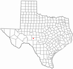
Eldorado is a city in and the county seat of Schleicher County, Texas, United States. The population was 1,951 at the 2010 census. Eldorado is located on U.S. Highway 277, some 21 miles (34 km) north of Sonora and 43 miles (69 km) south of San Angelo, Texas.

<span class="mw-page-title-main">Stratford, Texas</span> Town in Texas, United States

Stratford is a town in Sherman County, Texas, United States. The population was 2,017 at the 2010 census, up from 1,991 in 2000. It is the county seat of Sherman County.

<span class="mw-page-title-main">Josephine, Texas</span> City in Texas, United States

Josephine is a city in Collin and Hunt counties in the U.S. state of Texas. Its population was 812 at the 2010 census, with 755 residents in Collin County and 57 in Hunt County. By 2020, its population increased to 2,119.

Brighton is a census-designated place (CDP) in Monroe County, New York, United States. The population was 36,609 at the 2010 census. The CDP takes its name from locations in the county.

References

  1. "2019 U.S. Gazetteer Files". United States Census Bureau. Retrieved August 7, 2020.
  2. 1 2 "Population and Housing Unit Estimates". United States Census Bureau. May 24, 2020. Retrieved May 27, 2020.
  3. 1 2 "U.S. Census website". United States Census Bureau . Retrieved January 31, 2008.
  4. "US Board on Geographic Names". United States Geological Survey. October 25, 2007. Retrieved January 31, 2008.
  5. "Find a County". National Association of Counties. Retrieved June 7, 2011.
  6. "Population and Housing Unit Counts, 2010 Census of Population and Housing" (PDF). Texas: 2010.
  7. "US Gazetteer files: 2010, 2000, and 1990". United States Census Bureau. February 12, 2011. Retrieved April 23, 2011.
  8. "Census of Population and Housing". Census.gov. Retrieved June 4, 2015.
  9. "Explore Census Data". data.census.gov. Retrieved May 19, 2022.
  10. https://www.census.gov/ [ not specific enough to verify ]
  11. "About the Hispanic Population and its Origin". www.census.gov. Retrieved May 18, 2022.
  12. "City of Sonora, Texas Code of Ordinances Division 1, Sections 2-41 and 2-42" . Retrieved January 30, 2015.
  13. "City Council" . Retrieved January 30, 2015.
  14. "Jerald Jackson Taylor". apnewsarchive.com. April 3, 1995. Retrieved July 31, 2015.
  15. "Eaton Hill Nature Center". Texas Mountain Trail Region. Retrieved June 19, 2015.
  16. "Miers Home Museum". Texas Mountain Trail Region. Retrieved November 4, 2014.
  17. "Old Sonora Ice House Ranch Museum". Texas Mountain Trail Region. Retrieved November 4, 2014.
  1. Note: the US Census treats Hispanic/Latino as an ethnic category. This table excludes Latinos from the racial categories and assigns them to a separate category. Hispanics/Latinos can be of any race. [10] [11]