Plains, Texas

Last updated

Plains, Texas
Plains City Hall, Plains, Texas.jpg
Plains City Hall
TXMap-doton-Plains.PNG
Location of Plains, Texas
Yoakum County Plains.svg
Coordinates: 33°11′25″N102°49′39″W / 33.19028°N 102.82750°W / 33.19028; -102.82750
Country United States
State Texas
County Yoakum
Area
[1]
  Total1.50 sq mi (3.88 km2)
  Land1.50 sq mi (3.88 km2)
  Water0.00 sq mi (0.00 km2)
Elevation
[2]
3,642 ft (1,110 m)
Population
 (2010)
  Total1,355
  Density903.33/sq mi (349.23/km2)
Time zone UTC-6 (Central (CST))
  Summer (DST) UTC-5 (CDT)
ZIP code
79355
Area code 806
FIPS code 48-57968 [3]
GNIS feature ID2413140 [2]

Plains is a town and the county seat of Yoakum County [4] of western Texas, United States, particularly the south (inner) half of the panhandle's plains. The city's population was 1,355 at the 2020 census. Plains is in the Texas High Plains Wine country. [5]

Contents

History

In 1905, W. J. Luna founded and named Plains. When Yoakum County was organized in 1907, Plains was designated the county seat. After the discovery of oil in 1936, the population has grown steadily. [6]

Geography

Plains is located at 33°11′25″N102°49′39″W / 33.19028°N 102.82750°W / 33.19028; -102.82750 (33.190251, –102.827578). [7]

According to the United States Census Bureau, the town has a total area of 1.0 square mile (2.6 km2), all land.

Sulphur Springs Draw, which once held a stream, runs through town. Springs have dried up due to pumping of underground water. [6]

Climate

According to the Köppen climate classification system, Plains has a semiarid climate, BSk on climate maps. [8]

Climate data for Plains, Texas (1991–2020 normals, extremes 1946–present)
MonthJanFebMarAprMayJunJulAugSepOctNovDecYear
Record high °F (°C)82
(28)
86
(30)
95
(35)
98
(37)
107
(42)
111
(44)
109
(43)
106
(41)
104
(40)
100
(38)
88
(31)
80
(27)
111
(44)
Mean daily maximum °F (°C)54.3
(12.4)
59.3
(15.2)
67.3
(19.6)
75.3
(24.1)
83.7
(28.7)
91.8
(33.2)
92.5
(33.6)
91.4
(33.0)
84.3
(29.1)
75.2
(24.0)
63.3
(17.4)
55.0
(12.8)
74.5
(23.6)
Daily mean °F (°C)39.4
(4.1)
43.7
(6.5)
51.0
(10.6)
58.7
(14.8)
68.4
(20.2)
76.9
(24.9)
78.9
(26.1)
77.8
(25.4)
70.6
(21.4)
60.1
(15.6)
48.1
(8.9)
40.5
(4.7)
59.5
(15.3)
Mean daily minimum °F (°C)24.5
(−4.2)
28.2
(−2.1)
34.8
(1.6)
42.1
(5.6)
53.0
(11.7)
62.1
(16.7)
65.3
(18.5)
64.2
(17.9)
56.9
(13.8)
45.0
(7.2)
32.9
(0.5)
25.9
(−3.4)
44.6
(7.0)
Record low °F (°C)−12
(−24)
−12
(−24)
4
(−16)
16
(−9)
25
(−4)
42
(6)
50
(10)
49
(9)
34
(1)
12
(−11)
−2
(−19)
−4
(−20)
−12
(−24)
Average precipitation inches (mm)0.52
(13)
0.59
(15)
1.04
(26)
0.91
(23)
1.56
(40)
1.99
(51)
2.10
(53)
2.10
(53)
2.48
(63)
1.43
(36)
0.70
(18)
0.77
(20)
16.19
(411)
Average snowfall inches (cm)0.5
(1.3)
0.9
(2.3)
0.0
(0.0)
0.0
(0.0)
0.0
(0.0)
0.0
(0.0)
0.0
(0.0)
0.0
(0.0)
0.0
(0.0)
0.0
(0.0)
0.2
(0.51)
1.1
(2.8)
2.7
(6.9)
Average precipitation days (≥ 0.01 in)2.02.63.12.64.44.54.85.55.34.12.42.844.1
Average snowy days (≥ 0.1 in)0.30.50.00.00.00.00.00.00.00.00.30.71.8
Source: NOAA [9] [10]

Demographics

Historical population
CensusPop.Note
1960 1,195
1970 1,087−9.0%
1980 1,45734.0%
1990 1,422−2.4%
2000 1,4502.0%
2010 1,4812.1%
2020 1,355−8.5%
U.S. Decennial Census [11]

2020 census

Yoakum County Heritage and Art Museum Yoakum County Heritage and Art Museum.jpg
Yoakum County Heritage and Art Museum
Plains racial composition [12]
RaceNumberPercentage
White (non-Hispanic)45633.65%
Black or African American (non-Hispanic)10.07%
Native American 60.44%
Other/Mixed 271.99%
Hispanic or Latino 86563.84%
Total1,355

As of the 2020 United States census, there were 1,355 people, 428 households, and 346 families residing in the town.

2000 census

At the 2000 census, there were 1,450 people, 485 households, and 390 families living in the town. The population density was 1,465.6 inhabitants per square mile (565.9/km2). [3] There were 569 housing units at an average density of 575.1 per square mile (222.0/km2). The racial makeup of the town was 69.66% White, 0.76% Native American, 0.07% Asian, 0.07% Pacific Islander, 27.79% from other races, and 1.66% from two or more races. Hispanic or Latino of any race were 53.03% of the population.

Of the 485 households 42.3% had children under the age of 18 living with them, 68.0% were married couples living together, 8.9% had a female householder with no husband present, and 19.4% were non-families. 17.1% of households were one person and 8.7% were one person aged 65 or older. The average household size was 2.98 and the average family size was 3.37.

The age distribution was 32.6% under the age of 18, 8.1% from 18 to 24, 27.4% from 25 to 44, 20.7% from 45 to 64, and 11.2% 65 or older. The median age was 34 years. For every 100 females, there were 97.0 males. For every 100 females age 18 and over, there were 91.0 males.

The median household income was $32,188 and the median family income was $36,250. Males had a median income of $27,188 versus $21,042 for females. The per capita income for the town was $14,624. About 17.2% of families and 20.2% of the population were below the poverty line, including 28.9% of those under age 18 and 23.5% of those age 65 or over.

Education

The Town of Plains is served by the Plains Independent School District.

Notable person

Related Research Articles

<span class="mw-page-title-main">Yoakum County, Texas</span> County in Texas, United States

Yoakum County is a county located in the far western portion of the U.S. state of Texas. As of the 2020 census, the population was 7,694. Its county seat is Plains. The county was created in 1876 and later organized in 1907. It is named for Henderson King Yoakum, a Texas historian.

<span class="mw-page-title-main">Terry County, Texas</span> County in Texas, United States

Terry County is a county located in the U.S. state of Texas. As of the 2020 census, its population was 11,831. Its county seat is Brownfield. The county was demarked in 1876 and organized in 1904. It is named for Benjamin Franklin Terry, a colonel in the Confederate Army. Terry County was one of 46 dry counties in the state of Texas, but is now a moist county. Terry County is one of the most productive pumpkin producing counties in the United States.

<span class="mw-page-title-main">Hockley County, Texas</span> County in Texas, United States

Hockley County is a county located in the U.S. state of Texas. As of the 2020 census, its population was 21,537. Its county seat is Levelland. The county was created in 1876, but not organized until 1921. It is named for George Washington Hockley, a secretary of war of the Republic of Texas.

<span class="mw-page-title-main">Gaines County, Texas</span> County in Texas, United States

Gaines County is a county in the U.S. state of Texas. As of the 2020 census, its population was 21,598. The county seat is Seminole.

<span class="mw-page-title-main">Cochran County, Texas</span> County in Texas, United States

Cochran County is a county located in the U.S. state of Texas. As of the 2020 census, its population was 2,547. The county seat is Morton. The county was created in 1876 and later organized in 1924. It is named for Robert E. Cochran, a defender of the Alamo.

<span class="mw-page-title-main">Whiteland, Indiana</span> Town in Indiana, United States

Whiteland is a town in Pleasant, Franklin and Clark townships, Johnson County, Indiana, United States. The population was 4,599 at the 2020 census.

<span class="mw-page-title-main">Harrisonburg, Louisiana</span> Village in Louisiana, United States

Harrisonburg is a village in and the parish seat of Catahoula Parish, Louisiana, United States. The population was 348 as of the 2010 census, down from 746 in 2000.

<span class="mw-page-title-main">Baird, Texas</span> City in Texas, United States

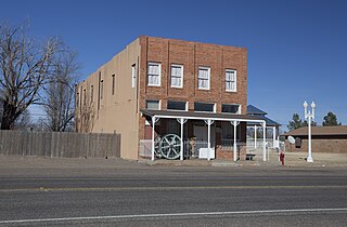
Baird is a city and the county seat of Callahan County, Texas, United States. Its population was 1,479 at the 2020 census. The city is named after Matthew Baird, the owner and director of the Texas and Pacific Railway. The railway depot is now operated as the visitor center and a transportation museum.

<span class="mw-page-title-main">Hart, Texas</span> City in Castro County, Texas, United States

Hart is a city in Castro County, Texas, United States. The population was 869 at the 2020 census.

<span class="mw-page-title-main">Bellevue, Texas</span> City in Texas, United States

Bellevue is a city in Clay County, Texas, United States. It is part of the Wichita Falls metropolitan statistical area. The population was 362 at the 2010 census.

<span class="mw-page-title-main">Whiteface, Texas</span> Community in Texas, United States

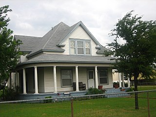
Whiteface is a town in Cochran County, Texas, United States. The population was 449 at the 2010 census.

<span class="mw-page-title-main">Crane, Texas</span> City in Texas, United States

Crane is a city in and the county seat of Crane County, Texas, United States. Its population was about 3,680 as of 2018. An oil boomtown since the 1920s, Crane is still in the center of a prominent oil-producing region. It is the only significant town in sparsely populated Crane County, and contains the only post office in the county.

<span class="mw-page-title-main">Tehuacana, Texas</span> A town in Texas

Tehuacana is a town near the Tehuacana Hills in Limestone County, Texas, United States. The population was 283 at the 2010 census. From 1869 until 1902, the town was home to Trinity University.

New Deal is a U.S. town in Lubbock County, Texas. The population was 794 at the 2010 census. It is part of the Lubbock Metropolitan Statistical Area and the Llano Estacado region.

<span class="mw-page-title-main">Milam, Texas</span> CDP in Texas, United States

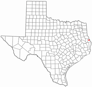
Milam is a census-designated place (CDP) in Sabine County, Texas, United States. It is located along the Sabine River at the junction of Highway 87 and Highway 21. The population was 1,355 at the 2020 census. Milam is the largest city in Sabine County.

<span class="mw-page-title-main">Grandfalls, Texas</span> Town in Texas, United States

Grandfalls is a town in Ward County, Texas, United States. It was named for its location near the "grand falls" of the Pecos River, located roughly 3 miles (4.8 km) to the west. Early settlers were attracted to the Grandfalls area in the late 1880s by the steady supply of water flowing in the Pecos River. Its population was 360 at the 2010 census.

<span class="mw-page-title-main">Thorntonville, Texas</span> Town in Texas, United States

Thorntonville is a town in Ward County, Texas, United States. The population was 476 according to the 2010 census.

<span class="mw-page-title-main">Granville, West Virginia</span> Town in West Virginia

Granville is a town in Monongalia County, West Virginia, United States. The population was 1,355 at the 2020 census. It is included in the Morgantown metropolitan area.

<span class="mw-page-title-main">Scotland, Texas</span> City in Texas, United States

Scotland is a city in Archer County in the U.S. state of Texas. It is part of the Wichita Falls, Texas Metropolitan Statistical Area. The population was 501 at the 2010 census. The town is named for its founder, Henry J. Scott.

<span class="mw-page-title-main">Yoakum, Texas</span> City in Texas, United States

Yoakum is a city in Lavaca and DeWitt counties in the U.S. state of Texas. The population was 5,908 at the 2020 census.

References

  1. "2019 U.S. Gazetteer Files". United States Census Bureau. Retrieved August 7, 2020.
  2. 1 2 U.S. Geological Survey Geographic Names Information System: Plains, Texas
  3. 1 2 "U.S. Census website". United States Census Bureau . Retrieved January 31, 2008.
  4. "Find a County". National Association of Counties. Retrieved June 7, 2011.
  5. "'Let the Grapes Speak for Themselves': Texas High Plains' Wine Country Contains Multitudes". March 30, 2021.
  6. 1 2 Bennett, Leoti A. "Plains, TX". Handbook of Texas. Texas State Historical Association. Retrieved December 29, 2023.
  7. "US Gazetteer files: 2010, 2000, and 1990". United States Census Bureau. February 12, 2011. Retrieved April 23, 2011.
  8. Climate Summary for Plains, Texas
  9. "NOWData - NOAA Online Weather Data". National Oceanic and Atmospheric Administration. Retrieved December 29, 2023.
  10. "Summary of Monthly Normals 1991-2020". National Oceanic and Atmospheric Administration. Retrieved December 29, 2023.
  11. "Census of Population and Housing". Census.gov. Retrieved June 4, 2015.
  12. "Explore Census Data". data.census.gov. Retrieved December 24, 2021.
  13. "Clyde (Bulldog) Turner". Pro Football Hall of Fame.