Robert Lee, Texas | |
---|---|
Coordinates: 31°53′44″N100°29′6″W / 31.89556°N 100.48500°W | |
Country | United States |
State | Texas |
County | Coke |
Area | |
• Total | 1.15 sq mi (2.98 km2) |
• Land | 1.14 sq mi (2.95 km2) |
• Water | 0.01 sq mi (0.03 km2) |
Elevation | 1,827 ft (557 m) |
Population (2010) | |
• Total | 1,049 |
• Estimate (2019) [2] | 1,048 |
• Density | 920.11/sq mi (355.19/km2) |
Time zone | UTC-6 (Central (CST)) |
• Summer (DST) | UTC-5 (CDT) |
ZIP code | 76945 |
Area code | 325 |
FIPS code | 48-62564 [3] |
GNIS feature ID | 1345308 [4] |
Robert Lee is a city in and the county seat of Coke County, Texas, United States. [5] The population was 1,049 at the 2010 census. [6]
The founders named the city after Robert E. Lee, who is thought to have set up camp for a time near the current townsite on the Colorado River. Lee served in Texas from 1856 to 1861 as a lieutenant colonel in the U.S. Army, Second Cavalry.[ citation needed ]
Robert Lee is downstream from the E.V. Spence Reservoir on the upper Colorado River.
According to the United States Census Bureau, the city has a total area of 1.1 square miles (2.8 km2), all land.
Climate data for Robert Lee, Texas (1991–2020 normals, extremes 1908–1911, 1962–2017) | |||||||||||||
---|---|---|---|---|---|---|---|---|---|---|---|---|---|
Month | Jan | Feb | Mar | Apr | May | Jun | Jul | Aug | Sep | Oct | Nov | Dec | Year |
Record high °F (°C) | 90 (32) | 98 (37) | 98 (37) | 102 (39) | 114 (46) | 111 (44) | 110 (43) | 110 (43) | 109 (43) | 104 (40) | 92 (33) | 86 (30) | 114 (46) |
Mean daily maximum °F (°C) | 58.0 (14.4) | 62.9 (17.2) | 70.1 (21.2) | 79.4 (26.3) | 87.0 (30.6) | 92.6 (33.7) | 96.1 (35.6) | 94.4 (34.7) | 87.4 (30.8) | 79.0 (26.1) | 66.9 (19.4) | 59.0 (15.0) | 77.7 (25.4) |
Daily mean °F (°C) | 43.9 (6.6) | 48.7 (9.3) | 55.9 (13.3) | 64.9 (18.3) | 73.8 (23.2) | 80.4 (26.9) | 84.1 (28.9) | 82.5 (28.1) | 75.1 (23.9) | 64.9 (18.3) | 53.4 (11.9) | 45.2 (7.3) | 64.4 (18.0) |
Mean daily minimum °F (°C) | 29.8 (−1.2) | 34.4 (1.3) | 41.7 (5.4) | 50.3 (10.2) | 60.6 (15.9) | 68.3 (20.2) | 72.0 (22.2) | 70.7 (21.5) | 62.8 (17.1) | 50.8 (10.4) | 39.9 (4.4) | 31.4 (−0.3) | 51.1 (10.6) |
Record low °F (°C) | 3 (−16) | −1 (−18) | 8 (−13) | 25 (−4) | 33 (1) | 49 (9) | 55 (13) | 52 (11) | 38 (3) | 24 (−4) | 14 (−10) | −2 (−19) | −2 (−19) |
Average precipitation inches (mm) | 1.06 (27) | 1.11 (28) | 1.30 (33) | 1.65 (42) | 2.60 (66) | 2.60 (66) | 1.54 (39) | 2.63 (67) | 2.65 (67) | 2.11 (54) | 1.23 (31) | 0.95 (24) | 21.43 (544) |
Average snowfall inches (cm) | 0.1 (0.25) | 0.2 (0.51) | 0.0 (0.0) | 0.1 (0.25) | 0.0 (0.0) | 0.0 (0.0) | 0.0 (0.0) | 0.0 (0.0) | 0.0 (0.0) | 0.0 (0.0) | 0.0 (0.0) | 0.1 (0.25) | 0.5 (1.3) |
Average precipitation days (≥ 0.01 in) | 3.5 | 3.5 | 3.9 | 3.4 | 5.1 | 5.0 | 3.9 | 5.8 | 4.3 | 4.2 | 3.8 | 2.9 | 49.3 |
Average snowy days (≥ 0.1 in) | 0.1 | 0.1 | 0.0 | 0.0 | 0.0 | 0.0 | 0.0 | 0.0 | 0.0 | 0.0 | 0.0 | 0.2 | 0.4 |
Source: NOAA [7] [8] |
Census | Pop. | Note | %± |
---|---|---|---|
1930 | 490 | — | |
1940 | 662 | 35.1% | |
1950 | 1,089 | 64.5% | |
1960 | 990 | −9.1% | |
1970 | 1,119 | 13.0% | |
1980 | 1,202 | 7.4% | |
1990 | 1,276 | 6.2% | |
2000 | 1,171 | −8.2% | |
2010 | 1,049 | −10.4% | |
2019 (est.) | 1,048 | [2] | −0.1% |
U.S. Decennial Census [9] |
Race | Number | Percentage |
---|---|---|
White (NH) | 702 | 68.35% |
Black or African American (NH) | 5 | 0.49% |
Native American or Alaska Native (NH) | 10 | 0.97% |
Pacific Islander (NH) | 3 | 0.29% |
Some Other Race (NH) | 3 | 0.29% |
Mixed/Multi-Racial (NH) | 28 | 2.73% |
Hispanic or Latino | 276 | 26.87% |
Total | 1,027 |
As of the 2020 United States census, there were 1,027 people, 540 households, and 297 families residing in the city.
As of the census [3] of 2000, 1,171 people, 496 households, and 326 families resided in the city. The population density was 1,026.7 inhabitants per square mile (396.4/km2). The 658 housing units averaged 576.9/sq mi (222.9/km2). The racial makeup of the city was 89.92% White, 0.26% African American, 0.77% Native American, 0.09% Asian, 7.34% from other races, and 1.62% from two or more races. Hispanics or Latinos of any race were 19.64% of the population.
Of 496 households, 27.4% had children under the age of 18 living with them, 52.6% were married couples living together, 11.3% had a female householder with no husband present, and 34.1% were not families. About 32.9% of all households were made up of individuals, and 21.8% had someone living alone who was 65 years of age or older. The average household size was 2.26 and the average family size was 2.85.
In the city, the population was distributed as 22.8% under the age of 18, 5.2% from 18 to 24, 21.1% from 25 to 44, 22.3% from 45 to 64, and 28.6% who were 65 years of age or older. The median age was 46 years. For every 100 females, there were 81.8 males. For every 100 females age 18 and over, there were 79.4 males.
The median income for a household in the city was $25,750, and for a family was $33,553. Males had a median income of $30,486 versus $19,615 for females. The per capita income for the city was $16,672. About 12.0% of families and 14.8% of the population were below the poverty line, including 16.6% of those under age 18 and 14.5% of those age 65 or over.
The city is served by the Robert Lee Independent School District and is the location of Robert Lee High School.
Burdett is a city in Pawnee County, Kansas, United States. As of the 2020 census, the population of the city was 228.
Colwich is a city in Sedgwick County, Kansas, United States, located northwest of Wichita. As of the 2020 census, the population of the city was 1,455.
Claude is a city in and the county seat of Armstrong County, Texas, United States. The population was 1,196 at the 2010 census. It is located east of Amarillo in the south Texas Panhandle. Claude is part of the Amarillo Metropolitan Statistical Area but is some thirty miles east of Amarillo.
Jourdanton is a city in and the county seat of Atascosa County, Texas, United States. The population is 4,094. It is part of the San Antonio metropolitan statistical area. The mayor is Robert "Doc" Williams. The city manager is Bobby J. Martinez. The police chief is Eric Kaiser. The fire chief is Jay Fojtik.
Lakehills is a census-designated place (CDP) in Bandera County, Texas, United States. The population was 5,150 at the 2010 census, making it the most populous place in Bandera County. It is part of the San Antonio Metropolitan Statistical Area.
Meridian is a city and the county seat of Bosque County in central Texas, United States. It is forty-seven miles northwest of Waco. The population was 1,493 at the 2010 census.
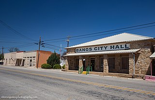
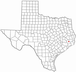
Bangs is a city located in Brown County in west-central Texas, United States. The population was 1,603 at the 2010 census.
Lakeport is a city in Gregg County, Texas, United States. The population was 974 at the 2010 census, up from 861 at the 2000 census; in 2020, its population was 976.
Stinnett is a city in and the county seat of Hutchinson County, Texas, United States. The population was 1,881 at the 2010 census, a decrease from 1,936 at the 2000 census.
Hardin is a city in Liberty County, Texas, United States. Its population was 768 at the 2020 census.
Onalaska is a city in Polk County, Texas, United States. Situated on a peninsula between the main channel and one arm of Lake Livingston, the population was 3,020 at the 2020 census.
Miami is a town in Roberts County, Texas, United States. It is part of the Pampa, Texas micropolitan statistical area. Its population was 597 at the 2010 census. It is the county seat of Roberts County and the only municipality in the county.
San Saba is a city located in, and the county seat of, San Saba County, Texas, United States. It was settled in 1854 and named for its location on the San Saba River. Its population was 3,099 at the 2010 census.
New Chapel Hill is a city in Smith County, Texas, United States. The population was 620 at the 2020 census. It is part of the Tyler, Texas Metropolitan Statistical Area.
Groveton is a city in Trinity County, Texas, United States. The population was 918 at the 2020 census. It is the county seat of Trinity County.
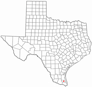
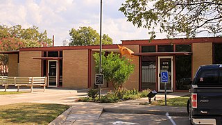
San Perlita is a city in Willacy County, Texas, United States. The population was 573 at the 2010 census. It may be included as part of the Brownsville–Harlingen–Raymondville and the Matamoros–Brownsville metropolitan areas.
Horseshoe Bay is a city in Llano and Burnet counties in the U.S. state of Texas.
San Diego is a city in Duval and Jim Wells counties, Texas, United States. The population was 3,748 at the 2020 census and 4,488 at the 2010 census. It is located primarily in Duval County, of which it is the county seat.
Waller is a city in Texas, United States, partly in Waller County and partly in Harris County within the Houston–Cypress metropolitan area. Its population was 2,682 at the 2020 U.S. census. The Waller area is located along U.S. Route 290 41 miles (66 km) northwest of downtown Houston.
Mart is a city in Limestone and McLennan counties in the U.S. state of Texas. The population was 1,748 at the 2020 census.