Coto de Caza, California

Last updated

Coto de Caza, California
Coto De Caza Ranch by D Ramey Logan.jpg
Coto de Caza in 2016
Orange County California Incorporated and Unincorporated areas Coto de Caza Highlighted.svg
Location of Coto de Caza within Orange County, California.
Coordinates: 33°35′45″N117°35′16″W / 33.59583°N 117.58778°W / 33.59583; -117.58778
Country Flag of the United States (23px).png  United States
State Flag of California.svg  California
County Orange
Area
[1]
  Total7.82 sq mi (20.26 km2)
  Land7.80 sq mi (20.20 km2)
  Water0.02 sq mi (0.06 km2)  0.29%
Elevation
[2]
709 ft (216 m)
Population
 (2020)
  Total14,710
  Density1,886.38/sq mi (728.36/km2)
Time zone UTC-8 (PST)
  Summer (DST) UTC-7 (PDT)
ZIP code
92679
Area code 949
FIPS code 06-16580
GNIS feature IDs 1867008, 2407666
Website community.dwellinglive.com/czmaster.aspx

Coto de Caza (Spanish for "Hunting Reserve") is a census-designated place (CDP) and guard-gated private community in Orange County, California, United States. The population was 14,710 at the 2020 census.

Contents

The CDP is a suburban planned community of about 4,000 homes and one of Orange County's oldest and most expensive master-planned communities. The project began in 1968, when it was envisioned as a hunting lodge, now the Lodge at Coto de Caza, and the community was completed in 2003. Coto de Caza also includes Los Ranchos Estates, a 355-acre rural community of 75 large custom homes. Los Ranchos Estates is a separate private community behind the gates of Coto de Caza and has its own homeowner's association.

History

Coto de Caza as it appeared in 1974 Coto de Caza, 1974.jpg
Coto de Caza as it appeared in 1974

The suburban planned community of Coto de Caza was a joint venture of Chevron and Arvida corporations. Development was first initiated in 1964. In 1979, Arvida bought out Chevron. Richard Boultinghouse, who had previously developed McCormick Ranch in Scottsdale, Arizona, was hired as president and general manager. In 1983, Orange County approved Coto's master plan for a community of approximately 5,000 homes, and three years later, the community officially opened. Coto de Caza's reputation as an ecologically oriented recreation community was strengthened by the former Vic Braden’s Tennis College and a 36-hole Robert Trent Jones Jr.-designed golf course.

In 1984, Arvida, Disney, Chevron, and City Federal Savings & Loan partnered in the development of Coto de Caza. Boultinghouse was later replaced by John C Yelverton.

In 1996, Lennar took over as development manager. Under Lennar’s stewardship, Coto de Caza was repositioned to promote more luxurious homes and lower densities, coincident with the regional recovery from the recent recession. The average price of a home in Coto de Caza increased from $375,000 in 1996 to $840,000 in 2000, to well over a million dollars.

Geography

Coto de Caza is located in the northern portion of Wagon Wheel Canyon in southeast Orange County, at 33°35′45″N117°35′16″W / 33.59583°N 117.58778°W / 33.59583; -117.58778 (33.595925, -117.587665). [3]

According to the United States Census Bureau, the CDP has a total area of 8.0 square miles (21 km2), of which, 8.0 square miles (21 km2) of it is land and 0.02 square miles (0.052 km2) of it (0.29%) is water.

Climate

According to the Köppen Climate Classification system, Coto de Caza has a warm-summer Mediterranean climate, abbreviated "Csa" on climate maps.

Demographics

Historical population
CensusPop.Note
1990 2,853
2000 13,057357.7%
2010 14,86613.9%
2020 14,710−1.0%
source: [4]

2020

The 2020 United States Census reported a population of 14,710. The racial makeup was 82.3% White, 1.7% African American, 8.4% Asian, and 11.2% Hispanic or Latino of any race. [5]

2010

The 2010 United States Census [6] reported that Coto de Caza had a population of 14,866. The population density was 1,864.2 inhabitants per square mile (719.8/km2). The racial makeup of Coto de Caza was 13,094 (88.1%) White (82.2% Non-Hispanic White), [7] 132 (0.9%) African American, 26 (0.2%) Native American, 878 (5.9%) Asian, 20 (0.1%) Pacific Islander, 174 (1.2%) from other races, and 542 (3.6%) from two or more races. Hispanic or Latino of any race were 1,170 persons (7.9%).

The Census reported that 14,866 people (100% of the population) lived in households, 0 (0%) lived in non-institutionalized group quarters, and 0 (0%) were institutionalized.

There were 4,736 households, out of which 2,407 (50.8%) had children under the age of 18 living in them, 3,763 (79.5%) were opposite-sex married couples living together, 294 (6.2%) had a female householder with no husband present, 133 (2.8%) had a male householder with no wife present. There were 96 (2.0%) unmarried opposite-sex partnerships, and 30 (0.6%) same-sex married couples or partnerships. 420 households (8.9%) were made up of individuals, and 116 (2.4%) had someone living alone who was 65 years of age or older. The average household size was 3.14. There were 4,190 families (88.5% of all households); the average family size was 3.35.

The population was spread out, with 4,545 people (30.6%) under the age of 18, 996 people (6.7%) aged 18 to 24, 2,706 people (18.2%) aged 25 to 44, 5,452 people (36.7%) aged 45 to 64, and 1,167 people (7.9%) who were 65 years of age or older. The median age was 42.2 years. For every 100 females, there were 96.8 males. For every 100 females age 18 and over, there were 95.1 males.

There were 4,853 housing units at an average density of 608.6 per square mile (235.0/km2), of which 4,341 (91.7%) were owner-occupied, and 395 (8.3%) were occupied by renters. The homeowner vacancy rate was 1.0%; the rental vacancy rate was 1.5%. 13,738 people (92.4% of the population) lived in owner-occupied housing units and 1,128 people (7.6%) lived in rental housing units.

According to the 2010 United States Census, Coto de Caza had a median household income of $169,176, with 2.0% of the population living below the federal poverty line. [7]

2000

As of the census [8] of 2000, there were 13,057 people, 4,049 households, and 3,644 families residing in the CDP. The population density was 1,654.5 inhabitants per square mile (638.8/km2). There were 4,152 housing units at an average density of 526.1 per square mile (203.1/km2). The racial makeup of the CDP was 89.36% White, 0.74% Black or African American, 0.15% Native American, 5.16% Asian, 0.15% Pacific Islander, 1.65% from other races, and 2.80% from two or more races. 6.65% of the population were Hispanic or Latino of any race.

There were 4,049 households, out of which 56.1% had children under the age of 18 living with them, 83.4% were married couples living together, 4.1% had a female householder with no husband present, and 10.0% were non-families. 7.5% of all households were made up of individuals, and 1.1% had someone living alone who was 65 years of age or older. The average household size was 3.22 and the average family size was 3.40.

In the CDP, the population was spread out, with 35.1% under the age of 18, 4.0% from 18 to 24, 33.4% from 25 to 44, 23.8% from 45 to 64, and 3.7% who were 65 years of age or older. The median age was 35 years. For every 100 females, there were 99.6 males. For every 100 females age 18 and over, there were 97.4 males.

The median income for a household in the CDP was $136,726, and the median income for a family was $141,598. Males had a median income of $97,803 versus $50,689 for females. The per capita income for the CDP was $55,900. About 0.7% of families and 0.9% of the population were below the poverty line, including 0.7% of those under age 18 and none of those age 65 or over.

Economy

Residents shop in Rancho Santa Margarita, Mission Viejo, Las Flores, or Ladera Ranch.

Thomas F. Riley Wilderness Park

The Thomas F. Riley Wilderness Park, which is open to the general public, surrounds the community of Coto de Caza on its eastern, northern, and southern borders. The park is a Wildlife and Plant Sanctuary. Its nature center houses an educational center for outdoor education for local schools and community groups. It also serves as an ecological preserve for the native endangered plant and animal species. The park is maintained and paid for by Orange County Parks, and is administered by Park Rangers and maintenance staff.

Education

Most students in Coto de Caza reside in the Capistrano Unified School District and attend Tijeras Creek Elementary, Wagon Wheel Elementary, Las Flores Middle School, Tesoro High School, and Santa Margarita Catholic High School (located at the North Gate and not part of Capistrano Unified). [9] St. John's Episcopal School and St. Junipero Serra Catholic School are private elementary and middle schools located outside the gates in nearby Rancho Santa Margarita.

The residents rebuffed an attempt to build a 400-student public school within the walls of the community. [9] They had concerns that it would "undermine the privacy and security" of the enclave, that it would be "downright illegal [to place a public school on a gated private property]", that it would force admission of large numbers of non-residents to the community, and that an eventual lawsuit would force the removal of the gates. [9] The reason for proposal was that Wagon Wheel Elementary School, which is located immediately outside the community gates, had far more students than planned. [9] The school equipment was to consist of 20 portable buildings which would have simply been added to Wagon Wheel if the new school's construction could not be completed. [9] Had it been built, it would have become the first public school to be built inside the limits of a gated community. [9]

Politics and government

In the California State Legislature, Coto de Caza is in the 38th Senate District , represented by Democrat Catherine Blakespear, and in the 71st Assembly District , represented by Republican Kate Sanchez. [10]

In the United States House of Representatives, Coto de Caza is in California's 40th congressional district , represented by Republican Young Kim. [11]

Coto de Caza gave more than 65 percent support to Proposition 8 in 2008. [12]

The area is patrolled by the California Highway Patrol, Orange County Sheriff's Department, and the Coto de Caza security force.

For the 1984 Summer Olympics, the community served as host to the riding, running, shooting, and fencing portions of the modern pentathlon events. [13] Princess Anne of England attended the event to support Richard Phelps, who finished fourth at the Olympic event.

The community was the original setting of the reality-based television show The Real Housewives of Orange County on Bravo, though over the years the show has expanded into other places like Newport Beach.

Notable people

See also

Related Research Articles

<span class="mw-page-title-main">East Rancho Dominguez, California</span> Unincorporated community in California, United States

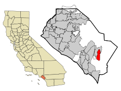
East Rancho Dominguez, also known as East Compton, is an unincorporated community and census-designated place (CDP) located in southern Los Angeles County, California. The population was 15,135 at the 2010 census, up from 9,286 at the 2000 census. East Rancho Dominguez is an accepted city name according to the USPS, and shares the 90221 ZIP Code with Compton.

<span class="mw-page-title-main">West Rancho Dominguez, California</span> Unincorporated community in California, United States

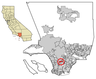
West Rancho Dominguez, formerly known as West Compton and also known as East Gardena, is an unincorporated census-designated place (CDP) located in southern Los Angeles County, California. Per the 2020 census, the population was 24,347. The community lies to the west of the city of Compton. The ZIP Codes encompassing the CDP area are 90220 & 90248.

<span class="mw-page-title-main">West Whittier-Los Nietos, California</span> Census-designated place in California, United States

West Whittier-Los Nietos is a census-designated place (CDP) in Los Angeles County, California, near the San Gabriel River and the San Gabriel River (I-605) Freeway. The population was 25,540 at the 2010 census, up from 25,129 at the 2000 census. The census area consists of separate unincorporated communities of Los Nietos and West Whittier.

<span class="mw-page-title-main">Willowbrook, California</span> Unincorporated community in California, United States

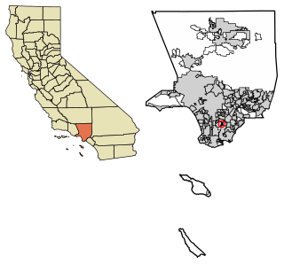
Willowbrook, alternatively named Willow Brook, is an unincorporated community and census-designated place (CDP) in Los Angeles County, California. The population was 24,295 at the 2020 census, down from 35,983 at the 2010 census.

<span class="mw-page-title-main">Tamalpais-Homestead Valley, California</span> Census-designated place in California, United States

Tamalpais-Homestead Valley is a census-designated place (CDP) in Marin County, California, United States. The population was 11,492 at the 2020 census.

<span class="mw-page-title-main">Aromas, California</span> Census-designated place in California, United States

Aromas is an unincorporated community and census-designated place (CDP) in Monterey County and San Benito County, California, United States. The population was 2,708 at the 2020 census.

<span class="mw-page-title-main">Las Flores, California</span> Place in California, United States

Las Flores is an unincorporated census-designated place (CDP) in Orange County, California, located adjacent to the City of Rancho Santa Margarita, California. The population was 5,971 at the 2010 census, up from 5,625 at the 2000 census. Las Flores does not have its own ZIP Code and is served by the same ZIP Code as adjacent Rancho Santa Margarita, 92688. The Rancho Santa Margarita dog/skate park is located in the CDP and is served by the Orange County Sheriff's Dept. and Orange County Fire Authority. Although Las Flores lies in the land grant of Rancho Mission Viejo, it is named after the land grant about 25 miles south Rancho Santa Margarita y Las Flores.

<span class="mw-page-title-main">Rancho Santa Margarita, California</span> City in California, United States

Rancho Santa Margarita is a city in Orange County, California, United States. One of Orange County's youngest cities, Rancho Santa Margarita is a master-planned community. The population was 47,853 at the 2010 census, up from 47,214 at the 2000 census. Although it is named for Rancho Santa Margarita y Las Flores, which was in San Diego County, the city limits fall within the borders of Rancho Mission Viejo. At 20 characters long, it is the longest city name in California.

<span class="mw-page-title-main">North Tustin, California</span> Place in California, United States

North Tustin is an unincorporated community and census designated place (CDP) in Orange County, California. The population was 25,718 at the 2020 census, up from 24,917 in 2010. For statistical purposes, the United States Census Bureau has defined North Tustin as a census-designated place (CDP). It is both the largest CDP and largest unincorporated community in Orange County. The CDP's name was changed from Tustin Foothills in 2005. Located outside the city limits of Tustin, North Tustin has 92705 and 92780 ZIP Codes.

<span class="mw-page-title-main">Rancho Murieta, California</span> Census-designated place in California, United States

Rancho Murieta is a census-designated place (CDP) and guard-gated community in Sacramento County, California, United States. It is part of the Sacramento–Arden-Arcade–Roseville Metropolitan Statistical Area. The population was 5,488 at the 2010 census, up from 4,193 at the 2000 census. It is located in the foothills of the Sierra Nevada range, about 25 miles (40 km) east of Sacramento.

<span class="mw-page-title-main">Fairbanks Ranch, California</span> Census-designated place in California, United States

Fairbanks Ranch is a census-designated place (CDP) in San Diego County, California. The population was 3,148 at the 2010 census, up from 2,244 at the 2000 census. The entire population is contained within two gated communities, divided into North and South sections by the formerly private San Dieguito Road.

<span class="mw-page-title-main">Lake San Marcos, California</span> Census-designated place in California, United States

Lake San Marcos is a census-designated place (CDP) in the North County region of the San Diego metropolitan area. It is nominally independent of San Marcos proper, but functionally dependent on the city.

<span class="mw-page-title-main">Rancho Santa Fe, California</span> Census-designated place in California, United States

Rancho Santa Fe is a census-designated place (CDP) in San Diego County, California, United States, within the San Diego metropolitan area. The population was 3,156 at the 2020 census. The CDP is primarily residential with a few shopping blocks, a middle and elementary school, and several restaurants.

<span class="mw-page-title-main">Nipomo, California</span> Place in California, United States

Nipomo is an unincorporated town in San Luis Obispo County, California, United States. The population was 16,714 for the 2010 census and grew to 18,176 for the 2020 census. For statistical purposes, the United States Census Bureau has defined Nipomo as a census-designated place (CDP).

<span class="mw-page-title-main">Country Walk, Florida</span> Census-designated place in Florida

Country Walk is a census-designated place (CDP) in Miami-Dade County, Florida, United States. It is part of the Miami metropolitan area of South Florida. The population was 16,951 at the 2020 census, up from 15,997 at the 2010 census.

<span class="mw-page-title-main">Rancho San Diego, California</span> Census designated place in California, United States

Rancho San Diego is a census-designated place (CDP) in the East County region of San Diego County, California. The population was 21,858 at the 2020 census, up from 21,208 at the 2010 census. The area was developed as subdivisions beginning in the 1970s.

<span class="mw-page-title-main">Rancho Tehama, California</span> Census-designated place in California, United States

Rancho Tehama, also known as the Rancho Tehama Reserve, is an unincorporated community in Tehama County, California, United States. As of the 2020 census, the population of the community and nearby areas was 1,572. The lightly populated rural, remote community has large lots where some residents farm olives, walnuts and almonds.

<span class="mw-page-title-main">Ranchos de Taos, New Mexico</span> Census-designated place in Taos County, New Mexico, United States

Ranchos de Taos is a census-designated place (CDP) in Taos County, New Mexico. The population was 2,390 at the time of the 2000 census.

<span class="mw-page-title-main">Ranchos Penitas West, Texas</span> CDP in Texas, United States

Ranchos Penitas West is a census-designated place (CDP) in Webb County, Texas, United States. The population was 573 at the 2010 census.

<span class="mw-page-title-main">Rossmoor, California</span> Census-designated place in California, United States

Rossmoor is a planned census-designated place located in Orange County, California. As of the 2020 census, the CDP had a total population of 10,625 up from the 2010 census population of 10,244. The gated Leisure World retirement community in the city of Seal Beach is to the south of Rossmoor, Los Alamitos is to the east and north, and Long Beach is to the west. The community of Rossmoor has two shopping centers within its boundaries, but only one—the Rossmoor Village Square, is now within the political boundaries of Rossmoor. A larger shopping center, the Rossmoor Business Center, was annexed, despite many protests, by the City of Seal Beach in 1967. The Center has been remodeled several times and was renamed the Shops at Rossmoor in the early 2000s.

References

  1. "2020 U.S. Gazetteer Files". United States Census Bureau. Retrieved October 30, 2021.
  2. "Coto De Caza". Geographic Names Information System . United States Geological Survey, United States Department of the Interior . Retrieved October 18, 2014.
  3. "US Gazetteer files: 2010, 2000, and 1990". United States Census Bureau. February 12, 2011. Retrieved April 23, 2011.
  4. "CENSUS OF POPULATION AND HOUSING (1790-2000)". U.S. Census Bureau . Retrieved July 17, 2010.
  5. "U.S. Census Bureau QuickFacts: Coto de Caza CDP, California". www.census.gov. Retrieved August 17, 2022.
  6. "2010 Census Interactive Population Search: CA - Coto de Caza CDP". U.S. Census Bureau. Archived from the original on July 15, 2014. Retrieved July 12, 2014.
  7. 1 2 "Coto de Caza CDP QuickFacts from the US Census Bureau". Archived from the original on July 10, 2012. Retrieved October 18, 2014.
  8. "U.S. Census website". United States Census Bureau . Retrieved January 31, 2008.
  9. 1 2 3 4 5 6 Linn Groves; Liz Seymour; Tina Nguyen (December 14, 1998). "Public School Plan Rattles Coto de Caza Residents". Los Angeles Times .
  10. "California Districts". UC Regents. Retrieved January 9, 2023.
  11. "California's 40th Congressional District - Representatives & District Map". Civic Impulse, LLC.
  12. ECCOPAC. "ECCOPAC: Orange County Says Yes On Prop 8".
  13. 1984 Summer Olympics official report. Volume 1. Part 1. pp. 140-3.
  14. Larsen, Peter (October 27, 2019). "Prince, up close". Orange County Register . p. C8.