Related Research Articles

The Patuxent River is a tributary of the Chesapeake Bay in the state of Maryland. There are three main river drainages for central Maryland: the Potomac River to the west passing through Washington, D.C., the Patapsco River to the northeast passing through Baltimore, and the Patuxent River between the two. The 908-square-mile (2,352 km2) Patuxent watershed had a rapidly growing population of 590,769 in 2000. It is the largest and longest river entirely within Maryland, and its watershed is the largest completely within the state.

Sligo Creek is a free-flowing tributary of the Northwest Branch of the Anacostia River in Maryland. The creek is approximately 9.1 miles (14.6 km) long, with a drainage area of about 11.6 square miles (30 km2).

Rock Creek is a free-flowing tributary of the Potomac River that empties into the Atlantic Ocean via the Chesapeake Bay. The 32.6-mile (52.5 km) creek drains about 76.5 square miles (198 km2). Its final quarter-mile is affected by tides.

Savage is an unincorporated community and census-designated place located in Howard County, Maryland, United States, approximately 18 miles (29 km) south of Baltimore and 21 miles (34 km) north of Washington, D.C. It is situated close to the city of Laurel and to the planned community of Columbia. As of the 2010 census it had a population of 7,054. The former mill town is a registered historic place, and has many original buildings preserved within and around the Savage Mill Historic District.

The Jug Bay Wetlands Sanctuary is located along the tidal Patuxent River in southern Maryland, United States. It was established in 1985 and is operated by the Anne Arundel County Department of Recreation and Parks. It includes more than 1,500 acres (6.1 km2) of tidal freshwater wetlands, forests, meadows and fields. The wetlands, with large stands of aquatic plants including wild rice, are home to many birds, fish, reptiles, and mammals. Miles of trails and boardwalks traverse a variety of habitats and provide glimpses into the rich history of the region. In 1990, the Sanctuary became a component of the Chesapeake Bay National Estuarine Research Reserve System. The sanctuary is also recognized as a Nationally Important Bird Area by the American Bird Conservancy and the National Audubon Society.
The South River is a 10-mile-long (16 km) tributary of the Chesapeake Bay in Anne Arundel County, Maryland in the United States. It lies south of the Severn River, east of the Patuxent River, and north of the West River and Rhode River, and drains to the Chesapeake Bay.
Cabin John Creek is a tributary stream of the Potomac River in Montgomery County, Maryland. The watershed covers an area of 26 square miles (67 km2). The headwaters of the creek originate in the city of Rockville, and the creek flows southward for 10.9 miles (17.5 km) to the Potomac River.
Codorus Creek is a 42.4-mile-long (68.2 km) tributary of the Susquehanna River in York County, Pennsylvania in the United States.
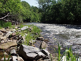
Deer Creek is a 52.9-mile-long (85.1 km) river in Maryland and Pennsylvania that flows through the scenic areas of Harford County and empties into the Susquehanna River, roughly halfway between the Interstate 95 bridge and Conowingo Dam. Its watershed area is 171 square miles (440 km2). Its watershed area in MD is 145 square miles (380 km2), with 3% impervious surface in 1994. It serves as a divider between the agricultural and urban/suburban areas of Harford County.

Queen Anne in Prince George's County, Maryland, United States, is a former seaport on the Patuxent River. It was delineated as a CDP for the 2010 census, at which time it had a population of 1,280.

Paint Branch is a 14.0-mile-long (22.5 km) stream that flows through Montgomery County and Prince George's County, Maryland. It is a tributary of the Northeast Branch, which flows to the Anacostia River, Potomac River and the Chesapeake Bay.
Hawlings River is a 12.9-mile-long (20.8 km) tributary of the Patuxent River in Montgomery County, Maryland. The watershed covers an area of about 28 square miles (73 km2). The headwaters of the river originate in the area north of Laytonsville, and the river flows southeast, entering the Patuxent about 1.5 miles (2.4 km) below the Triadelphia Reservoir. Portions of Hawlings River flow through Rachel Carson Conservation Park and Hawlings River Stream Valley Park. Tributaries of the Hawlings River include Mount Zion Tributary, Reddy Branch, Olney Mill Tributary, Gregg Tributary, and James Creek. The river and its tributaries total about 98 miles (158 km) of streams.
The Little Magothy River runs 2.5 miles (4.0 km) through Anne Arundel County in the U.S. state of Maryland. It is located southeast of the Magothy River, just outside its mouth and north of the Severn River.
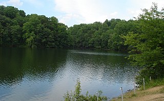
Triadelphia Reservoir is located on the Patuxent River, in Howard County and Montgomery County, Maryland near the town of Brookeville.
Northwest Branch Anacostia River is a 21.5-mile-long (34.6 km) free-flowing stream in Montgomery County and Prince George's County, Maryland. It is a tributary of the Anacostia River, which flows to the Potomac River and the Chesapeake Bay.

Allen Pond Park is an 85-acre (340,000 m2) multi-use park, located in and managed by the City of Bowie in Prince George's County, Maryland. The park includes an Ice Arena, Amphitheater, boat rentals, Skate Park, 10-acre (40,000 m2) stocked pond, six lighted ballfields, picnic areas and pavilions, walking and biking trails, a lighted basketball court, fitness station and several playground areas. It is also the home of Opportunity Park, which offers 100% accessible experiences at its tot lot, school-aged playground, fitness cluster and fishing. The park has a 39% total wood coverage, with the pond occupying 12% of the park. The parking lot that services the park can be accessed from 3404 Mitchellville Road, across from the Mitchellville Road Soccer Fields, and from the main 3330 Northview Drive entrance.
Town Creek is a tributary of the Patuxent River in Saint Mary's County, Maryland.
The Middle Patuxent Environmental Area (MPEA) is a 1,021-acre (4.13 km2) wildlife area in Clarksville, Maryland and operated by the Howard County Department of Recreation and Parks. It is located next to the River Hill village in the town of Columbia, Maryland, in the United States. The MPEA was created in 1996 for educational, research, and recreational purposes.
Collington Branch is a stream that flows into the Western Branch of the Patuxent River in Prince George's County, Maryland.
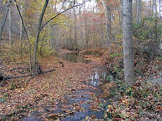
The Green Branch of the Patuxent River in Prince George's County, Maryland is part of the Upper Patuxent Watershead. The stream passes centrally through the Governor Bridge Natural Area / Patuxent River Park and joins the Patuxent, just south of Governor's Bridge.
References
- ↑ "City of Bowie Environmental Infrastructure Action Strategy Plan Staff Findings and Recommendations By Sub-watershed". City of Bowie. p. ii. Retrieved 21 January 2015.
- ↑ "Upper Patuxent River Watershed Restoration Action Strategy" (PDF). Watershed Restoration Action Strategies. Maryland Department of Natural Resources: 27. Retrieved 21 January 2015.
- 1 2 "City of Bowie Environmental Infrastructure Action Strategy Plan Staff Findings and Recommendations By Sub-watershed". City of Bowie. p. 30. Retrieved 21 January 2015.
Coordinates: 38°55′26.9″N76°42′34.5″W / 38.924139°N 76.709583°W
| This article related to a river in Maryland is a stub. You can help Wikipedia by expanding it. |