Pawnee City, Nebraska

Last updated

Pawnee City, Nebraska
Pawnee City, Nebraska G from 6th.JPG
West side of G Street, looking NW from 6th St, 2010
Pawnee County Nebraska Incorporated and Unincorporated areas Pawnee City Highlighted.svg
Location of Pawnee City, Nebraska
Coordinates: 40°06′38″N96°09′11″W / 40.11056°N 96.15306°W / 40.11056; -96.15306
Country United States
State Nebraska
County Pawnee
Incorporated1858
Area
[1]
  Total1.21 sq mi (3.12 km2)
  Land1.21 sq mi (3.12 km2)
  Water0.00 sq mi (0.00 km2)
Elevation
[2]
1,198 ft (365 m)
Population
 (2020)
  Total865
  Density717.84/sq mi (277.20/km2)
Time zone UTC-6 (Central (CST))
  Summer (DST) UTC-5 (CDT)
ZIP code
68420
Area code 402
FIPS code 31-38575 [3]
GNIS feature ID2396164 [2]
Website pawneecity.com

Pawnee City is a city in and the county seat of Pawnee County, Nebraska, United States. [4] The population was 878 at the 2010 census.

Contents

History

The site of present-day Pawnee City was designated as the county seat on November 4, 1856, and the townsite was platted in the spring of 1857 [5] . Pawnee City was incorporated in 1858, [6] and is named after the Pawnee Native Americans. [7]

By the 1880s, Pawnee City was a railroad town at the junction of two railroad lines. [8] On August 9, 1881, two-thirds of downtown Pawnee City was destroyed by a fire. Downtown was subsequently rebuilt with fireproof construction. [5] [6]

Geography

According to the United States Census Bureau, the city has a total area of 1.21 square miles (3.13 km2), all land. [9]

Demographics

Historical population
CensusPop.Note
1880 763
1890 1,550103.1%
1900 1,96927.0%
1910 1,610−18.2%
1920 1,595−0.9%
1930 1,573−1.4%
1940 1,6474.7%
1950 1,606−2.5%
1960 1,343−16.4%
1970 1,267−5.7%
1980 1,156−8.8%
1990 1,008−12.8%
2000 1,0332.5%
2010 878−15.0%
2020 865−1.5%
U.S. Decennial Census

2010 census

At the 2010 census there were 878 people, 425 households, and 210 families living in the city. The population density was 725.6 inhabitants per square mile (280.2/km2). There were 518 housing units at an average density of 428.1 per square mile (165.3/km2). The racial makeup of the city was 96.9% White, 0.2% African American, 0.3% Native American, 0.2% Asian, 0.3% from other races, and 1.9% from two or more races. Hispanic or Latino of any race were 2.1%. [10]

Of the 425 households 19.1% had children under the age of 18 living with them, 39.3% were married couples living together, 7.5% had a female householder with no husband present, 2.6% had a male householder with no wife present, and 50.6% were non-families. 45.6% of households were one person and 25.4% were one person aged 65 or older. The average household size was 1.97 and the average family size was 2.79.

The median age was 52.9 years. 18.7% of residents were under the age of 18; 5.3% were between the ages of 18 and 24; 15.7% were from 25 to 44; 28.5% were from 45 to 64; and 31.8% were 65 or older. The gender makeup of the city was 47.2% male and 52.8% female.

2000 census

At the 2000 census there were 1,033 people, 474 households, and 264 families living in the city. The population density was 881.9 inhabitants per square mile (340.5/km2). There were 542 housing units at an average density of 462.7 per square mile (178.6/km2). The racial makeup of the city was 99.13% White, 0.19% Native American, 0.10% Asian, and 0.58% from two or more races. Hispanic or Latino of any race were 0.68%. [3]

Of the 474 households 22.4% had children under the age of 18 living with them, 47.3% were married couples living together, 7.2% had a female householder with no husband present, and 44.3% were non-families. 42.2% of households were one person and 27.8% were one person aged 65 or older. The average household size was 2.07 and the average family size was 2.79.

The age distribution was 20.7% under the age of 18, 4.3% from 18 to 24, 19.4% from 25 to 44, 20.5% from 45 to 64, and 35.1% 65 or older. The median age was 50 years. For every 100 females, there were 75.7 males. For every 100 females age 18 and over, there were 72.4 males.

The median household income was $23,587, and the median family income was $32,717. Males had a median income of $25,489 versus $18,500 for females. The per capita income for the city was $17,386. About 8.3% of families and 14.3% of the population were below the poverty line, including 12.7% of those under age 18 and 16.0% of those age 65 or over.

Notable people

See also List of people from Pawnee County, Nebraska

See also

Related Research Articles

<span class="mw-page-title-main">Pawnee County, Nebraska</span> County in Nebraska, United States

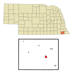
Pawnee County is a county in the U.S. state of Nebraska. As of the 2020 United States Census, the population was 2,544. Its county seat is Pawnee City.

<span class="mw-page-title-main">Merrick County, Nebraska</span> County in Nebraska, United States

Merrick County is a county in the U.S. state of Nebraska. As of the 2020 United States Census, the population was 7,668. Its county seat is Central City.

<span class="mw-page-title-main">Pawnee Rock, Kansas</span> City in Barton County, Kansas, United States

Pawnee Rock is a city in Barton County, Kansas, United States. As of the 2020 census, the population of the city was 193.

<span class="mw-page-title-main">Rozel, Kansas</span> City in Pawnee County, Kansas, United States

Rozel is a city in Pawnee County, Kansas, United States. As of the 2020 census, the population of the city was 102.

<span class="mw-page-title-main">West Point, Nebraska</span> City in Nebraska, United States

West Point is a city in and the county seat of Cuming County, Nebraska, United States. The population was 3,504 at the 2020 census.

<span class="mw-page-title-main">Beaver City, Nebraska</span> City in Nebraska, United States

Beaver City is a city in Furnas County, on the southern border of Nebraska, United States. The population was 609 at the 2010 census. It is the county seat of Furnas County.

<span class="mw-page-title-main">Battle Creek, Nebraska</span> City in Nebraska, United States

Battle Creek is a city in Madison County, Nebraska, United States. It is part of the Norfolk, Nebraska Micropolitan Statistical Area. The population was 1,207 at the 2010 census.

<span class="mw-page-title-main">Fullerton, Nebraska</span> City in and county seat of Nance County, Nebraska, United States

Fullerton is a city in, and the county seat of, Nance County, Nebraska, United States. Its population was 1,307 as of the 2010 Census.

<span class="mw-page-title-main">Genoa, Nebraska</span> City in Nance County, Nebraska, United States

Genoa(pron. je NO uh) is a city in Nance County, Nebraska, United States. The population was 894 at the 2020 census. The city was founded by Mormons in 1857. In the fall of 1859, the Mormon Colony was forced to abandon Genoa when the town and surrounding area were incorporated into the newly created Pawnee Reservation. The Pawnee Indian Agency utilized the structures vacated by the Mormons.

<span class="mw-page-title-main">Burchard, Nebraska</span> Village in Nebraska, United States

Burchard is a village in Pawnee County, Nebraska, United States. The population was 78 at the 2020 census. The village is approximately 10 miles from the Nebraska-Kansas border and ten miles west of Pawnee City.

<span class="mw-page-title-main">Du Bois, Nebraska</span> Village in Nebraska, United States

Du Bois( doo-BOYZ) is a village in the southeast corner of Pawnee County, Nebraska, United States. The population was 124 at the 2020 census.

<span class="mw-page-title-main">Lewiston, Nebraska</span> Village in Nebraska, United States

Lewiston is a village in northwest Pawnee County, Nebraska, United States. The population was 54 at the 2020 census.

<span class="mw-page-title-main">Steinauer, Nebraska</span> Village in Nebraska, United States

Steinauer, locally pronounced "Steener", is a village in Pawnee County, Nebraska, United States. The population was 59 at the 2020 census.

<span class="mw-page-title-main">Table Rock, Nebraska</span> Village in Nebraska, United States

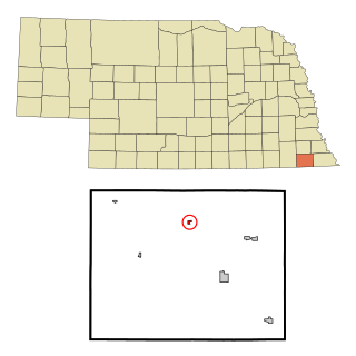
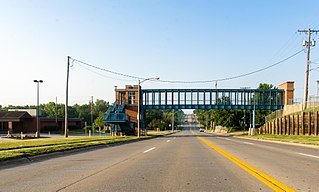
Table Rock is a village in Pawnee County, Nebraska, United States. The population was 236 at the 2020 census.

<span class="mw-page-title-main">Indianola, Nebraska</span> Village in Red Willow County, Nebraska, US

Indianola is a village in Red Willow County, Nebraska, United States. The population was 584 at the 2010 census.

<span class="mw-page-title-main">La Vista, Nebraska</span> City in Sarpy County, Nebraska, United States

La Vista is a city in Sarpy County, Nebraska, United States. The population was 16,746 at the 2020 census, making it the 12th most populous city in Nebraska. The city was incorporated on February 23, 1960.

<span class="mw-page-title-main">Leshara, Nebraska</span> Village in Saunders County, Nebraska, United States

Leshara is a village in Saunders County, Nebraska, United States. The population was 108 at the 2020 census.

<span class="mw-page-title-main">Seward, Nebraska</span> City in and county seat of Seward County, Nebraska, United States

Seward is a city and county seat of Seward County, Nebraska, United States. The population was 6,964 at the 2010 census. Seward is part of the Lincoln, Nebraska Metropolitan Statistical Area.

<span class="mw-page-title-main">Fort Calhoun, Nebraska</span> City in Washington County, Nebraska, United States

Fort Calhoun is a city in Washington County, Nebraska, United States. The population was 1,108 at the 2020 census. The city includes Fort Atkinson, the first fort built west of the Missouri River.

<span class="mw-page-title-main">Red Cloud, Nebraska</span> City in and county seat of Webster County, Nebraska, United States

Red Cloud is a city in and the county seat of Webster County, Nebraska, United States. The population was 962 at the 2020 census. Author Willa Cather made it famous.

References

  1. "ArcGIS REST Services Directory". United States Census Bureau. Retrieved September 18, 2022.
  2. 1 2 U.S. Geological Survey Geographic Names Information System: Pawnee City, Nebraska
  3. 1 2 "U.S. Census website". United States Census Bureau . Retrieved January 31, 2008.
  4. "Find a County". National Association of Counties. Archived from the original on May 31, 2011. Retrieved June 7, 2011.
  5. 1 2 team, The Explore Nebraska History. "Pawnee City". Explore Nebraska History. Retrieved January 5, 2024.
  6. 1 2 "Andreas' History of the State of Nebraska - Pawnee Co. - Part 2". www.kancoll.org. Retrieved January 5, 2024.
  7. Swanton, John Reed (1952). The Indian Tribes of North America. US Government Printing Office. p. 290. ISBN   978-0-8063-1730-4.
  8. "Pawnee City, Pawnee County". Center for Advanced Land Management Information Technologies. University of Nebraska. Retrieved August 21, 2014.
  9. "US Gazetteer files 2010". United States Census Bureau. Archived from the original on January 12, 2012. Retrieved June 24, 2012.
  10. "U.S. Census website". United States Census Bureau . Retrieved June 24, 2012.
  11. "WHERRY, Kenneth Spicer, (1892 - 1951)". Biographical Directory of the United States Congress. Retrieved October 19, 2012.