Thedford, Nebraska

Last updated

Thedford, Nebraska
Thedford, Nebraska.jpg
Aerial view of Thedford
Thomas County Nebraska Incorporated and Unincorporated areas Thedford Highlighted.svg
Location of Thedford, Nebraska
Coordinates: 41°58′45″N100°34′29″W / 41.97917°N 100.57472°W / 41.97917; -100.57472
Country United States
State Nebraska
County Thomas
Area
[1]
  Total0.24 sq mi (0.62 km2)
  Land0.24 sq mi (0.62 km2)
  Water0.00 sq mi (0.00 km2)
Elevation
[2]
2,868 ft (874 m)
Population
 (2020)
  Total208
  Density866.67/sq mi (334.29/km2)
Time zone UTC-6 (Central (CST))
  Summer (DST) UTC-5 (CDT)
ZIP code
69166
Area code 308
FIPS code 31-48760 [3]
GNIS feature ID2399968 [2]
Website thedfordnebraska.net

Thedford is a village and county seat of Thomas County, Nebraska, United States. The population was 208 at the 2020 census.

Contents

History

Thedford was established in 1887 when the Chicago, Burlington and Quincy Railroad was extended to that point, at which time the new town was designated county seat. [4] It was probably named after Thedford, Ontario, Canada. [5] Thedford was incorporated as a village in 1914. [6]

Geography [7]

According to the United States Census Bureau, the village has a total area of 0.23 square miles (0.60 km2), all land. [8]

Thedford is at the junction of U.S. Route 83 and Nebraska Route 2. [9]

Demographics

Historical population
CensusPop.Note
1920 200
1930 27035.0%
1940 2886.7%
1950 275−4.5%
1960 30310.2%
1970 3030.0%
1980 3133.3%
1990 243−22.4%
2000 211−13.2%
2010 188−10.9%
2020 20810.6%
U.S. Decennial Census [10]

2010 census

At the 2010 census, [11] there were 188 people, 93 households and 52 families residing in the village. The population density was 817.4 per square mile (315.6/km2). There were 118 housing units at an average density of 513.0 per square mile (198.1/km2). The racial make-up was 100.0% White. Hispanic or Latino of any race were 0.5% of the population.

There were 93 households, of which 21.5% had children under the age of 18 living with them, 47.3% were married couples living together, 3.2% had a female householder with no husband present, 5.4% had a male householder with no wife present, and 44.1% were non-families. 43.0% of all households were made up of individuals, and 15.1% had someone living alone who was 65 years of age or older. The average household size was 2.02 and the average family size was 2.69.

The median age was 44.7 years. 21.8% of residents were under the age of 18; 7% were between the ages of 18 and 24; 22.2% were from 25 to 44; 26% were from 45 to 64; and 22.9% were 65 years of age or older. The gender make-up was 46.8% male and 53.2% female.

2000 census

At the 2000 census. [3] there were 211 people, 101 households and 65 families residing in the village. The population density was 865.9 per square mile (334.3/km2). There were 126 housing units at an average density of 517.1 per square mile (199.7/km2). The racial make-up was 99.53% White and 0.47% from two or more races. Hispanic or Latino of any race were 2.37% of the population.

There were 101 households, of which 22.8% had children under the age of 18 living with them, 58.4% were married couples living together, 5.0% had a female householder with no husband present and 34.7% were non-families. 33.7% of all households were made up of individuals, and 16.8% had someone living alone who was 65 years of age or older. The average household size was 2.09 and the average family size was 2.65.

17.5% of the population were under the age of 18, 6.2% from 18 to 24, 25.6% from 25 to 44, 27.5% from 45 to 64, and 23.2% who were 65 years of age or older. The median age was 46 years. For every 100 females, there were 111.0 males. For every 100 females age 18 and over, there were 89.1 males.

The median household income was $29,583 and the median family income was $44,063. Males had a median income of $30,500 and females $20,938. The per capita income was $18,300. None of the families and 0.9% of the population were living below the poverty line, including no under eighteens and 3.4% of those over 64.

Economy

In 2009, the municipality had two convenience stores, one bank, one hotel and one restaurant. [9] Pearson Livestock Equipment Company makes cattle chutes in town for an industry. There was a law office, a lumber yard, a Dollar General store and a long time staple of a grocery store named Ewoldt's.

Education

Thedford Public Schools is the local school district. Some of the school activities are combined with a nearby school named Sandhills, which is in Dunning. The combined schools' activities mascot is the Sandhills-Thedford Knights.

See also

Related Research Articles

<span class="mw-page-title-main">Thomas County, Nebraska</span> County in Nebraska, United States

Thomas County is a county in the U.S. state of Nebraska. As of the 2020 United States Census, the population was 669. Its county seat is Thedford. The county was formed in 1887, and was named for General George H. Thomas.

<span class="mw-page-title-main">Holstein, Nebraska</span> Village in Adams County, Nebraska, United States

Holstein is a village in Adams County, Nebraska, United States. The population was 188 at the 2020 census. It is part of the Hastings, Nebraska Micropolitan Statistical Area.

<span class="mw-page-title-main">Cedar Creek, Nebraska</span> Village in Nebraska, United States

Cedar Creek is a village in Cass County, Nebraska, United States. The population was 465 at the 2020 census.

<span class="mw-page-title-main">Eagle, Nebraska</span> Village in Nebraska, United States

Eagle is a village in southwest Cass County, Nebraska, United States. As of the 2020 census, the village population was 1,065.

<span class="mw-page-title-main">Elmwood, Nebraska</span> Village in Nebraska, United States

Elmwood is a village in southeast Cass County, Nebraska, United States. The population was 654 at the 2020 census.

<span class="mw-page-title-main">Manley, Nebraska</span> Village in Nebraska, United States

Manley is a village in Cass County, Nebraska, United States. The population was 167 at the 2020 census.

<span class="mw-page-title-main">Murray, Nebraska</span> Village in Nebraska, United States

Murray is a village in Cass County, Nebraska, United States. The population was 480 at the 2020 census.

<span class="mw-page-title-main">Callaway, Nebraska</span> Village in Nebraska, United States

Callaway is a village in Custer County, Nebraska, United States. The population was 539 at the 2010 census.

<span class="mw-page-title-main">Bennington, Nebraska</span> City in Douglas County, Nebraska, United States

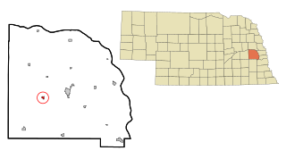
Bennington is a city in Douglas County, Nebraska, United States. The population was 2,026 at the 2020 U.S. Census.

<span class="mw-page-title-main">Waterloo, Nebraska</span> Village in Douglas County, Nebraska, United States

Waterloo is a village in Douglas County, Nebraska, United States. The population was 935 at the 2020 census.

<span class="mw-page-title-main">Page, Nebraska</span> Village in Holt County, Nebraska, United States

Page is a village in Holt County, Nebraska, United States. The population was 166 at the 2010 census.

<span class="mw-page-title-main">Stapleton, Nebraska</span> Village in and county seat of Logan County, Nebraska, United States

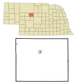
Stapleton is a village in and the county seat of Logan County, Nebraska, United States. The population was 267 at the 2020 census.

<span class="mw-page-title-main">Malmo, Nebraska</span> Village in Saunders County, Nebraska, United States

Malmo is a village in Saunders County, Nebraska, United States. The population was 94 at the 2020 census.

<span class="mw-page-title-main">Memphis, Nebraska</span> Village in Nebraska, United States

Memphis is a village in Saunders County, Nebraska, United States. The population was 109 at the 2020 census.

<span class="mw-page-title-main">Morse Bluff, Nebraska</span> Village in Saunders County, Nebraska, United States

Morse Bluff is a village in Saunders County, Nebraska, United States. The population was 117 at the 2020 census.

<span class="mw-page-title-main">Weston, Nebraska</span> Village in Saunder County, Nebraska, United States

Weston is a village in Saunders County, Nebraska, United States. The population was 250 at the 2020 census.

<span class="mw-page-title-main">Fort Calhoun, Nebraska</span> City in Washington County, Nebraska, United States

Fort Calhoun is a city in Washington County, Nebraska, United States. The population was 1,108 at the 2020 census. The city includes Fort Atkinson, the first fort built west of the Missouri River.

<span class="mw-page-title-main">Herman, Nebraska</span> Village in Washington County, Nebraska, United States

Herman is a village in Washington County, Nebraska, United States. The population was 268 at the 2010 census.

<span class="mw-page-title-main">Washington, Nebraska</span> Village in Washington County, Nebraska, United States

Washington is a village in Washington County, Nebraska, United States. The population was 150 at the 2010 census.

<span class="mw-page-title-main">Bartlett, Nebraska</span> Village in and county seat of Wheeler County, Nebraska, United States

Bartlett is a village in, and the county seat of, Wheeler County, Nebraska, United States. The population was 117 at the 2010 census.

References

  1. "ArcGIS REST Services Directory". United States Census Bureau. Retrieved September 18, 2022.
  2. 1 2 U.S. Geological Survey Geographic Names Information System: Thedford, Nebraska
  3. 1 2 "U.S. Census website". United States Census Bureau . Retrieved January 31, 2008.
  4. Hellmann, Paul T. (February 14, 2006). Historical Gazetteer of the United States. Routledge. p. 680. ISBN   1-135-94859-3.
  5. Fitzpatrick, Lillian L. (1960). Nebraska Place-Names. University of Nebraska Press. p. 139. ISBN   0-8032-5060-6. A 1925 edition is available for download at University of Nebraska—Lincoln Digital Commons.
  6. "Thedford, Thomas County". Center for Advanced Land Management Information Technologies. University of Nebraska. Retrieved August 23, 2014.
  7. 07 MAR 2024; Personal Converstation with Director of the National Weather Service Forecast Office - North Platte, NE.
  8. "US Gazetteer files 2010". United States Census Bureau. Archived from the original on January 25, 2012. Retrieved June 24, 2012.
  9. 1 2 "To Survive, Rival Teams Have to Combine". The New York Times . Associated Press. October 18, 2009. Retrieved July 13, 2018.
  10. "Census of Population and Housing". Census.gov. Retrieved June 4, 2015.
  11. "U.S. Census website". United States Census Bureau . Retrieved June 24, 2012.