County
| FIPS code [1] | County seat [2] | Est. [2] | Origin | Etymology | License plate prefix
[3] | Population [4] | Area [2] | Map |
|---|
| AdamsCounty | 001 | Hastings | 1867 | Unorganized territory | John Adams, second President of the United States | 14 | 30,899 | 563 sq mi
(1,458 km2) |  |
|---|
| AntelopeCounty | 003 | Neligh | 1871 | Unorganized territory | Pronghorn, often called antelope | 26 | 6,302 | 857 sq mi
(2,220 km2) |  |
|---|
| ArthurCounty | 005 | Arthur | 1913 | Unorganized territory | Chester A. Arthur, twenty-first president of the United States | 91 | 412 | 715 sq mi
(1,852 km2) | 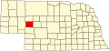 |
|---|
| BannerCounty | 007 | Harrisburg | 1888 | Formed from Cheyenne County | Early settlers' goal of making it the "banner county" of the state | 85 | 674 | 746 sq mi
(1,932 km2) |  |
|---|
| BlaineCounty | 009 | Brewster | 1885 | Unorganized territory | James G. Blaine, national politician | 86 | 436 | 711 sq mi
(1,841 km2) |  |
|---|
| BooneCounty | 011 | Albion | 1871 | Unorganized territory | Daniel Boone, American pioneer and trapper | 23 | 5,310 | 687 sq mi
(1,779 km2) |  |
|---|
| Box ButteCounty | 013 | Alliance | 1887 | Formed from Dawes County | A box-shaped butte north of Alliance | 65 | 10,692 | 1,075 sq mi
(2,784 km2) |  |
|---|
| BoydCounty | 015 | Butte | 1891 | Holt County and unorganized territory (Indian Territory) | James E. Boyd, the eighth governor of Nebraska | 63 | 1,725 | 540 sq mi
(1,399 km2) | 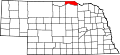 |
|---|
| BrownCounty | 017 | Ainsworth | 1883 | Unorganized territory | The Brown family of early settlers | 75 | 2,853 | 1,221 sq mi
(3,162 km2) |  |
|---|
| BuffaloCounty | 019 | Kearney | 1855 | Unorganized territory | The American Bison | 9 | 50,697 | 968 sq mi
(2,507 km2) |  |
|---|
| BurtCounty | 021 | Tekamah | 1854 | One of nine original counties | Francis Burt, the first territorial governor | 31 | 6,727 | 493 sq mi
(1,277 km2) |  |
|---|
| ButlerCounty | 023 | David City | 1856 | Formed from Greene County | William O. Butler, U.S. Congressman and military leader | 25 | 8,459 | 584 sq mi
(1,513 km2) |  |
|---|
| CassCounty | 025 | Plattsmouth | 1854 | One of nine original counties | Lewis Cass, U.S. Senator who supported the Kansas-Nebraska Act | 20 | 27,446 | 559 sq mi
(1,448 km2) | 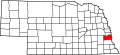 |
|---|
| CedarCounty | 027 | Hartington | 1857 | Formed from Dixon and Pierce Counties | The eastern red cedar [5] | 13 | 8,262 | 740 sq mi
(1,917 km2) |  |
|---|
| ChaseCounty | 029 | Imperial | 1873 | Unorganized territory | Champion S. Chase, Nebraska's first attorney general | 72 | 3,724 | 894 sq mi
(2,315 km2) | 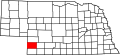 |
|---|
| CherryCounty | 031 | Valentine | 1883 | Unorganized territory | Samuel A. Cherry, army lieutenant killed in the Indian Wars | 66 | 5,492 | 5,961 sq mi
(15,439 km2) |  |
|---|
| CheyenneCounty | 033 | Sidney | 1867 | Unorganized territory | Named for the Cheyenne Indian tribe | 39 | 9,541 | 1,196 sq mi
(3,098 km2) |  |
|---|
| ClayCounty | 035 | Clay Center | 1855 | Formed from unorganized territory | Henry Clay, national politician | 30 | 6,116 | 573 sq mi
(1,484 km2) |  |
|---|
| ColfaxCounty | 037 | Schuyler | 1869 | Formed from Platte County | Schuyler Colfax, Vice President of the United States | 43 | 10,566 | 413 sq mi
(1,070 km2) |  |
|---|
| CumingCounty | 039 | West Point | 1855 | Formed from Burt County | Thomas B. Cuming, first territorial secretary | 24 | 8,918 | 572 sq mi
(1,481 km2) |  |
|---|
| CusterCounty | 041 | Broken Bow | 1877 | Unorganized territory | George Armstrong Custer, U.S. Army general | 4 | 10,581 | 2,576 sq mi
(6,672 km2) | 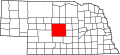 |
|---|
| DakotaCounty | 043 | Dakota City | 1855 | Formed from Burt County | Dakota branch of the Sioux Indian tribe | 70 | 21,268 | 264 sq mi
(684 km2) |  |
|---|
| DawesCounty | 045 | Chadron | 1885 | Formed from Sioux County | James W. Dawes, the sixth governor of Nebraska | 69 | 8,133 | 1,396 sq mi
(3,616 km2) |  |
|---|
| DawsonCounty | 047 | Lexington | 1860 | Unorganized territory | Jacob Dawson, first postmaster for Lincoln | 18 | 24,085 | 1,013 sq mi
(2,624 km2) |  |
|---|
| DeuelCounty | 049 | Chappell | 1888 | Formed from Cheyenne County | The Deuel family of early settlers | 78 | 1,871 | 440 sq mi
(1,140 km2) | 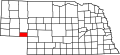 |
|---|
| DixonCounty | 051 | Ponca | 1856 | Formed from Blackbird County, Izard County, and unorganized territory | The Dixon family of early settlers | 35 | 5,491 | 476 sq mi
(1,233 km2) |  |
|---|
| DodgeCounty | 053 | Fremont | 1854 | One of nine original counties | Augustus Caesar Dodge, U.S. Senator who supported the Kansas-Nebraska Act | 5 | 37,187 | 534 sq mi
(1,383 km2) |  |
|---|
| DouglasCounty | 055 | Omaha | 1854 | One of nine original counties | Stephen Arnold Douglas, national politician | 1 | 589,540 | 331 sq mi
(857 km2) |  |
|---|
| DundyCounty | 057 | Benkelman | 1873 | Unorganized territory | Elmer Scipio Dundy, U.S. Circuit Court judge | 76 | 1,561 | 920 sq mi
(2,383 km2) |  |
|---|
| FillmoreCounty | 059 | Geneva | 1856 | Formed from Jackson County and unorganized territory | Millard Fillmore, thirteenth president of the United States | 34 | 5,548 | 576 sq mi
(1,492 km2) |  |
|---|
| FranklinCounty | 061 | Franklin | 1867 | Formed from Kearney County | Benjamin Franklin, Founding Father | 50 | 2,825 | 576 sq mi
(1,492 km2) | 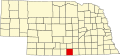 |
|---|
| FrontierCounty | 063 | Stockville | 1872 | Unorganized territory | Its location | 60 | 2,585 | 975 sq mi
(2,525 km2) |  |
|---|
| FurnasCounty | 065 | Beaver City | 1873 | Unorganized territory | Robert Wilkinson Furnas, third governor of Nebraska | 38 | 4,556 | 718 sq mi
(1,860 km2) | 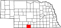 |
|---|
| GageCounty | 067 | Beatrice | 1855 | Unorganized territory | William D. Gage, contemporary chaplain of the state legislature | 3 | 21,634 | 855 sq mi
(2,214 km2) |  |
|---|
| GardenCounty | 069 | Oshkosh | 1910 | Formed from Deuel County | Early settlers' hopes for it to become the "garden spot of the west" | 77 | 1,794 | 1,705 sq mi
(4,416 km2) |  |
|---|
| GarfieldCounty | 071 | Burwell | 1884 | Formed from Wheeler County | James Abram Garfield, twentieth president of the United States | 83 | 1,763 | 570 sq mi
(1,476 km2) |  |
|---|
| GosperCounty | 073 | Elwood | 1873 | Unorganized territory | John J. Gosper, contemporary Nebraska secretary of state | 73 | 1,847 | 458 sq mi
(1,186 km2) |  |
|---|
| GrantCounty | 075 | Hyannis | 1887 | Unorganized territory | Ulysses S. Grant, eighteenth president of the United States | 92 | 565 | 776 sq mi
(2,010 km2) | 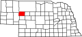 |
|---|
| GreeleyCounty | 077 | Greeley | 1871 | Unorganized territory | Horace Greeley, journalist | 62 | 2,219 | 570 sq mi
(1,476 km2) | 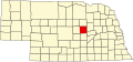 |
|---|
| HallCounty | 079 | Grand Island | 1858 | Unorganized territory | Augustus Hall, contemporary chief justice of the Territorial Supreme Court | 8 | 62,197 | 546 sq mi
(1,414 km2) |  |
|---|
| HamiltonCounty | 081 | Aurora | 1867 | Unorganized territory | Alexander Hamilton, first United States Secretary of the Treasury | 28 | 9,537 | 544 sq mi
(1,409 km2) |  |
|---|
| HarlanCounty | 083 | Alma | 1871 | Formed from Kearney County | Disputed; either James Harlan, national politician, or a local revenue collector | 51 | 3,045 | 553 sq mi
(1,432 km2) |  |
|---|
| HayesCounty | 085 | Hayes Center | 1877 | Unorganized territory | Rutherford B. Hayes, nineteenth president of the United States | 79 | 846 | 713 sq mi
(1,847 km2) |  |
|---|
| HitchcockCounty | 087 | Trenton | 1873 | Unorganized territory | Phineas Warren Hitchcock, Nebraska U.S. Senator | 67 | 2,552 | 710 sq mi
(1,839 km2) |  |
|---|
| HoltCounty | 089 | O'Neill | 1860 | Unorganized territory | Joseph Holt, U.S. Postmaster General and Secretary of War | 36 | 10,093 | 2,413 sq mi
(6,250 km2) |  |
|---|
| HookerCounty | 091 | Mullen | 1889 | Unorganized territory | Joseph Hooker, U.S. Army general | 93 | 679 | 721 sq mi
(1,867 km2) |  |
|---|
| HowardCounty | 093 | Saint Paul | 1871 | Formed from Hall County | Oliver O. Howard, U.S. Army general | 49 | 6,527 | 570 sq mi
(1,476 km2) |  |
|---|
| JeffersonCounty | 095 | Fairbury | 1856 | Unorganized territory | Thomas Jefferson, the third president of the United States | 33 | 7,054 | 573 sq mi
(1,484 km2) |  |
|---|
| JohnsonCounty | 097 | Tecumseh | 1857 | Formed from Nemaha and Otoe Counties | Richard Mentor Johnson, ninth vice president of the United States | 57 | 5,198 | 376 sq mi
(974 km2) |  |
|---|
| KearneyCounty | 099 | Minden | 1860 | Unorganized territory | Fort Kearny, with a misspelling | 52 | 6,770 | 516 sq mi
(1,336 km2) |  |
|---|
| KeithCounty | 101 | Ogallala | 1873 | Unorganized territory | M.C. Keith, rancher with wide holdings | 68 | 8,113 | 1,061 sq mi
(2,748 km2) |  |
|---|
| Keya PahaCounty | 103 | Springview | 1884 | Formed from Brown County and unorganized Indian territory | Dakota words Ké-ya Pa-há Wa-kpá (turtle hill river) | 82 | 805 | 773 sq mi
(2,002 km2) |  |
|---|
| KimballCounty | 105 | Kimball | 1888 | Formed from Cheyenne County | Thomas L. Kimball, Union Pacific Railroad official | 71 | 3,289 | 952 sq mi
(2,466 km2) |  |
|---|
| KnoxCounty | 107 | Center | 1857 | Formed from Pierce County and unorganized territory (Former names-L'Eau Qui Court (1857-1867) and Emmet (1867-1873)) | Henry Knox, first U.S. Secretary of War | 12 | 8,298 | 1,108 sq mi
(2,870 km2) |  |
|---|
| LancasterCounty | 109 | Lincoln | 1855 | Formed from Cass and Pierce Counties | Lancaster, Pennsylvania and Lancaster, England | 2 | 326,716 | 839 sq mi
(2,173 km2) |  |
|---|
| LincolnCounty | 111 | North Platte | 1860 | Unorganized territory | Abraham Lincoln, sixteenth president of the United States | 15 | 33,365 | 2,564 sq mi
(6,641 km2) | 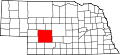 |
|---|
| LoganCounty | 113 | Stapleton | 1885 | Unorganized territory | John A. Logan, U.S. Army general | 87 | 655 | 571 sq mi
(1,479 km2) | 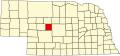 |
|---|
| LoupCounty | 115 | Taylor | 1883 | Unorganized territory | Loup River | 88 | 592 | 570 sq mi
(1,476 km2) | 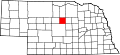 |
|---|
| MadisonCounty | 119 | Madison | 1856 | Formed from Loup County, and McNeale County, and unorganized territory | Either James Madison, fourth president of the United States, or local settlers' native Madison, Wisconsin | 7 | 35,627 | 573 sq mi
(1,484 km2) |  |
|---|
| McPhersonCounty | 117 | Tryon | 1887 | Unorganized territory | James B. McPherson, U.S. Army general | 90 | 383 | 859 sq mi
(2,225 km2) | 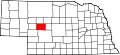 |
|---|
| MerrickCounty | 121 | Central City | 1858 | Formed from Polk County and unorganized territory | Elvira Merrick, wife of legislator Henry W. DePuy | 46 | 7,755 | 485 sq mi
(1,256 km2) | 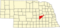 |
|---|
| MorrillCounty | 123 | Bridgeport | 1908 | Formed from Cheyenne County | Charles Henry Morrill, president of the Lincoln Land Company | 64 | 4,504 | 1,424 sq mi
(3,688 km2) | 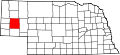 |
|---|
| NanceCounty | 125 | Fullerton | 1879 | Formed from a Pawnee Indian reservation | Albinus Nance, fourth governor of Nebraska | 58 | 3,274 | 441 sq mi
(1,142 km2) |  |
|---|
| NemahaCounty | 127 | Auburn | 1854 | One of nine original counties | Nimaha, the Otoe name meaning miry water for a local stream | 44 | 7,076 | 409 sq mi
(1,059 km2) |  |
|---|
| NuckollsCounty | 129 | Nelson | 1860 | Unorganized territory | Lafayette Nuckolls, a member of the first Nebraska territorial legislature; and his brother, Stephen Nuckolls, a pioneering Nebraska settler, businessman and banker | 42 | 4,095 | 575 sq mi
(1,489 km2) |  |
|---|
| OtoeCounty | 131 | Nebraska City | 1854 | One of nine original counties | Oto (also Otoe) Native American tribe | 11 | 16,335 | 616 sq mi
(1,595 km2) |  |
|---|
| PawneeCounty | 133 | Pawnee City | 1855 | Formed from Richardson County | Pawnee Native American tribe | 54 | 2,512 | 432 sq mi
(1,119 km2) | 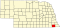 |
|---|
| PerkinsCounty | 135 | Grant | 1887 | Formed from Keith County | Charles E. Perkins, a president of the Chicago, Burlington and Quincy Railroad | 74 | 2,795 | 883 sq mi
(2,287 km2) | 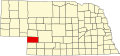 |
|---|
| PhelpsCounty | 137 | Holdrege | 1873 | Formed from Kearney County | William Phelps, an early settler [5] | 37 | 9,057 | 540 sq mi
(1,399 km2) |  |
|---|
| PierceCounty | 139 | Pierce | 1856 | Formed from Izard County, McNeale County, and unorganized territory | Franklin Pierce, the fourteenth president of the United States | 40 | 7,299 | 574 sq mi
(1,487 km2) |  |
|---|
| PlatteCounty | 141 | Columbus | 1856 | Formed from Greene and Loup Counties | Platte River which is in turn named for the French word for flat | 10 | 34,609 | 678 sq mi
(1,756 km2) |  |
|---|
| PolkCounty | 143 | Osceola | 1856 | Formed from York County and unorganized territory | James Knox Polk, the eleventh president of the United States | 41 | 5,228 | 439 sq mi
(1,137 km2) |  |
|---|
| Red WillowCounty | 145 | McCook | 1873 | Unorganized territory | Red Willow Creek, which runs through the area | 48 | 10,457 | 717 sq mi
(1,857 km2) |  |
|---|
| RichardsonCounty | 147 | Falls City | 1854 | One of nine original counties | William A. Richardson, a governor of the Nebraska Territory | 19 | 7,689 | 554 sq mi
(1,435 km2) |  |
|---|
| RockCounty | 149 | Bassett | 1885 | Formed from Brown County | Either Rock Creek, which flows in the county; or the rocky condition of the soil in the area | 81 | 1,271 | 1,008 sq mi
(2,611 km2) |  |
|---|
| SalineCounty | 151 | Wilber | 1867 | Unorganized territory | Named for a belief held by the early pioneers that great salt springs and deposits could be found in the area, a hope found to be false | 22 | 14,555 | 575 sq mi
(1,489 km2) | 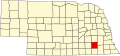 |
|---|
| SarpyCounty | 153 | Papillion | 1857 | Formed from Cass and Douglas Counties | Peter A. Sarpy, a commander of a trading post in the future county | 59 | 199,886 | 241 sq mi
(624 km2) |  |
|---|
| SaundersCounty | 155 | Wahoo | 1856 | Formed from Douglas and Lancaster Counties | Alvin Saunders, a governor of the Nebraska Territory | 6 | 23,463 | 754 sq mi
(1,953 km2) | 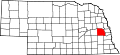 |
|---|
| Scotts BluffCounty | 157 | Gering | 1888 | Formed from Cheyenne County | Named for a towering bluff located in the Scotts Bluff National Monument; the bluffs themselves are named for Hiram Scott, a fur trapper who is alleged to have crawled 75 miles with a broken leg before collapsing and dying at the foot of the formation | 21 | 35,699 | 739 sq mi
(1,914 km2) |  |
|---|
| SewardCounty | 159 | Seward | 1855 | Formed from Cass and Pierce Counties | William Henry Seward, the United States Secretary of State during the 1860s | 16 | 17,671 | 575 sq mi
(1,489 km2) | 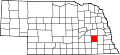 |
|---|
| SheridanCounty | 161 | Rushville | 1885 | Formed from Sioux County | Philip Henry Sheridan, a general in the American Civil War | 61 | 4,928 | 2,441 sq mi
(6,322 km2) |  |
|---|
| ShermanCounty | 163 | Loup City | 1871 | Formed from Buffalo County and unorganized territory | William Tecumseh Sherman, the American Civil War general | 56 | 2,983 | 566 sq mi
(1,466 km2) |  |
|---|
| SiouxCounty | 165 | Harrison | 1877 | Unorganized territory | Sioux Native American tribe | 80 | 1,154 | 1,313 sq mi
(3,401 km2) | 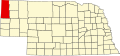 |
|---|
| StantonCounty | 167 | Stanton | 1855 | Formed from Burt County | Edwin M. Stanton, the United States Secretary of War during most of the American Civil War | 53 | 5,856 | 430 sq mi
(1,114 km2) |  |
|---|
| ThayerCounty | 169 | Hebron | 1871 | Formed from Jefferson County | John Milton Thayer, the seventh governor of Nebraska | 32 | 4,829 | 575 sq mi
(1,489 km2) | 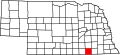 |
|---|
| ThomasCounty | 171 | Thedford | 1887 | Unorganized territory | George Henry Thomas, a general in the American Civil War | 89 | 677 | 713 sq mi
(1,847 km2) |  |
|---|
| ThurstonCounty | 173 | Pender | 1889 | Formed from Blackbird County and an Omaha Indian reservation | John Mellen Thurston, a U. S. senator from Nebraska | 55 | 6,557 | 394 sq mi
(1,020 km2) | 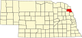 |
|---|
| ValleyCounty | 175 | Ord | 1871 | Unorganized territory | Named for the many valleys in the area | 47 | 4,012 | 568 sq mi
(1,471 km2) |  |
|---|
| WashingtonCounty | 177 | Blair | 1854 | One of nine original counties | George Washington, the first president of the United States | 29 | 21,152 | 390 sq mi
(1,010 km2) |  |
|---|
| WayneCounty | 179 | Wayne | 1867 | Unorganized territory | Anthony Wayne, the American Revolutionary War general nicknamed "Mad Anthony" by his troops | 27 | 9,874 | 444 sq mi
(1,150 km2) |  |
|---|
| WebsterCounty | 181 | Red Cloud | 1867 | Unorganized territory | Daniel Webster, the statesman and U.S. Senator from Massachusetts | 45 | 3,351 | 575 sq mi
(1,489 km2) |  |
|---|
| WheelerCounty | 183 | Bartlett | 1877 | Unorganized territory | Daniel H. Wheeler, a secretary of the Nebraska State Board of Agriculture | 84 | 775 | 575 sq mi
(1,489 km2) |  |
|---|
| YorkCounty | 185 | York | 1855 | Formed from Cass County, Pierce County, and unorganized territory | Named for either York, England, or York County, Pennsylvania | 17 | 14,356 | 576 sq mi
(1,492 km2) |  |
|---|