Wayne, Nebraska

Last updated

Wayne, Nebraska
Wayne, Nebraska 201-203 N Main from W.JPG
Wayne's commercial district is listed in the National Register of Historic Places. [2]
Wayne County Nebraska Incorporated and Unincorporated areas Wayne Highlighted.svg
Location of Wayne, Nebraska
Coordinates: 42°14′17″N97°00′36″W / 42.23806°N 97.01000°W / 42.23806; -97.01000
Country United States
State Nebraska
County Wayne
Founded1881
Named for Anthony Wayne
Government
  TypeMayor/Council
Area
[3]
  Total2.87 sq mi (7.43 km2)
  Land2.82 sq mi (7.32 km2)
  Water0.04 sq mi (0.11 km2)
Elevation
[4]
1,467 ft (447 m)
Population
 (2020)
  Total5,973
  Density2,115.08/sq mi (816.51/km2)
Time zone UTC-6 (Central (CST))
  Summer (DST) UTC-5 (CDT)
ZIP code
68787
Area code 402
FIPS code 31-51840
GNIS feature ID2397233 [4]
Website www.cityofwayne.org

Wayne is a city in Wayne County, Nebraska, United States. The population was 5,660 at the 2010 census. [5] It is the county seat of Wayne County [6] and the home of Wayne State College.

Contents

History

Wayne was founded in 1881 when the Chicago, St. Paul, Minneapolis & Omaha Railroad was extended to that point. [7] [8] It was named for and with Wayne County. [9]

Geography

According to the United States Census Bureau, the city has a total area of 2.25 square miles (5.83 km2), of which 2.21 square miles (5.72 km2) is land and 0.04 square miles (0.10 km2) is water. [10]

Demographics

Historical population
CensusPop.Note
1890 1,178
1900 2,11979.9%
1910 2,1401.0%
1920 2,115−1.2%
1930 2,38112.6%
1940 2,71914.2%
1950 3,59532.2%
1960 4,21717.3%
1970 5,37927.6%
1980 5,240−2.6%
1990 5,142−1.9%
2000 5,5838.6%
2010 5,6601.4%
2020 5,9735.5%
U.S. Decennial Census [11]
2012 Estimate [12]

2010 census

At the 2010 census there were 5,660 people, 1,953 households, and 987 families living in the city. The population density was 2,561.1 inhabitants per square mile (988.8/km2). There were 2,082 housing units at an average density of 942.1 per square mile (363.7/km2). The racial makeup of the city was 93.2% White, 2.1% African American, 0.5% Native American, 0.7% Asian, 0.2% Pacific Islander, 2.0% from other races, and 1.4% from two or more races. Hispanic or Latino of any race were 4.8%. [13]

Of the 1,953 households 23.3% had children under the age of 18 living with them, 41.4% were married couples living together, 6.7% had a female householder with no husband present, 2.5% had a male householder with no wife present, and 49.5% were non-families. 33.6% of households were one person and 12.8% were one person aged 65 or older. The average household size was 2.25 and the average family size was 2.90.

The median age was 22.9 years. 15.5% of residents were under the age of 18; 39.8% were between the ages of 18 and 24; 16.7% were from 25 to 44; 15.6% were from 45 to 64; and 12.4% were 65 or older. The gender makeup of the city was 49.2% male and 50.8% female.

2000 census

At the 2000 census, there were 5,583 people, 1,850 households, and 989 families living in the city. The population density was 2,550.9 inhabitants per square mile (984.9/km2). There were 1,963 housing units at an average density of 896.9 per square mile (346.3/km2). The racial makeup of the city was 96.35% White, 1.59% African American, 0.36% Native American, 0.34% Asian, 0.02% Pacific Islander, 0.43% from other races, and 0.91% from two or more races. Hispanic or Latino of any race were 1.42% of the population.

Of the 1,850 households 24.6% had children under the age of 18 living with them, 45.3% were married couples living together, 6.4% had a female householder with no husband present, and 46.5% were non-families. 28.6% of households were one person and 11.6% were one person aged 65 or older. The average household size was 2.36 and the average family size was 2.90.

The age distribution was 15.7% under the age of 18, 39.6% from 18 to 24, 17.4% from 25 to 44, 13.9% from 45 to 64, and 13.4% 65 or older. The median age was 23 years. For every 100 females, there were 85.6 males. For every 100 females age 18 and over, there were 85.7 males.

The median household income was $27,730, and the median family income was $51,033. Males had a median income of $30,560 versus $20,847 for females. The per capita income for the city was $13,984. About 7.5% of families and 20.0% of the population were below the poverty line, including 6.9% of those under age 18 and 7.4% of those age 65 or over.

Climate

According to the Köppen Climate Classification system, Wayne has a hot-summer humid continental climate, abbreviated "Dfa" on climate maps. The hottest temperature recorded in Wayne was 105 °F (40.6 °C) on July 13, 1995 and July 20, 2006, while the coldest temperature recorded was −27 °F (−32.8 °C) on January 2, 2018. [14]

Climate data for Wayne, Nebraska, 1991–2020 normals, extremes 1989–present
MonthJanFebMarAprMayJunJulAugSepOctNovDecYear
Record high °F (°C)74
(23)
74
(23)
90
(32)
92
(33)
100
(38)
103
(39)
105
(41)
103
(39)
101
(38)
92
(33)
83
(28)
69
(21)
105
(41)
Mean maximum °F (°C)54.6
(12.6)
59.7
(15.4)
73.8
(23.2)
83.0
(28.3)
89.4
(31.9)
94.8
(34.9)
95.8
(35.4)
94.3
(34.6)
90.7
(32.6)
83.3
(28.5)
71.2
(21.8)
56.2
(13.4)
97.5
(36.4)
Average high °F (°C)30.2
(−1.0)
35.0
(1.7)
47.4
(8.6)
60.1
(15.6)
71.0
(21.7)
81.2
(27.3)
85.1
(29.5)
82.8
(28.2)
75.9
(24.4)
62.5
(16.9)
47.0
(8.3)
34.1
(1.2)
59.4
(15.2)
Daily mean °F (°C)20.5
(−6.4)
24.8
(−4.0)
35.9
(2.2)
47.7
(8.7)
59.4
(15.2)
70.1
(21.2)
74.2
(23.4)
71.8
(22.1)
63.7
(17.6)
50.4
(10.2)
36.2
(2.3)
24.7
(−4.1)
48.3
(9.0)
Average low °F (°C)10.8
(−11.8)
14.5
(−9.7)
24.4
(−4.2)
35.3
(1.8)
47.8
(8.8)
59.0
(15.0)
63.4
(17.4)
60.8
(16.0)
51.4
(10.8)
38.3
(3.5)
25.3
(−3.7)
15.3
(−9.3)
37.2
(2.9)
Mean minimum °F (°C)−11.3
(−24.1)
−6.4
(−21.3)
3.6
(−15.8)
19.5
(−6.9)
33.4
(0.8)
46.1
(7.8)
51.7
(10.9)
49.2
(9.6)
35.6
(2.0)
21.1
(−6.1)
6.7
(−14.1)
−5.9
(−21.1)
−15.1
(−26.2)
Record low °F (°C)−27
(−33)
−25
(−32)
−15
(−26)
6
(−14)
26
(−3)
39
(4)
45
(7)
42
(6)
27
(−3)
9
(−13)
−12
(−24)
−26
(−32)
−27
(−33)
Average precipitation inches (mm)0.55
(14)
0.75
(19)
1.42
(36)
2.99
(76)
4.20
(107)
4.40
(112)
2.69
(68)
3.57
(91)
2.58
(66)
2.28
(58)
1.21
(31)
0.83
(21)
27.47
(699)
Average snowfall inches (cm)6.8
(17)
6.7
(17)
5.8
(15)
2.7
(6.9)
0.0
(0.0)
0.0
(0.0)
0.0
(0.0)
0.0
(0.0)
0.0
(0.0)
0.5
(1.3)
3.5
(8.9)
6.2
(16)
32.2
(82.1)
Average extreme snow depth inches (cm)6.9
(18)
7.2
(18)
5.0
(13)
2.0
(5.1)
0.0
(0.0)
0.0
(0.0)
0.0
(0.0)
0.0
(0.0)
0.0
(0.0)
0.2
(0.51)
2.5
(6.4)
4.6
(12)
10.3
(26)
Average precipitation days (≥ 0.01 in)4.14.45.58.110.29.06.97.46.05.74.14.375.7
Average snowy days (≥ 0.1 in)3.83.52.20.80.00.00.00.00.00.41.63.615.9
Source 1: NOAA [15]
Source 2: National Weather Service [14]

Education

Wayne Community Schools operates public schools.

Wayne State College is in Wayne.

St.Mary's Catholic Private School. Which is a Private School.

Notable people

See also

Related Research Articles

<span class="mw-page-title-main">Gibbon, Nebraska</span> City in Nebraska, United States

Gibbon is a city in Buffalo County, Nebraska, United States. It is part of the Kearney, Nebraska Micropolitan Statistical Area. The population was 1,833 at the 2010 census.

<span class="mw-page-title-main">Tekamah, Nebraska</span> City in Nebraska, United States

Tekamah is a city in Burt County, Nebraska, United States. The population was 1,736 at the 2010 census. It is the county seat of Burt County.

<span class="mw-page-title-main">Louisville, Nebraska</span> City in Nebraska, United States

Louisville is a city in northern Cass County, Nebraska, United States. The population was 1,319 at the 2020 census.

<span class="mw-page-title-main">Edgar, Nebraska</span> City in Nebraska, United States

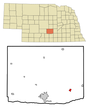
Edgar is a city in Clay County, Nebraska, United States. The population was 498 at the 2010 census. It is part of the Hastings, Nebraska Micropolitan Statistical Area.

<span class="mw-page-title-main">Ponca, Nebraska</span> City in and county seat of Dixon County, Nebraska, U.S.

Ponca is a city and county seat of Dixon County, Nebraska, United States. The population was 961 at the 2010 census.

<span class="mw-page-title-main">Bennington, Nebraska</span> City in Douglas County, Nebraska, United States

Bennington is a city in Douglas County, Nebraska, United States. The population was 2,026 at the 2020 U.S. Census.

<span class="mw-page-title-main">Atkinson, Nebraska</span> City in Nebraska, United States

Atkinson is a city in Holt County, Nebraska, United States. The population was 1,245 at the 2010 census.

<span class="mw-page-title-main">Center, Nebraska</span> Village in and county seat of Knox County, Nebraska, United States

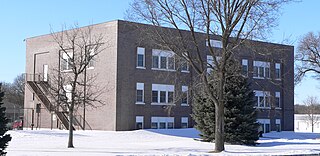
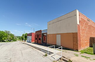
Center is a village in, and county seat of, Knox County, Nebraska, United States. The population was 73 at the 2020 census.

<span class="mw-page-title-main">Creighton, Nebraska</span> City in Nebraska, United States

Creighton is a city in Knox County, Nebraska, United States. The population was 1,154 at the 2010 census.

<span class="mw-page-title-main">Bayard, Nebraska</span> City in Nebraska, United States

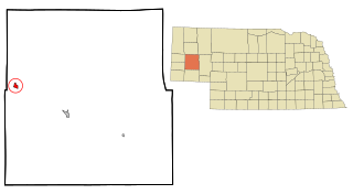
Bayard is a city in Morrill County, Nebraska, United States. The population was 1,209 at the 2010 census.

<span class="mw-page-title-main">Pawnee City, Nebraska</span> City in and county seat of Pawnee County, Nebraska, United States

Pawnee City is a city in and the county seat of Pawnee County, Nebraska, United States. The population was 878 at the 2010 census.

<span class="mw-page-title-main">Pierce, Nebraska</span> City in Nebraska, United States

Pierce is a city in and county seat of Pierce County, Nebraska, United States. The population was 1,767 at the 2010 census.

<span class="mw-page-title-main">Salem, Nebraska</span> Village in Richardson County, Nebraska, United States

Salem is a village in Richardson County, Nebraska, United States. The population was 84 at the 2020 census.

<span class="mw-page-title-main">Bassett, Nebraska</span> City in and county seat of Rock County, Nebraska, United States

Bassett is a city in Rock County, Nebraska, United States. The population was 619 at the 2010 census. It is the county seat of Rock County.

<span class="mw-page-title-main">Fort Calhoun, Nebraska</span> City in Washington County, Nebraska, United States

Fort Calhoun is a city in Washington County, Nebraska, United States. The population was 908 at the 2010 census. The city includes Fort Atkinson, the first fort built west of the Missouri River.

<span class="mw-page-title-main">Carroll, Nebraska</span> Village in Wayne County, Nebraska, United States

Carroll is a village in Wayne County, Nebraska, United States. The population was 193 at the 2020 census.

<span class="mw-page-title-main">Hoskins, Nebraska</span> Village in Wayne County, Nebraska, United States

Hoskins is a village in Wayne County, Nebraska, United States. The population was 267 at the 2020 census.

<span class="mw-page-title-main">Sholes, Nebraska</span> Village in Wayne County, Nebraska, United States

Sholes is a village in Wayne County, Nebraska, United States. The population was 15 at the 2020 census.

<span class="mw-page-title-main">Winside, Nebraska</span> Village in Wayne County, Nebraska, United States

Winside is a village in Wayne County, Nebraska, United States. The population was 381 at the 2020 census.

<span class="mw-page-title-main">Wakefield, Nebraska</span> City in Dixon and Wayne counties in Nebraska, United States

Wakefield is a city in Dixon and Wayne Counties in the State of Nebraska. The population was 1,451 at the 2010 census.

References

  1. "Nebraska National Register Sites in Wayne County". [Usurped!] Nebraska State Historical Society. [Usurped!] Retrieved 2012-09-04.
  2. "Nebraska National Register Sites in Wayne County". [Usurped!] Nebraska State Historical Society. [Usurped!] Retrieved 2012-09-04.
  3. "ArcGIS REST Services Directory". United States Census Bureau. Retrieved September 18, 2022.
  4. 1 2 U.S. Geological Survey Geographic Names Information System: Wayne, Nebraska
  5. "Many Area Neb. Counties Lose Population".
  6. "Find a County". National Association of Counties. Retrieved June 7, 2011.
  7. Burr, George L. (1921). History of Hamilton and Clay Counties, Nebraska, Volume 1. S.J. Clarke Publishing Company. p. 141.
  8. "Wayne, Wayne County". Center for Advanced Land Management Information Technologies. University of Nebraska. Retrieved August 24, 2014.
  9. Chicago and North Western Railway Company (1908). A History of the Origin of the Place Names Connected with the Chicago & North Western and Chicago, St. Paul, Minneapolis & Omaha Railways. p. 165.
  10. "US Gazetteer files 2010". United States Census Bureau. Archived from the original on January 25, 2012. Retrieved June 24, 2012.
  11. United States Census Bureau. "Census of Population and Housing". The United States Census Bureau. Retrieved October 18, 2013.
  12. "Annual Estimates of the Resident Population: April 1, 2010 to July 1, 2012". Archived from the original on October 19, 2013. Retrieved October 18, 2013.
  13. "U.S. Census website". United States Census Bureau . Retrieved June 24, 2012.
  14. 1 2 "NOAA Online Weather Data – NWS Omaha". National Weather Service. Retrieved November 1, 2022.
  15. "U.S. Climate Normals Quick Access – Station: Wayne, NE". National Oceanic and Atmospheric Administration. Retrieved November 1, 2022.
  16. Korbelik, Jeff (February 8, 2011). "NWU graduate enjoying TV, stage and music success". Lincoln Journal Star . Retrieved February 13, 2012.

Commons-logo.svg Media related to Wayne, Nebraska at Wikimedia Commons