Queensbury, West Yorkshire

Last updated

Queensbury
Chimney of the Black Dyke Mills, Queensbury.jpg
Queensbury and the chimney of the former Black Dyke Mills
West Yorkshire UK location map.svg
Red pog.svg
Queensbury
Location within West Yorkshire
Population16,273 (2011 Census) [1]
OS grid reference SE105311
  London 175 mi (282 km)  SE
Metropolitan borough
Metropolitan county
Region
Country England
Sovereign state United Kingdom
Post town BRADFORD
Postcode district BD13
Dialling code 01274
Police West Yorkshire
Fire West Yorkshire
Ambulance Yorkshire
UK Parliament
Councillors
List of places
UK
England
Yorkshire
53°46′06″N1°50′43″W / 53.768333°N 1.845278°W / 53.768333; -1.845278

Queensbury is a village in the metropolitan borough of Bradford, West Yorkshire, England. Perched on a high vantage point above Halifax, Clayton and Thornton and overlooking Bradford, Queensbury is one of the highest parishes in England, with views beyond the West Yorkshire conurbation to the hills of Brontë Country and the Yorkshire Dales to the north and north west. Its population of 8,718 in 2001 [2] increased to 16,273 in the 2011 Census. [1]

Contents

Queensbury is known as being the home of Black Dyke Mills, and the Black Dyke Band.

History

Queensbury was originally known as Queenshead, a name derived from a local public house, now a house on the High Street, which was popular with travellers on the pack horse route from Halifax to Bradford.

Governance

The village was divided between the township of Clayton in the parish of Bradford, and the township of Northowram in the parish of Halifax, both in the West Riding of Yorkshire. [3] It became a civil parish and urban district in 1894. In 1937 the civil parish was abolished, and the urban district was merged into the new Queensbury and Shelf Urban District. In 1974 the urban district was split, and Queensbury was transferred to the City of Bradford in the new county of West Yorkshire.

Queensbury Ward is a ward in Bradford Metropolitan District in the county of West Yorkshire, , named after the village. It includes the villages of Clayton Heights and Horton Bank Top as well as several hamlets: Ambler Thorn, Calder Banks, Catherine Slack, Hazel Hirst, Hunger Hill, Little Moor, Mountain, Old Dolphin, Scarlet Heights, Shibden Head and West Scholes.

Councillors
ElectionCouncillorCouncillorCouncillor
2004 Tracey McNulty (Con)Stuart Hanson (Con)Michael Walls (Con)
2006 Paul Gregory Smith Cromie (BNP)Stuart Hanson (Con)Michael Walls (Con)
2007 Paul Cromie (BNP)Lynda Cromie (BNP)Michael Walls (Con)
2008 Paul Cromie (BNP)Lynda Cromie (BNP)Michael Walls (Con)
2010 Paul Cromie (BNP)Lynda Cromie (BNP)Michael Walls (Con)
May 2011 Paul Cromie (BNP)Lynda Cromie (BNP)Michael Walls (Con)
June 2011Paul Cromie (The Queensbury Ward Independents) [4] Lynda Cromie (The Queensbury Ward Independents) [4] Michael Walls (Con)
2012 Paul Cromie (The Queensbury Ward Independents)Lynda Cromie (The Queensbury Ward Independents)Michael Walls (Con)
2014 Paul Cromie (The Queensbury Ward Independents)Lynda Cromie (The Queensbury Ward Independents)Michael Walls (Con)
2015 Paul Cromie (The Queensbury Ward Independents)Lisa Dawn Carmody (Con)Michael Walls (Con)
2016 Paul Cromie (The Queensbury Ward Independents)Lisa Carmody (Con)Lynda Cromie (The Queensbury Ward Independents)
By-election
4 May 2017
Paul Cromie (The Queensbury Ward Independents)Andrew Senior (Con) [5] [6] Lynda Cromie (The Queensbury Ward Independents)
2022 Matthew Bibby (Con) [7] Luke Majkowski (The Bradford South Independents) [8] Hazel Parsan (Lab) [9]

  indicates seat up for re-election.   indicates councillor defection.   indicates a by-election.

2004 boundaries of Queensbury Ward Queensbury Ward 2004.png
2004 boundaries of Queensbury Ward

Black Dyke Mills

Black Dyke Mills was built from 1835 onwards by John Foster as a wool spinning and weaving mill specialising in worsted and mohair fabric, and by 1851 dominated the town. John Foster & Son, the owners of Black Dyke Mills, were responsible for the construction of many of the buildings in and around Queensbury, each being for the benefit of the employees, be it housing/accommodation, shops and leisure facilities. In 1891 the company erected the Victoria Hall in Queensbury for the benefit of its workers and the local community - it had a concert hall, with gallery to seat 650 people, library, billiard room and many other facilities. It also sponsored the internationally famous Black Dyke Mills Band.

The mill has now been converted into individual business units. The company now manufactures elsewhere in the area.

Music

As well as being home to the world famous Black Dyke Band, Queensbury is also noted for its strong musical heritage. Home to the world-class rehearsal studio Backfeed, notable musical residents Giles Stocks and Joe Irish of Jon Jones and the Beatnik Movement, pop-punk trio State of Error, and the bands of the Sherry family, including the nationally successful Scarlet Heights (named after the hamlet), The Bad Beat Revue and Ti Amo.

Transport

Three railway lines once converged on Queensbury, one each from Halifax, Keighley and Bradford, known as the Queensbury Lines, all belonging to the Great Northern Railway (later the London & North Eastern Railway). Where they met was located Queensbury station, which famously consisted of continuous platforms on all three sides of a triangular junction, an uncommon layout in the United Kingdom (the only other examples were Ambergate, on the Midland Railway in Derbyshire and Earlestown in Lancashire).

A short distance from the station on the Halifax line was Queensbury Tunnel, 2,501 yards (2,287 m) in length (the second longest on the Great Northern system after Ponsbourne Tunnel in Hertfordshire), while close by on the Bradford line was Clayton Tunnel at 1,057 yards (967 m). All these lines were closed to passengers in May 1955, later to freight in the 1960s, before finally closing to all traffic in 1972–74.

The main Bradford to Halifax road A647 road runs through the village as well as the A644 road. These roads intersect at the Albert Memorial. First Calderdale & Huddersfield & First Bradford bus route 576, runs through the village between Bradford and Halifax along the A647 road.

See also

Related Research Articles

<span class="mw-page-title-main">West Yorkshire</span> County of England

West Yorkshire is a metropolitan and ceremonial county in the Yorkshire and the Humber region of England. It borders North Yorkshire to the north and east, South Yorkshire and Derbyshire to the south, Greater Manchester to the south-west, and Lancashire to the west. The city of Leeds is the largest settlement.

<span class="mw-page-title-main">Bingley</span> Town in West Yorkshire, England

Bingley is a market town and civil parish in the metropolitan borough of the City of Bradford, West Yorkshire, England, on the River Aire and the Leeds and Liverpool Canal, which had a population of 18,294 at the 2011 Census.

<span class="mw-page-title-main">Brighouse</span> Town in West Yorkshire, England

Brighouse is a town within the metropolitan borough of Calderdale, in West Yorkshire, England. Historically within the West Riding of Yorkshire, it is situated on the River Calder, 4 miles (6.4 km) east of Halifax. It is served by Junction 25 of the M62 motorway and Brighouse railway station on the Caldervale Line and Huddersfield Line. In the town centre is a mooring basin on the Calder and Hebble Navigation. The United Kingdom Census 2001 gave the Brighouse / Rastrick subdivision of the West Yorkshire Urban Area a population of 32,360. The Brighouse ward of Calderdale Council gave a population of 11,195 at the 2011 Census. Brighouse has a HD6 postcode.

<span class="mw-page-title-main">Calderdale</span> Metropolitan borough in West Yorkshire, England

Calderdale is a metropolitan borough of West Yorkshire, England, which had a population of 211,439. It takes its name from the River Calder, and dale, a word for valley. The name Calderdale usually refers to the borough through which the upper river flows, while the actual landform is known as the Calder Valley. Several small valleys contain tributaries of the River Calder. The main towns of the borough are Brighouse, Elland, Halifax, Hebden Bridge, Sowerby Bridge and Todmorden.

<span class="mw-page-title-main">City of Bradford</span> City and metropolitan borough in West Yorkshire, England

The City of BradfordMetropolitan District, commonly called Bradford, is a local government district of West Yorkshire, England, with the status of a city and metropolitan borough. It is named after its largest settlement, Bradford, but covers a large area which includes the towns and villages of Keighley, Shipley, Bingley, Ilkley, Haworth, Silsden, Queensbury, Thornton and Denholme. Bradford has a population of 528,155, making it the fourth-most populous metropolitan district and the sixth-most populous local authority district in England. It forms part of the West Yorkshire Urban Area conurbation which in 2011 had a population of 1,777,934, and the city is part of the Leeds-Bradford Larger Urban Zone (LUZ), which, with a population of 2,393,300, is the fourth largest in the United Kingdom after London, Birmingham and Manchester.

<span class="mw-page-title-main">Thornton, West Yorkshire</span> Village in West Yorkshire, England

Thornton is a village and former civil parish, within the metropolitan borough of the City of Bradford, in West Yorkshire, England. It lies 6 miles (9.7 km) to the west of the city centre of Bradford, and together with neighbouring Allerton, had a total resident population in 2001 of 15,004, increasing to 17,276 at the 2011 Census. Its most famous residents were the Brontës.

<span class="mw-page-title-main">Cullingworth</span> Village and civil parish in West Yorkshire, England

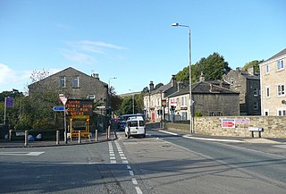
Cullingworth is a village and civil parish in the City of Bradford, West Yorkshire, England. Within the boundaries of the historic West Riding of Yorkshire, it is 7 miles (11 km) west of Bradford and 3 miles (5 km) south of Keighley. The surrounding countryside is mainly used for sheep and cattle farming, with areas of moorland lying to the north and west.

Clayton, or Clayton Village, is a civil parish in the City of Bradford metropolitan borough in West Yorkshire, England, situated 3 miles (4.8 km) to the west of Bradford city centre. It is listed in the Domesday Book, meaning it dates back to at least the 11th century and was privately owned from 1160 to 1866. It was noted for its clay. More recently, Clayton was a key location in the British and international wool trade, being the home of the British Wool Marketing Board headquarters. The old building was demolished and converted into housing in the late 1990s. The village re-acquired civil parish status with a parish council in 2004.

<span class="mw-page-title-main">Royds, Bradford</span> Ward in the City of Bradford, West Yorkshire, England

Royds is a ward within the City of Bradford Metropolitan District Council in the county of West Yorkshire, England. The population at the 2011 Census was 17,360.

<span class="mw-page-title-main">Wibsey</span> Ward in the City of Bradford, West Yorkshire, England

Wibsey is a ward within the City of Bradford Metropolitan District Council, West Yorkshire, England. The population had increased to 14,671 at the 2011 Census. Wibsey is named after Wibsey village which makes up the main part of the ward. As well as the area of Wibsey, the ward includes the area of Bankfoot to the east and much of the area of Odsal. It is located on a ridge which runs from the city centre, up to Queensbury, which has been credited as the highest market town in England.

<span class="mw-page-title-main">Denholme</span> Town and civil parish in West Yorkshire, England

Denholme is a town and civil parish in the Bradford Metropolitan Borough, West Yorkshire, England. It is 8 miles (13 km) west of Bradford, 7 miles (11 km) from Keighley and roughly the same distance from Halifax. Administratively, it is part of the Bingley Rural ward of the City of Bradford. Denholme has a population of 2,976, increasing to 3,489 at the 2011 Census.

<span class="mw-page-title-main">Luddendenfoot</span> Human settlement in England

Luddendenfoot or Luddenden Foot is a village and former civil parish, lying north-west of Sowerby Bridge and west of Halifax, in Calderdale, West Yorkshire, England. The population of Luddendenfoot is 2,547, with the wider Calderdale Ward at the 2011 Census as 10,653. It lies along the Upper Calder Valley below the village of Luddenden, between Sowerby Bridge and Mytholmroyd.

<span class="mw-page-title-main">A6177 road</span> Road in England

The A6177 is a ring road around Bradford in West Yorkshire, England. It is mostly formed from existing roads and save for its southern section is single-carriageway.

<span class="mw-page-title-main">Shelf, West Yorkshire</span> Village in West Yorkshire, England

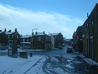
Shelf is a village in Calderdale in West Yorkshire, England. The village is situated approximately 3 miles (4.8 km) north-east of Halifax and 5 miles (8 km) south-west of Bradford, on the A6036 road. In 2001 it had a population of 4,496. At the 2011 Census Shelf was measured as part of the Calderdale ward of Northowram and Shelf.

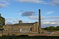
The Queensbury lines was the name given to a number of railway lines in West Yorkshire, England, that linked Bradford, Halifax and Keighley via Queensbury. All the lines were either solely owned by the Great Northern Railway (GNR) or jointly by the GNR and the Lancashire and Yorkshire Railway (L&YR). The terrain was extremely challenging for railway construction, and the lines were very expensive to build. The lines were

<span class="mw-page-title-main">Queensbury railway station</span> Disused railway station in West Yorkshire, England

Queensbury railway station was a station on the Queensbury lines serving the village of Queensbury, West Yorkshire, England. The station was unusual due to its triangular shape, and at its opening the only other examples of this arrangement were Ambergate station in Derbyshire and Earlestown in Lancashire; since then Shipley station, also in West Yorkshire, has gained platforms on all three sides. Of the stations on the Queensbury lines, this was the most ambitious.

<span class="mw-page-title-main">City of Bradford Metropolitan District Council</span> Local government body in England

City of Bradford Metropolitan District Council is the local authority of the City of Bradford in West Yorkshire, England. It is a metropolitan district council, one of five in West Yorkshire and one of 36 in the metropolitan counties of England, and provides the majority of local government services in Bradford. Since 2014 it has been a constituent member of the West Yorkshire Combined Authority.

Great Horton railway station was a railway station on the Queensbury-Bradford section of the Queensbury Lines which ran between Bradford, Keighley and Halifax via Queensbury. The station opened for passengers in 1878 and closed on 23 May 1955 but remained open to goods with full staff until 28 June 1965 before it was closed, then demolished and the branch line tracks ripped up.

<span class="mw-page-title-main">Calderdale Metropolitan Borough Council</span> Local government body in England

Calderdale Metropolitan Borough Council is the local authority for the Metropolitan Borough of Calderdale in West Yorkshire, England. The council styles itself Calderdale Council. It is a metropolitan district council, one of five in West Yorkshire and one of 36 in the metropolitan counties of England. It provides the majority of local government services in Calderdale. Since 2014 the council has been a constituent member of the West Yorkshire Combined Authority.

<span class="mw-page-title-main">The Great Northern Railway Trail</span> Footpath in England

The Great Northern Railway Trail is a cycleway and footpath in the Bradford District of West Yorkshire, England. The path follows the route of a former railway, that of the Great Northern railway line between Bradford and Keighley that went via Queensbury and Cullingworth. The path has been designated as part of the National Cycle Route number 69.

References

  1. 1 2 UK Census (2011). "Local Area Report – Queensbury Ward (E05001360)". Nomis. Office for National Statistics . Retrieved 19 September 2020.
  2. "Census 2001 : Urban Areas : Table KS01 : Usual Resident Population". Office for National Statistics. Archived from the original on 16 August 2009. Retrieved 26 August 2009.
  3. Vision of Britain website: Queensbury, West Riding
  4. 1 2 O'Rourke, Tanya (20 June 2011). "Paul and Lynda Cromie stand down for 'personal reasons'". Telegraph and Argus . Retrieved 27 September 2017.
  5. "Election results for Queensbury By-Election - Thursday, 4th May, 2017". bradford.moderngov.co.uk. City of Bradford Metropolitan District Council. 4 May 2017. Retrieved 27 September 2017.
  6. Mason, Vivien (4 May 2017). "Tory landslide in Queensbury by-election". Telegraph and Argus . Retrieved 27 September 2017.
  7. "Election results for Queensbury - Local - Combined District, NPR & Parish Elections - Thursday, 5th May, 2022". Bradford Council. Bradford Metropolitan District Council. Retrieved 17 June 2022.
  8. "Councillor Luke Majkowski". Bradford Council. Bradford Metropolitan District Council. Retrieved 17 June 2022.
  9. "Councillor Hazel Parsan". Bradford Council. Bradford Metropolitan District Council. Retrieved 17 June 2022.