Balrampur district, Uttar Pradesh

Last updated

Balrampur district
Tulsipur, Devi Patan.jpg
Patan Devi temple in Tulsipur
India Uttar Pradesh districts 2012 Balrampur.svg
Location of Balrampur in Uttar Pradesh
Coordinates(Balrampur): 27°26′N82°11′E / 27.43°N 82.18°E / 27.43; 82.18
CountryFlag of India.svg  India
State Uttar Pradesh
Division Devipatan
Established22 May 1997;26 years ago (1997-05-22)
Headquarters Balrampur
Area
  Total3,457 km2 (1,335 sq mi)
Population
 (2011)
  Total2,148,665
  Density620/km2 (1,600/sq mi)
   Urban
166,391
Demographics
   Literacy 51.76 per cent
  Sex ratio922/1000 Annual Rainfall = 2200 mm
Time zone UTC+05:30 (IST)
Vehicle registration 47
Lok Sabha constituencies Shravasti
Vidhan Sabha constituencies 4
Website balrampur.nic.in

Balrampur district is one of the district of the Indian state of Uttar Pradesh and is a part of Devipatan division as well as the historic Awadh regions. It has been cut from the adjacent district Gonda in 1997. Located on the banks of the West Rapti River. Balrampur is known for the temple of Pateshwari Devi, a Shakti Pitha, and for the ruins of the nearby ancient city of Sravasti, now a pilgrimage site for Buddhists and Jains. The nearest airport is Shravasti airport 23.3 kilometres (14.5 mi) from the town but it is not an international and regular airport; the nearest international and regular airport is Chaudhary Charan Singh International Airport in Lucknow, 235 kilometres (146 mi) away. Lucknow is the capital city of Uttar Pradesh and is 220 kilometres (140 mi) from Balrampur district headquarters.

Contents

Administration

The creation of Balrampur was done by G.D.No. 1428/1-5/97/172/85-R-5 Lucknow dated 25 May 1997 by the division of District Gonda. Siddharth Nagar, Shrawasti, Gonda District, are situated in the east-west and south sides respectively and Nepal State are Situated in its northern side. The area of the district is 336917 Hectares. In which the agriculture irrigated area is 221432 Hectares. In the north of the district is situated the Shivalik ranges of the Himalayas which is called Tarai Region. [1]

According to Government of India, the district Balrampur is one of the Minority Concentrated Districts on the basis of the 2001 census data on population, socio-economic indicators and basic amenities indicators.

Etymology

The district is named after the erstwhile princely estate (Taluqdari) and its capital, Balrampur. The name of this estate was derived from its founder Balram Das, who founded it in c. 1600 CE.

History

Ancient period

Shravasti was the capital of Uttara (North) Kosala. The ruins of Sahet, ancient Shravasti, spread an area of 400 acres (1.6 km2). Towards the Rapti River, a little north of Sahet, lies the ancient city of Mahet.

Gautam Buddha spent 21 rainy season under the sacred Peepal tree. The famous incident of Angulimal happened in the forest of Shravasti, where the dacoit who used to kill people and wear a garland of their fingers, was enlightened by Gautam Buddha.

Medieval period

Bahraich Sarkar of Awadh Subah and Mankapur presidency of gonda was a part of balrampur riyasat during the Mughal rule. Later, it came under the control of the ruler of Awadh till its annexation in February 1856 by the British government. British government separated Bahraich and Gonda from balrampur.

British and the post-independence period

During the British rule a commissionary was made for the administration of this area with its headquarters at Gonda and military command at Sakraura Colonelganj. During this period Balrampur was an Estate (Taluqdari) Janwar Rajput State in Utraula tehsil of Gonda district, which consisted 3 tehsils, Gonda Sadar, Tarabganj and Utraula. After independence, Balrampur estate was merged with Utraula tehsil of Gonda district. On 1 July 1953 the tehsil of Utraula was bifurcated into two tehsils, Balrampur and Utraula. In 1987 three new tehsils were created from Gonda Sadar tehsil, namely, Tulsipur, Mankapur and Colonelganj. Later, in 1997 Gonda district was bifurcated into two parts and a new district, Balrampur was born consisting of three tehsils of the northern part of the erstwhile Gonda district, Balrampur, Utraula, and Tulsipur.

Geography

The district's northern border with Nepal's Dang Deukhuri District follows the southern edge of the Dudhwa Range of the Siwaliks. To the northeast lies Kapilvastu District, Nepal. The rest of Balrampur is surrounded by Uttar Pradesh: on the east by Siddarthnagar, Basti on the south, Gonda on the southwest, and Shravasti on the west. Balrampur's area is 3,457 km2.

Economy

Balrampur is known for Balrampur Chini Mills, one of the largest sugar manufacturing industry in the country and one of the largest producer of ethanol in India.[ citation needed ] In 2006 the Ministry of Panchayati Raj named Balrampur one of the country's 250 most backward villages (out of a total of 640). [2] It is one of the 34 districts in Uttar Pradesh currently receiving funds from the Backward Regions Grant Fund Programme (BRGF). [2]

The district comprises 3 tehsils, Balrampur, Tulsipur and Utraula, which are further divided into 9 blocks: Balrampur, Gaindas bujurg, Gainsari, Harya satgharwa, Pachpedwa, Rehera bazar, Shriduttganj, Tulsipur and Utraula Sadullaah Nagar

Demographics

Historical population
YearPop.±% p.a.
1901529,899    
1911533,293+0.06%
1921556,274+0.42%
1931595,016+0.68%
1941649,247+0.88%
1951708,839+0.88%
1961793,354+1.13%
1971892,307+1.18%
19811,085,302+1.98%
19911,368,630+2.35%
20011,682,350+2.09%
20112,148,665+2.48%
source: [3]

According to the 2011 census Balrampur district has a population of 2,148,665. This gives it a ranking of 210th in India. The district has a population density of 64.2 inhabitants per square kilometre (166/sq mi). [4] Its population growth rate over the decade 2001-2011 was 27.74%. [4] Balrampur has a sex ratio of 922 females for every 1000 males, [4] and a literacy rate of 51.76%. 7.74% of the population lives in urban areas. Scheduled Castes and Scheduled Tribes make up 12.90% and 1.16% of the population respectively. The tribals of this district are Tharus. [4]

Languages

Languages of Balrampur district (2011) [5]

   Hindi (87.23%)
   Awadhi (8.61%)
   Urdu (4.06%)
  Others (0.10%)

At the time of the 2011 Census of India, 87.23% of the population in the district spoke Hindi, 8.61% Awadhi and 4.06% Urdu as their first language. [5]

Religion

Religions in Balrampur district (2011) [6]
ReligionPercent
Hinduism
62.05%
Islam
37.51%
Other or not stated
0.66%
Distribution of religions
TehsilHindusMuslimsOthers
Balrampur 72.07%27.40%0.53%
Tulsipur 60.09%39.44%0.47%
Utraula 54.72%44.97%0.31%

Balrampur district has a Hindu-majority population, but a significant Muslim minority. Muslims are most concentrated in Utraula tehsil and form a near-majority in urban areas. [6]

Hanuman Garhi in Tulsipur is the tallest structure in district. Hanuman garhi.jpg
Hanuman Garhi in Tulsipur is the tallest structure in district.

The fortified entrance to Mahet is made of mud, constructed in a crescent shape. The Sobhnath temple houses the great Stupas. These Stupas reflect the Buddhist tradition and boast of the history of the monasteries in Balrampur.

Jeetavana monastery, one of the oldest monasteries in the country, is said to be one of the favourite sites of Gautam Buddha. It contains the 12th century inscriptions. There is also a sacred tree of Peepal nearby. It is said that the tree was grown from a sapling from the original Bodhi Tree at Bodh Gaya. Another site of religious importance in the city is Sravasti. It is said that Mahavira Jain, the 24th Tirthankara of Jainism, 'influenced' this place. It houses the Shwetambar temple.

Education

Notable people

Media

The popular Hindi dailies such as North India Times, Shri Times, Dainik Hindustan, Dainik Jagran, Amar Ujala, Jansatta are available in district.

English dailies includes The Times of India , Hindustan Times , The Economic Times , The Business Line , The New Indian Express , The Hans India .

Urdu dailies includes Inqalab, Tareeqh, Roznama Rashtriya Sahara and so on.

Tehsil (Sub-disctrict)

Balrampur district have total of 3 Tehsils- [7]

  1. Balrampur
  2. Tulsipur
  3. Utraula

Blocks

There are total of 9 Blocks in Balrampur district.

  1. Harriya Sathgarwa
  2. Balrampur
  3. Tulsipur
  4. Gainsari
  5. Pachperwa
  6. Sridattganj
  7. Utraula
  8. Gaindas Bujurg
  9. Rehra Bazar

Villages

Related Research Articles

<span class="mw-page-title-main">Shravasti</span> Historical city in Uttar Pradesh, India

Shravasti ; Pali: 𑀲𑀸𑀯𑀢𑁆𑀣𑀻, romanized: Sāvatthī) is a town in Shravasti district in Indian State of Uttar Pradesh. It was the capital of the ancient Indian kingdom of Kosala and the place where the Buddha lived most after his enlightenment. It is near the Rapti river in the northeastern part of Uttar Pradesh India, close to the Nepalese border.

Gonda is a city and municipal board of Gonda district in the Indian state of Uttar Pradesh. It is situated 190 km north east of the state capital Lucknow. Gonda is divided into four tehsils named Gonda, Colonelganj, Tarabganj and Mankapur.

<span class="mw-page-title-main">Bahraich district</span> District of Uttar Pradesh in India

Bahraich district is one of the districts of Uttar Pradesh state of India, and Bahraich town is the district headquarters. Bahraich District is a part of Devipatan Division.

<span class="mw-page-title-main">Shravasti district</span> District of Uttar Pradesh in India

Shravasti district is one of the districts of the Uttar Pradesh state of India, with Bhinga town as its district headquarters. Shravasti district is a part of Devipatan Division. According to Government of India, it is among the 121 minority concentrated districts in India. It is the fourth most backward district in India, according to the 2018 Niti Aayog ranking. This district is the most poverty stricken district in the country.

<span class="mw-page-title-main">Sitapur district</span> District of Uttar Pradesh in India

Sitapur district is one of the districts which is situated in Uttar Pradesh state of India, with Sitapur town as the district headquarters. Sitapur district is a part of Lucknow division.

<span class="mw-page-title-main">Gonda district</span> District of Uttar Pradesh in India

Gonda district is one of the districts of Uttar Pradesh, India. The city of Gonda is the district headquarters, and also the administrative centre for the Devipatan Division. The total area of Gonda district is 4,003 km2 (1,546 sq mi).

Balrampur is a town and a municipal board in Balrampur district in the state of Uttar Pradesh, India. It is situated on the bank of river Rapti and is the district headquarters of Balrampur district.

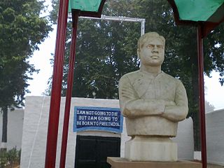
Bhinga is a town, Nagar Palika and district headquarter of Shravasti district in the state of Uttar Pradesh, India.

<span class="mw-page-title-main">Utraula</span> Town in Uttar Pradesh, India

Utraula is a city and a municipal board in Balrampur district in the Indian state of Uttar Pradesh. It is approximately 90 kilometres from the border with Nepal and 175 km in north east of Lucknow. Utraula is situated near the West Rapti River.

Mankapur is a town and a nagar panchayat in Gonda district in the Indian state of Uttar Pradesh. It is a constituency of Uttar Pradesh Legislative Assembly currently headed by BJP. It borders Gonda to the West, Rehra bazar to the North, Maskanwa to the East and Nawabganj to the South.

Nanpara is a town & municipal board in Bahraich district in the Indian state of Uttar Pradesh. It is a region along the Nepal Border and includes tracts of dense forests. It is a city surrounded by many villages.

Shohratgarh is a town and tehsil in Siddharthnagar district, Uttar Pradesh state of India.

<span class="mw-page-title-main">Tulsipur</span> Town in Uttar Pradesh

Tulsipur is a town and tehsil in the Balrampur district of the Indian state of Uttar Pradesh, A very famous sacred place Devi Patan Temple lies in the city, which is a sacred and pilgrimage site for Hindus, many pilgrims across the country and from Nepal log participation during Maha Shivratri and a fair also held during the festival."

Suhelva Sanctuary is a wildlife sanctuary located in Balrampur, Gonda and Sravasti districts of the state of Uttar Pradesh in India. It is about 66 km from Balrampur, 120 km from Gonda and about 210 km from Lucknow. It covers an area of 452 square kilometers.

<span class="mw-page-title-main">Shravasti Lok Sabha constituency</span> Lok Sabha constituency in Uttar Pradesh

Shrawasti Lok Sabha constituency is one of the 80 Lok Sabha (parliamentary) constituencies in Uttar Pradesh state in northern India. This constituency came into existence in 2008 as a part of the implementation of delimitation of parliamentary constituencies based on the recommendations of the Delimitation Commission of India constituted in 2002.

Gainsari is a nagar panchayat in Tulsipur tehsil, Balrampur district in the state of Uttar Pradesh, India. It is near the India-Nepal border and is 238 km far from Lucknow capital city of Uttar Pradesh. It has an average elevation of 109 metres above sea level.

Sadullah Nagar [saʿd-(u)-Allah Nagar سعد اللٰہ نگر] SMT Village is a village in Uttar Pradesh, India. Utraula, Balrampur, Faizabad, Tulsipur are the nearby Cities to Sadullah Nagar. Sadullah Nagar Pin Code is 271307. Sadullah Nagar is a legislative assembly constituency in Uttar Pradesh. Since 2008, Sadullah Nagar Assembly constituency merged as Utraula Assembly Constituency. ISadullah Nagar comes under Gonda Lok Sabha constituency. Sadullah Nagar is saprated from Utraula by Kunwa River and by Bishui river from Mankapur. Sadullah Nagar people speak Hindi, Urdu as their main communication language. located 169 km from State capital Lucknow.

Rehra Bazar is a block located in Balrampur district in rural Uttar Pradesh. It is one of the nine blocks of Balrampur district. According to the administration records, the block code of Rehra Bazar is 564. The block has 96 villages and there are total 32,318 houses in this block. Pincode of Rehra baza is 271306.There are 81 gram panchayats and 96 villages in Rehra Bazar kshetra panchayat / block. Hindi and Urdu are spoken by the natives here.

References

  1. "Welcome on Balrampur Website". Archived from the original on 16 August 2013. Retrieved 8 June 2013.
  2. 1 2 Ministry of Panchayati Raj (8 September 2009). "A Note on the Backward Regions Grant Fund Programme" (PDF). National Institute of Rural Development. Archived from the original (PDF) on 5 April 2012. Retrieved 27 September 2011.
  3. Decadal Variation In Population Since 1901
  4. 1 2 3 4 "District Census Handbook: Balrampur" (PDF). censusindia.gov.in. Registrar General and Census Commissioner of India. 2011.
  5. 1 2 "Table C-16 Population by Mother Tongue: Uttar Pradesh". www.censusindia.gov.in. Registrar General and Census Commissioner of India.
  6. 1 2 "Table C-01 Population by Religion: Uttar Pradesh". censusindia.gov.in. Registrar General and Census Commissioner of India. 2011.
  7. "Tehsil | S3WaaS | India" . Retrieved 22 September 2023.