Kanpur, formerly anglicized as Cawnpore, is a large industrial city located in the central-western part of the state of Uttar Pradesh, India. Founded in 1207, Kanpur became one of the most important commercial and military stations of British India. Kanpur is also the financial capital of Uttar Pradesh and part of upcoming Bundelkhand Industrial Development Authority i.e. BIDA Nestled on the banks of Ganges River, Kanpur has been the major financial and industrial centre of North India and also the ninth-largest urban economy in India. Today it is famous for its colonial architecture, gardens, IT parks and fine quality leather, plastic and textile products which are exported mainly to the West.

Etawah, also known as Ishtikapuri, is a city on the banks of Yamuna River in the state of Western Uttar Pradesh in India. It is the administrative headquarters of Etawah District. Etawah's population of 256,838 makes it the one hundred and eightieth-most populous city in India. The city lies 300 km (190 mi) southeast of the national capital New Delhi, and 230 km (140 mi) northwest of the state capital Lucknow.

Prayagraj division, formerly known as Allahabad division, is one of the 18 administrative geographical units of the northern Indian state of Uttar Pradesh, with the city of Prayagraj being the administrative divisional headquarters.
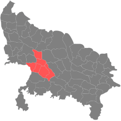
Kanpur Nagar district, meaning Urban Kanpur District is one of the districts of the Uttar Pradesh state of India. It is a part of Kanpur division and its district headquarters is Kanpur. Kanpur was formerly spelled Cawnpore.

Kannauj district is an administrative district of Uttar Pradesh state in northern India, along the river Ganges. The historic town of Kannauj, northwest of Kanpur, is the administrative center. The district was carved out of Farrukhabad district on 18 September 1997. The native dialect of this district is Kannauji.
Auraiya is a city and a municipal board in Auraiya district in the state of Uttar Pradesh, India. NH 19 passes through the center of the town. Phaphund railway station is nearest Railway Station. Saifai Airstrip is the nearest aviation facility, having limited private use. Nearest commercial airport is the Kanpur Airport.Before becoming the district headquarters, it was the tehsil headquarters of Etawah district. This district is under Kanpur Mandal. [1] [2] [3] This is the heroic place of Sengar Rajputs. Sengar dynasty Kanardhani Maharajadhiraj Vishok Dev was married to Devkala, sister of Maharaja Jaichand Gaharwar (Rathore) of Kannauj. He had received this entire area in dowry. The famous Devkali temple here was also built by him in the name of his wife Devkali. There are many famous villages of Kshatriya in which Ayana, Bhartaul, Jaswantpur, Bhurepur Kalan, Bhurepur Khurd, Sikharna, Fareha, Anepur, Senganpur, Barbatpur, Roshangpur, Manpur, Bhaupur, keontra, Phaphund, Aseva are very famous villages.
Dibiyapur is a municipality-based city in Auraiya district in the most populous state of Uttar Pradesh in India. It is situated on State Highway 21. It is linked to Phaphund railway station on Kanpur–Delhi section of Howrah–Delhi main line and Howrah–Gaya–Delhi line which is operated by North Central Railway. The district administrative headquarter of the city is Auraiya. The city is situated between Agra and Kanpur and is famous for industries and education. Lower Ganga Canal passes through mid of the city.

Jhinjhak is a town and a Municipal council in Kanpur Dehat district, India. The town is situated on the Lower Ganges Canal and is approximately 20 kilometres (12 mi) from the industrial city of Dibiyapur.
Kamalganj is a town and a nagar panchayat in Farrukhabad district in the Indian state of Uttar Pradesh. The town is one of the key contributors to Potato production in the district. Kamalganj was named after Muslim religion promoter and social worker 'Kamal Baba'.

Rasulabad is a town and a nagar panchayat in Kanpur Dehat district in the Indian state of Uttar Pradesh.
Saurikh is a nagar panchayat in Kannauj district in the Indian state of Uttar Pradesh. Its old name was Sau-Rishi.It is located near main industrial and educational hub of Dibiyapur which is around at a distance of 55 km from the town.
Shikohabad is a city and a municipal board in the Firozabad district of the Indian state of Uttar Pradesh.
Shivli or Sheoli is a town and a nagar panchayat in Kanpur Dehat district in the Indian state of Uttar Pradesh. It is located at 26°37′0″N80°3′0″E and has an average elevation of 128 meters (423 feet).

Chhatrapati Shahu Ji Maharaj University (CSJMU), formerly Kanpur University, is a public state collegiate university located in Kanpur, Uttar Pradesh, India. It is administered under the state legislature of the government of Uttar Pradesh.
The demographics of Uttar Pradesh is a complex topic, which is undergoing dynamic change. Uttar Pradesh is India's most populous state, and the largest subdivision in the world. It has a population of about 199,812,341 as per the 2011 census. If it were a separate country, Uttar Pradesh would be the world's fifth most populous nation, next only to China, India, the United States of America and Indonesia. Uttar Pradesh has a population more than that of Pakistan. There is an average population density of 828 persons per km² i.e. 2,146 per sq mi. The capital of Uttar Pradesh is Lucknow, and Prayagraj serves as the state’s judicial capital. Hindus and Muslims both consider the state as a holy place.
Sikandara is a town in Kanpur Dehat district in the Indian state of Uttar Pradesh. It is headquarters of tehsil Sikandara.
Greater Kanpur district is a district in Uttar Pradesh state in northern India. The administrative headquarters of the district are at Mati-Akbarpur. This district is part of Kanpur division. Kanpur was formerly spelled Cawnpore.

Auraiya district is one of the districts of Uttar Pradesh state of India, and Auraiya town is the district headquarters. It lies on the south-western portion of Uttar Pradesh and also forms a part of the Kanpur Division.

Bhaupur is a town in Kanpur Dehat district in the state of Uttar Pradesh, India.With World Bank funding development of Bhaupur Industrial Sector UPSIDC Amritsar-Kolkata dedicated freight corridor is being carried out.
Uttar Pradesh Sodic Land Reclamation III Project is a land reclamation project in India, designed to reclaim 1,30,000 ha sodic lands in 28 sodic infested districts of the State of Uttar Pradesh. A pilot, to reclaim 5000 ha ravine land in two districts, Fatehpur and Kanpur Dehat, is also envisaged in the project.