Maharajganj district

Last updated

Maharajganj district
Nepal India Border gate Sonauli.jpg
Nepal-India border checkpoint at Sonauli
India Uttar Pradesh districts 2012 Maharajganj.svg
Location of Maharajganj district in Uttar Pradesh
CountryFlag of India.svg  India
State Uttar Pradesh
Division Gorakhpur
Headquarters Mahrajganj
Tehsils Anand Nagar (Pharenda), Nautanwa, Nichlaul, Maharajganj Sadar
Government
   Lok Sabha constituencies Maharajganj
   Vidhan Sabha constituencies Maharajganj sadar, Siswa Bazar, Anand Nagar (Pharenda), Nautanwa and Paniyara
Area
[1]
  Total2,952 km2 (1,140 sq mi)
Population
 (2011)
  Total2,684,703
  Density910/km2 (2,400/sq mi)
   Urban
134,730
Language
  Official Hindi [2]
  Additional official Urdu [2]
  Regional Bhojpuri
Demographics
   Literacy 64.3 per cent
  Sex ratio943
Time zone UTC+05:30 (IST)
Major highways NH730, NH24, NH730S
Website maharajganj.nic.in

Maharajganj district is one of the 75 districts of Uttar Pradesh state in northern India, and the town of Maharajganj is the district headquarters. District is a part Gorakhpur division. It is located in Terai region of Himalayas, bordering Nepal in North. Gandak, Rapti, Rohin are some major river flowing through the district.

Contents


Geography

Maharajganj district is bounded by Nawalparasi and Rupandehi Districts of Lumbini Province of Nepal in the north, the districts of Kushinagar in the east, Maharajganj also shares border with West Champaran district of Bihar in east. It borders Gorakhpur to the south and Siddharthnagar and Sant Kabir Nagar in the west. It is part of Gorakhpur Division. The district covers an area of 2,951 km2. It has a population of 2,684,703 (2011 Census). [3]

History

The district was carved out from the erstwhile Gorakhpur district on 2 October 1989. It is known for the ruins of Buddha which are found here and it is expected that if proper excavation is done then many unknown facts about Buddha will be discovered. Religious temples of Lehra Devi: There is a temple of Lehra Devi (लेहड़ा देवी), also known as Aadravanavaasini (आद्रवनवासिनी), in Lehra forest. People from all over Eastern Uttar Pradesh visit here and worship the goddess Durga. There is special importance to visit here in the period of Navratri in months of March–April and September–October. This temple is about 50 km North-West of Gorakhpur located in Anandnagar. It is believed that while wandering in the forest for 14 years, Pandavas lived a year in disguise. They visited the Lehra Jungle and were offered shelter by Lehra Devi. There is one natural Pindi as in Vaishno Devi. It is also believed that Yudhishthira (युधिष्ठिर) answered the questions of Yaksha (यक्ष) here only in this forest. The Chinese traveller Hiuen-Tsang also mentions the temple in his book Si-Yu-Ki. During British Raj it was one Military Camp named Lehra. One day a British officer came here and fired a bullet at the Pindi. Suddenly, blood started coming out of the Pindi. Seeing the blood, the British ran away. They all died with their horses. Grave of the British Officer is situated in the West of temple about 1 km of distance. Once Maa came to the town as a beautiful girl and wanted to cross the river. She hired a boat and started the journey but in middle of the river the boatman grew interested in her splendid beauty and went off track. As soon as Devi understood his intention, she disappeared with the boat. In the Kali Yuga she was seen with the boat to her followers who made a temple at the very place. It is believed that if a person visits the temple for regular 5 Tuesdays, his wishes are fulfilled. To reach this temple, buses, autorickshaws and trains are available from Gorakhpur to Anandnagar (Pharenda). It is connected by other mediums to the temple from Anandnagar.[ citation needed ]

Politics

District has one Lok Sabha constituency named as Maharajganj (Uttar Pradesh Lok Sabha constituency), currently represented by Pankaj Chaudhary of Bhartiya Janta Party.

There are 5 Vidhan Sabha constituencies in the district which are:

Municipal Corporations

There are 4 Nagar Palikas in the district:[ citation needed ]

There are 8 Nagar Panchayat in the district:[ citation needed ]

Bridgemanganj, Partawal, Chowk and Paniyara are newly created.[ citation needed ]

Villages

Lejar mahdewa (lejruwa)|dhirendra|

Economy

In 2006 the Ministry of Panchayati Raj named Maharajganj one of the country's 250 most backward districts (out of a total of 640). [4] It is one of the 34 districts in Uttar Pradesh currently receiving funds from the Backward Regions Grant Fund Programme (BRGF). [4]

Divisions

Maharajganj district comprises 4 tehsils:

There are 1048 revenue villages in the district and 20 police stations, Bhitauli being the latest.

Sonauli is the main checkpoint at the Nepal border and is administered directly by home ministry of government of India.

Thuthibari, Bargadwan, Jhulnipur, Bhagwanpur, Kolhui bazar are some other major entry points at Nepal border.

Demographics

Historical population
YearPop.±% p.a.
1901496,095    
1911540,574+0.86%
1921551,476+0.20%
1931615,937+1.11%
1941681,685+1.02%
1951765,432+1.17%
1961892,048+1.54%
19711,057,848+1.72%
19811,335,090+2.35%
19911,676,378+2.30%
20012,173,878+2.63%
20112,684,703+2.13%
source: [5]

According to the 2011 census Maharajganj district has a population of 2,684,703, [6] roughly equal to the nation of Kuwait [7] or the US state of Nevada. [8] This gives it a ranking of 148th in India (out of a total of 640 districts). The district has a population density of 909 inhabitants per square kilometre (2,350/sq mi). Its population growth rate over the decade 2001–2011 was 23.50%. Maharajganj has a sex ratio of 943 females for every 1000 males, and a literacy rate of 62.76%. 5.02% of the population lives in urban areas. Scheduled Castes and Scheduled Tribes make up 18.36% and 0.61% of the population respectively. [6]

Religions in Maharajganj district (2011) [9]
ReligionPercent
Hinduism
81.83%
Islam
17.08%
Buddhism
0.60%
Other or not stated
0.49%

Hinduism is practiced by majority of the population, around 82%. Islam is followed by 17% of the population. Maharajganj district has the highest proportion of people following Buddhism in Uttar Pradesh. [9]

Languages in Mahrajganj district (2011) [10]

   Bhojpuri (59.23%)
   Hindi (39.65%)
   Urdu (0.90%)
  Others (0.22%)

At the time of the 2011 Census of India, 59.23% of the population in the district spoke Bhojpuri, 39.65% Hindi and 0.90% Urdu as their first language. [10]

Bhojpuri is the local language of Maharajganj. The Bhojpuri variant of Kaithi is the indigenous script of Bhojpuri language. [11]

Related Research Articles

<span class="mw-page-title-main">Udham Singh Nagar district</span> District in Uttarakhand, India

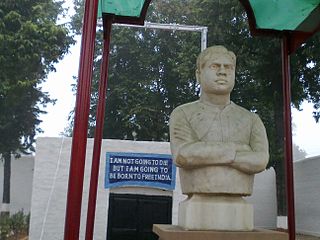
Udham Singh Nagar District is a district of Uttarakhand state in northern India. Rudrapur is the district headquarters. This district consists of nine Tehsils named Bajpur, Gadarpur, Rudrapur, Jaspur, Kashipur, Kichha, Khatima, Sitarganj, Nanakmatta. The district is located in the Terai region, and is part of Kumaon Division. It is bounded on the north by Nainital District, on the northeast by Champawat District, on the east by Nepal, and on the south and west by Bareilly, Rampur, Moradabad, Pilibhit and Bijnor District of Uttar Pradesh state. The district was created on 29 September 1995, by Mayawati government out of Nainital District. It is named for freedom fighter and Indian revolutionary Udham Singh.

<span class="mw-page-title-main">Azamgarh district</span> District in Uttar Pradesh, India

Azamgarh district is one of the three districts of Azamgarh division in the Indian state of Uttar Pradesh.

<span class="mw-page-title-main">Chandauli district</span> District in Uttar Pradesh, India

Chandauli district is a district of Uttar Pradesh state of India, and Chandauli town is the district headquarters. Chandauli district is a part of Varanasi Division. Chandauli became a separate district on 20 May 1997.

<span class="mw-page-title-main">Deoria district</span> District of Uttar Pradesh in India

Deoria district, one of the districts of eastern Uttar Pradesh, India has its headquarters located at Deoria and is a part of Gorakhpur division. It came into existence on 16 March 1946 from Gorakhpur district.

<span class="mw-page-title-main">Ayodhya district</span> District of Uttar Pradesh in India

Ayodhya district is an administrative district of the Indian state of Uttar Pradesh. The city of Ayodhya is its administrative headquarters. The district occupies an area of 2,522 square kilometres (974 sq mi), and had a population of 2,470,996 in the 2011 census. Ayodhya district shares its borders with 6 districts of Uttar Pradesh. It is bordered by Gonda and Basti districts on the northern side, Amethi and Sultanpur districts on the south, and Ambedkar Nagar and Barabanki districts share the border on the east and west.

<span class="mw-page-title-main">Sant Kabir Nagar district</span> District of Uttar Pradesh in India

Sant Kabir Nagar district is one of the 75 districts of Uttar Pradesh state in northern India. Khalilabad is the district headquarters. Sant Kabir Nagar district is a part of Basti division. The total area of Sant Kabir Nagar district is 1,646 km2 (636 sq mi).

<span class="mw-page-title-main">Shravasti district</span> District of Uttar Pradesh in India

Shravasti district is one of the districts of the Uttar Pradesh state of India, with Bhinga town as its district headquarters. Shravasti district is a part of Devipatan Division. According to Government of India, it is among the 121 minority concentrated districts in India. It is the fourth most backward district in India, according to the 2018 Niti Aayog ranking. This district is the most poverty stricken district in the country.

<span class="mw-page-title-main">Gonda district</span> District of Uttar Pradesh in India

Gonda district is one of the districts of Uttar Pradesh, India. The city of Gonda is the district headquarters, and also the administrative centre for the Devipatan Division. The total area of Gonda district is 4,003 km2 (1,546 sq mi).

<span class="mw-page-title-main">Gorakhpur district</span> District of Uttar Pradesh in India

Gorakhpur district is one of the 75 districts of Uttar Pradesh state in northern India. This district is a part of the Gorakhpur division. The city of Gorakhpur, or Gorakhpur is the administrative headquarters of this district and Gorakhpur division. It borders Sant Kabir Nagar district to the west, Kushinagar and Deoria districts to the east, and Maharajganj and Azamgarh districts to the north and south.

<span class="mw-page-title-main">Kushinagar district</span> District of Uttar Pradesh in India

Kushinagar is a district of the state of Uttar Pradesh in India situated in the easternmost part of the state. It has the administrative headquarters at Ravindra Nagar Dhoos. The district is named such after the town Kushinagar, a Buddhist pilgrimage site where Gautama Buddha attained parinirvana in the 5th century BCE. Since the independence of India, Kushinagar district was a part of Deoria District and came into existence on 13 May 1994 as a separate district division. It was earlier known as Padrauna and thereafter was renamed Kushinagar on 19 June 1997.

Nautanwa is a town and Nagar Palika in Maharajganj district in the state of Uttar Pradesh, India. It is about 87 km from Gorakhpur, NH24 and 68 km NH730 from Maharajganj and 7 km from Sonauli Indo-Nepal Border.

Pharenda, or Anandnagar, is a city in the Maharajganj district of the province of Uttar Pradesh in northern India. It is located approximately 44 kilometres north of Gorakhpur near the border with Nepal. District of Pharenda is Maharajganj. This is situated on the Buddhist Circuit which is built from Sarnath to Lumbini. It lies on NH-24 and near NH 29. It is about 45 km from Gorakhpur, 40 km from Siddharthnagar, 30 km from Maharajganj and 55 km from Sonauli Indo-Nepal border. This place is named after Seth Anandram Jaypuriya. There is closed sugar Mill which was started in about 1935 and closed in 1995. Near Anand Nagar there is a temple is Durga devi mandir, popularly known as Lehara Devi mandir.

<span class="mw-page-title-main">Ghughali</span> City in Uttar Pradesh, India

Ghughuli is a town and nagar panchayat in Maharajganj district in the Indian state of Uttar Pradesh. It is near Gorakhpur and very close to the Indo-Nepal border. East of Ghughali is the Baikunthi River. The bank of the Baikunthi is used for performing last rites and the quarry is for river sand.

Nichlaul is a town and a nagar panchayat in Maharajganj district in the Indian state of Uttar Pradesh. It is situated 25 km from district headquarter Maharajganj and 80 km from Gorakhpur. It is situated near the Indo-Nepal border.

<span class="mw-page-title-main">Siddharthnagar district</span> District of Uttar Pradesh in India

Siddharthnagar district is one of the 75 districts of the Indian state of Uttar Pradesh. Siddharthnagar is the district headquarters. Siddharthnagar district is a part of Basti division. It was under the ancient Kosala kingdom and also the Shakya kingdoms.

<span class="mw-page-title-main">Balrampur district, Uttar Pradesh</span> District of Uttar Pradesh in India

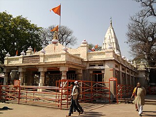
Balrampur district is one of the district of the Indian state of Uttar Pradesh and is a part of Devipatan division as well as the historic Awadh regions. It has been cut from the adjacent district Gonda in 1997. Located on the banks of the West Rapti River. Balrampur is known for the temple of Pateshwari Devi, a Shakti Pitha, and for the ruins of the nearby ancient city of Sravasti, now a pilgrimage site for Buddhists and Jains. The nearest airport is Shravasti airport 23.3 kilometres (14.5 mi) from the town but it is not an international and regular airport; the nearest international and regular airport is Chaudhary Charan Singh International Airport in Lucknow, 235 kilometres (146 mi) away. Lucknow is the capital city of Uttar Pradesh and is 220 kilometres (140 mi) from Balrampur district headquarters.

The demographics of Uttar Pradesh is a complex topic, which is undergoing dynamic change. Uttar Pradesh is India's most populous state, and the largest subdivision in the world. It has a population of about 199,812,341 as per the 2011 census. If it were a separate country, Uttar Pradesh would be the world's fifth most populous nation, next only to China, India, the United States of America and Indonesia. Uttar Pradesh has a population more than that of Pakistan. There is an average population density of 828 persons per km² i.e. 2,146 per sq mi. The capital of Uttar Pradesh is Lucknow, and Prayagraj serves as the state’s judicial capital. Hindus and Muslims both consider the state as a holy place.

Campierganj also called as Chaumukha, is a small Town in the province of Uttar Pradesh in north India, approximately 34 km (21 mi) north of Gorakhpur city near the border with Nepal on National Highway-24 (NH-24) in Gorakhpur District. This is situated on the Buddhist Circuit which is built from Lumbini (Nepal), Kushinagar, Sarnath up to Bodh Gaya. Campierganj is a Tahsil (subdivision) in Gorakhpur district of Uttar Pradesh.

<span class="mw-page-title-main">National Highway 24 (India)</span> National highway in India

National Highway 24 (NH 24) is a primary national highway in India, running in a north–south direction. This highway runs entirely in the state of Uttar Pradesh. This highway was created by renumbering former NH29 and NH97 as per new numbering system of national highways.

Brijmanganj is a town in Uttar Pradesh, India, situated at the point of western Maharajganj district and the border of Siddharthnagar district.

References

  1. "District Maharajganj" . Retrieved 26 October 2018.
  2. 1 2 "52nd Report of the Commissioner for Linguistic Minorities in India" (PDF). nclm.nic.in. Ministry of Minority Affairs. Archived from the original (PDF) on 25 May 2017. Retrieved 23 February 2019.
  3. "Uttar Pradesh". india,gov,in website. Retrieved 7 May 2010.
  4. 1 2 Ministry of Panchayati Raj (8 September 2009). "A Note on the Backward Regions Grant Fund Programme" (PDF). National Institute of Rural Development. Archived from the original (PDF) on 5 April 2012. Retrieved 27 September 2011.
  5. Decadal Variation In Population Since 1901
  6. 1 2 "District Census Handbook: Maharajganj" (PDF). censusindia.gov.in. Registrar General and Census Commissioner of India. 2011.
  7. US Directorate of Intelligence. "Country Comparison:Population". Archived from the original on 13 June 2007. Retrieved 1 October 2011. Kuwait 2,595,62
  8. "2010 Resident Population Data". U.S. Census Bureau. Archived from the original on 19 October 2013. Retrieved 30 September 2011. Nevada 2,700,551
  9. 1 2 "Table C-01 Population by Religion: Uttar Pradesh". censusindia.gov.in. Registrar General and Census Commissioner of India. 2011.
  10. 1 2 "Table C-16 Population by Mother Tongue: Uttar Pradesh". www.censusindia.gov.in. Registrar General and Census Commissioner of India.
  11. Grierson, George Abraham (1881). A handbook to the Kayathi character. The Library of Congress. Calcutta, Thacker, Spink, and co.