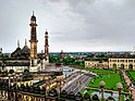
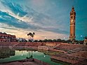
Located in what was historically known as the Awadh region, Lucknow has always been a multicultural place.[2]
The Lucknow district that exists today was created by the British in 1856, upon their annexation of Oudh State.[3] Under the Nawabs of Oudh, the area administered from Lucknow had been rather small, consisting of only the parganas immediately surrounding the city.[3] This was known as the Huzur tehsil.[3] The rest of the area had been part of other divisions whose headquarters lay outside the borders of the present-day district.[3]
From 1856 until 1872, the new Lucknow district consisted of 10 parganas in 4 tehsils: Lucknow tehsil contained the 3 parganas of Lucknow, Bijnaur, and Kakori; Kursi tehsil contained the 3 parganas of Kursi, Dewa, and Mahona; Mohanlalganj tehsil contained the 2 parganas of Mohanlalganj and Nigohan; and Malihabad tehsil consisted of the 2 parganas of Malihabad and Auras-Mohan.[3] In 1872, the first regular settlement conducted by the British was completed, and three parganas were transferred out of Lucknow district: Dewa and Kursi, the two easternmost parganas, were transferred to Barabanki district, while Auras-Mohan in the west was transferred to Unnao district.[3] At the same time, the tehsils of Malihabad and Mahona were merged into a single entity.[3]
Lucknow district covers an area of 2,528 square kilometers, centrally located in both the central Ganges plain as well as Uttar Pradesh as a whole.[1] It consists of three geographical sub-regions: the Gomti basin, the Lucknow-Uparwar plain, and the upper Sai catchments.[1] The landscape is very flat, with virtually no hills.[3] There is a gradual slope from northwest to southeast, following the course of the rivers.[3] Geologically, it is made of light alluvium[3] and dun gravels[1] of relatively recent age.[1] Scattered throughout the district are the nodular limestone deposits called kankar, which appear in beds of varying thickness located 2–5 feet below the surface.[3]
The area was once lightly wooded, but by the turn of the 20th century most of this had been cut down.[3] Large dhak forests covered parts of the old parganas of Malihabad, Mahona, and Mohanlalganj until the late 1800s, when they were cleared to make space for farms.[3] By the early 1900s, the only large area of dhak forest that remained was in the northeastern corner of Mahona pargana.[3] In 2008–09, it was recorded that 13,082 hectares of Lucknow district were under forest cover, representing 5.19% of the total land area.[1] Of note is the Kukrail forest reserve, on the outskirts of the Lucknow metro area.[1]
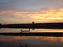
The main rivers of Lucknow district are the Gomti and the Sai.[3] The Gomti enters the district at the meeting of the borders with Hardoi and Sitapur districts,[1] and then winds its way through Lucknow district.[3] The riverbed of the Gomti is significantly lower than the surrounding area, limiting its use for irrigation.[3] In many places, the high banks of the Gomti are scarred with ravines, where rainfall has gradually eroded away the earth that used to be there.[3] The main tributary of the Gomti is the Behta, a perennial stream which originates in Hardoi district and joins the Gomti near the village of Kankarabad.[3] The other tributaries include the Loni and the nalas of Jhingi and Akraddi, as well as the Kukrail on the left bank.[3] The Sai enters Lucknow district at the village of Sulsa Mau and flows toward the southeast, forming the border with Unnao district until it turns south at the village of Agahiya.[1] The Sai's banks are shallower and less eroded than those of the Gomti.[3] The main tributary of the Sai is the Bakh, which originates as a chain of jhils in a depression near Bijnaur.[1]
There are also barren usar tracts, where there is little plant growth except for some small grasses that grow during the rainy season.[3] They are often formed from soil saturation.[3] They are most common in the southern and western parts of the district.[3]
The climate of Lucknow district is predominantly subtropical in nature, and it experiences the effects of the South Asian monsoon.[1] There are three main seasons: the summer season typically lasts from March to June, with May and June being the hottest months; then comes the rainy season, from July to October.[1] The heaviest rains are during July and August.[1] Then comes winter, which lasts from November until February.[1] January is generally the coldest month.[1] However, the Lucknow area has a fairly moderate climate, and does not experience particularly extreme temperatures.[1]Frost sometimes happens here in cold weather, but it is rare.[3]
Lucknow district is divided into 4 tehsils: Lucknow, Malihabad, Mohanlalganj, and Bakshi Ka Talab. These tehsils are then divided into 8 community development blocks (vikas khand), as follows:[1]
According to the 2011 census Lucknow district has a population of 4,589,838,[1] roughly equal to the nation of Georgia[5] or the US state of Louisiana.[6] This gives it a ranking of 31st in India (out of a total of 640).[7] The district has a population density of 1,815 inhabitants per square kilometre (4,700/sqmi).[7] Its population growth rate over the decade 2001-2011 was 25.79%.[7] Lucknow has a sex ratio of 906 females for every 1000 males,[7] and a literacy rate of 79.33%. 66.21% of the population lived in urban areas. Scheduled Castes made up 20.66% of the population.[7]
At the time of the 2011 Census of India, 90.71% of the population in the district spoke Hindi (or a related language) and 7.56% Urdu as their first language.[10]
Languages spoken here include Awadhi, a vernacular in the Hindicontinuum spoken by over 38 million people, mainly in the Awadh region.[11] Urdu and Hindi are also the two mainstream languages of the district. Lucknow city is also home to speakers of languages throughout India.
Agriculture
There are three harvests, called by the typical Hindustani names of rabi, kharif, and zaid.[1][3] Rabi is the springtime harvest, Kharif is the autumn harvest, and Zaid is the hot-weather harvest.[3] The most important of the three harvests is kharif, which historically has always involved larger areas of cultivation than Rabi.[3] Of the kharif crops, the most important was traditionally rice, grown in two kinds: early rice, harvested in July and not grown very extensively, and late or transplanted rice, harvested in October and November and far more extensively grown, especially in areas with heavier clayey soils.[3] The second most important kharif crop was historically juwar, grown in loamier soils, usually mixed with arhar, and often used as fodder.[3] Bajra (pearl millet) has also traditionally been grown extensively, particularly in areas with sandier soil.[3] Today, the main kharif crops in Lucknow district are rice, maize, juwar, bajra, urad, mung beans, and soybeans.[1] As for the rabi crops, the most important are wheat and barley, followed by gram, peas, arhar, and oilseeds.[1] In the early 20th century, peas and barley were not as widely grown.[3] There are only a few zaid crops, of which the most important in Lucknow district has historically been the melon; the melons grown here have been renowned for their taste.[3]
Most famous among Lucknow district's produce is the Dasheri mango, which are especially grown in the areas around Kakori and Malihabad.[1] The Dasheri is said to have originated during the 18th century, as a chance seedling in the Nawab's gardens.[12] Since then, the Dasheri has been spread throughout North India through continuous grafting.[12]
Notes
↑ Most of Chinhat block is in Lucknow tehsil, but a small part belongs to Bakshi Ka Talab tehsil instead.[1]
↑ M. Paul Lewis, ed. (2009). "Awadhi: A language of India". Ethnologue: Languages of the World (16thed.). Dallas, Texas: SIL International. Retrieved 28 September 2011.
Unnao is a city in the Indian state of Uttar Pradesh. It is the administrative headquarters of Unnao district and a part of Lucknow division, between Kanpur and Lucknow. Unnao is a large industrial city with three industrial suburbs around it. Unnao has the country's largest leather Export in the UPSIDC.
Pratapgarh, also called Belha or Bela Pratapgarh, is a town and municipality in the state of Uttar Pradesh in India. It is the administrative headquarters of Pratapgarh district, part of the Prayagraj division.
Barabanki district is one of the five districts of Ayodhya division in the central Awadh region of Uttar Pradesh, India. Barabanki city is the administrative headquarters of Barabanki district. Total area of Barabanki district is 3891.5 Sq. km.
Sitapur district is one of the districts which is situated in Uttar Pradesh state of India, with Sitapur town as the district headquarters. Sitapur district is a part of Lucknow division.
Hardoi district is a district situated in the center of Uttar Pradesh, India. The district headquarters is in the city of Hardoi. Hardoi is the third largest district of Uttar Pradesh. It falls under Lucknow division in the historical region of Awadh State.
Unnao district is a district of Uttar Pradesh state in central India. The city of Unnao is the district headquarters. The district is part of Lucknow Division.
Raebareli district is a district of Uttar Pradesh state in northern India. The city of Raebareli is the district headquarters. This district is a part of Lucknow Division in Uttar Pradesh state. The total area of Raebareli district is 3,371 Sq. km.
Malihabad is a town and nagar panchayat in the Lucknow district of Uttar Pradesh, India. It is also the seat of a tehsil and a community development block of the same name. As of 2011, its population was 17,818, in 3,032 households. Malihabad is the largest of Uttar Pradesh's 14 designated mango belts and accounted for 12.5% of all mango production in the state in 2013. Hundreds of mango varieties are grown here, including the Chausa, Langda, Safeda, and most famously the Dasheri, the "king of mangoes", of which it is one of India's main producers and exporters. Mango grower and Padma Shri recipient Kaleem Ullah Khan has contributed to the popularization of Malihabad's mango industry.
Sandila is a town and nagar palika parishad in Hardoi district in the Indian state of Uttar Pradesh. It serves as a tehsil headquarters within the district. Located midway between Hardoi and Lucknow, Sandila is a well-connected town with roads leading in all directions and a major broad gauge rail line passing through the south side of town. Important industries include sweets — its laddus are especially well-known — as well as beedi production and zardozi work.
The Dasheri mango is a mango cultivar which originated in a village near Kakori in Lucknow district in 18th century. It is a sweet and fragrant variety of mango grown in North India, the southern state Andhra Pradesh, Nepal, and Pakistan. Malihabad in Uttar Pradesh is the largest producer.
Bakshi Ka Talab is a nagar panchayat town in Lucknow district of Uttar Pradesh, India. It is also the headquarters of a corresponding tehsil, as well as a community development block of the same name. As of 2011, its population was 49,166, in 8,728 households. It consists of both residential and business settlements. Bakshi Ka Talab is an organised settlement developed by Lucknow Development Authority (LDA). It is connected to Lucknow via National Highway 24.
Bakshi Ka Talab is a constituency of the Uttar Pradesh Legislative Assembly covering the city of Bakshi Ka Talab in the Lucknow district of Uttar Pradesh, India. Bakshi Ka Talab is one of five assembly constituencies in the Mohanlalganj Lok Sabha constituency. Since 2008, this assembly constituency is numbered 169 amongst 403 constituencies.
National Highway 230, also known as Kisan Path or Lucknow Outer Ring Road is National Highway in Uttar Pradesh, India which also includes sections of Lucknow Inner Ring Road. The Lucknow outer ring road is an 8 lane that expand to 10 lanes at key junctions and 104 km long quadruple carriageway road project with a speed limit of 100kmph for Light Vehicles and 80kmph for Heavy vehicles. The 6 lane 11 km long stretch between Kursi Road to Sultanpur road has been constructed by the NHAI. This Ring Road has multiple 6 lane flyovers for smooth and swift commuting of the travellers. This Outer Ring Road will play a major role in the establishment of the Lucknow State Capital Region or the Uttar Pradesh State Capital Region as many IT cities, Housing Societies, Integrated Mega-Townships, Wellness City, Educational Hubs, and Commercial Hubs etc. across Multiple 1000's of acres of land are proposed to be established around this Ring Road. It is set to offload nearly 1.60 lakh vehicles off the main roads of the city of Lucknow as of now.
The Sai River, also referred to as the Aadi Ganga, is a tributary of the Gomti River in the Indian state of Uttar Pradesh.
Chinhat is a block in Lucknow City, Uttar Pradesh, India. According to 2011 Census of India the population of the village is 137,251 out of whom 71,211 are males and 66,040 are females. The village code is 0297. Lucknow serves as the block headquarters. The block is part of two tehsils, with some parts belonging to Lucknow tehsil and other parts belonging to Bakshi Ka Talab tehsil.
Kathwara is a large village in Bakshi Ka Talab block of Lucknow district, Uttar Pradesh, India. As of 2011, its population is 6,740, in 1,303 households. Kathwara is a village with a long history, with legendary origins said to date back to the Dvapara Yuga, and it is the site of the Chandrika Devi Temple.
Asoha is a village in Purwa tehsil of Unnao district, Uttar Pradesh, India. It is located about 16 km north of Purwa, the tehsil headquarters, and 51 km east of Unnao, the district headquarters. The main crops grown here are wheat, barley, gram, juwar, paddy, and pulses, and irrigation is provided by a canal as well as by tanks. The soil here is mostly clay. As of 2011, the population of Asoha is 3,709, in 856 households.
Hilauli is a village in Purwa tehsil of Unnao district, Uttar Pradesh, India. It is located on the road from Maurawan to Bachhrawan in Rae Bareli district, near the banks of the Sai. Hilauli hosts a market twice per week, on sunday and Thursdays, with grain and vegetables being the main items bought and sold. As of 2011, the population of Hilauli is 13,318, in 2,533 households.
Ajgain is a village in Nawabganj block of Unnao district, Uttar Pradesh, India. It is located northeast of Unnao, near the main Lucknow-Kanpur road. It has a railway station on the Lucknow-Kanpur line, lying between Sonik and Kusumbhi. It holds a market on Mondays and Fridays, with grain and vegetables being the main items of trade. As of 2011, the population of Ajgain is 8,926, in 1,481 households.
Parsandan is a village in Nawabganj block of Unnao district, Uttar Pradesh, India. It was historically the capital of a pargana, since at least the time of Akbar. As of 2011, its population is 3,946, in 778 households.
This page is based on this Wikipedia article Text is available under the CC BY-SA 4.0 license; additional terms may apply. Images, videos and audio are available under their respective licenses.