This article needs to be updated.(January 2016) |

Uttar Pradesh, the most populous state in India, has 75 districts. These districts, most of which have populations above 12 lakhs, are grouped into 18 divisions for administrative convenience.
This article needs to be updated.(January 2016) |
Uttar Pradesh, the most populous state in India, has 75 districts. These districts, most of which have populations above 12 lakhs, are grouped into 18 divisions for administrative convenience.
| Code [1] | District [2] | Headquarters | Formed | Population [3] | Area [3] | Density (/km2) [3] | Map |
|---|---|---|---|---|---|---|---|
| AG | Agra | Agra | Pre-Independence | 4,418,797 | 4,041 | 1093 |  |
| AL | Aligarh | Aligarh | Pre-Independence | 3,673,889 | 3,788 | 1007 |  |
| AN | Ambedkar Nagar | Akbarpur | 29 September 1995 (from Ayodhya district) | 2,397,888 | 2,350 | 1020 | 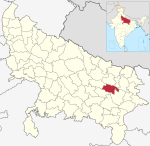 |
| AD | Ayodhya | Ayodhya | Pre-Independence | 2,470,996 | 2,522 | 1056 |  |
| AM | Amethi | Gauriganj | 1 July 2010 (from Rae Bareli) | 2,050,133 | 2,329.11 | 773 |  |
| JP | Amroha | Amroha | 24 April 1997 (from Moradabad district) | 1,840,221 | 2,249 | 818 |  |
| AU | Auraiya | Auraiya | 17 September 1997 (from Etawah district) | 1,379,545 | 2,016 | 684 | 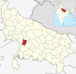 |
| AZ | Azamgarh | Azamgarh | Pre-Independence | 4,613,913 | 4,054 | 1138 |  |
| BD | Badaun | Badaun | Pre-Independence | 3,127,621 | 4,234 | 2368 |  |
| BG | Bagpat | Baghpat | 17 September 1997 (from Meerut district) | 1,303,048 | 1,321 | 249 |  |
| BH | Bahraich | Bahraich | Pre-Independence | 3,487,731 | 2,981 | 1170 |  |
| BL | Ballia | Ballia | Pre-Independence | 3,239,774 | 3,349 | 967 | 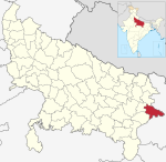 |
| BP | Balrampur | Balrampur | 22 May 1997 (from Gonda district) | 2,148,665 | 4,408 | 487 |  |
| BN | Banda | Banda | Pre-Independence | 1,799,410 | 4,402 | 409 | 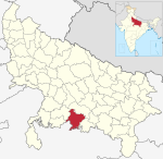 |
| BB | Barabanki | Barabanki | Pre-Independence | 3,260,699 | 4,120 | 791 |  |
| BR | Bareilly | Bareilly | Pre-Independence | 4,448,359 | 2,688 | 1655 | 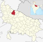 |
| BS | Basti | Basti | Pre-Independence | 2,464,464 | 4,561 | 540 |  |
| BI | Bijnor | Bijnor | Pre-Independence | 3,682,713 | 4,262 | 864 | 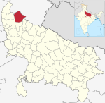 |
| BU | Bulandshahr | Bulandshahr | Pre-Independence | 3,499,171 | 4,441 | 776 |  |
| CD | Chandauli | Chandauli | 22 May 1997 (from Varanasi district) | 1,952,756 | 2,541 | 768 | 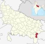 |
| CT | Chitrakoot | Chitrakoot | 6 May 1997 (from Banda district) | 991,730 | 3,216 | 308 | 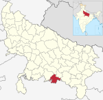 |
| DE | Deoria | Deoria | Pre-Independence | 3,100,946 | 2,540 | 1221 |  |
| ET | Etah | Etah | Pre-Independence | 1,774,480 | 2,431 | 730 |  |
| EW | Etawah | Etawah | Pre-Independence | 1,581,810 | 2,311 | 684 |  |
| FR | Farrukhabad | Fatehgarh | Pre-Independence | 1,885,204 | 2,181 | 864 |  |
| FT | Fatehpur | Fatehpur | Pre-Independence | 2,632,733 | 4,152 | 634 | 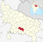 |
| FI | Firozabad | Firozabad | 5 February 1989 (from Agra district) | 2,498,156 | 2,407 | 1038 | 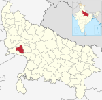 |
| GB | Gautam Buddha Nagar | Greater Noida | 6 September 1997 (from Ghaziabad and Bulandshahr districts) | 1,648,115 | 720 | 2288 |  |
| GZ | Ghaziabad | Ghaziabad | 14 November 1976 (from Meerut district) | 3,343,334 | 1,179 | 2836 |  |
| GP | Ghazipur | Ghazipur | Pre-Independence | 3,620,268 | 3,377 | 1072 | 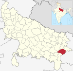 |
| GN | Gonda | Gonda | Pre-Independence | 3,433,919 | 4,003 | 858 |  |
| GR | Gorakhpur | Gorakhpur | Pre-Independence | 4,440,895 | 3,321 | 1337 |  |
| HM | Hamirpur | Hamirpur | Pre-Independence | 1,104,285 | 4,021 | 275 |  |
| HA | Hapur | Hapur | 28 September 2011 (from Ghaziabad district) | 1,338,311 | 649 | 2061 |  |
| HR | Hardoi | Hardoi | Pre-Independence | 4,092,845 | 5,986 | 684 | 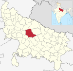 |
| HT | Hathras | Hathras | 3 May 1997 (from Aligarh district) | 1,564,708 | 1,840 | 850 | 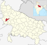 |
| JL | Jalaun | Orai | Pre-Independence | 1,689,974 | 4,565 | 370 |  |
| JU | Jaunpur | Jaunpur | Pre-Independence | 4,494,204 | 4,038 | 1113 | 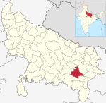 |
| JH | Jhansi | Jhansi | Pre-Independence | 1,998,603 | 5,024 | 398 |  |
| KJ | Kannauj | Kannauj | 18 September 1997 (from Farukkhabad district) | 1,656,616 | 2,093 | 792 | 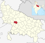 |
| KD | Kanpur Dehat | Akbarpur | 23 April 1981 (from Kanpur Nagar district) | 1,796,184 | 3,021 | 595 | 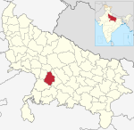 |
| KN | Kanpur Nagar | Kanpur | Pre-Independence | 4,581,268 | 3,155 | 1452 | 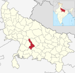 |
| KG | Kasganj | Kasganj | 15 April 2008 (from Etah district) | 1,436,719 | 1,955 | 735 |  |
| KS | Kaushambi | Manjhanpur | 4 April 1997 (from Prayagraj district) | 1,599,596 | 1,779 | 899 | 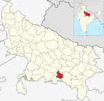 |
| KU | Kushinagar | Padarauna | 13 May 1994 (from Deoria district) | 4,021,243 | 2,905 | 1200 |  |
| LK | Lakhimpur Kheri | Kheri | Pre-Independence | 3,564,544 | 7,680 | 520 |  |
| LA | Lalitpur | Lalitpur | 1 March 1974 (from Jhansi district) | 1,221,592 | 5,039 | 242 | 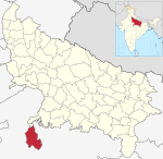 |
| LU | Lucknow | Lucknow | Pre-Independence | 4,589,838 | 2,528 | 1816 |  |
| MG | Maharajganj | Maharajganj | 2 October 1989 (from Gorakhpur district) | 2,684,703 | 2,952 | 909 |  |
| MH | Mahoba | Mahoba | 11 February 1995 (from Hamirpur district) | 875,958 | 3,144 | 279 | 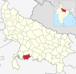 |
| MP | Mainpuri | Mainpuri | Pre-Independence | 1,868,529 | 2,760 | 677 | 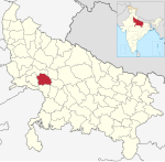 |
| MT | Mathura | Mathura | Pre-Independence | 2,547,184 | 3,340 | 763 |  |
| MB | Mau | Mau | 19 November 1988 (from Azamgarh district) | 2,205,968 | 1,713 | 1288 |  |
| ME | Meerut | Meerut | Pre-Independence | 3,443,689 | 2,559 | 1346 |  |
| MI | Mirzapur | Mirzapur | Pre-Independence | 2,496,970 | 4,405 | 567 |  |
| MO | Moradabad | Moradabad | Pre-Independence | 3,126,507 | 2,233 | 1400 |  |
| MU | Muzaffarnagar | Muzaffarnagar | Pre-Independence | 2,869,934 | 2,742 | 1047 |  |
| PI | Pilibhit | Pilibhit | Pre-Independence | 2,031,007 | 3,686 | 551 | 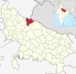 |
| PR | Pratapgarh | Pratapgarh | Pre-Independence | 3,209,141 | 3,717 | 863 | 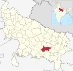 |
| PR | Prayagraj | Prayagraj | Pre-Independence | 5,954,391 | 5,482 | 1086 |  |
| RB | Rae Bareli | Rae Bareli | Pre-Independence | 2,903,507 | 3,937 | 737 | 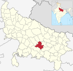 |
| RA | Rampur | Rampur | 1 December 1949 | 2,335,819 | 2,367 | 987 | 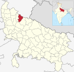 |
| SA | Saharanpur | Saharanpur | Pre-Independence | 3,466,382 | 3,689 | 940 |  |
| SK | Sant Kabir Nagar | Khalilabad | 5 September 1997 (from Basti district) | 2,199,774 | 2,390 | 920 |  |
| SR | Sant Ravidas Nagar | Gyanpur | 30 June 1994 (from Mirzapur district) | 1,715,183 | 1,646 | 1042 |  |
| SM | Sambhal | Sambhal | 3 May 2011 (from Moradabad district) | 1,578,213 | 1,015 | 1555 | 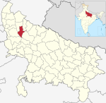 |
| SJ | Shahjahanpur | Shahjahanpur | Pre-Independence | 3,006,538 | 4,388 | 685 |  |
| SH | Shamli | Shamli | 3 May 2011 (from Muzaffarnagar district) | 1,273,578 | 1,266 | 1006 |  |
| SV | Shravasti | Shravasti | 22 May 1997 (from Bahraich district) | 1,117,361 | 1,640 | 681 |  |
| SN | Siddharthnagar | Siddharthnagar | 29 December 1988 (from Basti district) | 2,559,297 | 2,895 | 884 |  |
| SI | Sitapur | Sitapur | Pre-Independence | 4,483,992 | 5,743 | 781 |  |
| SO | Sonbhadra | Robertsganj | 4 March 1989 (from Mirzapur district) | 1,862,559 | 6,905 | 270 |  |
| SU | Sultanpur | Sultanpur | Pre-Independence | 2,249,036 | 2,457 | 915 |  |
| UN | Unnao | Unnao | Pre-Independence | 3,108,367 | 4,558 | 682 | 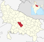 |
| VA | Varanasi | Varanasi | Pre-Independence | 3,676,841 | 1,535 | 2395 |  |
Uttar Pradesh Cabinet Minister and MLA from Aonla, Dharampal Singh demanded new Aonla District to be carved out of Bareilly District. [4]

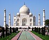
Uttar Pradesh is a state in northern India. With over 241 million inhabitants, it is the most populated state in India as well as the most populous country subdivision in the world – more populous than all but four other countries outside of India – and accounting for 16.5 per cent of the total population of India. It was established in 1950 after India had become a republic. It is a successor to the United Provinces, established in 1935 by renaming the United Provinces of Agra and Oudh, in turn established in 1902 from the North-Western Provinces and the Oudh Province. Lucknow serves as the state capital, with Prayagraj being the judicial capital. The state is divided into 18 divisions and 75 districts. On 9 November 2000, a new state, Uttaranchal, was created from Uttar Pradesh's western Himalayan hill region. The two major rivers of the state, the Ganges and its tributary Yamuna, meet at the Triveni Sangam in Prayagraj, a Hindu pilgrimage site. Other notable rivers are Gomti and Saryu. The forest cover in the state is 6.1 per cent of the state's geographical area. The cultivable area is 82 per cent of the total geographical area, and the net area sown is 68.5 per cent of the cultivable area.

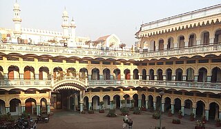
Kanpur ( ), formerly anglicized as Cawnpore, is a large industrial city located in the central-western part of the state of Uttar Pradesh, India. Founded in year 1207, Kanpur became one of the most important commercial and military stations of British India. Kanpur is also the financial capital of Uttar Pradesh and part of upcoming Bundelkhand Industrial Development Authority i.e. BIDA Nestled on the banks of Ganges River, Kanpur has been the major financial and industrial centre of North India and also the ninth-largest urban economy in India. Today it is famous for its colonial architecture, gardens, sweets, dialect, IT parks and fine quality leather, plastic and textile products which are exported mainly to the West.

Bareilly is a city in Bareilly district in the Indian state of Uttar Pradesh. It is among the largest metropolises in Western Uttar Pradesh and is the centre of the Bareilly division as well as the historical region of Rohilkhand. The city lies in the Indo-Gangetic Plains, about 252 kilometres (157 mi) northwest of the state capital, Lucknow, and 265 kilometres (165 mi) east of the national capital, New Delhi. With a population of 903,668 in 2011, it is the eighth most populous city in the state, 17th in northern India and 54th in India. It is located on the bank of Ramganga River and is the site of the Ramganga Barrage built for canal irrigation.
Saharanpur is a city and a municipal corporation in Uttar Pradesh, India. It is also the administrative headquarters of Saharanpur district.
Pratapgarh, also called Belha or Bela Pratapgarh, is a town and municipality in the state of Uttar Pradesh in India. It is the administrative headquarters of Pratapgarh district, part of the Prayagraj division.

Prayagraj district, also known as Allahabad district, is the most populous district in the Indian state of Uttar Pradesh. Prayagraj city is the district headquarters of this district. The District is divided into blocks within tehsils. As of 2011, there are 20 blocks in eight tehsils. The Prayagraj division includes the districts of Pratapgarh, Fatehpur, Kaushambi and Prayagraj, with some western parts that had previously part of Allahabad District becoming part of the new Kaushambi District. The administrative divisions are Phulpur, Koraon, Meja, Sadar, Soraon, Handia, Bara, Shringverpur and Karchana.

The Bareilly district belongs to the state Uttar Pradesh in northern India. Its capital is Bareilly city and it is divided in six administrative division or tehsils: Aonla, Baheri, Bareilly city, Faridpur, Mirganj, and Nawabganj. The Bareilly district is a part of the Bareilly Division and occupies an area of 4120 km2 with a population of 4,448,359 people according to the census of 2011.

Badaun district is one of the districts of Uttar Pradesh state of India, with its headquarters in the town of Badaun. The district is part of the Bareilly division, and covers an area of 4,234 km2 (1,635 sq mi). According to legend, Budaun was named after the Ahir prince Budh.

The Pratapgarh district is one of the districts of Uttar Pradesh state of India, and Pratapgarh city is the district headquarters. Pratapgarh district is a part of Prayagraj division. The total area of Pratapgarh district is 3730 Sq. km.
Gonda district is one of the districts of Uttar Pradesh, India. The city of Gonda is the district headquarters, and also the administrative centre for the Devipatan Division. The total area of Gonda district is 4,003 km2 (1,546 sq mi).

Meerut district, is one of the districts of Uttar Pradesh state of India, with the city of Meerut as the district headquarters. Meerut district is also a part of the Meerut division. The administrative head of district of Meerut is a District Magistrate while the administrative head of Meerut Division is Divisional Commissioner, an IAS officer.
Gorakhpur district is one of the 75 districts of Uttar Pradesh state in northern India. This district is a part of the Gorakhpur division. The city of Gorakhpur, or Gorakhpur is the administrative headquarters of this district and Gorakhpur division. It borders Sant Kabir Nagar district to the west, Kushinagar and Deoria districts to the east, and Maharajganj and Azamgarh districts to the north and south.
The administrative divisions of India are subnational administrative units of India; they are composed of a nested hierarchy of administrative divisions.
Shekhupur Assembly constituency is one of the 403 constituencies of the Uttar Pradesh Legislative Assembly, India. It is a part of the Badaun district and one of the five assembly constituencies in the Aonla Lok Sabha constituency. First election in this assembly constituency was held in 2012 after the "Delimitation of Parliamentary and Assembly Constituencies Order, 2008" was passed and the constituency was formed in 2008. The constituency is assigned identification number 116.
Dataganj Assembly constituency is one of the 403 constituencies of the Uttar Pradesh Legislative Assembly, India. It is a part of the Badaun district and one of the five assembly constituencies in the Aonla Lok Sabha constituency. First election in this assembly constituency was held in 1957 after the "DPACO (1956)" was passed in 1956. After the "Delimitation of Parliamentary and Assembly Constituencies Order" was passed in 2008, the constituency was assigned identification number 117.
Faridpur Assembly constituency is one of the 403 constituencies of the Uttar Pradesh Legislative Assembly, India. It is a part of the Bareilly district and one of the five assembly constituencies in the Aonla Lok Sabha constituency. First election in this assembly constituency was held in 1957 after the "DPACO (1956)" was passed in 1956. After the "Delimitation of Parliamentary and Assembly Constituencies Order" was passed in 2008, the constituency was assigned identification number 122 and is reserved for candidates from the Scheduled caste community.
Bithari Chainpur Assembly constituency is one of the 403 constituencies of the Uttar Pradesh Legislative Assembly, India. It is a part of the Bareilly district and one of the five assembly constituencies in the Aonla Lok Sabha constituency. First election in this assembly constituency was held in 2012 after the "Delimitation of Parliamentary and Assembly Constituencies Order, 2008" was passed and the constituency was formed in 2008. The constituency is assigned identification number 123.
Aonla Assembly constituency is one of the 403 constituencies of the Uttar Pradesh Legislative Assembly, India. It is a part of the Bareilly district and one of the five assembly constituencies in the Aonla Lok Sabha constituency. First election in this assembly constituency was held in 1952 after the "DPACO (1951)" was passed in 1951. After the "Delimitation of Parliamentary and Assembly Constituencies Order" was passed in 2008, the constituency was assigned identification number 126.