Deoria district

Last updated

Deoria district
ShyamMandirDeoria.jpg
Shyam Mandir in a Deoria
India Uttar Pradesh districts 2012 Deoria.svg
Location of Deoria district in Uttar Pradesh
Country Flag of India.svg  India
State Uttar Pradesh
Division Gorakhpur
Headquarters Deoria
Government
   Lok Sabha constituencies Deoria, Salempur, Bansgaon
   Vidhan Sabha constituencies Deoria, Rampur Karkhana, Barhaj, Rudrapur, Bhatpar Rani, Salempur, Pathardeva.
Area
  Total2,500 km2 (1,000 sq mi)
Population
 (2011)
  Total3,100,946
  Density1,200/km2 (3,200/sq mi)
   Urban
316,803
Demographics
   Literacy 73.53%
  Sex ratioM:F 1000:1013
Time zone UTC+05:30 (IST)
Major highways NH28, NH 221A, NH 441A
Average annual precipitation864.38 mm
Website deoria.nic.in

Deoria district, one of the districts of eastern Uttar Pradesh, India has its headquarters located at Deoria and is a part of Gorakhpur division. It came into existence on 16 March 1946 from Gorakhpur district.

Contents

History

Ancient

The area now known as the Deoria District was once a part of the Magadha Kingdom - a prime centre of ancient Aryan culture surrounded by the Himalayas in the north, the Syandika river in the south and the Panchala Kingdom in the west. Apart from the many legends told about this area, archaeological remains, such as statues, coins, bricks, Temples. Most of the People using surname Rao belong to the Kshatriya caste in Deoria Dist,.

The ancient history of the district is related with the Ramayana times when the Lord of Kosala, Ram, appointed his elder son Kusha the king of Kushwati, which is present-day Kushinagar. Before the Mahabharata era, this area had been related with Chakravorty Samrat Mahasudtsan Malla and his kingdom. Kushinagar was well developed and prosperous. Close to the border of his kingdom was the thick forested area called the Mahavan. This area was under the control of the Maurya rulers, the Gupta rulers, the Bihar rulers, and then the Garhwal ruler Govinda Chandra from 1114 AD until 1154 AD.

Modern

The Deoria district came into existence on 16 March 1946, being separated from the Gorakhpur District. It is believed that the name Deoria is derived from Devaranya or possibly Devpuria. According to official gazetteers, the district was named "Deoria" after its headquarters in Deoria, and the term Deoria generally means a place where there are temples. The name Deoria probably developed because of the existence of important temples in the area. The famous temples & places in Deoria to see are Devraha baba ashram and Dugdheswarnath Mandir. [1] During British rule the district was under the control of Majhauli Royal family and prominent landlords of Rajput community, [2] with their descendants still owning major chunks of land (Munshi Gorakhnath). [3] Some other families had their impact on various part of the district in which Dubey's of Badkagaon are quite famous. During Freedom struggle of India the district joined struggle under the leadership of Pandit Bibhuti Mani Tripathi of village Dehrauli, Rudrapur.

Geography

Deoria district is located between 26 ° 6' and 26° 48' north latitude to 83° 23' and 84° 16' east longitude. It is surrounded by Kushinagar district in the north, Gopalganj and Siwan districts of Bihar in the east, Mau and Ballia districts in the south and Gorakhpur district in the west. [4] The district has two Nagar Palika Parishad- Deoria and Gaura Barhaj . It has nine Nagar Panchayats which are Baitalpur, Hetimpur, Rudrapur, Rampur Karkhana, Bariyarpur, Bhatni Bazar, Bhatpar Rani, Gauri Bazar, Lar, Majhauli Raj and Salempur. [5] Hetimpur is a newly created nagar panchayat located at the banks of Chhoti Gandak river near the NH 27. [6]

Ghaghara, Rapti and Chhoti Gandak are the main rivers in the district. [4]

Demographics

Historical population
YearPop.±% p.a.
1901749,486    
1911816,191+0.86%
1921833,199+0.21%
1931889,726+0.66%
1941992,352+1.10%
19511,059,208+0.65%
19611,190,803+1.18%
19711,410,868+1.71%
19811,749,946+2.18%
19912,184,904+2.24%
20012,714,179+2.19%
20113,100,946+1.34%
source: [7]
Religions in Deoria district (2011) [8]
ReligionPercent
Hinduism
87.07%
Islam
11.56%
Other or not stated
0.37%

According to the 2011 census Deoria district has a population of 3,100,946. [9] This gives it a ranking of 114th in India (out of a total of 640). [9] The district has a population density of 1,220 inhabitants per square kilometre (3,200/sq mi) . [9] Its population growth rate over the decade 2001-2011 was 14.23%. [9] Deoria has a sex ratio of 1013 females for every 1000 males, [9] and a literacy rate of 73.53%. 10.22% of the population lives in urban areas. Scheduled Castes and Scheduled Tribes make up 15.11% and 3.54% of the population respectively. [9]

Languages

Languages in Deoria district (2011) [10]

   Bhojpuri (85.80%)
   Hindi (12.67%)
   Urdu (1.40%)
  Others (0.13%)

At the time of the 2011 Census of India, 85.80% of the population in the district spoke Bhojpuri, 12.67% Hindi and 1.40% Urdu as their first language. [10]

Bhojpuri is the native language of Deoria. [11] The Bhojpuri variant of Kaithi is the indigenous script of Bhojpuri language. [12]

Notable people

Colleges

Related Research Articles

<span class="mw-page-title-main">Gorakhpur</span> City in Uttar Pradesh, India

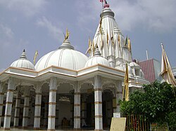
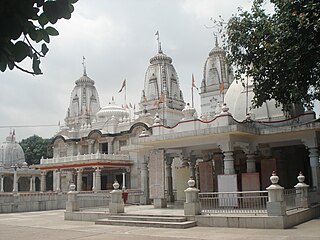
Gorakhpur is a city in the Indian state of Uttar Pradesh, along the banks of the Rapti river in the Purvanchal region. It is situated 272 kilometres east of the state capital, Lucknow. It is the administrative headquarters of Gorakhpur district, North Eastern Railway Zone and Gorakhpur division. The city is home to the Gorakhnath Math, a Gorakhnath temple. The city also has had an Indian Air Force station since 1963. Gita Press, the world's largest publisher of Hindu religious texts like Ramayana and Mahabharat, has been established here since 1926.

<span class="mw-page-title-main">Udham Singh Nagar</span> District in Uttarakhand, India

Udham Singh Nagar is a district of Uttarakhand state in northern India. Rudrapur is the district headquarter. The district consists of nine Tehsils named Bajpur, Gadarpur, Jaspur, Kashipur, Khatima, Kichha, Nanakmatta, Rudrapur, Sitarganj. The district is located in the Terai region, and is part of Kumaon Division. It is bounded on the north by Nainital District, on the northeast by Champawat District, on the east by Nepal, and on the south and west by Bareilly, Rampur, Moradabad, Pilibhit and Bijnor District of Uttar Pradesh state. The district was created on 29 September 1995, by Mayawati government out of Nainital District. It is named for freedom fighter and Indian revolutionary Udham Singh.

<span class="mw-page-title-main">Basti district</span> District of Uttar Pradesh in India

Basti district is one of the districts of Uttar Pradesh state, India, and a part of Basti Division. Basti city is the district headquarters.

<span class="mw-page-title-main">Mau district</span> District in Uttar Pradesh, India

Mau district is one of the districts of Uttar Pradesh state of India, and Mau town is the district headquarters which is also one of the few remaining areas of handloom saree production in eastern Uttar Pradesh, specializing in Sadiya silk sarees. Mau was carved out as a separate district from Azamgarh on 19 November 1988. It is situated in the south-eastern part of the state with headquarters in Maunath Bhanjan. The district is surrounded by Ghazipur district on the south, Ballia district in the east, Azamgarh district in the west, and by Gorakhpur and Deoria districts on the north; says, Pallavi mishra.

<span class="mw-page-title-main">Sant Kabir Nagar district</span> District of Uttar Pradesh in India

Sant Kabir Nagar district is one of the 75 districts of Uttar Pradesh state in northern India. Khalilabad is the district headquarters. Sant Kabir Nagar district is a part of Basti division. The total area of Sant Kabir Nagar district is 1,646 km2 (636 sq mi).

<span class="mw-page-title-main">Maharajganj district</span> District of Uttar Pradesh in India

Maharajganj district is one of the 75 districts of Uttar Pradesh state in northern India, and the town of Maharajganj is the district headquarters. District is a part Gorakhpur division. It is located in Terai region of Himalayas, bordering Nepal in North. Gandak, Rapti, Rohin are some major river flowing through the district.

<span class="mw-page-title-main">Gorakhpur district</span> District of Uttar Pradesh in India

Gorakhpur district is one of the 75 districts of Uttar Pradesh state in northern India. This district is a part of the Gorakhpur division. The city of Gorakhpur, or Gorakhpur is the administrative headquarters of this district and Gorakhpur division. It borders Sant Kabir Nagar district to the west, Kushinagar and Deoria districts to the east, and Maharajganj and Azamgarh districts to the north and south.

<span class="mw-page-title-main">Kushinagar district</span> District of Uttar Pradesh in India

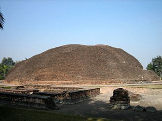
Kushinagar is a district of the state of Uttar Pradesh in India situated in the easternmost part of the state. It has the administrative headquarters at Ravindra Nagar Dhoos. The district is named such after the town Kushinagar, a Buddhist pilgrimage site where Gautama Buddha attained parinirvana in the 5th century BCE. Since the independence of India, Kushinagar district was a part of Deoria District and came into existence on 13 May 1994 as a separate district division. It was earlier known as Padrauna and thereafter was renamed Kushinagar on 19 June 1997.

Bhatpar Rani is a town and tehsil in Deoria District in the state of Uttar Pradesh in India. It belongs to Gorakhpur Division. It is located 48 km towards East from District headquarters Deoria.The Member of Legislative Council of Bhatpar Rani Constituency is Shri. Sabhakunwar Kushwaha In Bhatpar Rani, the block number of village is 127. The biggest village in this tehsil is Sarayan. Khan Sir(Teacher), Shilpi Raj(Singer) were born here.

<span class="mw-page-title-main">Deoria, Uttar Pradesh</span> City in Uttar Pradesh, India

Deoria is a city in the state of Uttar Pradesh, India. It is one of five tehsils of the Deoria district. Deoria is located 45 km east of Gorakhpur and about 317 km from the state capital Lucknow. It shares its eastern border with the Indian state of Bihar.

Khadda is a town, a nagar panchayat and a tehsil in Kushinagar district in the Indian state of Uttar Pradesh. It is situated approximately 8 kilometres (5.0 mi) from the border with Bihar and 18 kilometres (11 mi) from the India-Nepal border.

Majhauli Raj is a town and a nagar panchayat in Deoria district in the Indian state of Uttar Pradesh.

<span class="mw-page-title-main">Rudrapur, Uttarakhand</span> City in Uttarakhand, India

Rudrapur is a city that serves as the headquarters of the Udham Singh Nagar district in the Indian state of Uttarakhand. Located at a distance of about 250 km (160 mi) northeast of New Delhi and 250 km (160 mi) south of Dehradun, Rudrapur is located in the fertile Terai plains in the southern part of Kumaon division over an area of 27.65 km2. With a population of 140,857 according to the 2011 census of India, it is the 5th most populous city of Uttarakhand.

Salempur City is one of the oldest Tehsil Headquarters, 71 Parliamentary Constituency which covers Vidhan Sabha of Salempur and Bhatpar Rani in Deoria district and Belthara Road, Sikanderpur and Bansdih of Ballia District. It is a Nagar Panchayat in Deoria district in the India state of Uttar Pradesh. It is one of oldest Tehsil which was founded in 1939 at the time of British Rule. It has an important Railway Station of North Eastern Railway. The Chhoti Gandak river passes through Salempur Town.

Rudrapur is a town and a nagar panchayat in Deoria district in the Indian state of Uttar Pradesh.

Lar is a town, a nagar panchayat, and is a block headquarter in Deoria district in the Indian state of Uttar Pradesh. It belongs to Salempur tehsil in the district Deoria under Gorakhpur Division.

<span class="mw-page-title-main">Siddharthnagar district</span> District of Uttar Pradesh in India

Siddharthnagar district is one of the 75 districts of the Indian state of Uttar Pradesh. Siddharthnagar is the district headquarters. Siddharthnagar district is a part of Basti division. It was under the ancient Kosala kingdom and also the Shakya kingdoms.

Ahirauli Baghel is an Indian village located in Uttar Pradesh, India. Ahirauli Baghel comes under Bankata Block of Deoria district. It belongs to Gorakhpur division. It is located 47 KM towards East from district headquarter Deoria. It distance is 374 KM from State capital Lucknow. Bhojpuri and Hindi is the primary language spoken in this village.

The demographics of Uttar Pradesh is a complex topic, which is undergoing dynamic change. Uttar Pradesh is India's most populous state, and the largest subdivision in the world. It has a population of about 199,812,341 as per the 2011 census. If it were a separate country, Uttar Pradesh would be the world's fifth most populous nation, next only to China, the rest of India, the United States of America and Indonesia. Uttar Pradesh has a population more than that of Pakistan. There is an average population density of 828 persons per km2 i.e. 2,146 per sq mi. The capital of Uttar Pradesh is Lucknow, and Prayagraj serves as the state’s judicial capital. Hindus and Muslims both consider the state as a holy place.

<span class="mw-page-title-main">Kushinagar</span> Historical city in Uttar Pradesh, India

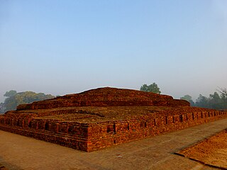
Kushinagar is a town in the Kushinagar district in Uttar Pradesh, India. Located 53 kilometres east of Gorakhpur on National Highway 27, Kushinagar is an important and popular Buddhist pilgrimage site, where Buddhists believe Gautama Buddha attained parinirvana.

References

  1. "Places of Interest | District Deoria, Government Of Uttar Pradesh | India" . Retrieved 18 January 2021.
  2. "Railways" (PDF).
  3. "Elected Wing Paden Sadashya". nppdeoria.in. Retrieved 29 November 2022.
  4. 1 2 "Deoria". Deoria district administration. Retrieved 5 August 2010.
  5. "Municipalities | District Deoria, Government Of Uttar Pradesh | India" . Retrieved 6 January 2023.
  6. "नगर पालिका देवरिया सीमा का विस्तार, हेतिमपुर को नगर पंचायत का दर्जा". Amar Ujala (in Hindi). Retrieved 6 January 2023.
  7. Decadal Variation In Population Since 1901
  8. "Table C-01 Population by Religion: Uttar Pradesh". censusindia.gov.in. Registrar General and Census Commissioner of India. 2011.
  9. 1 2 3 4 5 6 "District Census Handbook: Deoria" (PDF). censusindia.gov.in. Registrar General and Census Commissioner of India. 2011.
  10. 1 2 "Table C-16 Population by Mother Tongue: Uttar Pradesh". www.censusindia.gov.in. Registrar General and Census Commissioner of India.
  11. M. Paul Lewis, ed. (2009). "Bhojpuri: A language of India". Ethnologue: Languages of the World (16th ed.). Dallas, Texas: SIL International. Retrieved 30 September 2011.
  12. Grierson, George Abraham (1881). A handbook to the Kayathi character. The Library of Congress. Calcutta, Thacker, Spink, and co.

26°30′36″N83°46′48″E / 26.51000°N 83.78000°E / 26.51000; 83.78000