Cottage Grove, Wisconsin

Last updated

Cottage Grove, Wisconsin
Cottage Grove Village Hall - panoramio.jpg
Cottage Grove municipal building
Dane County Wisconsin Incorporated and Unincorporated areas Cottage Grove Highlighted.svg
Location of Cottage Grove in Dane County, Wisconsin.
Coordinates: 43°5′16″N89°12′00″W / 43.08778°N 89.20000°W / 43.08778; -89.20000
Country Flag of the United States.svg  United States
State Flag of Wisconsin.svg  Wisconsin
County Dane
Area
[1]
  Total4.69 sq mi (12.15 km2)
  Land4.69 sq mi (12.15 km2)
  Water0.00 sq mi (0.00 km2)
Elevation
[2]
892 ft (272 m)
Population
 (2020) [3]
  Total7,303
  Density1,523.03/sq mi (587.99/km2)
Time zone UTC-6 (Central (CST))
  Summer (DST) UTC-5 (CDT)
Area code 608
FIPS code 55-17200 [4]
GNIS feature ID1583018 [2]
Website Village of Cottage Grove, Wisconsin

Cottage Grove is a village in Dane County, Wisconsin, United States. Its population was 7,303 at the 2020 census. A suburb of Madison, it shares a school district with Monona. The village is located partially within the survey township of Cottage Grove.

Contents

The village was named from a settler's cottage in a grove near the village site. [5]

Geography

Cottage Grove is located at 43°5′16″N89°12′0″W / 43.08778°N 89.20000°W / 43.08778; -89.20000 (43.088017, -89.200143). [6]

According to the United States Census Bureau, the village has a total area of 3.48 square miles (9.01 km2), all of it land. [7]

Demographics

Historical population
CensusPop.Note
1930 261
1940 31018.8%
1950 37220.0%
1960 41311.0%
1970 47815.7%
1980 88885.8%
1990 1,13127.4%
2000 4,059258.9%
2010 6,19252.5%
2020 7,30317.9%
U.S. Decennial Census [8]

2010 census

As of the census [3] of 2010, 6,192 people, 2,210 households, and 1,628 families were living in the village. The population density was 1,779.3 inhabitants per square mile (687.0/km2). There were 2,289 housing units at an average density of 657.8 per square mile (254.0/km2). The racial makeup of the village was 92.1% White, 2.5% African American, 0.2% Native American, 2.2% Asian, 1.1% from other races, and 2.0% from two or more races. Hispanics or Latinos of any race were 3.0% of the population.

Of the 2,210 households, 47.1% had children under 18 living with them, 59.4% were married couples living together, 9.3% had a female householder with no husband present, 4.9% had a male householder with no wife present, and 26.3% were not families. About 20.2% of all households were made up of individuals, and 9.0% had someone living alone who was 65 or older. The average household size was 2.80. and the average family size was 3.26.

The median age in the village was 33.8 years. About 32.5% of residents were under 18; 5.7% were between 18 and 24; 32.4% were from 25 to 44; 21.7% were from 45 to 64; and 7.7% were 65 or older. The gender makeup of the village was 49.0% male and 51.0% female.

2000 census

As of the census [4] of 2000, 4,059 people, 1,427 households, and 1,084 families were living in the village. The population density was 1,775.3 people per square mile (684.4/km2). The 1,453 housing units had an average density of 635.5 per square mile (245.0/km2). The racial makeup of the village was 95.71% White, 1.82% African American, 0.25% Native American, 0.49% Asian, 0.54% from other races, and 1.18% from two or more races. Around 1.80% of the population were Hispanics or Latinos of any race.

Of the 1,427 households, 47.3% had children under 18 living with them, 65.0% were married couples living together, 7.5% had a female householder with no husband present, and 24.0% were not families. About 16.1% of all households were made up of individuals, and 6.0% had someone living alone who was 65 or older. The average household size was 2.83, and the average family size was 3.20.

In the village, the age distribution was 32.1% under 18, 5.6% from 18 to 24, 42.1% from 25 to 44, 14.3% from 45 to 64, and 6.0% who were 65 or older. The median age was 31 years. For every 100 females, there were 102.5 males. For every 100 females 18 and over, there were 97.3 males.

The median income for a household in the village was $66,628, and for a family was $68,667. Males had a median income of $46,190 versus $30,391 for females. The per capita income for the village was $25,777. About 2.7% of families and 3.8% of the population were below the poverty line, including 4.6% of those under 18 and 12.6% of those 65 or over.

Notable people

Gabe Carimi Gabe Carimi ASU.jpg
Gabe Carimi

Related Research Articles

<span class="mw-page-title-main">Oak Grove, Illinois</span> Village in Illinois, United States

Oak Grove is a village in Rock Island County, Illinois, United States. The population was 476 at the time of the 2020 census; up from 396 at the 2010 census.

Hermon is a town in Penobscot County, Maine, United States. The population was 6,461 at the 2020 census.

<span class="mw-page-title-main">Nelson Township, Michigan</span> Civil township in Michigan, United States

Nelson Township is a civil township of Kent County in the U.S. state of Michigan. The population was 4,895 at the 2020 census, which was up from 4,774 at the 2010 census.

<span class="mw-page-title-main">Sugar Grove, Ohio</span> Village in Ohio, United States

Sugar Grove is a village in Fairfield County, Ohio, United States. The population was 429 at the 2020 census.

<span class="mw-page-title-main">Grover Hill, Ohio</span> Village in Ohio, United States

Grover Hill is a village in Paulding County, Ohio, United States. The population was 382 at the 2020 census. The village is named after President Grover Cleveland.

<span class="mw-page-title-main">Burgoon, Ohio</span> Village in Ohio, United States

Burgoon is a village in Sandusky County, Ohio, United States. The population was 183 at the 2020 census.

<span class="mw-page-title-main">Cottage Grove, Tennessee</span> Town in Tennessee, United States

Cottage Grove is a town in Henry County, Tennessee, United States. The population was 88 at the 2010 census. Cottage Grove is currently the smallest town in Tennessee.

<span class="mw-page-title-main">Indian Lake, Texas</span> Town in Texas, United States

Indian Lake is a town in Cameron County, Texas, United States. The population was 640 at the 2010 census. It may be included as part of the Brownsville–Harlingen–Raymondville and the Matamoros–Brownsville metropolitan areas.

<span class="mw-page-title-main">Oak Grove Village, Missouri</span> Village in Missouri, United States

Oak Grove Village is a village in Franklin County, Missouri, United States. The population was 509 at the 2010 census.

<span class="mw-page-title-main">Valley Grove, West Virginia</span> Village in West Virginia, United States

Valley Grove is a village in Ohio County, West Virginia, United States. It is part of the Wheeling, West Virginia Metropolitan Statistical Area. The population was 378 at the 2010 census. The village was named from a nearby recreational area at a grove in a valley.

<span class="mw-page-title-main">Whitelaw, Wisconsin</span> Village in Wisconsin, United States

Whitelaw is a village in Manitowoc County, Wisconsin, United States. The population was 737 at the 2020 census.

<span class="mw-page-title-main">Footville, Wisconsin</span> Village in Wisconsin, United States

Footville is a village in Rock County, Wisconsin, United States. The population was 772 at the 2020 census.

<span class="mw-page-title-main">Elm Grove, Wisconsin</span> Village in Wisconsin, United States

Elm Grove is a village in Waukesha County, Wisconsin, United States. The population was 6,524 at the 2020 census. Elm Grove was named as America's best suburb by Business Insider in October 2014.

<span class="mw-page-title-main">Bluffton, Ohio</span> Village in Ohio, United States

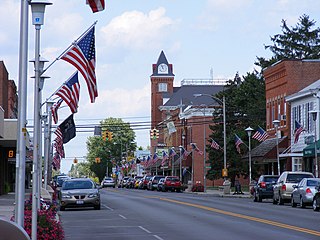
Bluffton, originally known as Shannon, is a village in Allen and Hancock counties in the U.S. state of Ohio. The population was 3,967 at the 2020 census. Bluffton is home to Bluffton University, a four-year educational institution affiliated with Mennonite Church USA. Bluffton is served by the Bluffton general aviation airport. Bluffton participates in the Tree City USA program.

<span class="mw-page-title-main">Cottage Grove (town), Wisconsin</span> Town in Wisconsin, United States

The Town of Cottage Grove is located in Dane County, Wisconsin. As of the 2020 census, the town had a population of 3,791. The Village of Cottage Grove is located partially in the town, but is governed independently. The unincorporated communities of Door Creek, Nora, and Vilas also are located in the town. The unincorporated communities of Hoffman Corners and Hope also are located partially in the town.

<span class="mw-page-title-main">Deerfield, Wisconsin</span> Village in Wisconsin, United States

Deerfield is a village in Dane County, Wisconsin. The population was 2,319 at the time of the 2010 census. The village is located within the Town of Deerfield. It is part of the Madison Metropolitan Statistical Area. Towns and villages near Deerfield include Marshall, Medina, London, Cambridge, and Cottage Grove, Wisconsin.

<span class="mw-page-title-main">Patch Grove, Wisconsin</span> Village in Wisconsin, United States

Patch Grove is a village in Grant County, Wisconsin, United States. The population was 198 at the 2010 census. The village is located within the Town of Patch Grove.

<span class="mw-page-title-main">Hixton, Wisconsin</span> Village in Wisconsin, United States

Hixton is a village in Jackson County, Wisconsin, United States, along the Trempealeau River. The population was 433 at the 2010 census. The village is located within the Town of Hixton.

<span class="mw-page-title-main">East Troy (town), Wisconsin</span> Civil town in Walworth County, Wisconsin

East Troy is a town in Walworth County, Wisconsin, United States. The population was 3,392 as of the 2020 census. The unincorporated communities of Hilburn, Lake Beulah, and Potter Lake are located in the town, as was the ghost town of Army Lake. East Troy is also home to several summer camps.

<span class="mw-page-title-main">Shirley (CDP), Massachusetts</span> Census-designated place in Massachusetts, United States

Shirley is a census-designated place (CDP) comprising the main village in the town of Shirley in Middlesex County, Massachusetts, United States. The population was 1,611 at the 2020 census, out of 7,431 in the entire town of Shirley.

References

  1. "2019 U.S. Gazetteer Files". United States Census Bureau. Retrieved August 7, 2020.
  2. 1 2 "US Board on Geographic Names". United States Geological Survey. October 25, 2007. Retrieved January 31, 2008.
  3. 1 2 "U.S. Census website". United States Census Bureau . Retrieved November 18, 2012.
  4. 1 2 "U.S. Census website". United States Census Bureau . Retrieved January 31, 2008.
  5. Company, Chicago and North Western Railway (1908). A History of the Origin of the Place Names Connected with the Chicago & North Western and Chicago, St. Paul, Minneapolis & Omaha Railways. p. 59.
  6. "US Gazetteer files: 2010, 2000, and 1990". United States Census Bureau. February 12, 2011. Retrieved April 23, 2011.
  7. "US Gazetteer files 2010". United States Census Bureau. Archived from the original on July 2, 2012. Retrieved November 18, 2012.
  8. "Census of Population and Housing". Census.gov. Retrieved June 4, 2015.