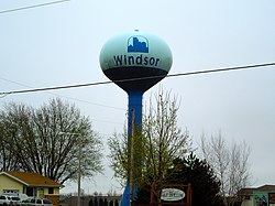
Windsor, Wisconsin

Last updated
Windsor, Wisconsin
Windsor Tower - panoramio.jpg
Windsor water tower
Dane County Wisconsin Incorporated and Unincorporated areas Windsor Highlighted.svg
Location of Windsor in Dane County, Wisconsin.
Coordinates: 43°13′51″N89°19′57″W / 43.23083°N 89.33250°W / 43.23083; -89.33250
Country Flag of the United States.svg  United States
State Flag of Wisconsin.svg  Wisconsin
County Dane
Government
  Village PresidentBob Wipperfurth
  Municipal JudgeJason Hanson
Area
[1]
  Total27.67 sq mi (71.67 km2)
  Land27.56 sq mi (71.39 km2)
  Water0.11 sq mi (0.28 km2)
Elevation
[2]
1,033 ft (315 m)
Population
 (2020)
  Total8,754
  Estimate 
(2019) [3]
7,644
  Density277.32/sq mi (107.07/km2)
Time zone UTC-6 (Central (CST))
  Summer (DST) UTC-5 (CDT)
Area code 608
FIPS code 55-87750 [4]
GNIS feature ID1584454 [2]
Website www.windsorwi.gov

Windsor is a village and former town in Dane County, Wisconsin. The population was 8,754 at the time of the 2020 census. The communities of Lake Windsor, Morrisonville, and Token Creek are located within the village. Windsor voted to incorporate as a village on November 3, 2015; prior to its incorporation, it was a town, and a portion of the town was a census-designated place. [5] Windsor is a part of the Census Bureau's Madison metropolitan statistical area.

Contents

A portion of the former town was part of a disputed annexation by the Village of DeForest. In July 2004, the village and town reached a settlement in which part of the disputed area would be annexed by the village and part would remain with the town. In addition, the town and village agreed to exchange other less populated land.

History

While visited in the late 1830s, the first settler to the town was William Lawrence, who came from the state of Vermont in 1841. He later served in the Civil War. James Morrison settled in the town in 1843 at what is now Morrisonville. [6]

Geography

According to the United States Census Bureau, the town has a total area of 30.8 square miles (79.9 km2), of which, 30.7 square miles (79.6 km2) of it is land and 0.1 square miles (0.3 km2) of it (0.32%) is water.

Demographics

Historical population
CensusPop.Note
2020 8,754
U.S. Decennial Census [7]

As of the census [4] of 2000, there were 5,286 people, 1,880 households, and 1,549 families living in the town. The population density was 172.0 people per square mile (66.4/km2). There were 1,923 housing units at an average density of 62.6 per square mile (24.2/km2). The racial makeup of the town was 96.71% White, 0.45% Black or African American, 0.32% Native American, 0.93% Asian, 0.04% Pacific Islander, 0.44% from other races, and 1.12% from two or more races. 1.15% of the population were Hispanic or Latino of any race.

There were 1,880 households, out of which 41.4% had children under the age of 18 living with them, 71.8% were married couples living together, 7.1% had a female householder with no husband present, and 17.6% were non-families. 11.8% of all households were made up of individuals, and 3.1% had someone living alone who was 65 years of age or older. The average household size was 2.80 and the average family size was 3.05.

In the town the population was spread out, with 28.6% under the age of 18, 6.3% from 18 to 24, 31.4% from 25 to 44, 27.1% from 45 to 64, and 6.6% who were 65 years of age or older. The median age was 37 years. For every 100 females, there were 98.6 males. For every 100 females age 18 and over, there were 99.4 males.

The median income for a household in the town was $67,610, and the median income for a family was $73,042. Males had a median income of $41,745 versus $29,921 for females. The per capita income for the town was $29,266. None of the families and 0.5% of the population were living below the poverty line, including no under eighteens and none of those over 64.

The population of the Windsor census-designated place was 3,573 at the 2010 census. [8] As of the census [4] of 2000, there were 2,533 people, 945 households, and 746 families living in the CDP. The population density was 308.5/km2 (800.2/mi2). There were 978 housing units at an average density of 119.1/km2 (309.0/mi2). The racial makeup of the CDP was 96.13% White, 0.51% Black or African American, 0.36% Native American, 1.18% Asian, 0.59% from other races, and 1.22% from two or more races. Hispanic or Latino of any race were 1.46% of the population.

There were 945 households, out of which 38.0% had children under the age of 18 living with them, 67.0% were married couples living together, 8.5% had a female householder with no husband present, and 21.0% were non-families. 13.9% of all households were made up of individuals, and 3.0% had someone living alone who was 65 years of age or older. The average household size was 2.67 and the average family size was 2.95.

In the CDP the population was spread out, with 27.0% under the age of 18, 6.8% from 18 to 24, 32.3% from 25 to 44, 27.0% from 45 to 64, and 6.8% who were 65 years of age or older. The median age was 36 years. For every 100 females, there were 98.8 males. For every 100 females age 18 and over, there were 100.0 males.

The median income for a household in the CDP was $61,958, and the median income for a family was $69,150. Males had a median income of $41,232 versus $27,863 for females. The per capita income for the CDP was $31,529. None of the families and 1.0% of the population were living below the poverty line, including no under eighteens and none of those over 64.

Education

The only public school in Windsor is Windsor Elementary School, serving grades K-4. Windsor is served by DeForest Area School District, which operates several additional schools in nearby DeForest.

Notable residents

Related Research Articles

<span class="mw-page-title-main">Broad Brook, Connecticut</span> Census-designated place in Connecticut, United States

Broad Brook is a neighborhood and census-designated place (CDP) in the town of East Windsor, Hartford County, Connecticut, United States. As of the 2010 census, the CDP population was 4,069.

<span class="mw-page-title-main">Thompsonville, Connecticut</span> Census-designated place in Connecticut, United States

Thompsonville is a census-designated place (CDP) in the town of Enfield in Hartford County, Connecticut, United States. The population of the CDP was 8,577 at the 2010 census.

<span class="mw-page-title-main">Windsor, Indian River County, Florida</span> Census-designated place in Florida, United States

Windsor, formerly known as North Beach, is a gated community and census-designated place (CDP) on North Hutchinson Island in Indian River County, Florida, United States. The population was 256 at the 2010 census. It is part of the Sebastian–Vero Beach Metropolitan Statistical Area.

<span class="mw-page-title-main">Barnhart, Missouri</span> CDP in Missouri, United States

Barnhart is a census-designated place (CDP) in Jefferson County, Missouri, United States. Barnhart is also a suburb of St. Louis.

<span class="mw-page-title-main">Imperial, Missouri</span> Census-designated place in Missouri, United States

Imperial is a census-designated place (CDP) in Jefferson County, Missouri, United States, and is a suburb of St. Louis. The population was 4,947 at the 2020 census. Imperial was originally known as West Kimmswick, the historic Catholic church of St. John’s in Imperial, became an independent parish in 1869.

<span class="mw-page-title-main">Wye, Montana</span> Place in Montana, United States

Wye is a unincorporated community in Missoula County, Montana, United States. It is part of the Missoula, Montana Metropolitan Statistical Area. The population was 511 at the 2010 census, an increase from its population of 381 in 2000. For statistical purposes, the United States Census Bureau has defined Saticoy as a census-designated place (CDP). Wye is named for the "y"-shaped DeSmet Junction where US 93 and MT 200 met former US 10.

<span class="mw-page-title-main">Southwood Acres, Connecticut</span> Census-designated place in Connecticut, United States

Southwood Acres is a suburban neighborhood within the town of Enfield in northern Hartford County, Connecticut, United States. The neighborhood is listed as a census-designated place (CDP) by the U.S. Census Bureau and had a population of 7,657 at the 2010 census.

<span class="mw-page-title-main">Crestwood Village, New Jersey</span> Populated place in Ocean County, New Jersey, US

Crestwood Village is an unincorporated community and census-designated place (CDP) located within Manchester Township, in Ocean County, in the U.S. state of New Jersey. As of the 2010 United States Census, the CDP's population was 7,907.

<span class="mw-page-title-main">Morrisonville, New York</span> Census-designated place in New York, United States

Morrisonville is a hamlet and census-designated place in Clinton County, New York, United States. The population was 1,545 at the 2010 census.

<span class="mw-page-title-main">Schuyler Falls, New York</span> Town in New York, United States

Schuyler Falls is a town in Clinton County, New York, United States. The population was 5,181 at the 2010 census. The town was named after Peter Schuyler, who bought the mill on the Salmon River from Zephaniah Platt.

<span class="mw-page-title-main">Billington Heights, New York</span> Census-designated place in New York, United States

Billington Heights is a hamlet and census-designated place (CDP) in the towns of Elma and Aurora in Erie County, New York, United States. The population was 1,685 at the 2010 census. It is part of the Buffalo–Niagara Falls Metropolitan Statistical Area.

<span class="mw-page-title-main">Chester (CDP), Vermont</span> Census-designated place in Vermont, United States

Chester is a census-designated place (CDP) in Windsor County, Vermont, United States. The population was 1,005 at the 2010 census. The CDP is a statistical area encompassing three distinct places: the urbanized center of the town of Chester; a locale known as Chester Depot, which is separated from the town center by the tracks of the former Rutland Railroad; and the village of North Chester.

<span class="mw-page-title-main">Kennebunkport (CDP), Maine</span> Census-designated place in Maine, United States

Kennebunkport is a census-designated place (CDP) consisting of the central village in the town of Kennebunkport in York County, Maine, United States. The population was 1,238 at the 2010 census, out of a total town population of 3,474. It is part of the Portland–South Portland–Biddeford, Maine Metropolitan Statistical Area.

Ghent is a census-designated place (CDP) in the town of Ghent in Columbia County, New York, United States. The population of the CDP was 564 at the 2010 census, out of a total town population of 5,402.

<span class="mw-page-title-main">New Windsor (CDP), New York</span> Census-designated place in New York, United States

New Windsor is a census-designated place (CDP) in the town of New Windsor in Orange County, New York, United States. The population was 8,882 at the 2020 census. It is part of the Poughkeepsie–Newburgh–Middletown, NY Metropolitan Statistical Area as well as the larger New York–Newark–Bridgeport, NY-NJ-CT-PA Combined Statistical Area.

<span class="mw-page-title-main">Springfield (CDP), Vermont</span> Census-designated place in Vermont, United States

Springfield is a census-designated place (CDP) comprising the main settlement within the town of Springfield, Windsor County, Vermont, United States. The population of the CDP was 3,979 at the 2010 census, compared with 9,373 for the town as a whole.

<span class="mw-page-title-main">King Township, Christian County, Illinois</span> Township in Illinois, United States

King Township is one of seventeen townships in Christian County, Illinois, USA. As of the 2020 census, its population was 198 and it contained 94 housing units.

<span class="mw-page-title-main">Suffield Depot, Connecticut</span> Census-designated place in Connecticut, United States

Suffield Depot is the name of a census-designated place (CDP) corresponding to the village of Suffield, the primary settlement of the town of Suffield, Connecticut, in Hartford County. The population of the CDP was 1,325 as of the 2010 census.

<span class="mw-page-title-main">Townsend (CDP), Massachusetts</span> Census-designated place in Massachusetts, United States

Townsend is a census-designated place (CDP) comprising the main village in the town of Townsend in Middlesex County, Massachusetts, United States. The population was 1,213 at the 2020 census, out of 9,127 in the entire town.

<span class="mw-page-title-main">Limestone (CDP), Maine</span> Census-designated place in Maine, United States

Limestone is a census-designated place (CDP) comprising the main village within the town of Limestone in Aroostook County, Maine, United States. The population was 1,075 at the 2010 census, out of a population of 2,314 for the entire town.

References

  1. "2019 U.S. Gazetteer Files". United States Census Bureau. Retrieved August 7, 2020.
  2. 1 2 "US Board on Geographic Names". United States Geological Survey. 2007-10-25. Retrieved 2008-01-31.
  3. "Population and Housing Unit Estimates". United States Census Bureau. May 24, 2020. Retrieved May 27, 2020.
  4. 1 2 3 "U.S. Census website". United States Census Bureau . Retrieved 2008-01-31.
  5. Village of Windsor. Incorporation
  6. DeForest Area Historical Society-Early History of the Area
  7. "Census of Population and Housing". Census.gov. Retrieved June 4, 2016.
  8. "U.S. Census website". U.S. Census Bureau . Retrieved 20 April 2011.