Edwards Run Wildlife Management Area is located on 397 acres (1.6 km2) two miles (3 km) north of Capon Bridge on Cold Stream Road near Cold Stream in Hampshire County, West Virginia. Edwards Run WMA is owned by the West Virginia Division of Natural Resources.
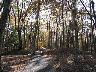
The Fort Mill Ridge Wildlife Management Area is located on 217 acres (0.88 km2) two miles (3 km) southwest of Romney in Hampshire County, West Virginia. Fort Mill Ridge WMA is owned by the West Virginia Division of Natural Resources. The Fort Mill Ridge Civil War Trenches are located at the top of the Fort Mill Ridge access road.

Nathaniel Mountain Wildlife Management Area is located on 10,675 acres (43.20 km2) south of Romney in Hampshire County, West Virginia. The wildlife management area's principle access road is off Grassy Lick Road. Nathaniel Mountain is owned by the West Virginia Division of Natural Resources (WVDNR), and is one of West Virginia's largest wildlife management areas. The WMA was expanded in November 2003 after the WVDNR purchased 1,800 acres (7.3 km2) from the MeadWestvaco Corporation.
The South Branch Wildlife Management Area is 1,092 acres (4.42 km2) of mixed oak-hickory woodlands and pastures in Hampshire and Hardy Counties, West Virginia, USA. The South Branch WMA consists of four separate tracts along the South Branch Potomac River around and south of the river gorge known as The Trough. It is known throughout the region for its dove, squirrel, deer, and wild turkey hunting. The WMA is owned by the West Virginia Division of Natural Resources.

The Allegheny Wildlife Management Area is located on 6,202 acres (25.1 km2) on two separate tracts of mixed oak-hickory woodlands in western Mineral County along the Allegheny Front. The large land tract of 5,034 acres (2,037.2 ha) is accessible via Pinnacle Road and Pine Swamp Road four miles (6 km) southwest of Keyser. The smaller tract of 1,168 acres (4.7 km2) is accessed by West Virginia Route 46 and Barnum Road about 6 miles (10 km) north from Elk Garden. The Barnum Road tract consists of old farm fields along the river and the ridgetop, connected by steep slopes.
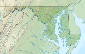
The Maryland Department of Natural Resources (DNR) is a government agency in the state of Maryland charged with maintaining natural resources including state parks, public lands, state forests, state waterways, wildlife and recreation areas. Its headquarters are in Annapolis.

Deal Island Wildlife Management Area protects 13,565 acres (54.90 km2) in western Somerset County, Maryland near the community of Deal Island. As a wildlife management area, the area is managed by the Maryland Department of Natural Resources' Wildlife and Heritage Service to conserve wildlife populations and their habitats, while providing public recreational use of wildlife resources.

Dierssen Wildlife Management Area is a Wildlife Management Area (WMA) near Seneca in Montgomery County, Maryland.

McKee-Beshers Wildlife Management Area is a Wildlife Management Area in Montgomery County, Maryland. It is a large contiguous forest of varied habitat, situated between the Potomac River and the Chesapeake & Ohio Canal to the south, and Seneca Creek State Park to the east.

Gwynnbrook Wildlife Management Area is an 88-acre (36 ha) Wildlife Management Area in Owings Mills, Baltimore County, Maryland. The property is a former game farm that was purchased by Maryland in 1919, and is the oldest WMA in the state.
Heater's Island Wildlife Management Area is a Wildlife Management Area in Frederick County, Maryland. Heater's Island is a large forested island in the Potomac River near Point of Rocks, Maryland. It was long inhabited by the Piscataway people, who were forced to leave by smallpox in 1705.

Purse State Park is a former Maryland state park located on the Potomac River in Charles County that has been subsumed into the 1,365-acre (552 ha) Nanjemoy Wildlife Management Area. As the Purse Area, the former park is known for fossil hunting on the beaches of Wades Bay at the southern end of the Nanjemoy WMA. Fossil discoveries have included shark teeth and Cibicides.

Laurel Lake Wildlife Management Area is located between Dingess and Lenore in Mingo County, West Virginia. Located on 12,856 acres (5,203 ha) of steep terrain with narrow valleys and ridgetops, the WMA contains second growth mixed hardwoods and hemlock with thick understory of mountain laurel and rhododendron.

Meadow River Wildlife Management Area, is located near Rupert, West Virginia in Greenbrier County. Occupying 2,385 acres (965 ha) of river bottomland, the WMA is located along the Meadow River and consists mainly of wetlands habitat.
Maryland Wildlands are a group of public properties that are protected from logging or other activities in the state of Maryland.

A Natural Environment Area (NEA) is a unit of the Park Service of the Maryland Department of Natural Resources. These public lands are generally 1,000 acres (4 km2) or more in extent and are judged to constitute a "significant natural attraction or unique geological feature". Development within an NEA is generally confined to trails, interpretive facilities and limited support facilities.

Upper Deckers Creek Wildlife Management Area, is located about 1 mile (1.6 km) north of Reedsville, West Virginia in Preston County. Upper Deckers Creek WMA is located on 56 acres (23 ha), consisting of two small fishing ponds and surrounding forested rolling hills.

Upper Mud River Wildlife Management Area, is located about 12 miles (19 km) south of Hamlin, West Virginia in Lincoln County, U.S.A. Upper Mud River WMA is located on 1,425 acres (577 ha) of steeply forested terrain.

Widmeyer Wildlife Management Area, is located about 3 miles (4.8 km) north of Great Cacapon, West Virginia in Morgan County. Widmeyer WMA is located on 422 acres (171 ha) of upland hills above the Potomac River.