
Mount Nebo is the southernmost and highest mountain in the Wasatch Range of Utah, in the United States, and the centerpiece of the Mount Nebo Wilderness, inside the Uinta National Forest. It is named after the biblical Mount Nebo, overlooking Israel from the east of the Jordan river, which is said to be the place of Moses' death.
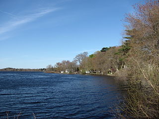
Lake Nippenicket, known locally as The Nip, is a freshwater pond in the town of Bridgewater, Massachusetts, and immediately adjacent to Raynham, Massachusetts. The lake borders a tiny portion of Route 104, and is near the junction of I-495 and Route 24. Lake Nippenicket is part of the Taunton River Watershed, emptying into the Town River and into the Taunton River, and a good-size portion of it is included with the Hockomock Swamp Wildlife Management Area. The lake is named after a Native American tribe from that area.

Meadow Branch is a 16.7-mile-long (26.9 km) tributary stream of Sleepy Creek in West Virginia's Eastern Panhandle region. It passes through the Sleepy Creek Wildlife Management Area, where it is dammed to form the 205-acre (0.83 km2) Sleepy Creek Lake.

The Red Hills, also referred to as Gypsum Hills, is the name of a physiographic region located mostly in Clark, Comanche and Barber counties in southern and central Kansas. This undulating terrain of red-tinted sediments, a product of the underlying geology, does not fit the conventional description of the Great Plains landscape of Kansas.

Lee Metcalf National Wildlife Refuge is a 2,800-acre (1,100 ha) National Wildlife Refuge (NWR) along the Bitterroot River in southwestern Montana, U.S. Established in 1964 as Ravalli NWR, it was renamed in 1978 in honor of the late Senator Lee Metcalf, a native of Montana. The refuge was set aside for the protection of migratory bird species. About 235 species of birds have been documented on the refuge, with over 100 nesting there. Additionally, 37 species of mammals, and 17 species of reptiles and amphibians also have been documented.
Black Coulee National Wildlife Refuge is a 1,308-acre (529 ha) National Wildlife Refuge in the U.S. state of Montana near the Canada–US border. This very remote refuge is a part of the Bowdoin Wetland Management District (WMD), and is unstaffed. The refuge is managed from Bowdoin National Wildlife Refuge.
Creedman Coulee National Wildlife Refuge is a 2,728-acre (1,104 ha) National Wildlife Refuge in the northern region of the U.S. state of Montana. This very remote refuge is a part of the Bowdoin Wetland Management District (WMD), and is unstaffed. The refuge consists of only 80 acres (32 ha) that are federally owned, while the remaining 2,648 acres (1,072 ha) is an easement with local landowners and on private property. The refuge is managed from Bowdoin National Wildlife Refuge.

Hewitt Lake National Wildlife Refuge is a 1,360-acre (550 ha) National Wildlife Refuge in the northern region of the U.S. state of Montana. This refuge is a part of the Bowdoin Wetland Management District (WMD), and is unstaffed. The refuge is partly owned by the U.S. Government, while the rest is an easement with local landowners. The refuge is managed from Bowdoin National Wildlife Refuge.
Lake Thibadeau National Wildlife Refuge is a 3,868-acre (1,565 ha) National Wildlife Refuge in the U.S. state of Montana, 15 mi (24 km) northeast of Havre, Montana. This refuge is a part of the Bowdoin Wetland Management District (WMD), and is managed from Bowdoin National Wildlife Refuge. The refuge is an easement refuge almost entirely on privately owned property and consists of grassland, marshes and cropland.
Grass Lake National Wildlife Refuge is in the central section of the U.S. state of Montana and is an integral part of the Charles M. Russell National Wildlife Refuge Complex, managed from the Charles M. Russell National Wildlife Refuge. This refuge provides nesting habitat for migratory bird species.
Lake Mason National Wildlife Refuge is located in the center of the U.S. state of Montana. The refuge has numerous lakes and extensive marshlands along Willow Creek, which provide nesting habitat for over a hundred bird species. The refuge is managed from the Charles M. Russell National Wildlife Refuge and is normally unstaffed and has few visitor improvements. The refuge consists of three discontinuous areas; the Lake Mason area which has seasonal wetlands, the North section consisting primarily of uplands and the Willow Creek section which was set aside to protect habitat for the mountain plover.
Little Conococheague Creek is a 12.4-mile-long (20.0 km) tributary stream of the Potomac River in the U.S. states of Maryland and Pennsylvania. The stream rises on Two Top Mountain, west of the Whitetail Ski Resort in Franklin County, Pennsylvania, and proceeds south into Washington County, Maryland. It empties into the Potomac about 2 miles (3 km) southeast of Big Spring, Maryland. The watershed of the creek is 18 square miles (47 km2) and includes Indian Springs Wildlife Management Area. Tributaries include Toms Run.

Center Branch Wildlife Management Area is located on 975 acres (395 ha) in Harrison County near Stonewood, West Virginia. The WMA is located on a former strip mine site, and contains several flat benches and high walls. Second growth oak-hickory and mixed hardwoods forests cover much of the land.
Little Tom Mountain is a 73-acre (300,000 m2) nature preserve in Holyoke, Massachusetts and is managed by the Trustees of Reservations. The land was purchased in 2002 by a joint effort of the Trustees of Reservations, U.S. Fish and Wildlife Service, the Department of Conservation and Recreation, and the Holyoke Boys & Girls Club from the holders of the former Mt. Tom Ski area. The Trustees and the Holyoke Boys and Girls Club have a cooperative management approach of the area and run an environmental education program together.
The Indian Pass Wilderness is 32,418-acre (13,119 ha) wilderness area under the administered by the Bureau of Land Management. The reserve is located in the very southeastern part of the Chocolate Mountains, in the southeastern part of California, just to the west of the Colorado River in the Lower Colorado River Valley. It adjoins the Picacho Peak Wilderness to the south, and the Imperial National Wildlife Refuge to the east.
Dents Run Wildlife Management Area is located on 1,226 acres (496 ha) near Mannington in Marion County, West Virginia. It includes a 30-acre (0.12 km2) lake and will provide hunting opportunities for deer, wild turkey, squirrel, and other species.
Deep Creek State Forest (DCSF) is a 380-acre state forest 11 miles north of St. Augustine, Florida in St. Johns County, Florida. Deep Creek State Forest is located on both sides of Deep Creek, for which it is named. The state forest is west of the Guana River Wildlife Management Area across the Intracoastal Waterway.

Wheatland is an unincorporated community within Manchester Township in Ocean County, New Jersey, United States.
Double T State Fish and Wildlife Area, also known as the Double 'T' Goose Management Area, is a 1,961 acres (794 ha) State of Illinois recreation area. It is located within Fulton County, and is administered by the Illinois Department of Natural Resources (IDNR). The nearest large town is Canton, Illinois.
Island No. 1 is a partially submerged island in the Napa River, upstream of San Pablo Bay. It is in Napa and Solano County, California, and parts of it are managed as part of the Napa-Sonoma Marshes Wildlife Area. Its coordinates are 38°08′35″N122°20′40″W, and the United States Geological Survey measured its elevation as 3 ft (0.91 m) in 1981. It, along with Island No. 2, Green Island and Tubbs Island, are labeled on a 1902 USGS map of the area.

