Londontowne, Maryland

Last updated
Londontowne, Maryland
Anne Arundel County Maryland Incorporated and Unincorporated areas Londontowne Highlighted.svg
Location of Londontowne, Maryland
Coordinates: 38°56′10″N76°33′15″W / 38.93611°N 76.55417°W / 38.93611; -76.55417
CountryFlag of the United States.svg United States
State Flag of Maryland.svg  Maryland
County Flag of Anne Arundel County, Maryland.png Anne Arundel
Area
  Total3.8 sq mi (9.8 km2)
  Land3.0 sq mi (7.8 km2)
  Water0.8 sq mi (2.0 km2)
Elevation
26 ft (8 m)
Population
 (2000)
  Total7,595
  Density2,517.3/sq mi (971.9/km2)
Time zone UTC−5 (Eastern (EST))
  Summer (DST) UTC−4 (EDT)
FIPS code 24-47925
GNIS feature ID0588901

Londontowne is an unincorporated area and former census-designated place (CDP) in Anne Arundel County, Maryland, United States, and the site of a former colonial seaport founded on the South River in 1683. The population was 7,595 at the 2000 census. At the 2010 census, the area was delineated as the Edgewater CDP.

Contents

Geography

According to the United States Census Bureau, the CDP had a total area of 3.8 square miles (9.8 km2), of which 3.0 square miles (7.8 km2) was land and 0.8 square mile (2.0 km2) (20.11%) was water.

History

London Town was a colonial seaport settlement founded in 1683 near Annapolis. The original wharf was built by Colonel William Burgess, one of the area's original settlers. He parceled his land and sold it and it was established as a town by an act of 1683. It was once considered as the site for the Province of Maryland and was for a time as prominent in trade as Annapolis and Williamsburg, Virginia. It declined and disappeared by the 19th century for reasons including its non-selection as a tobacco inspection station, economic depression, and the Revolutionary War.

Speculation exists that the South River Club's first clubhouse was built here. [1]

Historic London Town and Gardens

The London Town Publik House (William Brown House) and grounds London Town Publik House MD2.jpg
The London Town Publik House (William Brown House) and grounds

Today, the area of the old town comprises the 23-acre (9.3 ha)Historic London Town and Gardens, owned by Anne Arundel County and operated by the London Town Foundation, a 501(c)(3) non-profit. The park includes the London Town Publik House, listed on the National Register of Historic Places and designated a National Historic Landmark, as well as reconstructed period buildings, a public museum, an archaeology lab, and extensive gardens. [2] [3] The park offers guided tours, musket fire demonstrations, and various other educational events, [4] [5] and its facilities may be rented as an event venue. [6]

London Town's 8-acre (3.2 ha) woodland gardens began in the late 1960s as naturalized shade gardens. Today they include an azalea glade with both deciduous and evergreen plantings; a camellia walk with winter blooming camellias; a holly collection; and a winter garden featuring plants of winter interest, with evergreens such as mountain laurel ( Kalmia latifolia).

Demographics

At the 2000 census there were 7,595 people, 2,927 households, and 2,040 families in the CDP. The population density was 2,517.3 inhabitants per square mile (971.9/km2). There were 3,095 housing units at an average density of 1,025.8 per square mile (396.1/km2). The racial makup of the CDP was 95.89% White, 1.97% African American, 0.32% Native American, 0.49% Asian, 0.01% Pacific Islander, 0.16% from other races, and 1.16% from two or more races. Hispanic or Latino people of any race were 1.95%. [7]

Of the 2,927 households 31.8% had children under the age of 18 living with them, 55.2% were married couples living together, 10.1% had a female householder with no husband present, and 30.3% were non-families. 22.9% of households were one person and 6.6% were one person aged 65 or older. The average household size was 2.56 and the average family size was 3.02.

The age distribution was 23.5% under the age of 18, 6.7% from 18 to 24, 33.3% from 25 to 44, 25.6% from 45 to 64, and 11.0% 65 or older. The median age was 38 years. For every 100 females, there were 98.7 males. For every 100 females age 18 and over, there were 95.9 males.

The median household income was $63,021 and the median family income was $68,190. Males had a median income of $45,589 versus $34,555 for females. The per capita income for the CDP was $31,245. About 2.5% of families and 3.3% of the population were below the poverty line, including 2.6% of those under age 18 and 4.5% of those age 65 or over.

See also

Related Research Articles

<span class="mw-page-title-main">Brooklyn Park, Maryland</span> Census-designated place in Maryland, United States

Brooklyn Park is a census-designated place (CDP) in Anne Arundel County, Maryland, United States. The population was 14,373 at the 2010 census.

<span class="mw-page-title-main">Cape St. Claire, Maryland</span> Census-designated place in Maryland, United States

Cape St. Claire, a suburb of Annapolis, is a covenanted, unincorporated community as well as a census-designated place (CDP) in Anne Arundel County, Maryland, United States. While the community of Cape St. Claire lies entirely within the CDP and accounts for approximately 80% of the homes and residents, the CDP also includes the smaller communities of Atlantis, Walnut Ridge, Green Holly, and St. Claire Court. The population of the CDP was 8,747 at the 2010 census.

<span class="mw-page-title-main">Crownsville, Maryland</span> Census-designated place in Maryland, United States

Crownsville is a census-designated place (CDP) in Anne Arundel County, Maryland, United States. The population was 1,757 at the 2010 census. It hosts the Anne Arundel County Fair each September, as well as the annual Maryland Renaissance Festival for several summer weekends. A state psychiatric hospital was formerly in Crownsville. The area offers waterfront scenery and easy access to urban metropolitan areas and culture.

<span class="mw-page-title-main">Deale, Maryland</span> Census-designated place in Maryland, United States

Deale is a census-designated place (CDP) in Anne Arundel County, Maryland, United States. The population was 4,945 at the 2010 census. It has a scenic view of Chesapeake Bay and is popular with boaters. Sudley was listed on the National Register of Historic Places in 1973.

<span class="mw-page-title-main">Ferndale, Maryland</span> Census-designated place in Maryland, United States

Ferndale is a census-designated place (CDP) in Anne Arundel County, Maryland, United States. At the 2010 census, the population was 16,746.

<span class="mw-page-title-main">Glen Burnie, Maryland</span> Census-designated place in Maryland, United States

Glen Burnie is an unincorporated town and census-designated place (CDP) in Anne Arundel County, Maryland, United States. It is a suburb of Baltimore. The population was 72,891 at the 2020 census.

<span class="mw-page-title-main">Hillsmere Shores, Maryland</span> Former census-designated place in Maryland, United States

Hillsmere Shores was a census-designated place (CDP) in Anne Arundel County, Maryland, United States. It is a suburb of Annapolis. The population was 2,977 at the 2000 census. It was included in the Annapolis Neck CDP at the 2010 census. Built in phases, beginning in 1960, the community has been home to The Key School, a non-sectarian private school, since the 1960s.

<span class="mw-page-title-main">Linthicum, Maryland</span> Census-designated place in Maryland, United States

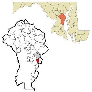
Linthicum is a census-designated place (CDP) and unincorporated community in Anne Arundel County, Maryland, United States. The population was 10,324 at the 2010 census. It is located directly north of Baltimore–Washington International Thurgood Marshall Airport (BWI).

<span class="mw-page-title-main">Maryland City, Maryland</span> Census-designated place in Maryland, United States

Maryland City is a census-designated place (CDP) in Anne Arundel County, Maryland, United States. The population was 16,093 at the 2010 census. It is located east of Laurel, just over the border with Prince George's County, and it has a Laurel ZIP Code. Maryland City mostly consists of an older, compact housing development and is adjacent to Fort Meade army base. A large newer development on the north side of Maryland Route 198 is known as Russett and is included within the Maryland City CDP.

<span class="mw-page-title-main">Mayo, Maryland</span> Census-designated place in Maryland, United States

Mayo is a census-designated place (CDP) in Anne Arundel County, Maryland, United States. The population was 8,298 at the 2010 census. The Mayo CDP of 2010 includes all of the area that used to be counted as the Selby-on-the-Bay CDP. The beach in Mayo used to be a popular weekend resort.

<span class="mw-page-title-main">Naval Academy, Maryland</span> Census-designated place in Maryland, United States

Naval Academy is a census-designated place (CDP) in Anne Arundel County, Maryland, United States, which covers the campus of the United States Naval Academy. The population was 4,802 at the 2010 census.

<span class="mw-page-title-main">Odenton, Maryland</span> Census-designated place in Maryland, U.S.

Odenton is a census-designated place (CDP) in Anne Arundel County, Maryland, United States, located approximately 10–20 minutes from the state capital, Annapolis. The population was 37,132 at the 2010 census, up from 20,534 at the 2000 census. The town's population growth rate of 80.8% between 2000 and 2010 was the greatest of any town in western Anne Arundel County. Odenton is located west of Annapolis, south of Baltimore, and northeast of Washington.

<span class="mw-page-title-main">Parole, Maryland</span> Census-designated place in Maryland, United States

Parole, a suburb of Annapolis, is a census-designated place (CDP) in Anne Arundel County, Maryland, United States. The population was 15,922 at the 2010 census. It is where several major roads intersect at the western edge of the state capital, Annapolis, and contains the Annapolis Mall, and a number of other large shopping centers, and the Anne Arundel Medical Center. It is generally considered to be part of Annapolis rather than a separate town. The neighborhood was named because it was a parole camp, where Union and Confederate prisoners of war were brought for mutual exchange and eventual return to their respective homes.

<span class="mw-page-title-main">Pasadena, Maryland</span> Census-designated place in Maryland, United States

Pasadena is a census-designated place (CDP) in Anne Arundel County, Maryland, United States. The population was 24,287 at the 2010 census.

<span class="mw-page-title-main">Pumphrey, Maryland</span> Unincorporated community in Maryland, United States

Pumphrey is an unincorporated community and former census-designated place (CDP) in Anne Arundel County, Maryland, United States. At the 2000 census, the population was 5,317. It was split between the Linthicum and Brooklyn Park CDPs for the 2010 census.

<span class="mw-page-title-main">Riva, Maryland</span> Census-designated place in Maryland, United States

Riva is a census-designated place (CDP) in Anne Arundel County, Maryland, United States. The population was 4,076 at the 2010 census. The area is scenic, especially where the two-lane Riva Road crosses the South River on a bridge. The area is growing with large new homes as the suburbs of Annapolis grow outward. Riva is bordered by Annapolis to the north, Edgewater to the east, and Davidsonville to the west.

<span class="mw-page-title-main">Severna Park, Maryland</span> Census-designated place in Maryland, United States

Severna Park is a census-designated place (CDP) in Anne Arundel County, Maryland, United States. Severna Park is part of the Baltimore-Washington Metropolitan Area, and is located approximately 8 miles (13 km) north of Annapolis, 17 miles (27 km) south of Baltimore and 39 miles (63 km) east of Washington, D.C. Severna Park's population was 39,933 at the 2020 census.

<span class="mw-page-title-main">Shady Side, Maryland</span> Census-designated place in Maryland, United States

Shady Side is a census-designated place (CDP) in Anne Arundel County, Maryland, United States. The population was 5,803 at the 2010 census.

<span class="mw-page-title-main">Owings, Maryland</span> Census-designated place in Maryland, United States

Owings is a town center and census-designated place (CDP) in northern Calvert County, Maryland, United States. The population was 2,149 at the 2010 census, up from 1,325 in 2000.

<span class="mw-page-title-main">Baltimore Highlands, Maryland</span> Census-designated place in Maryland, United States

Baltimore Highlands is a census-designated place (CDP) in Baltimore County, Maryland, United States, directly south of the city of Baltimore. The population was 7,019 at the 2010 census. At the 2000 census and earlier, the area was delineated as part of the Lansdowne-Baltimore Highlands CDP.

References

  1. Richardson, Hester Dorsey (1913). Side-lights on Maryland History: With Sketches of Early Maryland Families. Baltimore, Maryland: Williams and Wilkins Company. pp. 197–204.
  2. "About Us". Historic London Town and Gardens. Retrieved 21 March 2017.
  3. "Historic Area". Historic London Town and Gardens. Retrieved 21 March 2017.
  4. "Visit". Historic London Town and Gardens. Retrieved 21 March 2017.
  5. "Events". Historic London Town and Gardens. Retrieved 21 March 2017.
  6. "Historic London Town and Gardens: Annapolis' Premier Waterfront Venue" . Retrieved 21 March 2017.
  7. "U.S. Census website". United States Census Bureau . Retrieved 2008-01-31.