South Deering, Chicago

Last updated

South Deering
Community Area 51 - South Deering
Faded Box Cars.jpg
Boxcars in the area
US-IL-Chicago-CA51.svg
Location within the city of Chicago
Coordinates: 41°42.6′N87°33.6′W / 41.7100°N 87.5600°W / 41.7100; -87.5600
CountryUnited States
StateIllinois
County Cook
CityChicago
Neighborhoods
list
  • Jeffery Manor
  • Slag Valley
  • Irondale
  • Vet's Park
Area
  Total10.70 sq mi (27.71 km2)
Population
 (2020)
  Total14,105
  Density1,300/sq mi (510/km2)
Demographics 2020 [1]
   White 5.0%
  Black63.7%
  Hispanic31.0%
  Asian0.0%
  Other0.4%
Time zone UTC-6 (CST)
  Summer (DST) UTC-5 (CDT)
ZIP Codes
parts of 60617 and 60633
Median household income $35,056 [1]
Source: U.S. Census, Record Information Services

South Deering, located on Chicago's far South Side, is the largest of the 77 official community areas of that city. Primarily an industrial area, a small residential neighborhood exists in the northeast corner and Lake Calumet takes up a large portion of the area. 80% of the community area is zoned as industrial, natural wetlands, or parks. The remaining 20% is zoned for residential and small-scale commercial uses. It is part of the 10th Ward, once under the control of former Richard J. Daley ally Alderman Edward Vrdolyak.

Contents

The neighborhood is named for Charles Deering, an executive in the Deering Harvester Company that would later form a major part of International Harvester. International Harvester owned Wisconsin Steel, which was originally established in 1875 and was located along Torrence Avenue south of 106th Street to 109th Street. [2]

It is the location of Calumet Fisheries, a historic seafood restaurant that opened in 1928 and has been featured on Anthony Bourdain: No Reservations . The original Calumet Bakery store, a South Side favorite since 1935, is located at 2510 E 106th St, Chicago, IL 60617. It was also the location of the Wisconsin Steel Works, originally the Joseph H. Brown Iron and Steel Company, which opened in 1875 and closed in 1980. Since the closing of the steel mill, the neighborhood has remained economically depressed.

Louis Rosen documented the racial transition of this and nearby communities in his 1998 book The South Side: The Racial Transformation of an American Neighborhood. [3]

Neighborhoods

Irondale

The original settlement of South Deering was named "Irondale" before 1903, founded when the Joseph H. Brown Iron & Steel Company (later Wisconsin Steel) was established in 1875. Irondale was concentrated along and west of Torrence Avenue from 103rd Street to 109th. Large numbers of taverns were located along Torrence Avenue south of 106th Street to serve factory workers at the end of their shifts.

Aerial photographs from the 1930s show that the areas that would become Jeffrey Manor and Vet's Park were platted in the 1920s during the Chicago real estate boom, but it would not be until the 1950s that these plots would have homes constructed upon them due to the effects of the Great Depression. [4]

The Trumbull Park Homes were built in 1937–38 immediately west of the original settlement, [5] and were the site of major racial violence in July 1953 when the Chicago Housing Authority (CHA) accidentally gave permission to a black family to move into the segregated housing project (the applicant, Betty Howard, was an exceptionally light-skinned black woman). A police presence was maintained for nearly a year after, and in October 1953 the CHA gave further permission for 10 more black families to move into the project. Racial tensions continued, and black residents feared using the nearby park without police protection through 1963. [6]

Jeffery Manor

Jeffery Manor [7] is located between 95th Street on the north, Torrence Avenue on the east, 103rd Street on the south, and the Chicago and Western Indiana Railroad on the west. Construction began in 1947. When the steel mills operated, this area was predominantly Jewish, populated by World War II veterans purchasing their first house. The homes in this area are primarily duplexes, with bungalows and stand-alone two-storey homes around the edges.

The neighborhood of Jeffery Manor also includes another, smaller neighborhood, called Merrionette Manor. This sub-neighborhood is a unique break from the Chicago grid system, as the streets curve and form loops, giving a suburban feel in the heart of an otherwise urban, industrial neighborhood. [8]

Vet's Park

The area from 95th to 103rd and from Torrence Avenue to the Norfolk Southern railroad tracks is named "Vet's Park", as many of the houses were built immediately after World War Two to house returning soldiers who wanted to work in industry. [9]

Slag Valley

The area along S. Commercial Avenue between 104th and 100th Streets has been nicknamed "Slag Valley" by the locals for nearly 100 years, since large mounds of slag, petroleum coke, salt and other substances are left out in the open near homes and businesses. [10]

In 2013, community activists have fought to have the mounds removed, since the dust can damage the health of residents, and succeeded in having a city ordinance passed banning open-air storage of petcoke in 2015. The piles were removed in June 2016, but in 2017, the Environmental Protection Agency (EPA) warned residents of high levels of airborne manganese blowing over from the same areas that stored petcoke. Manganese can lead to a permanent neurological disorder known as manganism, the symptoms of which include tremors, difficulty walking, facial muscle spasms and mood changes. In children, manganese can affect brain development, including changes in behavior and decreases in learning and memory capacities. As of December 2017, the EPA and city of Chicago still investigating. [11]

History

Early history

South Deering was originally settled in the 1870s by workers from England, Wales, and Ireland who were attracted by the industrial jobs in nearby factories. As more industries were set up along the Calumet River, immigrants from eastern and southern Europe arrived, in addition to a small Mexican community which formed by the 1910s.

Major employers included Wisconsin Steel, Illinois Slag and Ballast Company, and the Federal Furnace Company, as well as U.S. Steel Southworks in nearby South Chicago and the Ford Assembly Plant in Hegewisch. Additionally, a large railroad marshalling yard has been present in the northwest part of the neighborhood since the 1870s.

20th century

The area prospered through World War One and the 1920s, but like other neighborhoods reliant on heavy industry, South Deering was devastated during the Great Depression. The decline in production led to mass unemployment, and by October 1933 some 20% of households were receiving relief from the city, state, or federal government.

South Deering's fortunes improved with the onset of World War II, as the mills and other factories operated around-the-clock, even on holidays, to produce the steel, food products, and armored vehicles necessary to win the war. The segregated Trumbull Park Homes, a public housing project, and the Jeffery Manor subdivision were constructed beginning in 1938 and 1947, respectively, and the population increased from 7,900 in 1930 to 18,900 by 1960. Starting in 1953, racial tensions worsened as the existing white residents violently opposed a handful of black residents who were seeking suburban-style homes close to the factories. White flight occurred in South Deering in the 1960s and 1970s, as white families began to move to suburbs such as Dolton, Riverdale, Burnham, Calumet City, South Holland, and Lansing, but it never reached the levels of other neighborhoods such as Roseland, South Chicago, and South Shore. [12]

While the Calumet River was industrialized by the Great Depression, Lake Calumet itself was left mostly untouched until the 1950s, when the city of Chicago and state of Illinois began to infill parts of the lake to construct the International Port of Illinois (1959) and large slips for more steel mills, chemical plants, and oil refineries.

However, the decline of heavy industry slammed South Deering in the 1970s and 1980s, as Wisconsin Steel (which employed over 3,000 workers during the 1960s) shuttered for good in 1980 and the nearby U.S. Steel Southworks laid off half of its workforce in the 1970s before also closing for good in 1992. The neighborhood has never recovered from these losses, and the population declined by nearly 20%. [13]

Modern day

Today, South Deering is a primarily black and Latino neighborhood, with some elderly white ethnic residents remaining. The average household income is 43% below the average for the city of Chicago as a whole, and about 25% of the population lives in poverty. Crime is somewhat higher than average, but South Deering has been spared the worst violence that has plagued nearby neighborhoods such as Pullman and South Chicago. The Insane King Cobras and Spanish Vice Lords were founded in this neighborhood in 1979 and 1980, respectively, though violent crime has significantly died down since the early 1990s. Petty crime does remain a problem, however. [14]

In recent years, many abandoned factories were demolished, leaving large tracts of polluted land behind. Community activists have fought to establish more natural parkland in the area, and have some former industrial sites designated as Superfund sites, citing the health hazards to residents, with varying degrees of success.

Demographics

According to a June 2017 analysis by the Chicago Metropolitan Agency for Planning, there were 15,305 people and 5,068 households in South Deering. The racial makeup of the area was 3.9% White, 65.1% African American, 0.1% Asian, 1.0% from other races. Hispanic or Latino of any race were 29.9% of the population. In the area, the population was spread out, with 28.8% under the age of 19, 19.1% from 20 to 34, 16.4% from 35 to 49, 19.6% from 50 to 64, and 15% who were 65 years of age or older. The median age was 37 years. [1]

Politics

South Deering overwhelmingly voted for the Democratic Party in the past two presidential elections. In the 2016 presidential election, South Deering cast 5,980 votes for Hillary Clinton and cast 486 votes for Donald Trump. [15] In the 2012 presidential election, South Deering cast 6,772 votes for Barack Obama and cast 462 votes for Mitt Romney. [16]

Transportation

South Deering is served by a number of CTA bus routes:

As part of the Red Line’s extension from the 95th/Dan Ryan terminal, South Deering will be served by the 130th station. It will be the terminal of the extended Red Line and serve the Riverdale and South Deering community areas. It will also serve near south suburban Dolton and Calumet City.

Religion

The Roman Catholic Archdiocese of Chicago operates Catholic churches. On July 1, 2020, Our Lady Gate of Heaven Church in Jeffery Manor, along with Our Lady of Peace, St. Bride, and St. Philip Neri in South Shore, will merge. [17]

Notable residents

Related Research Articles

<span class="mw-page-title-main">Washington Park (community area), Chicago</span> Community area in Chicago

Washington Park is a community area on the South Side of Chicago which includes the 372 acre (1.5 km2) park of the same name, stretching east-west from Cottage Grove Avenue to the Dan Ryan Expressway, and north-south from 51st Street to 63rd. It is home to the DuSable Museum of African American History. The park was the proposed site of the Olympic Stadium and the Olympic Aquatics Center in Chicago's bid to host the 2016 Summer Olympics.

<span class="mw-page-title-main">Albany Park, Chicago</span> Community area in Chicago

Albany Park is one of 77 well-defined community areas of Chicago. Located on the Northwest Side of the City of Chicago with the North Branch of the Chicago River forming its east and north boundaries, it includes the ethnically diverse Albany Park neighborhood, with one of the highest percentages of foreign-born residents of any Chicago neighborhood.

<span class="mw-page-title-main">Beverly, Chicago</span> Community area in Chicago

Beverly, officially Beverly Hills, is the 72nd of Chicago's 77 community areas. Located 12 miles (19 km) from the Loop, it is on the city's far south side. Beverly is considered part of the Blue Island Ridge, along with the nearby community areas of Morgan Park and Mount Greenwood, and Washington Heights, and the City of Blue Island. As of 2020, Beverly had 20,027 inhabitants.

<span class="mw-page-title-main">South Shore, Chicago</span> Community area in Chicago

South Shore is one of 77 defined community areas of Chicago, Illinois, United States. Located on the city's South Side, the area is named for its location along the city's southern lakefront. Although South Shore has seen a greater than 40% decrease in residents since Chicago's population peaked in the 1950s, the area remains one of the most densely populated neighborhoods on the South Side. The community benefits from its location along the waterfront, its accessibility to Lake Shore Drive, and its proximity to major institutions and attractions such as the University of Chicago, the Museum of Science and Industry, and Jackson Park.

<span class="mw-page-title-main">South Chicago, Chicago</span> Community area in Chicago

South Chicago, formerly known as Ainsworth, is one of the 77 community areas of Chicago, Illinois.

<span class="mw-page-title-main">Burnside, Chicago</span> Community area in Chicago

Burnside is one of the 77 community areas in Chicago. The 47th numbered area, it is located on the city's far south side. This area is also called "The Triangle" by locals, as it is bordered by railroad tracks on every side; the Canadian National Railway on the west, the Union Pacific Railroad on the south and the Norfolk Southern Railway on the east. With a population of 2,254 in 2016, it is the least populous of the community areas, as well as the second smallest by area after Oakland.

<span class="mw-page-title-main">Calumet Heights, Chicago</span> Community area in Chicago

Calumet Heights, located on the South Side of the city, is one of the 77 well defined community areas of Chicago, Illinois. Calumet Heights is bounded by 87th Street on the north, South Chicago Avenue on the east, and railroad lines on the west and south.

<span class="mw-page-title-main">Roseland, Chicago</span> Community area in Chicago

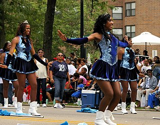
Roseland is one of the 77 official community areas of Chicago, Illinois, located on the far south side of the city. It includes the neighborhoods of Fernwood, Princeton Park, Lilydale, the southern portion of West Chesterfield, Rosemoor, Sheldon Heights and West Roseland.

<span class="mw-page-title-main">East Side, Chicago</span> Community area in Chicago

East Side is one of the 77 official community areas of Chicago, Illinois. It is on the far south side of the city, between the Calumet River and the Illinois-Indiana state line, 13 miles (21 km) south of downtown Chicago. The neighborhood has a park on Lake Michigan, Calumet Park, and a forest, Eggers Grove Forest Preserve. The forest preserve has hiking/walking trails, picnic grounds and birdwatching. It is served by U.S. Highway 12, U.S. Highway 20, and U.S. Highway 41.

<span class="mw-page-title-main">Riverdale, Chicago</span> Community area in Chicago

Riverdale is one of the 77 official community areas of Chicago, Illinois and is located on the city's far south side.

<span class="mw-page-title-main">Hegewisch, Chicago</span> Community area in Chicago

Hegewisch is one of the 77 community areas of Chicago, Illinois, located on the city's far south side. It is bordered by the neighborhoods of Riverdale and South Deering to the west, the East Side to the north, the village of Burnham to the south and the city of Hammond, Indiana to the east. The community area is named for Adolph Hegewisch, the president of U.S. Rolling Stock Company who hoped to establish "an ideal workingman's community" when he laid out the town along a rail line in 1883, six years before Chicago annexed the town.

<span class="mw-page-title-main">Washington Heights, Chicago</span> Community area in Chicago

Washington Heights is the 73rd of Chicago's 77 community areas. Located 12 miles (19 km) from the Loop, it is on the city's far south side. Washington Heights is considered part of the Blue Island Ridge, along with the nearby community areas of Beverly, Morgan Park and Mount Greenwood, and the village of Blue Island. It contains a neighborhood also known as Washington Heights, as well as the neighborhoods of Brainerd and Fernwood. As of 2017, Washington Heights had 27,453 inhabitants.

<span class="mw-page-title-main">95th/Dan Ryan station</span> Chicago "L" station

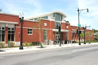
95th/Dan Ryan, announced as 95th, is an 'L' station in the median of the Dan Ryan Expressway and serving Chicago's Roseland neighborhood. It serves as the southern terminus of the Chicago Transit Authority's Red Line. This station was the system's thirteenth busiest in 2021. Trains take approximately 30 minutes to travel to the Loop, and 60 minutes to reach Howard.

<span class="mw-page-title-main">Lake Calumet</span>

Lake Calumet is the largest body of water within the city of Chicago. Formerly a shallow, postglacial lake draining into Lake Michigan, it was transformed into an industrial harbor during the 20th century. Parts of the lake have been dredged, and other parts reshaped by landfill. Following the completion of the Cal-Sag Channel in 1922, which reversed the flow of the Calumet River, the lake drains into the Des Plaines River via the channel instead of Lake Michigan.

<span class="mw-page-title-main">Illinois's 2nd congressional district</span> U.S. House district for Illinois

Illinois's 2nd congressional district is a congressional district in the U.S. state of Illinois. Based in the south suburbs of Chicago, the district includes southern Cook county, eastern Will county, and Kankakee county, as well as the city of Chicago's far southeast side.

<span class="mw-page-title-main">Stony Island Avenue</span> Major north-south street in Chicago, Illinois, U.S.

Stony Island Avenue is a major street on South Side of the city of Chicago, designated 1600 East in Chicago's street numbering system. It runs from 56th Street south to the Calumet River. Stony Island Avenue continues sporadically south of the Calumet in the southern suburbs, running alongside the Bishop Ford Freeway, sometimes as a frontage road. It terminates at County Line Road on the border of Will and Kankakee Counties.

<span class="mw-page-title-main">95th Street (Chicago)</span>

95th Street is a major east–west highway on Chicago's South Side, and in the southwest suburbs, is designated as 9500 South in Chicago's address system. 95th Street is 11 miles (18 km) south of Madison Street.

The Daily Calumet was a Chicago newspaper that existed from 1881 until 1987. It was at one time billed as "America's Oldest Daily Community Newspaper."

<span class="mw-page-title-main">Pill Hill, Chicago</span> Neighborhood in Calumet Heights, Chicago

Pill Hill is a neighborhood in the Calumet Heights community area on the South Side of Chicago, Illinois, United States.

Torrence Avenue is a major north–south street in the South Side of Chicago, as well as its southern suburbs. It marks 2628 East in the Chicago address system, being located slightly more than 3+14 miles (5.2 km) east of State Street. The road runs north from Richton Road in Crete to Steger Road at the Will–Cook county line in Sauk Village. From there, its northern segment begins just west of here. Torrence Avenue continues north, intersecting Interstate 80 (I-80) and I-94 in Lansing. From here, the road goes north until ending just south of 95th Street. The road carries Illinois Route 83 (IL 83) from Glenwood Dyer Road in Lynwood to Sibley Boulevard in Calumet City, as well as carrying US 6 from the Kingery Expressway to 159th Street.

References

  1. 1 2 3 "Community Data Snapshot - South Deering" (PDF). cmap.illinois.gov. MetroPulse. Retrieved December 3, 2017.
  2. "Southeast Side History - Slideshow" (PDF). Chicago State University. Retrieved October 26, 2018.
  3. Rosen, Louis (1998). The South Side : the racial transformation of an American neighborhood . Chicago: Ivan R. Dee. ISBN   1-56663-190-4.
  4. "Historic Aerials - 1938 aerials". NETROnline. Nationwide Environmental Title Research, LLC. Retrieved October 21, 2018.
  5. "South Deering". Encyclopedia of Chicago. Retrieved December 31, 2017.
  6. "Trumbull Park Homes Race Riots, 1953-1954". Encyclopedia of Chicago. Retrieved December 31, 2017.
  7. "Jeffery Manor neighborhood". The Field Museum. Retrieved September 11, 2012.
  8. "Jeffery Manor". The Chicago Neighborhoods. Retrieved December 31, 2017.
  9. "'Irondale' and 'Slag Valley?' Only on Chicago's Southeast Side". Times of Northwest Indiana. Retrieved December 31, 2017.
  10. "'Irondale' and 'Slag Valley?' Only on Chicago's Southeast Side". The Times of Northwest Indiana. Retrieved December 31, 2017.
  11. "Petcoke piles gone, but another dangerous pollutant discovered in the air". Chicago Tribune. Retrieved December 31, 2017.
  12. Dyja, Thomas (March 2014). The third coast : when Chicago built the American Dream. ISBN   978-0143125099.
  13. "South Deering". Encyclopedia of Chicago. Chicago History Museum. Retrieved December 30, 2017.
  14. "CRIME REPORTS IN SOUTH DEERING". Chicago Tribune. Chicago Tribune. Retrieved December 30, 2017.
  15. Ali, Tanveer (November 9, 2016). "How Every Chicago Neighborhood Voted In The 2016 Presidential Election". DNAInfo . Archived from the original on September 24, 2019. Retrieved October 4, 2019.
  16. Ali, Tanveer (November 9, 2012). "How Every Chicago Neighborhood Voted In The 2012 Presidential Election". DNAInfo . Archived from the original on February 3, 2019. Retrieved October 4, 2019.
  17. Anderson, Javonte (February 7, 2020). "23 Chicago-area Roman Catholic parishes to close, merge in latest round of restructuring". Chicago Tribune . Retrieved May 8, 2020.
  18. Conroy, John (February 4, 2005). "Tools of Torture". Chicago Reader . Retrieved December 25, 2017.
  19. "Gregory Mitchell Wins 7th Ward Election Over Incumbent Natashia Holmes". Archived from the original on October 24, 2016. Retrieved February 25, 2017.
  20. Zemaitis, G.J. (August 15, 1995). "Arrest For Trespassing Angers Chicago Activist". Chicago Tribune . Retrieved December 25, 2017.
  21. Noel, Josh (May 23, 2006). "Sherman Skolnick". Chicago Tribune . Retrieved March 8, 2014.