Near West Side, Chicago

Last updated

Near West Side
Community Area 28 - Near West Side
Near West Side.jpg
Fulton Market, West Loop
US-IL-Chicago-CA28.svg
Location within the city of Chicago
Coordinates: 41°52′48″N87°40′00″W / 41.88000°N 87.66667°W / 41.88000; -87.66667 [1]
CountryUnited States
StateIllinois
County Cook
CityChicago
Area
  Total5.75 sq mi (14.89 km2)
Elevation
[1]
594 ft (181 m)
Population
 (2020) [2]
  Total67,881
  Density12,000/sq mi (4,600/km2)
Demographics 2020 [2]
   White 43.6%
  Black24.2%
  Hispanic10.0%
  Asian18.5%
  Other3.7%
Educational Attainment 2020 [2]
  High School Diploma or Higher93.9%
  Bachelor's Degree or Higher69.6%
Time zone UTC-6 (CST)
  Summer (DST) UTC-5 (CDT)
ZIP Codes
parts of 60606, 60607, 60608, 60610, 60612 and 60661
Median household income (2020) [2] $93,202
Source: U.S. Census, Record Information Services

The Near West Side, one of the 77 community areas of Chicago, is on the West Side, west of the Chicago River and adjacent to the Loop. The Great Chicago Fire of 1871 started on the Near West Side. Waves of immigration shaped the history of the Near West Side of Chicago, including the founding of Hull House, a prominent settlement house. [3] In the 19th century railroads became prominent features. In the mid-20th century, the area saw the development of freeways centered in the Jane Byrne Interchange.

Contents

The area is home to the University of Illinois at Chicago (UIC), Chicago-Kent College of Law, and City Colleges' Malcolm X College. The United Center arena, the Illinois Medical District, Union Station, Ogilvie Station, and the Jane Byrne Interchange are also located in the community area.

Neighborhoods

West Loop

900 West Randolph in West Loop 20230704 900 West Randolph.jpg
900 West Randolph in West Loop

The West Loop lies along the western bank of the Chicago River. It generally includes the districts of Fulton River, Fulton Market, and Greektown. It is approximately bounded by Grand Avenue on the north, Ashland Avenue on the west, the Eisenhower Expressway on the south, and the Chicago River on the east. Popular restaurants line Randolph Street, including Girl and the Goat by Stephanie Izard, [4] and Leña Brava, founded by Rick Bayless who has since departed the establishment. [5] The area has experienced rapid gentrification. [6] A former manufacturing and warehousing area, many of the buildings have been converted to loft condominiums, restaurants, bars, and art galleries. Oprah Winfrey's Harpo Studios were located on Randolph Street; [7] the site is now the recently constructed corporate headquarters of McDonald's. [8] Soho House was one of the first boutique hotels in West Loop; Ace Hotels followed in 2017 but closed and re-branded. The Hoxton and Nobu Hotel and Restaurant later joined the neighborhood. Retailers in West Loop include Billy Reid, Lululemon, LoveSac, Free People, and Madewell.

Fulton River District and Fulton Market

Fulton-Randolph Market District Fulton Market, West Loop (47090474824).jpg
Fulton-Randolph Market District

The Fulton River District makes up the north east area of the Near West Side, on the Chicago River just west of the Loop. The related Fulton Market area extends west of the Kennedy Expressway as far as Union Park. The district is a former manufacturing and current transportation corridor turned mixed-use commercial and residential neighborhood. The neighborhood includes warehouses that have been converted to loft condominiums, new construction high rise condominiums and apartments, high rise and mid rise business offices, retail and restaurants. The Fulton River District is the home of the Ogilvie Transportation Center (formerly Chicago & North Western Station), a major commuter rail terminal. The neighborhood is known for the aroma of chocolate emanating from the Blommer Chocolate Company.

Greektown

Greektown is a restaurant and nightlife corridor along Halsted Street between Van Buren and Madison Streets. In the late 19th century Greek immigrants settled the area and competed with nearby Italians for business and jobs. [9]

The area previously bustled with Greek restaurants but has seen Greek influence decrease as inhabitants moved to Chicago suburbs. [10] [11] [12] Greektown is home to the National Hellenic Museum, the nation's leading museum dedicated to the significant cultural contributions of Greek people.

Oprah Winfrey's Harpo Studios was formerly in the Near West Side. Oprah new 3.JPG
Oprah Winfrey's Harpo Studios was formerly in the Near West Side.

Little Italy

The neighborhood between the Illinois Medical District and UIC's east campus is known as Little Italy. An Italian community developed in the late nineteenth century.

Italians never actually constituted a majority in the polyglot area, [13] but the neighborhood is still home to several Italian-American landmarks, such as the Shrine of Our Lady of Pompei and the National Italian American Sports Hall of Fame, as well as Italian-American social clubs. Taylor Street is home to the Italian restaurants Rosebud, Francesca's, Pompei and Al's No. 1 Italian Beef. There are other schools in this neighborhood. For example, Village Leadership Academy (VLA).

Part of the Italian-American population of the neighborhood was displaced in the 1960s and 70s by the construction of UIC's east campus. [14] The university is the source of the current name for the area.

The 1980 novel Paper Fish by Tina De Rosa takes place in this community. [15]

University Village/Maxwell Street

University Village is a neighborhood consisting of residential and retail properties. University Village, along with other major developments such as University Commons and University Station, is conveniently located near the University of Illinois at Chicago (UIC) campus, the medical district, and Maxwell Street.

The blocks around the intersection of Maxwell and Halsted Streets, the heart of University Village, once served as a weekly outdoor market. The area was also a center in the development of the Chicago Blues in the mid-twentieth century. The Market was moved twice in the 1990s and 2000s, and continues on Des Plaines Street. In the 2000s, UIC led a redevelopment of the area, which included new dormitories, parking garages, commercial buildings, and housing.

The borders are 16th Street to the south, the Dan Ryan Expressway to the east, Racine to the west, and Harrison Street to the north. Taylor Street is part of University Village.

South Water Market

Chicago's original produce market sat along the south side of the Chicago River, west of what is now Michigan Avenue. Incoming vessels could bring fruits and vegetables from the states located around the Great Lakes. This market became known as South Water Market because of its location. [16]

By the 1920s, the market was congested and overcrowded. The City of Chicago built new streets parallel to the Chicago River and moved the market to the neighborhood, alongside the St. Charles Air Line. The three-story buildings were originally designed by the architects Fugard & Knapp.

On July 10, 2003, the Chicago Planning Commission granted their approval on the sale of the produce market for a cost of approximately $36 million to Enterprise Companies of Chicago redevelop into retail and housing. [17]

Illinois Medical District

The Illinois Medical District is one of the largest medical districts in the United States, and the largest in the state. John H. Stroger Jr. Hospital of Cook County (formerly known as Cook County Hospital), one of the largest county-run hospitals in the U.S. and inspiration for the TV shows ER and The Fugitive , is located here. [18] The District had its start in the 1870s when Cook County Hospital, Rush Medical College, and the College of Physicians and Surgeons were established on the Near West Side following the great Chicago fire of 1871. The cornerstone for the Medical Center was the building of Cook County Hospital in 1876. In 1877, Rush Medical College erected a building next to County at Harrison and Wood. Presbyterian Hospital (affiliated with Rush) was built in 1883. The University of Illinois at Chicago's origins in the District can be traced to the College of Physicians and Surgeons, founded in 1881. In 1917, the State acquired the vacated West Side Park located at Polk and Wolcott for the University.

The district is also home to University of Illinois Medical Center, Rush University Medical Center, Rush University, University of Illinois College of Medicine, Illinois Eye and Ear Infirmary, UIC College of Dentistry, UIC College of Pharmacy, Jesse Brown VA, The Neuropsychiatric Institute, Ruth M. Rothstein CORE Center, Chicago Lighthouse, Illinois Forensic Science Center, West Side CDC, the Chicago Children's Advocacy Center, the Chicago office of the Federal Bureau of Investigation, the Cook County Juvenile Temporary Detention Center, Chicago Department of Public Health and the Cook County Medical Examiner's Office.

Tri-Taylor

The Tri-Taylor neighborhood lies directly west of the Illinois Medical District. The neighborhood area roughly resembles a triangle with Interstate 290, Ogden Avenue, and industrial railroad tracks west of Western Avenue as the borders. [19] The neighborhood is traditionally an extension of the Little Italy neighborhood to its east, although it has consistently been one of the most diverse neighborhoods in Chicago as it was situated on the borders of African American, Irish, Hispanic, and Italian areas. It is a residential area for students from UIC. The neighborhood is also home to the Chicago Technology Park research center as well as the West Side Center for Disease Control, the office for the Medical Examiner of Cook County, and Chicago Hope Academy (a private Christian high school that opened in the former St. Callistus School in 2005).

United Center area

The United Center opened its doors in 1994, replacing Chicago Stadium, which was located on the opposite side of Madison Street. The United Center is the home arena for the Chicago Bulls and Blackhawks, and also occasionally hosts concerts and other special events. The venue can seat between 20,000 and 25,000 people, depending on the event. A statue of Michael Jordan sits in front of the arena. The area around the United Center used to be known for its notoriously high crime rate and housing projects off Lake Street and Damen known as the Henry Horner Homes, also known as "the Hornetz nest".

Landmarks

Map depicting the landmarked Fulton-Randolph Market District (red), within the broader Fulton Market District (black) and its neighboring Fulton River District (green) Fulton Market District.jpg
Map depicting the landmarked Fulton-Randolph Market District (red), within the broader Fulton Market District (black) and its neighboring Fulton River District (green)

Designated Chicago Landmarks in the Near West Side include:

Politics

Local

In the Chicago City Council, the plurality of the area is within 27th ward, represented by Democrat Walter Burnett Jr., while substantial parts are located within the 25th and 28th wards, represented by Democrats Daniel Solis and Jason Ervin, and smaller parts are within the 11th and 42nd wards, represented by Democrats Patrick Daley Thompson and Brendan Reilly. [21]

State

In the Illinois Senate, the Near West Side is located almost entirely in the 5th Legislative District, represented by Democratic Senator Patricia Van Pelt. In the Illinois House of Representatives, it is located in the 9th House District and the 10th House District represented by Democratic Representatives Jawaharial Williams and Lakesia Collins. [22]

Small portions of the Near West Side are located in the 1st Legislative District, represented by Democratic Senator Antonio Munoz, the 3rd Legislative District, represented by Democratic Senator Mattie Hunter, the 2nd Representative District, represented by Theresa Mah, and the 6th Representative District, represented by Sonya Harper. [23] [24]

Federal

Almost all of the area is part of Illinois's 7th congressional district, the most Democratically leaning district in the State of Illinois according to the Cook Partisan Voting Index, with a score of D+38, represented by Democrat Danny K. Davis. The southeasternmost jog is part of Illinois's 4th congressional district, the second-most Democratically leaning district in the state, with a Cook score of D+33, represented by Democrat Luis Gutiérrez.

The Near West Side community area has supported the Democratic Party in the past two presidential elections. In the 2016 presidential election, the Near West Side cast 20,622 votes for Hillary Clinton and cast 3,094 votes for Donald Trump (82.68% to 12.40%). [25] In the 2012 presidential election, the Near West Side cast 18,068 votes for Barack Obama and cast 4,234 votes for Mitt Romney (79.51% to 18.63%). [26]

Government

Historical population
CensusPop.Note
1930 152,457
1940 136,518−10.5%
1950 160,36217.5%
1960 126,610−21.0%
1970 78,830−37.7%
1980 57,305−27.3%
1990 46,197−19.4%
2000 46,4190.5%
2010 54,88118.2%
2020 67,88123.7%
[2]

The United States Postal Service (USPS) operates the main Chicago Post Office at 433 West Harrison Street in the Near West Side. [27] [28] The post office is the only 24-hour post office in the United States. [29] USPS also operates the Nancy B. Jefferson Post Office at 116 South Western Avenue. [30]

The Federal Bureau of Investigation Chicago Field Office is at 2111 W. Roosevelt Road. [31]

Transportation

Private transportation

Interstates 290 and 90 both run through the Near West Side. Their interchange is a major transportation hub for the region. The southern and western boundaries of the area are defined by busy rail-road tracks. The St. Charles Air Line, at the area's southern edge is also a major passenger train route. [32]

Public transportation

A pre-WWI view of Marshfield, an "L" station that was once in the area. Marshfield.png
A pre-WWI view of Marshfield, an "L" station that was once in the area.

There are many bus routes in the area.

For rapid transit, the area is served by the Blue, Green, and Pink Lines on the Chicago "L". The Lake Street Elevated, the portion of the Green Line running through the area, has been in operation since 1893. [33] The Metropolitan West Side Elevated Railroad, another company that built the "L", opened several branches of rapid transit in the area in 1895 and 1896. [34] These branches included the Logan Square, Garfield Park, and Douglas Park branches, which all converged into the Metropolitan main line at Marshfield station in the area. [35] The Garfield Park branch and main line were replaced by the Congress Line in the 1950s, [36] which continues as part of the Blue Line. The Logan Square branch was replaced in revenue service by the Milwaukee-Dearborn subway in 1951, [36] but was retained for non-revenue linkage to the rest of the "L" system as the "Paulina Connector"; it was renovated in the 2000s and reactivated as part of the Pink Line in 2006. The Douglas Park branch was part of the Blue Line until it was joined with the Connector to become a part of the Pink Line.

Union and Ogilvie stations, major terminals for Metra and Amtrak trains, are on the eastern edge of the Near West Side. The Chicago Aurora and Elgin Railroad (AE&C), an interurban, used the Garfield Park branch and Metropolitan main line's tracks in the area to access downtown from 1905 to 1953; however, within Chicago it only boarded westbound passengers and alighted eastbound passengers lest it compete with the "L".

Economy

Orbitz has its headquarters in the Citigroup Center in the Near West Side. [37]

McDonald's moved its headquarters to West Loop in 2018. [38] [39]

PepsiCo's Chicago offices are in the Near West Side. [40] Aeroméxico operates the Chicago Downtown Location on the first floor at 954 West Washington Boulevard. [41]

The Consulate-General of Mexico in Chicago is located at 204 South Ashland Avenue. [42]

Previously, Trizec Properties's headquarters and Chicago-area offices were in 10 S. Riverside Plaza. [43]

Education

Colleges and universities

Primary and secondary schools

Chicago Public Schools (CPS) operates public schools. [44]

K-8 schools serving the Near West Side include W. Brown, Calhoun North, Dett, Herbert, Washington Irving, King, Mitchell, Otis, Plamondon, Skinner, and Smyth. [45]

Crane High School previously served as the zoned high school for the Near West Side. [46] CPS announced in 2012 that Crane was to be converted into a magnet school for medical sciences. [47] Whitney M. Young Magnet High School is also in the Near West Side.

Washington Irving School is located in Tri-Taylor. In the 2000–2001 school year, of the area children who attended CPS schools (the figure does not include those who attended private schools nor charter schools), 69% attended Irving. By the 2013–2014 school year this declined to 46%, and Linda Lutton of WBEZ stated that Irving "is largely ignored by the families who live here." [48] As of that school year, 80% of Irving students originated from outside of the school's attendance zone, and according to Lutton it was "a neighborhood school in name only." [48]

Moses Montefiore Academy, a CPS special school for at-risk youth, was located in the Near West Side.

Chicago Virtual Charter School, a public K-12 charter school, is also located in the Near West Side.

St. Ignatius College Prep is an elite Catholic high school located in the Near West Side.

Notable people

Related Research Articles

<span class="mw-page-title-main">Chicago Loop</span> Community area in Chicago

The Loop, one of Chicago's 77 designated community areas, is the central business district of the city and is the main section of Downtown Chicago. Home to Chicago's commercial core, it is the second largest commercial business district in North America and contains the headquarters and regional offices of several global and national businesses, retail establishments, restaurants, hotels, and theaters, as well as many of Chicago's most famous attractions. It is home to Chicago's City Hall, the seat of Cook County, and numerous offices of other levels of government and consulates of foreign nations. The intersection of State Street and Madison Street is the origin point for the address system on Chicago's street grid. Most of Grant Park's 319 acres (1.29 km2) are in the eastern section of the community area. The Loop community area is bounded on the north and west by the Chicago River, on the east by Lake Michigan, and on the south by Roosevelt Road.

<span class="mw-page-title-main">University of Illinois Chicago</span> Public university in Chicago, Illinois, U.S.

The University of Illinois Chicago (UIC) is a public research university in Chicago, Illinois, United States. Its campus is in the Near West Side community area, adjacent to the Chicago Loop. The second campus established under the University of Illinois system, UIC is also the largest university in the Chicago metropolitan area, having more than 33,000 students enrolled in 16 colleges. It is classified among "R1: Doctoral Universities – Very high research activity."

<span class="mw-page-title-main">Lake View, Chicago</span> Community area in Chicago

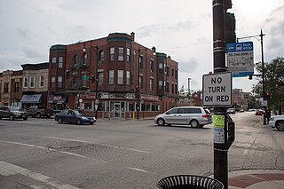
Lakeview, also spelled Lake View, is one of the 77 community areas of Chicago, Illinois. Lakeview is located in the city's North Side. It is bordered by West Diversey Parkway on the south, West Irving Park Road on the north, North Ravenswood Avenue on the west, and the shore of Lake Michigan on the east. The Uptown community area is to Lakeview's north, Lincoln Square to its northwest, North Center to its west, and Lincoln Park to its south. The 2020 population of Lakeview was 103,050 residents, making it the second-largest Chicago community area by population.

<span class="mw-page-title-main">Bridgeport, Chicago</span> Community area in Chicago, Illinois

Bridgeport is one of the 77 community areas in Chicago, on the city's South Side, bounded on the north by the South Branch of the Chicago River, on the west by Bubbly Creek, on the south by Pershing Road, and on the east by the Union Pacific railroad tracks. Neighboring communities are Pilsen across the river to the north, McKinley Park to the west, Canaryville to the south, and Armour Square to the east. Bridgeport has been the home of five Chicago mayors. Once known for its racial intolerance, Bridgeport today ranks as one of the city's most diverse neighborhoods.

<span class="mw-page-title-main">Norwood Park, Chicago</span> Community area in Chicago

Norwood Park is one of the 77 Chicago community areas. It encompasses the smaller neighborhoods of Big Oaks, Norwood Park East, Norwood Park West, Old Norwood Park, Oriole Park, and Union Ridge.

<span class="mw-page-title-main">Near North Side, Chicago</span> Community area in Chicago

The Near North Side is the eighth of Chicago's 77 community areas. It is the northernmost of the three areas that constitute central Chicago, the others being the Loop and the Near South Side. The community area is located north and east of the Chicago River. To its east is Lake Michigan, and its northern boundary is the early 19th-century city limit of Chicago, North Avenue. In 2020 the Near North Side had 105,481 residents, surpassing Lake View as the largest Chicago community area by population. It is also the most densely populated community area and has the second most skyscrapers, after the Loop. With the exception of Goose Island, the Near North Side is known for its extreme affluence, typified by the Gold Coast, Magnificent Mile, Navy Pier, and skyscrapers.

<span class="mw-page-title-main">Near South Side, Chicago</span> Community area in Chicago

The Near South Side is a community area of Chicago, Illinois, United States, just south of the downtown central business district, the Loop. The Near South Side's boundaries are as follows: North—Roosevelt Road ; South—26th Street; West—Chicago River between Roosevelt and 18th Street, Clark Street between 18th Street and Cermak Road, Federal between Cermak Road and the Stevenson Expressway just south of 25th Street, and Clark Street again between the Stevenson and 26th Street; and East—Lake Michigan.

<span class="mw-page-title-main">Brighton Park, Chicago</span> Community area in Chicago

Brighton Park is a community area located on the southwest side of Chicago, Illinois. It is number 58 of the 77 community areas of Chicago.

<span class="mw-page-title-main">Lower West Side, Chicago</span> Community area in Chicago, Illinois, United States

Lower West Side is a community area on the West Side of Chicago, Illinois, United States. It is three miles southwest of the Chicago Loop and its main neighborhood is Pilsen. The Heart of Chicago is a neighborhood in the southwest corner of the Lower West Side.

<span class="mw-page-title-main">Englewood, Chicago</span> Community area in Chicago

Englewood is a neighborhood and community area located on the South Side of Chicago, Illinois, United States. It is also the 68th of the 77 community areas in the city. At its peak population in 1960, over 97,000 people lived in its approximately 3 square miles (7.8 km2), but the neighborhood's population has since dropped dramatically. In 2000, it had a population of approximately 40,000 inhabitants, and the 2010 census indicated that its population has further declined to approximately 30,000. Englewood to the north, 75th Street to the south, Racine Avenue to the west, and an irregular border that wends along the Metra Railroad Tracks to the east. On the southwest side of Chicago lies West Englewood, which is generally lumped in with Englewood by Chicagoans. Englewood, a low-income African-American community, has a high rate of foreclosed properties due to its population drop.

<span class="mw-page-title-main">Riverdale, Chicago</span> Community area in Chicago

Riverdale is one of the 77 official community areas of Chicago, Illinois and is located on the city's far south side.

<span class="mw-page-title-main">Washington Heights, Chicago</span> Community area in Chicago

Washington Heights is the 73rd of Chicago's 77 community areas. Located 12 miles (19 km) from the Loop, it is on the city's far south side. Washington Heights is considered part of the Blue Island Ridge, along with the nearby community areas of Beverly, Morgan Park and Mount Greenwood, and the village of Blue Island. It contains a neighborhood also known as Washington Heights, as well as the neighborhoods of Brainerd and Fernwood. As of 2017, Washington Heights had 27,453 inhabitants.

<span class="mw-page-title-main">Greektown, Chicago</span> Neighborhood in Chicago

Greektown is a social and dining district, located on the Near West Side of the United States' city of Chicago, Illinois. Today, Greektown consists mostly of restaurants and businesses, although a cultural museum and an annual parade and festival still remain in the neighborhood.

<span class="mw-page-title-main">Little Italy, Chicago</span>

Little Italy, sometimes combined with University Village into one neighborhood, is on the Near West Side of Chicago, Illinois. The current boundaries of Little Italy are Ashland Avenue on the west and Interstate 90/94 on the east, the Eisenhower Expressway on the north and Roosevelt to the south. It lies between the east side of the University of Illinois at Chicago campus in the Illinois Medical District and the west side of the University of Illinois at Chicago campus. The community was once predominantly Italian immigrants but now is made up of diverse ethnic and socio-economic backgrounds as a result of immigration, urban renewal, gentrification and the growth of the resident student and faculty population of the University of Illinois at Chicago (UIC). Its Italian-American heritage is primarily evident in the Italian-American restaurants that once lined Taylor Street. The neighborhood is home to the National Italian American Sports Hall of Fame as well as the historic Roman Catholic churches Our Lady of Pompeii, Notre Dame de Chicago, and Holy Family.

<span class="mw-page-title-main">Maxwell Street Polish</span> Sausage from Chicago

A Maxwell Street Polish consists of a grilled or fried length of Polish sausage topped with grilled onions and yellow mustard and optional pickled whole, green sport peppers, served on a bun. The sandwich traces its origins to Chicago's Maxwell Street market, and has been called one of "the classic foods synonymous with Chicago".

<span class="mw-page-title-main">Halsted Street</span> Major north-south street in Chicago, Illinois, U.S.

Halsted Street is a major north-south street in the U.S. city of Chicago, Illinois.

<span class="mw-page-title-main">Maxwell Street</span> Human settlement in Chicago, Illinois, United States of America

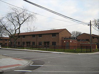
Maxwell Street is an east–west street in Chicago, Illinois, that intersects with Halsted Street just south of Roosevelt Road. It runs at 1330 South in the numbering system running from 500 West to 1126 West. The Maxwell Street neighborhood is considered part of the Near West Side and is one of the city's oldest residential districts. It is notable as the location of the celebrated Maxwell Street Market and the birthplace of Chicago blues and the "Maxwell Street Polish", a sausage sandwich. A large portion of the area is now part of the campus of the University of Illinois at Chicago (UIC) and a private housing development sponsored by the university.

<span class="mw-page-title-main">UIC–Halsted station</span> Chicago "L" station

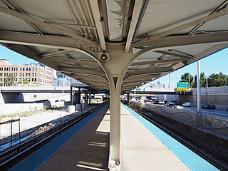
UIC–Halsted, is a Chicago "L" station on the CTA's Blue Line. The station serves the University of Illinois at Chicago, the University Village neighborhood, and the Greektown neighborhood all located in the Near West Side.

<span class="mw-page-title-main">Fulton River District, Chicago</span> Chicago neighborhood

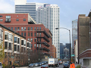
Fulton River District is a Chicago neighborhood located on the edge of Chicago's downtown, northwest of the Loop. The district is bounded by the Chicago River to the east, the Kennedy Expressway to the west, Ohio Street to the north and Madison Street to the south, making it part of the Near West Side and West Town community areas of Chicago in Cook County, Illinois, United States. Just across the expressway to the west is the Fulton Market District. Money magazine ranked the neighborhood as #4 best place to live in the United States in 2019.

<span class="mw-page-title-main">West Side, Chicago</span> District in Illinois, United States

The West Side is one of the three major sections of the city of Chicago, Illinois, U.S. The other two sections within Chicago that associate with the West Side are the North Side and the South Side. The West Side consists of communities that are of historical, cultural, and ideological importance to the history and development of Chicago. On the flag of Chicago, the West Side is represented by the central white stripe.

References

  1. 1 2 "Nearwest Side". Geographic Names Information System . United States Geological Survey, United States Department of the Interior. January 7, 1998.
  2. 1 2 3 4 5 "Community Data Snapshot - Near West Side" (PDF). cmap.illinois.gov. MetroPulse. Retrieved February 28, 2023.
  3. Taylor Street Archives
  4. Girl and the Goat
  5. Leña Brava
  6. Dizik, Alina. "Hot in Chicago: the West Loop Neighborhood". Wall Street Journal. ISSN   0099-9660 . Retrieved January 7, 2016.
  7. "End of an Era: Harpo Studios Signs Removed from West Loop Building". DNAinfo Chicago. Archived from the original on January 6, 2016. Retrieved January 7, 2016.
  8. RYAN ORI and PETER FROST, McDonald's moving HQ to Oprah's Harpo Studios site Crain’s Chicago Business , June 1, 2016
  9. "Greeks: Halsted Street". Maxwell and Halsted. University of Illinois, Chicago. Retrieved October 19, 2019.
  10. "Greeks". Encyclopedia of Chicago. Chicago History Museum. Retrieved January 12, 2013.
  11. "Can Greektown survive?". Crain's Chicago Business. November 16, 2018. Retrieved January 2, 2019.
  12. "Here Are Chicago's Top-Earning Restaurants (Gibsons Grossed $25M In 2016)". DNAinfo Chicago. Archived from the original on January 3, 2019. Retrieved January 2, 2019.
  13. "Little Italy".
  14. "Littly Italy, UIC". Explore Chicago. City of Chicago. Archived from the original on December 21, 2012. Retrieved January 12, 2013.
  15. Candeloro, Dominic. "Chicago's Italians: A Survey of the Ethnic Factor, 1850–1990." In: Jones, Peter d'Alroy and Melvin G. Holli. Ethnic Chicago: A Multicultural Portrait. Wm. B. Eerdmans Publishing, 1995. p. 229–259. ISBN   0802870538, 9780802870537. p. 231.
  16. "Retail Geography". Encyclopedia of Chicago. Chicago History Museum. Retrieved January 14, 2013.
  17. "S. Water Market to become residences". tribunedigital-chicagotribune. Retrieved October 8, 2016.
  18. "Juvenile Temporary Detention Center". CookCountyIL.gov. Retrieved June 20, 2017.
  19. "Tri-Taylor". Google Maps. Retrieved December 31, 2021.
  20. "Fulton-Randolph Market District Granted Formal Status as City Landmark". DNAinfo Chicago. Archived from the original on January 9, 2016. Retrieved January 8, 2016.
  21. "Aldermanic Wards for the City of Chicago" (PDF). CityOfChicago.org. City of Chicago. Archived from the original (PDF) on December 1, 2017. Retrieved September 12, 2018.
  22. "PA 97-0006 Legislative District 5" (PDF). May 18, 2011. Retrieved September 7, 2015.
  23. "PA 97-0006 Legislative District 1" (PDF). May 18, 2011. Retrieved September 7, 2015.
  24. "PA 97-0006 Legislative District 3" (PDF). May 18, 2011. Retrieved September 7, 2015.
  25. Ali, Tanveer (November 9, 2016). "How Every Chicago Neighborhood Voted In The 2016 Presidential Election". DNAInfo . Archived from the original on September 24, 2019. Retrieved October 4, 2019.
  26. Ali, Tanveer (November 9, 2012). "How Every Chicago Neighborhood Voted In The 2012 Presidential Election". DNAInfo . Archived from the original on February 3, 2019. Retrieved October 4, 2019.
  27. "Major Office Buildings". Chicago City and Neighborhood Guide. Retrieved April 17, 2009.
  28. "Richard Wright Immortalized on Postage". United States Postal Service. April 8, 2009. Archived from the original on April 12, 2009. Retrieved April 17, 2009.
  29. "New York City's main post office stops 24-hour service". Associated Press. Friday. April 17, 2009. Retrieved May 5, 2009.
  30. "Post Office Location - NANCY B JEFFERSON". United States Postal Service. Archived from the original on July 22, 2012. Retrieved April 17, 2009.
  31. "Chicago Division." Federal Bureau of Investigation. Retrieved on June 9, 2015. "2111 W. Roosevelt Road Chicago, IL 60608"
  32. Studenkov, Igor (January 18, 2012). "Train traffic along 16th Street to decrease, but timeline unclear". Chicago Journal. Archived from the original on September 23, 2015. Retrieved January 12, 2013.
  33. Moffat 1995, p. 62.
  34. Moffat 1995, pp. 130–131.
  35. 1895 Review, p. 264
  36. 1 2 Public Information Department (1967). Congress Rapid Transit. Chicago: Chicago Transit Authority via Internet Archive.
  37. "Orbitz Worldwide, Inc. (NYSE: OWW)." Forbes. Retrieved on September 27, 2011. "Orbitz Worldwide 500 West Madison Avenue Suite 1000 Chicago, IL 60661 "
  38. Tribune, Chicago. "McDonald's future Near West Side neighbors air parking, traffic safety beefs". chicagotribune.com. Retrieved August 7, 2016.
  39. Hufford, Austen (June 14, 2016). "McDonald's to Move Headquarters to Downtown Chicago". Wall Street Journal. Retrieved August 7, 2016.
  40. "PepsiCo Contacts Archived 2009-12-23 at the Wayback Machine ." PepsiCo. Retrieved on December 23, 2009.
  41. "Illinois - Ticket Offices". Aeroméxico. Archived from the original on January 7, 2009. Retrieved January 28, 2009.
  42. "Home Page". Consulate-General of Mexico in Chicago . Retrieved January 31, 2009.
  43. "Contact Us" (Archive). Trizec Properties. April 11, 2003. Retrieved on March 8, 2014. "Corporate Headquarters Trizec Properties, Inc. 10 S. Riverside Plaza, Suite 1100 Chicago, IL 60606"
  44. "Near West Side" (map). City of Chicago. Retrieved on December 25, 2016.
  45. "Near North/West/Central Elementary Schools Archived June 12, 2009, at the Wayback Machine " (Archive). Chicago Public Schools. May 17, 2013. Retrieved on May 25, 2015.
  46. "West/Central/South High Schools" (). Chicago Public Schools. May 17, 2013. Retrieved on May 25, 2015.
  47. Monica Staton. "CPS changes mind on Crane, wants health sciences school". Gazette Chicago . April 5, 2012. Retrieved on July 6, 2012.
  48. 1 2 Lutton, Linda (August 6, 2014). "More Chicago Kids Say 'No' To Their Neighborhood Grammar School". WBEZ . Retrieved December 25, 2016.
  49. "Mrs. Frank J. Armstrong Entertains Delightfully". Chicago Defender . May 16, 1931 via ProQuest.
  50. "J.F. Armstrong, Doctor, Slain: Irate Local Medics Post $1,000 Reward". Chicago Defender . November 9, 1946 via ProQuest.
  51. "Race Has Eighty-One Licensed Aircraft Pilots: Chicago Leads with 15". Chicago Defender . February 4, 1939. p. 2.
  52. Luft, Kerry; Jacquelyn Heard (March 12, 1989). "Joseph Ferriola, Chicago mob figure, dies at 61". Chicago Tribune . p. 1.
  53. 1 2 3 4 5 6 7 Bear, Marjorie Warvelle (2007). Bennett, Marjorie Harbaugh (ed.). A Mile Square of Chicago. Oak Brook, Illinois: TIPRAC. ISBN   978-0-9633995-4-0 . Retrieved June 30, 2020.
  54. 1 2 Marquis, Albert Nelson, ed. (1911). The Book of Chicagoans: A Biographical Dictionary of Leading Living Men of the City of Chicago, 1911. A.N. Marquis. page 277
  55. Staff Report (August 8, 1948). "20 Streets in New City To Be Named for Men in War II". Chicago Tribune via ProQuest.
  56. Staff (February 4, 2020). "The one where David Schwimmer sells his Near West Side loft". The Real Deal . Retrieved June 30, 2020.

Works cited