West Pullman, Chicago

Last updated

West Pullman
Community Area 53 - West Pullman
US-IL-Chicago-CA53.svg
Location within the city of Chicago
Coordinates: 41°40.8′N87°37.8′W / 41.6800°N 87.6300°W / 41.6800; -87.6300
CountryUnited States
StateIllinois
County Cook
CityChicago
Neighborhoods
list
  • West Pullman
Area
  Total3.58 sq mi (9.27 km2)
Population
 (2020)
  Total26,104
  Density7,300/sq mi (2,800/km2)
Demographics 2015 [1]
   White 1.00%
  Black93.39%
  Hispanic4.83%
  Asian0.24%
  Other0.54%
Time zone UTC−6 (CST)
  Summer (DST) UTC−5 (CDT)
ZIP Codes
parts of 60628 and 60643
Median income $33,898 [1]
Source: U.S. Census, Record Information Services

West Pullman is a neighborhood located on the far south side of the city of Chicago, Illinois. It is one of the 77 official community areas of Chicago. The Neighborhood of West Pullman was largely inhabited by workers of the Pullman Train Company who were looking to escape the grip of the company town Pullman. The commercial corridor of Kensington/115th Street was one of many Italian communities within Chicago.

Contents

It is bounded on the north by 115th Street, on the east by the former Illinois Central Railroad, on the south by the Calumet River and Riverdale, on the west by Calumet Park, Blue Island and Ashland Avenue.

Demographics

West Pullman School West Pullman School postcard.jpg
West Pullman School

According to a June 2017 analysis by the Chicago Metropolitan Agency for Planning, there were 27,982 people and 9,058 households in West Pullman. From 2000 to 2015, the area lost more than 20% of its residents. The racial makeup of the area was 1% White, 93.39% African American, 0.24% Asian, 0.54% from other races. Residents who identify as Hispanic or Latino of any race were 4.83% of the population. The age distribution was 29.7% under the age of 19, 19.3% from 20 to 34, 17.7% from 35 to 49, 18.5% from 50 to 64, and 14.8% 65 or older. The median age was 35 years. [1]

Economy

The median income is $33,898.

West Pullman residents were victimized by predatory lenders during the 1970s. In the 1980s, West Pullman residents lost both industrial and professional jobs making unemployment an extra hurdle for the community. Habitat for Humanity has built and is continuing to build homes in the community of West Pullman. The residents are working hard to turn their economy around.

West Pullman recently overcame the industrial legacy of toxic waste with the help of the EPA. There is now a community garden in place of the former "toxic zone." [2]

West Pullman is also home to the largest urban photovoltaic solar plant in the United States. The 10 MW plant utilizes 32,800 SunPower solar panels, spans 39 acres (160,000 m2), and generates enough power to supply energy to approximately 1500 homes in the Midwest. It is owned and operated by Exelon and came online in early 2010. [3]

History

St. Salomea - Erected in 1913 at 118th St. and Indiana Ave. St. Salomea Church.jpg
St. Salomea - Erected in 1913 at 118th St. and Indiana Ave.
St. Anthony Catholic Church Erected in 1903 - "Old Italian Community of Kensigton." St.-Anthony.jpg
St. Anthony Catholic Church Erected in 1903 - "Old Italian Community of Kensigton."
St. Catherine of Genoa Erected in 1893 - W 118th and S. Lowe St. Catherine of Genoa.jpg
St. Catherine of Genoa Erected in 1893 - W 118th and S. Lowe

After the expulsion of the Potawatomi as part of the 1833 Treaty of Chicago, the area that is now West Pullman was settled by westbound settlers. In the 1880s, real estate speculators created the West Pullman Land Association to develop land between Wentworth and Ashland Avenues. The Association was successful in industrial development, and later residential development before the Panic of 1893, the Pullman Strike of 1894 dealt an economic blow that resulted in bankruptcy. [4]

The University of Chicago sociologists created the West Pullman community area in the 1920s. They did this by merging several existing communities. The first of these communities was Kensington which grew alongside the town Pullman. The second of these communities was the former village of Gano. The area of Gano was populated by Pullman workers who desired to own their own homes and escape from the corporate control of George Pullman's company town. West Pullman was launched as an industrial and residential subdivision in 1891 by the West Pullman Land Association. West Pullman was the largest of the identifiable communities in the nation where a type of fusion between residential and factory life existed in the same space.

Parks

West Pullman Park [5] - Indoor Pool

Kensington Park [6] - Basketball Court with Seating. Playground equipment.

Major Taylor Trail Bridge Over the River Crossing from West Pullman to Riverdale. West Pullman Major Taylor Mural .jpg
Major Taylor Trail Bridge Over the River Crossing from West Pullman to Riverdale.

Major Taylor Trail [7] - 6 Miles

Gano Park

Morgan Field Park

Cooper Park (Jack Leroy)

Sports / Community Facilities

Salvation Army Ray & Joan Kroc Community Center Corps [8]

Lion's Field Kroc Community Center

Healthcare

According to the Pritzker School of Medicine, fourteen percent (14%) of the West Pullman population is uninsured, though ninety-two percent (92%) report having a consistent primary care provider. The obesity rate is fifty-three percent (53%). [9]

Politics

West Pullman is a stronghold of the Democratic Party. In the 2016 presidential election, West Pullman cast 12,473 votes for Hillary Clinton and cast 217 votes Donald Trump. It was Clinton's 11th largest margin of victory in the 76 community areas she won. [10] In the 2012 presidential election, West Pullman cast 14,496 votes for Barack Obama and 86 votes for Mitt Romney. It was Obama's 8th largest margin of victory in the 76 community areas he won. [11]

At the local level, West Pullman is located in Chicago's 9th and 34th wards represented by Democrats Anthony Beale and Carrie Austin respectively. [12] [13]

Transportation

West Pullman is home to four stations on the Metra Electric District's Blue Island branch; Racine, State Street, Stewart Ridge, and West Pullman. [14] Red Ahead, a program to extend the Red Line south to 130th Street, would result in a new station at Michigan Avenue in West Pullman. In 2020, it was estimated that this project would begin construction in 2025 and would be completed in 2029. [15]

Improvement Projects

Habitat For Humanity is interjecting single-family homes throughout the neighborhood for improvement.

Cottage Grove Ave is being extended Southbound from E 115th St. to E 130th St. with light and visual improvements.

E 115th St. and S. Cottage Grove Ave will see train station improvements along with retail improvements.

Notable people

Related Research Articles

<span class="mw-page-title-main">Chicago Loop</span> Community area in Chicago

The Loop, one of Chicago's 77 designated community areas, is the central business district of the city and is the main section of Downtown Chicago. Home to Chicago's commercial core, it is the second largest commercial business district in North America and contains the headquarters and regional offices of several global and national businesses, retail establishments, restaurants, hotels, and theaters, as well as many of Chicago's most famous attractions. It is home to Chicago's City Hall, the seat of Cook County, and numerous offices of other levels of government and consulates of foreign nations. The intersection of State Street and Madison Street, located in the area, is the origin of the address system of Chicago's street grid. Most of Grant Park's 319 acres (1.29 km2) are in the eastern section of the community area. The Loop community area is bounded on the north and west by the Chicago River, on the east by Lake Michigan, and on the south by Roosevelt Road.

<span class="mw-page-title-main">Pullman, Chicago</span> Community area in Chicago

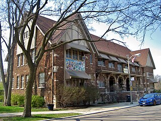
Pullman, one of Chicago's 77 defined community areas, is a neighborhood located on the city's South Side. Twelve miles from the Chicago Loop, Pullman is situated adjacent to Lake Calumet.

<span class="mw-page-title-main">Rogers Park, Chicago</span> Community area in the United States

Rogers Park is the first of Chicago's 77 community areas. Located 9 miles (14 km) from the Loop, it is on the city's far north side on the shore of Lake Michigan. The neighborhood is commonly known for its cultural diversity, lush green public spaces, early 20th century architecture, live theater, unique bars/restaurants, beaches, and progressive mindset. It is bounded by the city of Evanston along Juneway Terrace and Howard Street to the north, Ridge Boulevard to the west, Devon Avenue and the Edgewater neighborhood to the south, and Lake Michigan to the east. The neighborhood just to the west, West Ridge, was part of Rogers Park until the 1890s and is still commonly referred to as West Rogers Park.

<span class="mw-page-title-main">Norwood Park, Chicago</span> Community area in Chicago

Norwood Park is one of the 77 Chicago community areas. It encompasses the smaller neighborhoods of Big Oaks, Norwood Park East, Norwood Park West, Old Norwood Park, Oriole Park, and Union Ridge.

<span class="mw-page-title-main">Albany Park, Chicago</span> Community area in Chicago

Albany Park is one of 77 well-defined community areas of Chicago. Located on the Northwest Side of the City of Chicago with the North Branch of the Chicago River forming its east and north boundaries, it includes the ethnically diverse Albany Park neighborhood, with one of the highest percentages of foreign-born residents of any Chicago neighborhood.

<span class="mw-page-title-main">Hermosa, Chicago</span> Community area in Chicago

Hermosa is one of 77 designated Chicago community areas and is located on the northwest side of Chicago, Illinois. The Hermosa community area contains the Kelvyn Park and Hermosa neighborhoods. The area includes the birthplace of Walt Disney and is the former headquarters of the Schwinn Bicycle Company. While being one of the smaller community areas, Hermosa is one of the city's most densely populated neighborhoods.

<span class="mw-page-title-main">Armour Square, Chicago</span> Community area in Illinois, United States

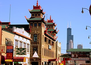
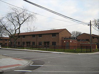
Armour Square is a Chicago neighborhood on the city's South Side, as well as a larger, officially defined community area, which also includes Chinatown and the CHA Wentworth Gardens housing project. Armour Square is bordered by Bridgeport to the west, Pilsen to the northwest, Douglas and Grand Boulevard to the east and southeast, and with the Near South Side bordering the area to the north, and Fuller Park bordering its southernmost boundary, along Pershing Road.

<span class="mw-page-title-main">Ashburn, Chicago</span> Community area in Chicago

Ashburn, one of Chicago's 77 community areas, is located on the south side of the city. Greater Ashburn covers nearly five square miles. The approximate boundaries of Ashburn are 72nd Street (north), Western Avenue (east), 87th Street (south) and Cicero Avenue (west).

<span class="mw-page-title-main">West Ridge, Chicago</span> Community area in Chicago

West Ridge is one of 77 Chicago community areas. It is a middle-class neighborhood located on the far North Side of the City of Chicago. It is located in the 50th ward and the 40th ward. Also historically called North Town, and frequently referred to as West Rogers Park, it is bordered on the north by Howard Street, on the east by Ridge Boulevard, Western Avenue, and Ravenswood Avenue, the south by Bryn Mawr Avenue and Peterson Avenue, and on the west by Kedzie Avenue and the North Shore channel of the Chicago River. At one time joined with neighboring Rogers Park, it seceded to become its own village in 1890 over a conflict concerning park districts. West Ridge was annexed to Chicago on April 4, 1893, along with Rogers Park.

<span class="mw-page-title-main">Douglas, Chicago</span> Community area in Illinois, United States

Douglas, on the South Side of Chicago, Illinois, is one of Chicago's 77 community areas. The neighborhood is named for Stephen A. Douglas, Illinois politician and Abraham Lincoln's political foe, whose estate included a tract of land given to the federal government. This tract later was developed for use as the Civil War Union training and prison camp, Camp Douglas, located in what is now the eastern portion of the Douglas neighborhood. Douglas gave that part of his estate at Cottage Grove and 35th to the Old University of Chicago. The Chicago 2016 Olympic bid planned for the Olympic Village to be constructed on a 37-acre (15 ha) truck parking lot, south of McCormick Place, that is mostly in the Douglas community area and partly in the Near South Side.

<span class="mw-page-title-main">Chatham, Chicago</span> Community area in Chicago

Chatham is one of the 77 community areas of the city of Chicago, Illinois. It is located on the city's South Side. It includes the neighborhoods of Chatham-Avalon, Chatham Club, Chesterfield, East Chatham, West Chatham and the northern portion of West Chesterfield. Its residents are predominantly African American, and it is home to former Senator Roland Burris. Housing many city employees and other officials, Chatham has been a central area for Chicago's middle-class African Americans since the late 1950s.

<span class="mw-page-title-main">South Chicago, Chicago</span> Community area in Chicago

South Chicago, formerly known as Ainsworth, is one of the 77 community areas of Chicago, Illinois.

<span class="mw-page-title-main">Burnside, Chicago</span> Community area in Chicago

Burnside is one of the 77 community areas in Chicago. The 47th numbered area, it is located on the city's far south side. This area is also called "The Triangle" by locals, as it is bordered by railroad tracks on every side; the Canadian National Railway on the west, the Union Pacific Railroad on the south and the Norfolk Southern Railway on the east. With a population of 2,254 in 2016, it is the least populous of the community areas, as well as the second smallest by area after Oakland.

<span class="mw-page-title-main">Calumet Heights, Chicago</span> Community area in Chicago

Calumet Heights, located on the South Side of the city, is one of the 77 well defined community areas of Chicago, Illinois. Calumet Heights is bounded by 87th Street on the north, South Chicago Avenue on the east, and railroad lines on the west and south.

<span class="mw-page-title-main">Roseland, Chicago</span> Community area in Chicago

Roseland is one of the 77 official community areas of Chicago, Illinois, located on the far south side of the city. It includes the neighborhoods of Fernwood, Princeton Park, Lilydale, the southern portion of West Chesterfield, Rosemoor, Sheldon Heights and West Roseland.

<span class="mw-page-title-main">South Deering, Chicago</span> Community area in Chicago

South Deering, located on Chicago's far South Side, is the largest of the 77 official community areas of that city. Primarily an industrial area, a small residential neighborhood exists in the northeast corner and Lake Calumet takes up a large portion of the area. 80% of the community area is zoned as industrial, natural wetlands, or parks. The remaining 20% is zoned for residential and small-scale commercial uses. It is part of the 10th Ward, once under the control of former Richard J. Daley ally Alderman Edward Vrdolyak.

<span class="mw-page-title-main">East Side, Chicago</span> Community area in Chicago

East Side is one of the 77 official community areas of Chicago, Illinois. It is on the far south side of the city, between the Calumet River and the Illinois-Indiana state line, 13 miles (21 km) south of downtown Chicago. The neighborhood has a park on Lake Michigan, Calumet Park, and a forest, Eggers Grove Forest Preserve. The forest preserve has hiking/walking trails, picnic grounds and birdwatching. It is served by U.S. Highway 12, U.S. Highway 20, and U.S. Highway 41.

<span class="mw-page-title-main">Riverdale, Chicago</span> Community area in Chicago

Riverdale is one of the 77 official community areas of Chicago, Illinois and is located on the city's far south side.

<span class="mw-page-title-main">Hegewisch, Chicago</span> Community area in Chicago

Hegewisch is one of the 77 community areas of Chicago, Illinois, located on the city's far south side. It is bordered by the neighborhoods of Riverdale and South Deering to the west, the East Side to the north, the village of Burnham to the south and the city of Hammond, Indiana to the east. The community area is named for Adolph Hegewisch, the president of U.S. Rolling Stock Company who hoped to establish "an ideal workingman's community" when he laid out the town along a rail line in 1883, six years before Chicago annexed the town.

<span class="mw-page-title-main">Kensington/115th Street station</span>

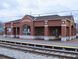
Kensington/115th Street is a commuter rail station on the far south side of Chicago that serves the Metra Electric Line north to Millennium Station and south to University Park and Blue Island. The station is located at 115th Street and Cottage Grove Avenue in the Pullman & West Pullman, Chicago neighborhoods. It is the last station for Blue Island Branch trains before those split off of the main line for Blue Island. As of 2018, the station is the 37th busiest of Metra's 236 non-downtown stations, with an average of 1,136 weekday boardings. The South Shore Line diverges to Indiana immediately south of this station. It had previously stopped at this station prior to February 15, 2012, with the reconfiguration of the junction to minimize congestion.

References

  1. 1 2 3 "Community Data Snapshot - West Pullman" (PDF). cmap.illinois.gov. MetroPulse. Retrieved December 4, 2017.
  2. "Pullman Residents Turn Former Toxic Waste Site Into Community Garden". DNAinfo Chicago. Retrieved July 2, 2020.
  3. Chicago Exelon City Solar Plant
  4. Zangs, Mary (2014). The Chicago 77: A Community Area Handbook. Charleston, South Carolina: Arcadia Publishing. pp. 276–279. ISBN   9781625851468 . Retrieved January 6, 2021.
  5. "West Pullman Park | Chicago Park District". www.chicagoparkdistrict.com. Retrieved September 21, 2020.
  6. "Kensington Park | Chicago Park District". www.chicagoparkdistrict.com. Retrieved September 21, 2020.
  7. "Major Taylor Trail | Illinois Trails | TrailLink". www.traillink.com. Retrieved September 21, 2020.
  8. "Kroc Center Chicago | Let Your Kroc Adventure Begin". www.kroccenterchicago.com. Retrieved January 26, 2021.
  9. "Community Profile: West Pullman" (PDF). Pritzker School of Medicine . Retrieved April 12, 2020.
  10. Ali, Tanveer (November 9, 2016). "How Every Chicago Neighborhood Voted In The 2016 Presidential Election". Chicago, Illinois: DNAinfo.com. Archived from the original on March 17, 2017. Retrieved March 16, 2017.
  11. Ali, Tanveer (November 7, 2012). "How Every Chicago Neighborhood Voted In The 2012 Presidential Election". Chicago, Illinois: DNAinfo.com. Archived from the original on March 17, 2017. Retrieved March 16, 2017.
  12. Connolly, Colleen (February 6, 2015). "Get to Know Your Ward: 9th Ward". Ward Room. WMAQ-TV . Retrieved December 25, 2017.
  13. Connolly, Colleen (February 6, 2015). "Get to Know Your Ward: 34th Ward". Ward Room. WMAQ-TV . Retrieved December 25, 2017.
  14. Lane, Laura (January 19, 2014). "Map: South Shore Line, Metra Electric Line". The Times of Northwest Indiana . Archived from the original on June 11, 2020. Retrieved June 11, 2020.
  15. "CTA Wins Federal Approval for Next Phase of Red Line Extension; Construction Could Start in 2025".
  16. Clements, Bill (May 2005). "Chicago's Most Feared Attorney". Illinois Super Lawyers. Eagan, Minnesota. Archived from the original on October 5, 2022. Retrieved September 4, 2017.
  17. Strom, Roy (December 1, 2012). "Chicago Lawyer's 2012 Person of the Year: Robert A. Clifford". Chicago Lawyer Magazine. Retrieved January 8, 2022.
  18. Illinois Blue Book 1959-1960. p. 94. Retrieved March 23, 2023.
  19. Illinois Blue Book 1965-1966 page 164