Municipalities of Vermont | |
---|---|
Category | Municipality |
Location | State of Vermont |
Found in | County |
Created |
|
Number | 247 |
Populations | 70 (Victory) – 44,743 (Burlington) |
Areas | 1.5 square miles (3.9 km2) (Winooski) – 73.8 square miles (191 km2) ( data-sort-value="Chittenden" |Chittenden) |
Government | |
Subdivisions |
The U.S. state of Vermont is divided into 247 municipalities, including 237 towns and 10 cities. Vermont also has 9 unincorporated areas, split between 5 unincorporated towns and 4 gores. As of 2024, Vermont has 30 incorporated villages, which are municipal governments operating within a town and providing additional services.
Cities in Vermont are municipalities with the city form of government. Vermont has ten cities with a combined area of 80.2 sq mi (208 km2), or 0.8% of the state's total area.[ citation needed ]
According to the 2020 census, 119,299 people, or 18.54% of the state's population, resided in Vermont's cities (excluding Essex Junction, which incorporated in 2022). Six of Vermont's 14 counties have at least one city within their borders. Five cities serve as the county seats for their respective counties and are indicated below with an asterisk (*).
Towns in Vermont are municipalities that typically incorporate the town meeting format into their government
In some cases, a town and city have the same name, such as Barre City which is almost entirely surrounded by the separate municipality of Barre Town.
Municipality | Type | County | Population (2020) [1] | Land area | Year incorporated |
---|---|---|---|---|---|
Burlington | City | Chittenden (seat) | 44,743 | 15.49 sq mi (40.1 km2) | 1864 |
South Burlington | City | Chittenden | 20,292 | 29.58 sq mi (76.6 km2) | 1971 |
Colchester | Town | Chittenden | 17,524 | 58.57 sq mi (151.7 km2) | |
Rutland | City | Rutland (seat) | 15,807 | 7.68 sq mi (19.9 km2) | 1892 |
Bennington | Town | Bennington (seat) | 15,333 | 42.50 sq mi (110.1 km2) | |
Brattleboro | Town | Windham | 12,184 | 32.41 sq mi (83.9 km2) | |
Essex | Town | Chittenden | 11,540 | 39.32 sq mi (101.8 km2) | |
Milton | Town | Chittenden | 10,723 | 60.89 sq mi (157.7 km2) | |
Hartford | Town | Windsor | 10,686 | 45.88 sq mi (118.8 km2) | |
Essex Junction | City | Chittenden | 10,590 | 4.74 sq mi (12.3 km2) | 2022 |
Williston | Town | Chittenden | 10,103 | 30.58 sq mi (79.2 km2) | |
Middlebury | Town | Addison (seat) | 9,152 | 39.22 sq mi (101.6 km2) | |
Springfield | Town | Windsor | 9,062 | 49.44 sq mi (128.0 km2) | |
Barre | City | Washington | 8,491 | 3.98 sq mi (10.3 km2) | 1895 |
Montpelier | City (capital) | Washington (seat) | 8,074 | 10.25 sq mi (26.5 km2) | 1895 |
Winooski | City | Chittenden | 7,997 | 1.51 sq mi (3.9 km2) | 1921 |
Barre | Town | Washington | 7,923 | 30.72 sq mi (79.6 km2) | |
Shelburne | Town | Chittenden | 7,717 | 45.07 sq mi (116.7 km2) | |
St. Johnsbury | Town | Caledonia (seat) | 7,364 | 36.74 sq mi (95.2 km2) | |
St. Albans | Town | Franklin | 6,988 | 60.53 sq mi (156.8 km2) | |
St. Albans | City | Franklin (seat) | 6,887 | 2.03 sq mi (5.3 km2) | 1902 |
Swanton | Town | Franklin | 6,701 | 61.67 sq mi (159.7 km2) | |
Northfield | Town | Washington | 5,918 | 43.63 sq mi (113.0 km2) | |
Lyndon | Town | Caledonia | 5,491 | 39.82 sq mi (103.1 km2) | |
Morristown | Town | Lamoille | 5,434 | 51.68 sq mi (133.9 km2) | |
Waterbury | Town | Washington | 5,331 | 49.76 sq mi (128.9 km2) | |
Stowe | Town | Lamoille | 5,223 | 72.76 sq mi (188.4 km2) | |
Jericho | Town | Chittenden | 5,104 | 35.55 sq mi (92.1 km2) | |
Fairfax | Town | Franklin | 5,014 | 40.43 sq mi (104.7 km2) | |
Georgia | Town | Franklin | 4,845 | 45.22 sq mi (117.1 km2) | |
Rockingham | Town | Windham | 4,832 | 42.23 sq mi (109.4 km2) | |
Randolph | Town | Orange | 4,774 | 48.20 sq mi (124.8 km2) | |
Hinesburg | Town | Chittenden | 4,698 | 39.83 sq mi (103.2 km2) | |
Derby | Town | Orleans | 4,579 | 57.60 sq mi (149.2 km2) | |
Manchester | Town | Bennington (seat) | 4,484 | 42.25 sq mi (109.4 km2) | |
Castleton | Town | Rutland | 4,458 | 42.35 sq mi (109.7 km2) | |
Newport | City | Orleans (seat) | 4,455 | 7.63 sq mi (19.8 km2) | 1917 |
Richmond | Town | Chittenden | 4,167 | 32.75 sq mi (84.8 km2) | |
Brandon | Town | Rutland | 4,129 | 40.14 sq mi (104.0 km2) | |
Rutland | Town | Rutland | 3,924 | 19.34 sq mi (50.1 km2) | |
Cambridge | Town | Lamoille | 3,839 | 63.69 sq mi (165.0 km2) | |
Charlotte | Town | Chittenden | 3,783 | 50.36 sq mi (130.4 km2) | |
Bristol | Town | Addison | 3,782 | 42.18 sq mi (109.2 km2) | |
Norwich | Town | Windsor | 3,612 | 44.68 sq mi (115.7 km2) | |
Shaftsbury | Town | Bennington | 3,598 | 43.18 sq mi (111.8 km2) | |
Windsor | Town | Windsor | 3,559 | 19.75 sq mi (51.2 km2) | |
Williamstown | Town | Orange | 3,515 | 40.45 sq mi (104.8 km2) | |
Johnson | Town | Lamoille | 3,491 | 45.09 sq mi (116.8 km2) | |
Highgate | Town | Franklin | 3,472 | 59.74 sq mi (154.7 km2) | |
Hartland | Town | Windsor | 3,446 | 45.20 sq mi (117.1 km2) | |
Pownal | Town | Bennington | 3,258 | 46.73 sq mi (121.0 km2) | |
Underhill | Town | Chittenden | 3,129 | 51.40 sq mi (133.1 km2) | |
Hyde Park | Town | Lamoille (seat) | 3,020 | 38.93 sq mi (100.8 km2) | |
Poultney | Town | Rutland | 3,020 | 43.96 sq mi (113.9 km2) | |
Westminster | Town | Windham | 3,016 | 46.09 sq mi (119.4 km2) | |
Chester | Town | Windsor | 3,005 | 55.94 sq mi (144.9 km2) | |
Woodstock | Town | Windsor (seat) | 3,005 | 44.64 sq mi (115.6 km2) | |
Hardwick | Town | Caledonia | 2,920 | 39.02 sq mi (101.1 km2) | |
Barton | Town | Orleans | 2,872 | 44.88 sq mi (116.2 km2) | |
Pittsford | Town | Rutland | 2,862 | 43.58 sq mi (112.9 km2) | |
Berlin | Town | Washington | 2,849 | 36.94 sq mi (95.7 km2) | |
Weathersfield | Town | Windsor | 2,842 | 44.20 sq mi (114.5 km2) | |
Enosburgh | Town | Franklin | 2,810 | 48.72 sq mi (126.2 km2) | |
Bradford | Town | Orange | 2,790 | 29.84 sq mi (77.3 km2) | |
Thetford | Town | Orange | 2,775 | 44.43 sq mi (115.1 km2) | |
Royalton | Town | Windsor | 2,750 | 40.93 sq mi (106.0 km2) | |
Fair Haven | Town | Rutland | 2,736 | 18.15 sq mi (47.0 km2) | |
Ferrisburgh | Town | Addison | 2,646 | 61.16 sq mi (158.4 km2) | |
Putney | Town | Windham | 2,617 | 26.83 sq mi (69.5 km2) | |
East Montpelier | Town | Washington | 2,598 | 32.12 sq mi (83.2 km2) | |
Vergennes | City | Addison | 2,553 | 2.51 sq mi (6.5 km2) | 1788 |
Arlington | Town | Bennington | 2,457 | 42.43 sq mi (109.9 km2) | |
Clarendon | Town | Rutland | 2,412 | 31.52 sq mi (81.6 km2) | |
Richford | Town | Franklin | 2,346 | 43.29 sq mi (112.1 km2) | |
Danville | Town | Caledonia | 2,335 | 61.13 sq mi (158.3 km2) | |
Newbury | Town | Orange | 2,293 | 64.81 sq mi (167.9 km2) | |
Wilmington | Town | Windham | 2,255 | 41.71 sq mi (108.0 km2) | |
West Rutland | Town | Rutland | 2,214 | 17.98 sq mi (46.6 km2) | |
Vernon | Town | Windham | 2,192 | 20.06 sq mi (52.0 km2) | |
Ludlow | Town | Windsor | 2,172 | 35.70 sq mi (92.5 km2) | |
Sheldon | Town | Franklin | 2,136 | 39.54 sq mi (102.4 km2) | |
Dorset | Town | Bennington | 2,133 | 47.88 sq mi (124.0 km2) | |
Wallingford | Town | Rutland | 2,129 | 43.44 sq mi (112.5 km2) | |
Guilford | Town | Windham | 2,120 | 39.96 sq mi (103.5 km2) | |
Alburgh | Town | Grand Isle | 2,106 | 48.82 sq mi (126.4 km2) | |
Grand Isle | Town | Grand Isle | 2,086 | 35.13 sq mi (91.0 km2) | |
Monkton | Town | Addison | 2,079 | 36.24 sq mi (93.9 km2) | |
Westford | Town | Chittenden | 2,062 | 39.29 sq mi (101.8 km2) | |
Fairfield | Town | Franklin | 2,044 | 68.50 sq mi (177.4 km2) | |
Warren | Town | Washington | 1,977 | 39.98 sq mi (103.5 km2) | |
Bethel | Town | Windsor | 1,942 | 45.44 sq mi (117.7 km2) | |
Huntington | Town | Chittenden | 1,934 | 38.04 sq mi (98.5 km2) | |
Londonderry | Town | Windham | 1,919 | 35.90 sq mi (93.0 km2) | |
Dummerston | Town | Windham | 1,865 | 30.83 sq mi (79.8 km2) | |
Waitsfield | Town | Washington | 1,844 | 26.90 sq mi (69.7 km2) | |
Dover | Town | Windham | 1,798 | 35.33 sq mi (91.5 km2) | |
Middlesex | Town | Washington | 1,779 | 39.87 sq mi (103.3 km2) | |
Proctor | Town | Rutland | 1,763 | 7.60 sq mi (19.7 km2) | |
Starksboro | Town | Addison | 1,756 | 45.87 sq mi (118.8 km2) | |
Moretown | Town | Washington | 1,753 | 40.21 sq mi (104.1 km2) | |
Marlboro | Town | Windham | 1,722 | 40.65 sq mi (105.3 km2) | |
Troy | Town | Orleans | 1,722 | 36.05 sq mi (93.4 km2) | |
New Haven | Town | Addison | 1,683 | 41.54 sq mi (107.6 km2) | |
South Hero | Town | Grand Isle | 1,674 | 47.49 sq mi (123.0 km2) | |
Wolcott | Town | Lamoille | 1,670 | 39.13 sq mi (101.3 km2) | |
Barnet | Town | Caledonia | 1,663 | 43.58 sq mi (112.9 km2) | |
Calais | Town | Washington | 1,661 | 38.56 sq mi (99.9 km2) | |
Burke | Town | Caledonia | 1,651 | 34.03 sq mi (88.1 km2) | |
Newfane | Town | Windham (seat) | 1,645 | 40.52 sq mi (104.9 km2) | |
Marshfield | Town | Washington | 1,583 | 43.43 sq mi (112.5 km2) | |
Sharon | Town | Windsor | 1,560 | 40.16 sq mi (104.0 km2) | |
Berkshire | Town | Franklin | 1,547 | 42.23 sq mi (109.4 km2) | |
Newport | Town | Orleans | 1,526 | 43.52 sq mi (112.7 km2) | |
Corinth | Town | Orange | 1,455 | 48.55 sq mi (125.7 km2) | |
Cabot | Town | Washington | 1,443 | 38.53 sq mi (99.8 km2) | |
Pawlet | Town | Rutland | 1,424 | 42.90 sq mi (111.1 km2) | |
Duxbury | Town | Washington | 1,413 | 43.10 sq mi (111.6 km2) | |
Killington | Town | Rutland | 1,407 | 46.86 sq mi (121.4 km2) | |
Cavendish | Town | Windsor | 1,392 | 39.71 sq mi (102.8 km2) | |
Mount Holly | Town | Rutland | 1,385 | 49.57 sq mi (128.4 km2) | |
Addison | Town | Addison | 1,365 | 48.93 sq mi (126.7 km2) | |
Fayston | Town | Washington | 1,364 | 36.45 sq mi (94.4 km2) | |
Franklin | Town | Franklin | 1,363 | 40.76 sq mi (105.6 km2) | |
Fletcher | Town | Franklin | 1,346 | 38.00 sq mi (98.4 km2) | |
West Windsor | Town | Windsor | 1,344 | 24.73 sq mi (64.1 km2) | |
Whitingham | Town | Windham | 1,344 | 38.87 sq mi (100.7 km2) | |
Craftsbury | Town | Orleans | 1,343 | 39.76 sq mi (103.0 km2) | |
Eden | Town | Lamoille | 1,338 | 64.29 sq mi (166.5 km2) | |
Tunbridge | Town | Orange | 1,337 | 44.72 sq mi (115.8 km2) | |
Lincoln | Town | Addison | 1,323 | 44.60 sq mi (115.5 km2) | |
Bolton | Town | Chittenden | 1,301 | 42.53 sq mi (110.2 km2) | |
Townshend | Town | Windham | 1,291 | 42.67 sq mi (110.5 km2) | |
Danby | Town | Rutland | 1,284 | 41.54 sq mi (107.6 km2) | |
Bakersfield | Town | Franklin | 1,273 | 44.63 sq mi (115.6 km2) | |
Waterford | Town | Caledonia | 1,268 | 39.74 sq mi (102.9 km2) | |
Shoreham | Town | Addison | 1,260 | 46.39 sq mi (120.1 km2) | |
Lunenburg | Town | Essex | 1,246 | 45.78 sq mi (118.6 km2) | |
Brookfield | Town | Orange | 1,244 | 41.15 sq mi (106.6 km2) | |
Orwell | Town | Addison | 1,239 | 49.67 sq mi (128.6 km2) | |
Chittenden | Town | Rutland | 1,237 | 73.80 sq mi (191.1 km2) | |
Plainfield | Town | Washington | 1,236 | 21.05 sq mi (54.5 km2) | |
Chelsea | Town | Orange (seat) | 1,233 | 39.94 sq mi (103.4 km2) | |
Irasburg | Town | Orleans | 1,233 | 40.58 sq mi (105.1 km2) | |
Bridport | Town | Addison | 1,225 | 46.31 sq mi (119.9 km2) | |
Salisbury | Town | Addison | 1,221 | 30.02 sq mi (77.8 km2) | |
Wells | Town | Rutland | 1,214 | 22.99 sq mi (59.5 km2) | |
Braintree | Town | Orange | 1,207 | 38.39 sq mi (99.4 km2) | |
Cornwall | Town | Addison | 1,207 | 28.61 sq mi (74.1 km2) | |
Topsham | Town | Orange | 1,199 | 48.99 sq mi (126.9 km2) | |
Montgomery | Town | Franklin | 1,184 | 56.70 sq mi (146.9 km2) | |
Winhall | Town | Bennington | 1,182 | 44.02 sq mi (114.0 km2) | |
Ryegate | Town | Caledonia | 1,165 | 36.77 sq mi (95.2 km2) | |
Brighton | Town | Essex | 1,157 | 53.34 sq mi (138.1 km2) | |
Mendon | Town | Rutland | 1,149 | 38.09 sq mi (98.7 km2) | |
Concord | Town | Essex | 1,141 | 53.52 sq mi (138.6 km2) | |
Glover | Town | Orleans | 1,114 | 38.61 sq mi (100.0 km2) | |
Coventry | Town | Orleans | 1,100 | 27.67 sq mi (71.7 km2) | |
Rochester | Town | Windsor | 1,099 | 57.38 sq mi (148.6 km2) | |
Shrewsbury | Town | Rutland | 1,096 | 50.17 sq mi (129.9 km2) | |
Strafford | Town | Orange | 1,094 | 44.30 sq mi (114.7 km2) | |
Sunderland | Town | Bennington | 1,056 | 45.65 sq mi (118.2 km2) | |
Orange | Town | Orange | 1,048 | 39.01 sq mi (101.0 km2) | |
Brownington | Town | Orleans | 1,042 | 28.45 sq mi (73.7 km2) | |
Washington | Town | Orange | 1,032 | 38.87 sq mi (100.7 km2) | |
Charleston | Town | Orleans | 1,021 | 38.82 sq mi (100.5 km2) | |
Jamaica | Town | Windham | 1,005 | 49.46 sq mi (128.1 km2) | |
Barnard | Town | Windsor | 992 | 48.89 sq mi (126.6 km2) | |
Leicester | Town | Addison | 990 | 21.78 sq mi (56.4 km2) | |
Fairlee | Town | Orange | 988 | 21.25 sq mi (55.0 km2) | |
Groton | Town | Caledonia | 984 | 54.96 sq mi (142.3 km2) | |
Albany | Town | Orleans | 976 | 38.67 sq mi (100.2 km2) | |
Benson | Town | Rutland | 974 | 45.52 sq mi (117.9 km2) | |
Worcester | Town | Washington | 964 | 38.83 sq mi (100.6 km2) | |
Walden | Town | Caledonia | 956 | 38.94 sq mi (100.9 km2) | |
North Hero | Town | Grand Isle (seat) | 939 | 46.57 sq mi (120.6 km2) | |
Woodbury | Town | Washington | 928 | 39.10 sq mi (101.3 km2) | |
Pomfret | Town | Windsor | 916 | 39.47 sq mi (102.2 km2) | |
Sutton | Town | Caledonia | 913 | 38.37 sq mi (99.4 km2) | |
Bridgewater | Town | Windsor | 903 | 49.54 sq mi (128.3 km2) | |
Canaan | Town | Essex | 896 | 33.43 sq mi (86.6 km2) | |
Lowell | Town | Orleans | 887 | 56.08 sq mi (145.2 km2) | |
Elmore | Town | Lamoille | 886 | 39.58 sq mi (102.5 km2) | |
Wardsboro | Town | Windham | 869 | 29.23 sq mi (75.7 km2) | |
Stamford | Town | Bennington | 861 | 39.62 sq mi (102.6 km2) | |
Weybridge | Town | Addison | 814 | 17.61 sq mi (45.6 km2) | |
Greensboro | Town | Orleans | 811 | 39.39 sq mi (102.0 km2) | |
Middletown Springs | Town | Rutland | 794 | 22.32 sq mi (57.8 km2) | |
St. George | Town | Chittenden | 794 | 3.56 sq mi (9.2 km2) | |
Halifax | Town | Windham | 771 | 39.81 sq mi (103.1 km2) | |
Wheelock | Town | Caledonia | 759 | 39.82 sq mi (103.1 km2) | |
Ripton | Town | Addison | 739 | 49.86 sq mi (129.1 km2) | |
Hubbardton | Town | Rutland | 735 | 28.84 sq mi (74.7 km2) | |
Stockbridge | Town | Windsor | 718 | 46.17 sq mi (119.6 km2) | |
Peacham | Town | Caledonia | 715 | 47.68 sq mi (123.5 km2) | |
Readsboro | Town | Bennington | 702 | 36.48 sq mi (94.5 km2) | |
Rupert | Town | Bennington | 698 | 44.60 sq mi (115.5 km2) | |
Reading | Town | Windsor | 687 | 41.65 sq mi (107.9 km2) | |
Waterville | Town | Lamoille | 686 | 16.40 sq mi (42.5 km2) | |
Sheffield | Town | Caledonia | 682 | 32.77 sq mi (84.9 km2) | |
Roxbury | Town | Washington | 678 | 42.03 sq mi (108.9 km2) | |
Vershire | Town | Orange | 672 | 36.54 sq mi (94.6 km2) | |
Panton | Town | Addison | 646 | 22.06 sq mi (57.1 km2) | |
Grafton | Town | Windham | 645 | 38.37 sq mi (99.4 km2) | |
Plymouth | Town | Windsor | 641 | 48.68 sq mi (126.1 km2) | |
Morgan | Town | Orleans | 638 | 33.82 sq mi (87.6 km2) | |
Holland | Town | Orleans | 632 | 38.08 sq mi (98.6 km2) | |
Weston | Town | Windsor | 623 | 35.17 sq mi (91.1 km2) | |
West Fairlee | Town | Orange | 621 | 22.82 sq mi (59.1 km2) | |
Newark | Town | Caledonia | 584 | 37.21 sq mi (96.4 km2) | |
Kirby | Town | Caledonia | 575 | 24.42 sq mi (63.2 km2) | |
Andover | Town | Windsor | 568 | 28.78 sq mi (74.5 km2) | |
Tinmouth | Town | Rutland | 553 | 28.72 sq mi (74.4 km2) | |
Jay | Town | Orleans | 551 | 33.97 sq mi (88.0 km2) | |
Sudbury | Town | Rutland | 545 | 22.22 sq mi (57.5 km2) | |
Brookline | Town | Windham | 540 | 12.90 sq mi (33.4 km2) | |
Westfield | Town | Orleans | 534 | 40.20 sq mi (104.1 km2) | |
Peru | Town | Bennington | 531 | 37.34 sq mi (96.7 km2) | |
Pittsfield | Town | Rutland | 504 | 20.46 sq mi (53.0 km2) | |
Isle La Motte | Town | Grand Isle | 488 | 16.66 sq mi (43.1 km2) | |
Windham | Town | Windham | 449 | 26.10 sq mi (67.6 km2) | |
Waltham | Town | Addison | 446 | 9.06 sq mi (23.5 km2) | |
Stratton | Town | Windham | 440 | 46.89 sq mi (121.4 km2) | |
Whiting | Town | Addison | 405 | 13.70 sq mi (35.5 km2) | |
Sandgate | Town | Bennington | 387 | 42.20 sq mi (109.3 km2) | |
Athens | Town | Windham | 380 | 13.12 sq mi (34.0 km2) | |
Ira | Town | Rutland | 368 | 22.78 sq mi (59.0 km2) | |
Hancock | Town | Addison | 359 | 38.13 sq mi (98.8 km2) | |
Belvidere | Town | Lamoille | 358 | 32.14 sq mi (83.2 km2) | |
Westmore | Town | Orleans | 357 | 37.39 sq mi (96.8 km2) | |
Woodford | Town | Bennington | 355 | 47.59 sq mi (123.3 km2) | |
Granville | Town | Addison | 301 | 51.51 sq mi (133.4 km2) | |
East Haven | Town | Essex | 270 | 37.41 sq mi (96.9 km2) | |
Guildhall | Town | Essex (seat) | 262 | 33.09 sq mi (85.7 km2) | |
West Haven | Town | Rutland | 239 | 28.47 sq mi (73.7 km2) | |
Baltimore | Town | Windsor | 229 | 4.66 sq mi (12.1 km2) | |
Bloomfield | Town | Essex | 217 | 40.54 sq mi (105.0 km2) | |
Maidstone | Town | Essex | 211 | 32.30 sq mi (83.7 km2) | |
Mount Tabor | Town | Rutland | 210 | 43.81 sq mi (113.5 km2) | |
Stannard | Town | Caledonia | 208 | 12.51 sq mi (32.4 km2) | |
Landgrove | Town | Bennington | 177 | 9.17 sq mi (23.8 km2) | |
Goshen | Town | Addison | 172 | 20.81 sq mi (53.9 km2) | |
Norton | Town | Essex | 153 | 39.62 sq mi (102.6 km2) | |
Searsburg | Town | Bennington | 126 | 21.57 sq mi (55.9 km2) | |
Brunswick | Town | Essex | 88 | 26.00 sq mi (67.3 km2) | |
Lemington | Town | Essex | 87 | 35.52 sq mi (92.0 km2) | |
Granby | Town | Essex | 81 | 39.13 sq mi (101.3 km2) | |
Victory | Town | Essex | 70 | 43.00 sq mi (111.4 km2) |
Unincorporated towns in Vermont are towns that had their charters revoked by the Vermont legislature or never formally organized due to lack of residents. Towns in name only, their affairs are managed by a state-appointed supervisor and not by a local government.
Gores in Vermont are seen as an unincorporated area of a county that is not part of any town, has limited self-government, and may be unpopulated. Vermont has 4 current gores.
Area | Type | County | 2020 Population [2] | Area in Square Miles (km2) [3] |
---|---|---|---|---|
Buels Gore | Gore | Chittenden | 29 | 5.0 sq mi (13.1 km2) |
Averill | Unincorporated Town | Essex | 21 | 38.07 sq mi (98.6 km2) |
Ferdinand | Unincorporated Town | Essex | 16 | 52.81 sq mi (136.8 km2) |
Glastenbury | Unincorporated Town | Bennington | 9 | 44.45 sq mi (115.1 km2) |
Somerset | Unincorporated Town | Windham | 6 | 28.13 sq mi (72.9 km2) |
Lewis | Unincorporated Town | Essex | 2 | 39.66 sq mi (102.7 km2) |
Warren's Gore | Gore | Essex | 2 | 11.6 sq mi (30.0 km2) |
Averys Gore | Gore | Essex | 0 | 17.6 sq mi (45.6 km2) |
Warner's Grant | Gore | Essex | 0 | 3.2 sq mi (8.2 km2) |
This article has an unclear citation style .(July 2021) |
In the U.S. state of Vermont, villages are named communities located within the boundaries of a town. Villages may be incorporated or unincorporated.
An incorporated village is a defined area within a town that was either granted a village charter by a special act of the legislature, or organized under the general legislation. A village is a clearly defined municipality and provides a variety of municipal services, such as potable water, sewage, police and fire services, garbage collection, street lighting and maintenance, management of cemeteries, and building code enforcement. Other municipal services not provided by the village are provided by the parent town. Incorporated villages in Vermont are administratively similar to villages in New York. Vermont is the only state in New England that has incorporated villages.
As of 2024, there are 30 incorporated villages with active governments in Vermont. Historically, there were more but most have since disincorporated, while others were chartered as cities. Below is a list of incorporated villages that have existed, ordered by date of incorporation. Extant villages are bolded.
Village | Parent town | Date incorporated | Current status |
---|---|---|---|
Middlebury | Middlebury | 1816/1832 | disincorporated 1955/1966 |
Montpelier | Montpelier | 1818 | chartered as city in 1894 |
Brattleboro | Brattleboro | 1832 | disincorporated 1927 |
Windsor | Windsor | 1832 | disincorporated 1967 |
Bellows Falls | Rockingham | 1833 | incorporated village |
Springfield Center | Springfield | 1835 | disincorporated ? |
Woodstock | Woodstock | 1836 | incorporated village |
Rutland | Rutland | 1847 | chartered as city in 1892 |
Castleton | Castleton | 1849 | Incorporation rejected by voters |
Bennington | Bennington | 1849 | disincorporated 1967/1970 |
St. Johnsbury | St. Johnsbury | 1852 | disincorporated 1965 |
West Poultney | Poultney | 1852 | Incorporation rejected by voters |
Northfield | Northfield | 1855 | disincorporated 2014 |
Wilmington | Wilmington | 1855 | disincorporated 1959/1965 |
St. Albans | St. Albans | 1859 | chartered as city in 1896 |
Newport | Newport | 1862 | chartered as city in 1917 |
Fair Haven | Fair Haven | 1865 | disincorporated 1955 |
Cabot | Cabot | 1866 | disincorporated 2010 |
North Bennington | Bennington | 1866 | incorporated village |
Winooski | Colchester | 1866 | chartered as city in 1921 |
Ludlow | Ludlow | 1866 | incorporated village |
Springfield | Springfield | 1866 | disincorporated 1947 |
Plainfield | Plainfield | 1867 | disincorporated 1984 |
Benson | Benson | 1869 | Incorporation rejected by voters |
Danby | Danby | 1874 | Incorporation rejected by voters |
Barton | Barton | 1874 | incorporated village |
North Troy | Troy | 1876 | incorporated village |
Richford | Richford | 1878 | disincorporated 1998 |
Orleans | Barton | 1878 | incorporated village |
Randolph | Randolph | 1880 | disincorporated 1984 |
Lyndonville | Lyndon | 1880 | disincorporated 2023 [4] |
Waterbury | Waterbury | 1882 | disincorporated 2018 |
Proctor | Proctor | 1884 | disincorporated 1967 |
Barre | Barre | 1886 | chartered as city in 1894 |
Enosburg Falls | Enosburgh | 1886 | incorporated village |
Bristol | Bristol | 1886/1903 | disincorporated 1994 |
Brandon | Brandon | 1888 | disincorporated ? |
Wells River | Newbury | 1888 | incorporated village |
Swanton | Swanton | 1888 | incorporated village |
Bradford | Bradford | 1890 | disincorporated 2004 |
Morrisville | Morristown | 1890 | incorporated village |
Hardwick | Hardwick | 1890 | disincorporated 1988 |
Readsboro | Readsboro | 1892 | disincorporated 1986 |
Essex Junction | Essex | 1892 | chartered as city in 2022 |
Johnson | Johnson | 1894 | incorporated village |
West Derby | Derby | 1894 | consolidated with Newport 1917 |
Hyde Park | Hyde Park | 1895 | incorporated village |
Stowe | Stowe | 1895 | disincorporated 1996 |
Lyndon Center | Lyndon | 1896 | disincorporated |
Jeffersonville | Cambridge | 1896 | incorporated village |
Newbury | Newbury | 1896/1904 | incorporated village |
Derby Center | Derby | 1898 | incorporated village |
Derby Line | Derby | 1898 | incorporated village |
Hinesburg | Hinesburg | 1898 | Incorporation rejected by voters |
Lyndon Corner | Lyndon | 1899/1917 | disincorporated 1951 |
Island Pond | Brighton | 1900 | Incorporation rejected by voters |
Milton | Milton | 1900 | disincorporated 2003 |
Manchester | Manchester | 1900 | incorporated village |
Old Bennington | Bennington | 1900 | incorporated village |
Richmond | Richmond | 1903 | disincorporated 1989 |
West Concord | Concord | 1902 | Incorporation rejected by voters |
West Burke | Burke | 1902 | incorporated village |
Chester | Chester | 1900/1906 | disincorporated 1967 |
Concord | Concord | 1904 | disincorporated 1969 |
Cambridge | Cambridge | 1904 | incorporated village |
Glover | Glover | 1905 | disincorporated 1973 |
Jacksonville | Whitingham | 1904 | incorporated village |
Poultney | Poultney | 1904 | incorporated village |
Saxtons River | Rockingham | 1905 | incorporated village |
Groton | Groton | 1907 | inactive since 1965 |
Newfane | Newfane | 1906 | incorporated village |
Proctorsville | Cavendish | 1907 | disincorporated 1987 |
Westminster | Westminster | 1907 | incorporated village |
South Royalton | Royalton | 1908 | disincorporated ? |
Halifax | Halifax | 1908 | Incorporation rejected by voters |
Newport Center | Newport | 1908 | disincorporated 1931 |
South Ryegate | Ryegate | 1908 | disincorporated |
West Glover | Glover | 1910 | disincorporated 1973 |
Marshfield | Marshfield | 1910 | incorporated village |
Pittsford | Pittsford | 1912 | disincorporated 1988 |
Albany | Albany | 1915 | incorporated village |
South Shaftsbury | Shaftsbury | 1915 | Incorporation rejected by voters |
Alburgh | Alburgh | 1916 | incorporated village |
Townshend | Townshend | 1916 | inactive since 1961 |
West Barnet | Barnet | 1922 | disincorporated 1961 |
North Westminster | Westminster | 1925 | disincorporated 2010 |
Perkinsville | Weathersfield | 1928 | disincorporated 2020? |
Jericho | Jericho | 1933 | incorporated village |
Essex Center | Essex | 1949 | disincorporated 1977 |
Binghamville | Fletcher |
Hanover is a town located along the Connecticut River in Grafton County, New Hampshire, United States. As of the 2020 census, its population was 11,870. The town is home to the Ivy League university Dartmouth College, the U.S. Army Corps of Engineers Cold Regions Research and Engineering Laboratory, and Hanover High School. The Appalachian Trail crosses the town, connecting with a number of trails and nature preserves.
Montpelier is the capital of the U.S. state of Vermont and the county seat of Washington County. The site of Vermont's state government, it is the least populous state capital in the United States. As of the 2020 census, the population was 8,074, with a daytime population growth of about 21,000 due to the large number of jobs within city limits. The Vermont College of Fine Arts is located in the municipality. It was named after Montpellier, a city in the south of France.
Caledonia County is a county located in the northeastern part of the U.S. state of Vermont. As of the 2020 census, the population was 30,233. Its shire town is the town of St. Johnsbury. The county was created in 1792 and organized in 1796. It was given the Latin name for Scotland, in honor of the many settlers who claimed ancestry there.
South Burlington is a city in Chittenden County, Vermont, United States. Along with neighboring Burlington, it is a principal city of the Burlington metropolitan area. As of the 2020 U.S. census, the population was 20,292, making it the second largest city in Vermont. It is home to the headquarters of Ben & Jerry's and the state of Vermont's largest mall, the University Mall.
Newport is a town in Orleans County, Vermont, United States. The population was 1,526 at the 2020 census. The town is referred to by the United States Postal Service and the media as Newport Center, the name of the main settlement of the town. Newport is also the name of neighboring Newport City.
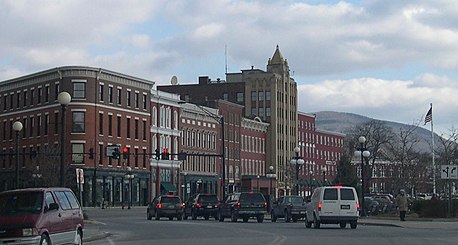
Barre is a town in Washington County, Vermont, United States. The population was 7,923 at the 2020 census, making it the 3rd largest municipality in Washington County and the 16th largest municipality in Vermont. Popularly referred to as "Barre Town", the town of Barre almost completely surrounds "Barre City", which is a separate municipality. The original town now known as Barre was first chartered in 1780 as the Town of Wildersburgh. In 1793 the name Wildersburgh was unpopular with the inhabitants and the name of the town was changed to Barre. In 1895 the City of Barre was incorporated and separated from the town of Barre, and both continue to exist as separate municipalities.
A census-designated place (CDP) is a concentration of population defined by the United States Census Bureau for statistical purposes only.
A minor civil division (MCD) is a term used by the United States Census Bureau for primary governmental and/or administrative divisions of a county or county-equivalent, typically a municipal government such as a city, town, or civil township. MCDs are used for statistical purposes by the Census Bureau, and do not necessarily represent the primary form of local government. They range from non-governing geographical survey areas to municipalities with weak or strong powers of self-government. Some states with large unincorporated areas give substantial powers to counties; others have smaller or larger incorporated entities with governmental powers that are smaller than the MCD level chosen by the Census.
Waterbury is a town in Washington County in central Vermont, United States. Although the town is still home to the Waterbury Village Historic District, the village sharing the name of the town officially dissolved as a municipality in 2018. As of the 2020 census, the population was 5,331.
A civil township is a widely used unit of local government in the United States that is subordinate to a county, most often in the northern and midwestern parts of the country. The term town is used in New England, New York, as well as Wisconsin to refer to the equivalent of the civil township in these states; Minnesota uses "town" officially but often uses it and "township" interchangeably. Specific responsibilities and the degree of autonomy vary in each state. Civil townships are distinct from survey townships, but in states that have both, the boundaries often coincide and may completely geographically subdivide a county. The U.S. Census Bureau classifies civil townships as minor civil divisions. Currently, there are 20 states with civil townships.
The administrative divisions of New York are the various units of government that provide local services in the U.S. State of New York. The state is divided into boroughs, counties, cities, towns, and villages. They are municipal corporations, chartered (created) by the New York State Legislature, as under the New York State Constitution the only body that can create governmental units is the state. All of them have their own governments, sometimes with no paid employees, that provide local services. Centers of population that are not incorporated and have no government or local services are designated hamlets. Whether a municipality is defined as a borough, city, town, or village is determined not by population or land area, but rather on the form of government selected by the residents and approved by the New York State Legislature. Each type of local government is granted specific home rule powers by the New York State Constitution. There are still occasional changes as a village becomes a city, or a village dissolves, each of which requires legislative action. New York also has various corporate entities that provide local services and have their own administrative structures (governments), such as school and fire districts. These are not found in all counties.
Cabot is a New England town located in the northeast corner of Washington County, Vermont, United States. The population was 1,443 at the 2020 census. It contains the unincorporated villages of Cabot Village, Cabot Plains, South Cabot, East Cabot, Molly's Pond, and Lower Cabot. Cabot contains several ponds and dairy farms. It is the location of the Cabot Creamery, a producer and national distributor of dairy products, especially known for their cheddar cheese.
The town is the basic unit of local government and local division of state authority in the six New England states. Most other U.S. states lack a direct counterpart to the New England town. New England towns overlay the entire area of a state, similar to civil townships in other states where they exist, but they are fully functioning municipal corporations, possessing powers similar to cities and counties in other states. New Jersey's system of equally powerful townships, boroughs, towns, and cities is the system which is most similar to that of New England. New England towns are often governed by a town meeting, an assembly of eligible town residents. The great majority of municipal corporations in New England are based on the town model; there, statutory forms based on the concept of a compact populated place are uncommon, though elsewhere in the U.S. they are prevalent. County government in New England states is typically weak at best, and in some states nonexistent. Connecticut, for example, has no county governments, nor does Rhode Island. Both of those states retain counties only as geographic subdivisions with no governmental authority, while Massachusetts has abolished eight of fourteen county governments so far. Counties serve mostly as dividing lines for the states' judicial systems and some other state services in the southern New England states, while providing varying services in the more sparsely populated three northern New England states.
The Berlin Micropolitan Statistical Area is the core-based statistical area centered on the urban cluster associated with the city Berlin, New Hampshire, in the United States. As defined by the Office of Management and Budget using counties as building blocks, the area consists of two counties – Coös County in New Hampshire, which contains the city of Berlin, and the adjacent Essex County in Vermont.
Averys Gore is a gore located in Essex County, Vermont, United States.
A Vermont municipality is a particular type of New England municipality. It is the basic unit of local government.