Blo' Norton is a village and civil parish in the Breckland district of Norfolk, England, on the River Little Ouse, about 6 1⁄2 miles (10 km) west of Diss. The 2001 Census recorded the parish population as 270 people, living in about 100 households.

Benacre is a village and civil parish in the East Suffolk district of the English county of Suffolk. The village is located about 5 3⁄4 miles (9 km) south of Lowestoft and 1 1⁄2 miles (2 km) north-east of Wrentham, between the main A12 road and the North Sea coast. Neighbouring villages include Kessingland and Covehithe with the town of Southwold 5 miles (8 km) to the south.

Brockley(not to be confused with Brockley Green, 8 miles southwest in Hundon parish) is a village and civil parish in the West Suffolk district of Suffolk, England. Brockley parish includes the hamlets of Pound Green and Gulling Green. According to the 2001 Census parish population was 281, and increased to 312 at the 2011 Census.

Burgh is a village and civil parish in the East Suffolk district of Suffolk, England, about 3.5 miles (6 km) north-west of Woodbridge.
Mutford is a small village and civil parish located south-west of Lowestoft in the English county of Suffolk. The village is located between Lowestoft and Beccles in a rural area south of the A146 at Barnby. Nearby villages include Gisleham and Henstead. The village gave its name to the Half Hundred of Mutford which is named in the Domesday Book.

Wissett is a village and civil parish in the East Suffolk district of Suffolk, England located at 52.35N 01.46E TM3679 about 2 km northwest of Halesworth. Historically, it was in the Blything Hundred. It has a population of more than 200, measured at 268 in the 2011 Census.

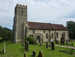
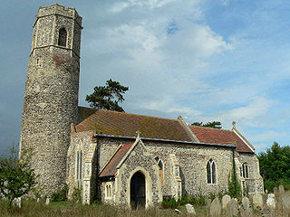
Ilketshall St Andrew is a village and civil parish in the East Suffolk district of Suffolk, England. The population of St Andrew, Ilketshall was 291 according to the 2011 Census, of which 146 are males, and 145 are females. St Andrew's church is one of 38 existing round-tower churches in Suffolk.

Farnham is a village and civil parish about 3 miles (4.8 km) south-west of Saxmundham in the English county of Suffolk on the A12 road. Farnham is located west of Friday Street, south of Benhall Low Street and north-east of Stratford St Andrew.

Chelmondiston is a small village and civil parish in Suffolk, England located on the Shotley Peninsula, five miles south-east of Ipswich. The hamlet of Pin Mill lies within the parish on the south bank of the River Orwell. The village comprises approximately 500 dwellings and has a population of just over 1,000. It is one of the largest villages situated on the Shotley Peninsula.

"Brandeston is a village in Suffolk, England on the River Deben 11 miles (18 km) northeast of Ipswich. Brandeston is west of Kettleburgh and northwest of Hoo Green. It is a Parish in Plomesgate district and 3½ miles SW of Framlingham r. station."
Clopton is a village and civil parish in Suffolk. It is located between Ipswich and Debenham two kilometres north of Grundisburgh on the River Lark. The village is no larger than a series of houses either side of the B1078, surrounded by farm land. The village itself has no clear centre; houses and other buildings are concentrated around the four manors of Kingshall, Brendhall, Rousehall and Wascolies, all of which are mentioned in the Domesday Book.

Willingham St Mary is a village and civil parish in the English county of Suffolk located about 3.5 miles (6 km) south of Beccles along the A145 in the East Suffolk district. The village is joined with Shadingfield and 1.5 miles (2 km) west of Sotterley. At the 2001 census the parish had a population of 155, decreasing slightly to 152 at the 2011 census. A joint parish council covers the parishes of Ellough, Shadingfield, Sotterley and Willingham St Mary.

Nowton is a small village and civil parish in the West Suffolk district of Suffolk in eastern England. Located on the southern edge of Bury St Edmunds, in 2005 its population was estimated to be 140. At the 2011 census 163 people were recorded as living in the village.
Market Weston is a small village and civil parish in the West Suffolk district of Suffolk in eastern England. It is located near the Norfolk border around seven miles east-south-east of Thetford. In 2005 its population was estimated to be 260. 245 people were recorded at 2011 census. The parish also contains the Weston Fen SSSI.

Lidgate is a small village and a civil parish in the West Suffolk district, in the English county of Suffolk. Lidgate is located on the B1063 road in between the towns of Newmarket and Clare. The population of Lidgate is around 250, measured at 241 in the 2011 Census.

Cransford is a village and a civil parish in the East Suffolk district, in the English county of Suffolk. The civil parish had a population at the 2011 Census of 162.

Falkenham is a village and a civil parish in the East Suffolk district, in the English county of Suffolk, near the village of Kirton and the towns of Ipswich and Felixstowe. The population of the civil parish as of the 2011 census was 170.
Stratford St Andrew is a small village and a civil parish just off the A12 road, in the East Suffolk district, in the English county of Suffolk. It is located 3 miles south west of Saxmundham, which is the nearest town to the village.

Hoo is a village and civil parish in the East Suffolk district of the English county of Suffolk. It is located 3 miles (4.8 km) north-west of the town of Wickham Market and 3 miles (4.8 km) south-west of Framlingham. The parish lies to the south of the River Deben - neighbouring villages include Kettleburgh, Charsfield and Letheringham. The parish council is combined with Cretingham and Monewden, with Hoo itself having one of the smallest populations in Suffolk with 86 residents recorded at the 2001 census. At the 2011 Census the parish was recorded in combination with Letheringham giving a total population of 160.
Linstead Parva is a small village and civil parish in the East Suffolk district of Suffolk in eastern England. It has a small but notable 13th-century parish church, still in regular use. The village pub, The Greyhound, was already established and trading when referenced in 1874, but it closed permanently in March 1955, and is now a private dwelling.