
Saxtead Green Post Windmill is a Grade II* listed post mill at Saxtead Green, Woodbridge, Suffolk, England which is also a Scheduled monument and has been restored.
Walberswick is a village and civil parish on the Suffolk coast in England. It is at the mouth of the River Blyth on the south side of the river. The town of Southwold lies to the north of the river and is the nearest town to Walberswick, around 1 mile (1.6 km) away. Walberswick is around 11 miles (18 km) south of Lowestoft on the North Sea coast. It is 7 miles (11 km) east of Halesworth and 28 miles (45 km) northeast of the county town of Ipswich.
Toppesfield is a village and civil parish in the Braintree district of Essex, England. The village is approximately 19 miles (31 km) north from the county town of Chelmsford, and 1.5 miles (2.4 km) west from the village of Great Yeldham. The parish contains the hamlets of Gainsford End and Grass Green.

Syleham is a small parish, next to the River Waveney in Suffolk, England, about six miles east of Diss.

Bardwell is a village and civil parish in the West Suffolk district of Suffolk, England.
Gazeley is a village and civil parish in the West Suffolk district of Suffolk in eastern England and is part of the West Suffolk UK Parliament constituency. In 2005 it had a population of 740. A house converted from a windmill survives in the village. The surnames of Gazeley, Gazley and Gazlay derive from this source.
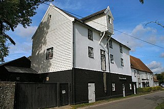
Pakenham is a village and civil parish in the West Suffolk district of Suffolk in eastern England. Its name can be linked to Anglo-Saxon roots, Pacca being the founder of a settlement on the hill surrounding Pakenham church. The village describes itself as the "Village of Two Mills", as it has a water mill which claims to be the only working example in the county. The Pakenham windmill no longer works.

Onehouse is a small village in the English county of Suffolk, about 3 miles west from the centre of Stowmarket near to the Golf Club. The population of the parish at the 2011 Census was 810.

Wickham Skeith is a village and civil parish in Suffolk, England, about 5 miles to the west of Eye and about 3 miles east of Finningham.

Old Buckenham is a village and civil parish in the English county of Norfolk, approximately 29 km (18 mi) south-west of Norwich.
Shipley is a village and civil parish in the Horsham District of West Sussex, England. It lies just off the A272 road 6 miles north-east of Storrington. The parish includes the village of Coolham and the hamlets of Dragon's Green, Brooks Green and Broomer's Corner.

Felthorpe is a village and civil parish in the English county of Norfolk. The village is located 11 miles (18 km) east of Dereham and 7.1 miles (11.4 km) north-west of Norwich.

Lound is a village and civil parish in the north of the English county of Suffolk. It is 4.5 miles (7.2 km) north of Lowestoft, 5 miles (8.0 km) south of Great Yarmouth in the East Suffolk district. It is 2 miles (3.2 km) from the North Sea coast at Hopton-on-Sea and is on the border with the county of Norfolk.

Somerton is a civil parish in the Babergh district of Suffolk in eastern England.

Gedding is a village and civil parish in the Mid Suffolk district of Suffolk in eastern England. Located around six miles south east of Bury St Edmunds. At the 2011 census its population was 125, rising to 134 at the 2018 ONS mid year estimate.

Chevington is a village and civil parish in the West Suffolk district of Suffolk in East Anglia, England. Located around 10 km south-west of Bury St Edmunds, in 2005 its population was 630, reducing to 602 at the 2011 Census. The parish also contains the hamlets of Broad Green and Tan Office Green.
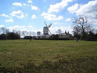
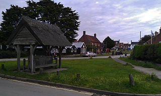
Saxtead Green is a village on the A1120 road and the B1119 road, in the civil parish of Saxtead, near the town of Framlingham, in the East Suffolk district, in the county of Suffolk, England.

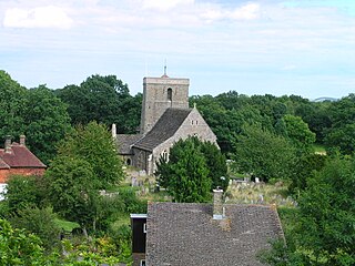
St Margaret South Elmham is a village and civil parish in the north of the English county of Suffolk. It is 4 miles (6.4 km) south-west of the market town of Bungay in the East Suffolk district. It is one of the parishes surrounding Bungay which are known as The Saints.

