
Eye is a market town and civil parish in the north of the English county of Suffolk, about 4 miles (6 km) south of Diss, 17.5 miles (28 km) north of Ipswich and 23 miles (37 km) south-west of Norwich. The population in the 2011 Census of 2,154 was estimated to be 2,361 in 2019. It lies close to the River Waveney, which forms the border with Norfolk, and on the River Dove. Eye is twinned with the town of Pouzauges in the Vendée department of France.

Hintlesham is a small village in Suffolk, England, situated roughly halfway between Ipswich and Hadleigh. It is in the Belstead Brook electoral division of Suffolk County Council.
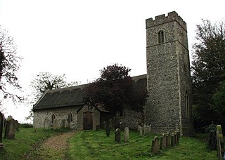
Barnby is a village and civil parish in the East Suffolk district of the English county of Suffolk. The village is 5 miles (8.0 km) west of Lowestoft and 3 miles (4.8 km) east of Beccles in the north of the county. It is effectively merged with the village of North Cove which constitutes a separate parish.

Boulge is a hamlet and civil parish in the East Suffolk district of Suffolk, England. It is about 3 miles (5 km) north of Woodbridge. The population remained only minimal at the 2011 Census and was included in the civil parish of Debach.

Monks Eleigh is a village and a civil parish in Babergh, Suffolk, United Kingdom, situated on the tributary to the River Brett in a rural area. The parish contains the hamlets of Swingleton Green and Stackyard Green.

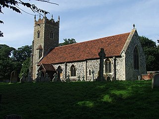
Sotterley, originally Southern-lea from its situation south of the river, is a village and civil parish in the East Suffolk district, in the English county of Suffolk, located approximately 4 miles (6 km) south-east of Beccles and 1.5 miles (2 km) east of Willingham St Mary and Shadingfield. The parish is primarily agricultural with a dispersed population of 113 at the 2011 census. The parish council operates to administer jointly the parishes of Shadingfield, Willingham St Mary, Sotterley and Ellough.

Playford is a village and civil parish in the East Suffolk district, in Suffolk, England, on the outskirts of Ipswich. It has about 215 residents in 90 households. The name comes from the Old English plega meaning play, sport; used of a place for games, or a courtship or mating-place for animals, and the Old English ford meaning a place where a stream or river can be crossed. Villages nearby include Rushmere, Little Bealings, Great Bealings, Culpho and Grundisburgh. There are no pubs or shops in Playford, although it has a church and a village hall.
Wherstead is a village and a civil parish located in the county of Suffolk, England. Wherstead village lies 3 miles (4.8 km) south of Ipswich on the Shotley peninsula. It is in the Belstead Brook electoral division of Suffolk County Council.

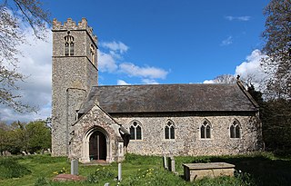
Stowlangtoft is a village and civil parish in the Mid Suffolk district of Suffolk in eastern England two miles south-east from Ixworth. Located around five miles north-east of Bury St Edmunds, in 2005 its population was 270.

Hanwell is a village and civil parish in Oxfordshire, about 2 miles (3 km) northwest of Banbury. Its area is 1,240 acres (500 ha) and its highest point is about 500 feet (150 m) above sea level. The 2011 Census recorded the parish's population as 263.

Nowton is a small village and civil parish in the West Suffolk district of Suffolk in eastern England. Located on the southern edge of Bury St Edmunds, in 2005 its population was estimated to be 140. At the 2011 census 163 people were recorded as living in the village.

Denham is a village and civil parish in the West Suffolk district of Suffolk in eastern England. Located around five miles west of Bury St Edmunds, in 2005 its population was 170, increasing to 171 at the 2011 Census. The parish also includes the hamlet of Denham End, as well as the remains of Denham Castle, a motte-and-bailey structure. The parish council is shared with neighbouring Barrow.

Fornham St Martin is a village and civil parish in the West Suffolk district of Suffolk in eastern England. Located on the northern outskirts of Bury St Edmunds off east and west from the A134, in 2005 its population was 1300. Its parish council is shared with neighbouring Fornham St Genevieve, and is known as Fornham St Martin cum St Genevieve Parish Council. Fornham St Martin is one of a trio of contiguous villages by the River Lark. The other villages are Fornham St Genevieve and Fornham All Saints.

Hepworth is a village and civil parish in the West Suffolk district of the English county of Suffolk. Nearby settlements include the villages of Stanton and Barningham. For transport there is the A143 road nearby. Hepworth has a place of worship. The population at the 2011 Census was 536.

Cretingham is a village and a civil parish in the East Suffolk district, in the English county of Suffolk. It is on the River Deben, 2 miles south off the A1120 road. It is four miles west from Framlingham and eight miles northwest from Woodbridge.

St Mary's Church is a redundant Church of England parish church in the civil parish of Chilton, Suffolk, England. It is a Grade I listed building, and is in the care of the Churches Conservation Trust.
Linstead Magna is a civil parish in the East Suffolk district of Suffolk in eastern England.

St Cross South Elmham is a village and civil parish in the north of the English county of Suffolk. It is in the East Suffolk district, close to the border with Norfolk and is 3 miles (4.8 km) east of Harleston and 4.25 miles (6.84 km) south-west of Bungay. It is one of the villages around Bungay known as the Saints.
Ilketshall St John is a village and civil parish in the East Suffolk district of the English county of Suffolk. It is 2 miles (3.2 km) south-east of the market town of Bungay and is part of a group of parishes with similar names known collectively as the Saints.

St Peter South Elmham is a village and civil parish in the north of the English county of Suffolk. It is around 3 miles (4.8 km) south of the market town of Bungay in the East Suffolk district. It is one of the villages surrounding Bungay which make up the area known as The Saints.


