
The A12 is a major road in Eastern England. It runs north-east/south-west between London and the coastal town of Lowestoft in the north-eastern corner of Suffolk, following a similar route to the Great Eastern Main Line until Ipswich. A section of the road between Lowestoft and Great Yarmouth became part of the A47 in 2017. Between the junctions with the M25 and the A14, the A12 forms part of the unsigned Euroroute E30. Unlike most A roads, this section of the A12, together with the A14 and the A55, has junction numbers as if it were a motorway.

Darsham is a village in Suffolk, England. It is located approximately 4 miles (6 km) north east of Saxmundham. The village is bypassed by the A12 and is served by Darsham railway station, which is approximately one mile away from the village centre, on the Ipswich-Lowestoft East Suffolk Line.

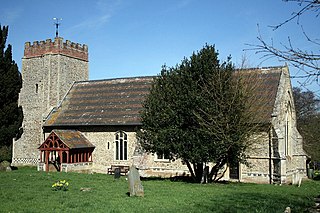
Kelsale cum Carlton is a civil parish in the English county of Suffolk. Situated to the north of Saxmundham, Kelsale cum Carlton is one of the largest parishes in Suffolk by area and includes, in addition to Kelsale and Carlton, villages and hamlets such as Dorley's Corner, Curlew Green, East Green and North Green within its boundaries. The population of the civil parish at the 2011 Census was 990. The parish was formed in 1885.

Dallinghoo is a village and civil parish about three miles (5 km) north of Woodbridge, East Suffolk, Suffolk, England. In 2011 the parish had a population of 171.
Frostenden is a village and civil parish in the East Suffolk district of the English county of Suffolk. It is around 8 miles (13 km) south-west of Lowestoft and 3.5 miles (5.6 km) north-west of Southwold and lies on the A12 road between Wrentham and Wangford. Neighbouring parishes include Wrentham, Sotterley, Uggeshall, Wangford with Henham, Reydon and South Cove.

Farnham is a village and civil parish about 3 miles (4.8 km) south-west of Saxmundham in the English county of Suffolk on the A12 road. Farnham is located west of Friday Street, south of Benhall Low Street and north-east of Stratford St Andrew.

The A146 is an A road that connects Norwich in Norfolk and Lowestoft in Suffolk, two of East Anglia's largest population centres. It is around 27 miles (43 km) in length and has primary classification along its entire route. It is mainly single carriageway throughout its route, with the exception of a section of dual carriageway on the southern edge of Norwich.

The A145 is an A road in the English county of Suffolk. It runs from east of the town of Beccles, close to the border with Norfolk, to the village of Blythburgh where it joins the A12 road. It is around 11 miles (18 km) in length and single carriageway throughout.
Copdock and Washbrook is a civil parish in the Babergh district in the county of Suffolk, England. It covers the villages of Copdock and Washbrook, as well as the hamlets of Coles Green, Mace Green and Washbrook Street.

Copdock is a village and former civil parish, now in the parish of Copdock and Washbrook, in the Babergh district, in the county of Suffolk, England. In 1961 the civil parish had a population of 399.

Marlesford railway station was a station located in Marlesford, Suffolk. It closed in 1952.

Brampton with Stoven is a civil parish in the East Suffolk district of the English county of Suffolk. It is located 6 miles (9.7 km) south of the town of Beccles and 4 miles (6.4 km) north-east of Halesworth, with an area of 12 square kilometres (4.6 sq mi). The parish was formed in 1987 from the parishes of Brampton and Stoven, and the two villages are the major population centres in the parish, with Brampton the larger centre with almost all of the parishes services. It borders the parishes of Sotterley, Uggeshall, Sotherton, Westhall, Ilketshall St Andrew and Shadingfield.
Margaretting is a village and civil parish in the Chelmsford district, in the county of Essex, England. The population of the village taken at the 2011 Census was 847.

Little Glemham is a small village and civil parish on the A12 road, in the East Suffolk district, in the county of Suffolk, England. The population of the parish at the 2011 Census was 187. Nearby settlements include the villages of Wickham Market and Marlesford. Little Glemham has a church, St. Andrew's, a pub and a hall called Glemham Hall. The corresponding village of Great Glemham is a few miles away. From 1974 to 2019 it was in Suffolk Coastal district.

Monewden is a small village and a civil parish in the hundred of Loss, in the East Suffolk District, in the English county of Suffolk. The population of the civil parish as of the 2011 census was 120. The village is located around 12 miles (19 km) north of Ipswich and 4 miles (6.4 km) west of Wickham Market.

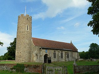
Thorington is a village and a civil parish in the hundred of Blything, in the East Suffolk district of the English county of Suffolk. It is located around 3 miles (4.8 km) south-east of the town of Halesworth, immediately south of the village of Wenhaston. The A12 main road runs through the parish to the east of the village. Thorington Hall was demolished in 1949, but The Round House, a listed gamekeeper's lodge for the Thorington Estate, survives.

Hemley is a village and a civil parish in the East Suffolk district, in the English county of Suffolk.

Falkenham is a village and a civil parish in the East Suffolk district, in the English county of Suffolk, near the village of Kirton and the towns of Ipswich and Felixstowe. The population of the civil parish as of the 2011 census was 170.

The A144 is an A road in the English county of Suffolk. It runs from the town of Bungay, close to the border with Norfolk, to the A12 trunk road near the village of Darsham, passing through the market town of Halesworth. It is around 14 miles (23 km) in length and is single carriageway throughout.

Wangford with Henham is a civil parish in the East Suffolk district of the English county of Suffolk. It is around 5.5 miles (8.9 km) east of Halesworth, 3 miles (4.8 km) north-west of Southwold and 8.5 miles (13.7 km) south of Beccles. The parish includes the village of Wangford, the hamlet of Barnaby Green and Henham Park, the site of the Latitude Festival and a variety of other events. The Henham estate, owned by the Rous family, later the Earls of Stradbroke, owned much of the land in the parish and were responsible for many of the buildings in the area.


