Nashville, North Carolina

Last updated
Nashville, North Carolina
Nashville, North Carolina.jpg
Nashville, NC Town Seal.jpg
Motto: 
"The Original Town of Nashville"
Nash County North Carolina incorporated and unincorporated areas Nashville highlighted.svg
Location in Nash County and the state of North Carolina.
Coordinates: 35°58′09″N77°57′20″W / 35.96917°N 77.95556°W / 35.96917; -77.95556
Country United States
State North Carolina
County Nash
Named for Francis Nash [1]
Area
[2]
  Total4.70 sq mi (12.17 km2)
  Land4.70 sq mi (12.16 km2)
  Water0.00 sq mi (0.01 km2)
Elevation
[3]
167 ft (51 m)
Population
 (2020)
  Total5,632
  Density1,199.57/sq mi (463.12/km2)
Time zone UTC-5 (Eastern (EST))
  Summer (DST) UTC-4 (EDT)
ZIP code
27856
Area code 252
FIPS code 37-46000 [4]
GNIS feature ID2406965 [3]
Website www.townofnashville.com

Nashville is a town in Nash County, North Carolina, United States. The town was founded in 1780 and features Victorian and Queen Anne style homes. It is part of the Rocky Mount, North Carolina Metropolitan Statistical Area. The population of Nashville was 5,632 in 2020. [5] It is the county seat of Nash County. [6]

Contents

History

The town was founded in 1780, and is named for Francis Nash, an officer of the North Carolina militia who died in the American Revolutionary War.[ citation needed ]

Geography

According to the United States Census Bureau, the town has a total area of 3.0 square miles (7.8 km2), all of it land.

Demographics

Historical population
CensusPop.Note
1880 212
1890 40189.2%
1900 47919.5%
1910 75056.6%
1920 93925.2%
1930 1,13721.1%
1940 1,1713.0%
1950 1,30211.2%
1960 1,4239.3%
1970 1,67017.4%
1980 3,03381.6%
1990 3,61719.3%
2000 4,30919.1%
2010 5,35224.2%
2020 5,6325.2%
U.S. Decennial Census [7]

2020 census

Nashville racial composition [8]
RaceNumberPercentage
White (non-Hispanic)2,49844.35%
Black or African American (non-Hispanic)2,70748.06%
Native American 420.75%
Asian 280.5%
Pacific Islander 40.07%
Other/Mixed 2043.62%
Hispanic or Latino 1492.65%

As of the 2020 United States census, there were 5,632 people, 2,284 households, and 1,423 families residing in the town.

2000 census

As of the census [4] of 2000, there were 4,309 people, 1,629 households, and 1,124 families residing in the town. The population density was 1,425.2 people per square mile (550.3 people/km2). There were 1,751 housing units at an average density of 579.1 per square mile (223.6/km2). The racial makeup of the town was 54.82% White, 43.10% African American, 0.30% Native American, 0.58% Asian, 0.60% from other races, and 0.60% from two or more races. Hispanic or Latino of any race were 1.25% of the population.

There were 1,629 households, out of which 32.5% had children under the age of 18 living with them, 48.4% were married couples living together, 16.7% had a female householder with no husband present, and 31.0% were non-families. 28.4% of all households were made up of individuals, and 11.8% had someone living alone who was 65 years of age or older. The average household size was 2.43 and the average family size was 2.98.

In the town, the population was spread out, with 23.7% under the age of 18, 7.1% from 18 to 24, 30.4% from 25 to 44, 22.5% from 45 to 64, and 16.3% who were 65 years of age or older. The median age was 38 years. For every 100 females, there were 89.2 males. For every 100 females age 18 and over, there were 84.4 males.

The median income for a household in the town was $36,371, and the median income for a family was $44,180. Males had a median income of $32,282 versus $22,176 for females. The per capita income for the town was $18,603. About 9.5% of families and 10.5% of the population were below the poverty line, including 10.0% of those under age 18 and 15.6% of those age 65 or over.

Arts and culture

The Nashville Blooming Festival was founded in 1997, and features food, music, vendors, a parade, and a carnival. [9]

The Bissette-Cooley House, Nash County Courthouse, Nashville Historic District, and Rose Hill are listed on the National Register of Historic Places. [10]

Notable people

Related Research Articles

<span class="mw-page-title-main">Crockett County, Tennessee</span> County in Tennessee, United States

Crockett County is located in the U.S. state of Tennessee. As of the 2020 census, the population was 13,911. Its county seat is Alamo. Crockett County is included in the Jackson, TN Metropolitan Statistical Area.

<span class="mw-page-title-main">Wilson County, North Carolina</span> County in North Carolina, United States

Wilson County is a county located in the U.S. state of North Carolina. As of the 2020 census, the population was 78,784. The county seat is Wilson. The county comprises the Wilson, NC Micropolitan Statistical Area, which is also included within the Rocky Mount-Wilson-Roanoke Rapids, NC Combined Statistical Area.

<span class="mw-page-title-main">Nash County, North Carolina</span> County in North Carolina, United States

Nash County is a county located in the U.S. state of North Carolina. As of the 2020 census, the population was 94,970. Its county seat is Nashville.

<span class="mw-page-title-main">Taylorsville, North Carolina</span> Town in North Carolina, United States

Taylorsville is a town in Alexander County, North Carolina, United States. The population was 2,098 at the 2010 census. It is the county seat of Alexander County.

<span class="mw-page-title-main">Wadesboro, North Carolina</span> Town in North Carolina, United States

Wadesboro is a town and the county seat of Anson County, North Carolina, United States. The population was 5,049 at the 2020 census. The town was originally found in 1783 as New Town but changed by the North Carolina General Assembly to Wadesboro in 1787 to honor Colonel Thomas Wade, a native son, state legislator, and Revolutionary War commander of the Anson County Regiment.

<span class="mw-page-title-main">Gatesville, North Carolina</span> Town in North Carolina, United States

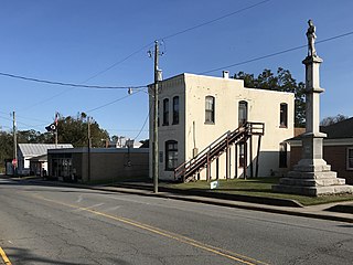
Gatesville is a town in Gates County, North Carolina, United States. The population was 321 at the 2010 census. It is the county seat of Gates County.

<span class="mw-page-title-main">Littleton, North Carolina</span> Town in North Carolina, United States

Littleton is a town in Halifax County, North Carolina, United States. The population was 674 at the 2010 census. It is part of the Roanoke Rapids, North Carolina Micropolitan Statistical Area.

<span class="mw-page-title-main">Biscoe, North Carolina</span> Town in North Carolina, United States

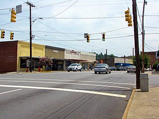
Biscoe is a town in Montgomery County, North Carolina, United States. The population was 1,700 at the 2010 census. The town is named after Henry Biscoe, an important customer of the local lumber business.

<span class="mw-page-title-main">Bailey, North Carolina</span> Town in North Carolina, United States

Bailey is a town in Nash County, North Carolina, United States. It is part of the Rocky Mount, North Carolina Metropolitan Statistical Area. The population was 566 at the 2020 census.

<span class="mw-page-title-main">Middlesex, North Carolina</span> Town in North Carolina, United States

Middlesex is a town in Nash County, North Carolina, United States. It is part of the Rocky Mount, North Carolina Metropolitan Statistical Area. Middlesex is about 25 miles east of Raleigh. The population was 822 at the 2010 census.

<span class="mw-page-title-main">Momeyer, North Carolina</span> Town in North Carolina, United States

Momeyer is a town in Nash County, North Carolina, United States. It is part of the Rocky Mount, North Carolina Metropolitan Statistical Area. The population was 277 in 2020.

<span class="mw-page-title-main">Red Oak, North Carolina</span> Town in North Carolina, United States

Red Oak is a town in Nash County, North Carolina, United States. It is part of the Rocky Mount, North Carolina Metropolitan Statistical Area. The population was 3,430 in 2010.

<span class="mw-page-title-main">Spring Hope, North Carolina</span> Town in North Carolina, United States

Spring Hope is a town in Nash County, North Carolina, United States. It is part of the Rocky Mount, North Carolina Metropolitan Statistical Area. The population was 1,320 at the 2010 census.

<span class="mw-page-title-main">Richlands, North Carolina</span> Town in North Carolina, United States

Richlands is a town in Onslow County, North Carolina, United States. In the 2020 U.S. census, the population was 2,287. It is included in the Jacksonville, North Carolina Metropolitan Statistical Area. Incorporated on March 29, 1880, it was the first town in Onslow County to have its own library and museum. Richlands was also the first town in Onslow County to have a female mayor, Annette Hargett.

<span class="mw-page-title-main">Blooming Valley, Pennsylvania</span> Borough in Pennsylvania, United States

Blooming Valley is a borough in Crawford County, Pennsylvania, United States. The population was 342 at the 2020 census, up from 337 at the 2010 census.

<span class="mw-page-title-main">Blooming Grove, Texas</span> Town in Texas, United States

Blooming Grove is a town in western Navarro County, Texas, United States. As of the 2010 census, the town population was 821.

<span class="mw-page-title-main">Pittsford, Vermont</span> Town in Vermont, United States

Pittsford is a town in Rutland County, Vermont, United States. As of the 2020 census, the town population was 2,862. Named for William Pitt, it has two picket forts used in the American Revolutionary War.

<span class="mw-page-title-main">Nashville, Wisconsin</span> Town in Wisconsin, United States

Nashville is a town in Forest County, Wisconsin, United States. The population was 1,064 at the 2010 census. The Mole Lake Indian Reservation is located within the town. The town is named after G.V. Nash of Forest City, Arkansas.

<span class="mw-page-title-main">Sharpsburg, North Carolina</span> Town in North Carolina, United States

Sharpsburg is a town in Edgecombe, Nash, and Wilson counties, North Carolina, United States. It is part of the Rocky Mount, North Carolina Metropolitan Statistical Area. The population was 2,024 at the 2010 Census.

<span class="mw-page-title-main">Whitakers, North Carolina</span> Town in North Carolina, United States

Whitakers is a town in Edgecombe and Nash Counties in the U.S. state of North Carolina. It is divided between the two counties by railroad tracks and is the northernmost town in the two counties. It is part of the Rocky Mount, North Carolina Metropolitan Statistical Area. The population was 744 in 2010.

References

  1. "Nashville NC History | Town of Nashville, NC, Nash County North Carolina". Archived from the original on 2018-03-19. Retrieved 2016-10-31.
  2. "ArcGIS REST Services Directory". United States Census Bureau. Retrieved September 20, 2022.
  3. 1 2 U.S. Geological Survey Geographic Names Information System: Nashville, North Carolina
  4. 1 2 "U.S. Census website". United States Census Bureau . Retrieved 2008-01-31.
  5. "Explore Census Data". data.census.gov. Retrieved 2021-12-19.
  6. "Find a County". National Association of Counties. Retrieved 2011-06-07.
  7. "Census of Population and Housing". Census.gov. Retrieved June 4, 2015.
  8. "Explore Census Data". data.census.gov. Retrieved 2021-12-24.
  9. "Nashville Blooming Festival". allevents.in. Retrieved March 23, 2024.
  10. "National Register Information System". National Register of Historic Places . National Park Service. July 9, 2010.