Raeford, North Carolina

Last updated

Raeford, North Carolina
Raeford, North Carolina.jpg
Downtown Raeford, 2019
Raeford, NC City Seal.png
NCMap-doton-Raeford.PNG
Location of Raeford, North Carolina
Coordinates: 34°58′51″N79°13′45″W / 34.98083°N 79.22917°W / 34.98083; -79.22917
Country United States
State North Carolina
County Hoke
Government
  TypeCity Council
  MayorJohn Knox McNeill III
Area
[1]
  Total4.31 sq mi (11.15 km2)
  Land4.28 sq mi (11.10 km2)
  Water0.02 sq mi (0.06 km2)
Elevation
[2]
256 ft (78 m)
Population
 (2020) [3]
  Total4,559
  Density1,064.19/sq mi (410.87/km2)
Time zone UTC-5 (Eastern (EST))
  Summer (DST) UTC-4 (EDT)
ZIP codes
28361, 28376
Area codes 910, 472
FIPS code 37-54580 [4]
GNIS feature ID2404587 [2]
Website www.raefordcity.org

Raeford is a city in Hoke County, North Carolina, United States. Its population was 4,559 at the 2020 census. [3] It is the county seat of Hoke County. [5]

Contents

History

John McRae and A.A. Williford operated a turpentine distillery and general store, respectively. Each took a syllable from his name and came up with the name Raeford for the post office they established.[ citation needed ] The McRae family, who lived at the "ford of the creek", was at one time made up primarily of old Highland Scot families. Likewise, the Upper Cape Fear Valley of North Carolina was, in the 18th and 19th centuries, the largest settlement of Gaelic-speaking Highland Scots in North America.[ citation needed ] Today, many of these old families continue to live in the area, though their presence is noticeably diminished by the great numbers of newcomers to the area as a result of Fort Liberty. Since World War II, many Lumbee Indian families have moved northward from Robeson County and now constitute a significant element of the population that is otherwise European and African American.

The Hoke County Courthouse and Raeford Historic District are listed on the National Register of Historic Places. [6]

Geography

Raeford is located in central Hoke County and is bordered to the northeast by Rockfish Creek, an east-flowing tributary of the Cape Fear River. The southern part of the city drains to Toneys Creek, a south-flowing component of the Lumber RiverPee Dee RiverWaccamaw River watershed.

U.S. Route 401 runs through the north and west sides of Raeford, leading east 22 miles (35 km) to Fayetteville and southwest 20 miles (32 km) to Laurinburg. U.S. 401 Business passes through the center of town as Harris Avenue and East Central Avenue. North Carolina Highway 20 leaves the center of Raeford as St. Pauls Drive, leading southeast 19 miles (31 km) to St. Pauls. North Carolina Highway 211 runs through the center of Raeford, entering from the south on Main Street and leaving to the west on Prospect Avenue; NC-211 leads south 30 miles (48 km) to Lumberton and northwest 17 miles (27 km) to Aberdeen.

According to the United States Census Bureau, the city has a total area of 4.3 square miles (11.1 km2), of which 0.02 square miles (0.06 km2), or 0.53%, is covered by water. [7]

Demographics

Historical population
CensusPop.Note
1910 580
1920 1,235112.9%
1930 1,3035.5%
1940 1,62824.9%
1950 2,03024.7%
1960 3,05850.6%
1970 3,1804.0%
1980 3,63014.2%
1990 3,469−4.4%
2000 3,386−2.4%
2010 4,61136.2%
2020 4,559−1.1%
U.S. Decennial Census [8]

2020 census

Raeford racial composition [9]
RaceNum.Perc.
White (non-Hispanic)1,70737.44%
Black or African American (non-Hispanic)1,79339.33%
Native American 2014.41%
Asian 400.88%
Pacific Islander 20.04%
Other/Mixed 2254.94%
Hispanic or Latino 59112.96%

As of the 2020 United States census, there were 4,559 people, 1,909 households, and 1,086 families residing in the city.

2000 census

As of the census [4] of 2000, 3,386 people, 1,323 households, and 899 families resided in the city. The population density was 902.3 inhabitants per square mile (348.4/km2). The 1,440 housing units averaged 383.7 per square mile (148.3/km2). The racial makeup of the city was 52.75% White, 40.93% African American, 2.86% Native American, 0.95% Asian, 0.03% Pacific Islander, 1.09% from other races, and 1.39% from two or more races. Hispanics or Latinos of any race were 4.16% of the population.

Of the 1,323 households, 30.2% had children under the age of 18 living with them, 45.1% were married couples living together, 18.9% had a female householder with no husband present, and 32.0% were not families. About 29.6% of all households were made up of individuals, and 14.7% had someone living alone who was 65 years of age or older. The average household size was 2.40 and the average family size was 2.94.

In the city, the age distribution was 23.7% under 18, 7.3% from 18 to 24, 25.5% from 25 to 44, 23.7% from 45 to 64, and 19.7% who were 65 years of age or older. The median age was 41 years. For every 100 females, there were 84.9 males. For every 100 females age 18 and over, there were 77.9 males.

The median income for a household in the city was $31,306, and for a family was $33,772. Males had a median income of $27,060 versus $26,050 for females. The per capita income for the city was $16,093. About 18.6% of families and 22.0% of the population were below the poverty line, including 30.6% of those under age 18 and 13.6% of those age 65 or over.

Notable people

Related Research Articles

<span class="mw-page-title-main">Lincoln County, North Carolina</span> County in North Carolina, United States

Lincoln County is a county located in the U.S. state of North Carolina. As of the 2020 census, the population was 86,810, making it the most populous "Lincoln County" in the United States. Its county seat is Lincolnton.

<span class="mw-page-title-main">Hoke County, North Carolina</span> County in North Carolina, United States

Hoke County is a county in the U.S. state of North Carolina. As of the 2020 census, its population was 52,082. Its county seat is Raeford.

<span class="mw-page-title-main">Hokes Bluff</span> City in Alabama, United States

Hokes Bluff is a city in Etowah County, Alabama, United States. It is part of the Gadsden Metropolitan Statistical Area. At the 2020 census, the population was 4,446.

<span class="mw-page-title-main">Bushnell, Illinois</span> City in Illinois, United States

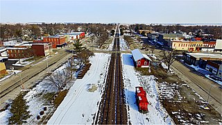
Bushnell is a city in McDonough County, Illinois, United States. The population was 2,718 at the 2020 census, down from 3,117 in 2010.

<span class="mw-page-title-main">Valdese, North Carolina</span> Town in North Carolina, United States

Valdese is a town in Burke County, North Carolina, United States. The population was 4,689 at the 2020 census. It is part of the Hickory-Lenoir-Morganton Metropolitan Statistical Area. One of the largest Waldensian congregations in the United States was founded in the town in the late nineteenth century, now known as the Waldensian Presbyterian Church. The town was settled by immigrants from the Cottian Alps in the Piedmont region of Italy.

<span class="mw-page-title-main">Spring Lake, North Carolina</span> Town in North Carolina, United States

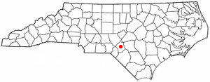
Spring Lake is a town in Cumberland County, North Carolina, United States. The 2010 census recorded the population at 11,964 people, with an estimated population in 2019 of 12,005.

<span class="mw-page-title-main">Clemmons, North Carolina</span> Village in North Carolina

Clemmons is a village in Forsyth County, North Carolina, United States and a suburb of Winston-Salem. The population was 21,177 at the 2020 census, with an estimated population of 21,517 in 2021.

<span class="mw-page-title-main">Ashley Heights, North Carolina</span> Census-designated place in North Carolina, United States

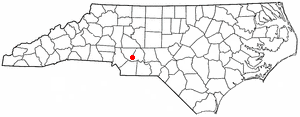
Ashley Heights is an unincorporated community and census-designated place (CDP) in Hoke County, North Carolina, United States. The population was 380 at the 2010 census.

<span class="mw-page-title-main">Bowmore, North Carolina</span> Census-designated place in North Carolina, United States

Bowmore is an unincorporated community and census-designated place (CDP) in Hoke County, North Carolina, United States. The population was 103 at the 2010 census.

<span class="mw-page-title-main">Dundarrach, North Carolina</span> Census-designated place in North Carolina, United States

Dundarrach is a census-designated place (CDP) in Hoke County, North Carolina, United States. At the 2010 census, the population was 41.

<span class="mw-page-title-main">Five Points, North Carolina</span> Census-designated place in North Carolina, United States

Five Points is a census-designated place (CDP) in Hoke County, North Carolina, United States. The population was 689 at the 2010 census.

<span class="mw-page-title-main">Rockfish, North Carolina</span> Census-designated place in North Carolina, United States

Rockfish is a census-designated place (CDP) in Hoke County, North Carolina, United States. The population was 3,298 at the 2010 census, up from 2,353 at the 2000 census.

<span class="mw-page-title-main">Silver City, North Carolina</span> Census-designated place in North Carolina, United States

Silver City is an unincorporated area and census-designated place (CDP) in Hoke County, North Carolina in the United States. The population was 882 at the 2010 census, down from 1,146 at the 2000 census.

<span class="mw-page-title-main">Lincolnton, North Carolina</span> City in North Carolina, United States

Lincolnton is a city in Lincoln County, North Carolina, United States within the Charlotte metropolitan area. The population was 10,486 at the 2010 census. Lincolnton is northwest of Charlotte, on the South Fork of the Catawba River. The city is the county seat of Lincoln County.

<span class="mw-page-title-main">New Ellenton, South Carolina</span> City in South Carolina

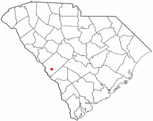
New Ellenton is a city in Aiken County, South Carolina, United States. The population was 2,210 at the 2020 census. It is part of the Augusta, Georgia metropolitan area.

<span class="mw-page-title-main">Loris, South Carolina</span> City in South Carolina, United States

Loris is a city in Horry County, South Carolina, United States. The population was 2,396 at the 2010 census, up from 2,079 in 2000.

<span class="mw-page-title-main">Locust, North Carolina</span> City in North Carolina, United States

Locust is a small rural city in Stanly and Cabarrus counties in the U.S. state of North Carolina. The population was 2,930 at the 2010 census.

<span class="mw-page-title-main">King, North Carolina</span> City in North Carolina, United States

King is a city in Stokes and Forsyth counties, North Carolina, United States. The population was 7,096 at the 2020 census. King is part of the Piedmont Triad metropolitan area, located 15 miles (24 km) northwest of Winston-Salem.

<span class="mw-page-title-main">Red Springs, North Carolina</span> Town in North Carolina, United States

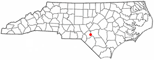
Red Springs is a town in Robeson County in the U.S. state of North Carolina. The population was 3,428 at the 2010 census.

<span class="mw-page-title-main">Fayetteville metropolitan area, North Carolina</span> MSA consisting of three counties – Cumberland, Harnett, and Hoke – in eastern North Carolina

The Fayetteville, NC Metropolitan Statistical Area, as defined by the US Office of Management and Budget (OMB), is an area consisting of three counties – Cumberland, Harnett, and Hoke – in eastern North Carolina, anchored by the city of Fayetteville. It is served by Interstate 95, Interstate 295, U.S. and state highways, Fayetteville Regional Airport, Amtrak, Greyhound, Megabus and several railroad systems. As of the 2000 census, the MSA had a population of 336,609. As of the 2010 census the MSA had a population of 366,383. In 2011 the estimated population was 374,157. The 2019 estimated population is 526,719.

References

  1. "ArcGIS REST Services Directory". United States Census Bureau. Retrieved September 20, 2022.
  2. 1 2 U.S. Geological Survey Geographic Names Information System: Raeford, North Carolina
  3. 1 2 "Profile of General Population and Housing Characteristics: 2020 Demographic Profile Data (DP-1): Raeford city, North Carolina". United States Census Bureau . Retrieved February 25, 2024.
  4. 1 2 "U.S. Census website". United States Census Bureau . Retrieved January 31, 2008.
  5. "Find a County". National Association of Counties. Retrieved June 7, 2011.
  6. "National Register Information System". National Register of Historic Places . National Park Service. July 9, 2010.
  7. "Geographic Identifiers: 2010 Census Summary File 1 (G001): Raeford city, North Carolina". American Factfinder. U.S. Census Bureau. Archived from the original on February 13, 2020. Retrieved December 20, 2017.
  8. "Census of Population and Housing". Census.gov. Retrieved June 4, 2015.
  9. "Explore Census Data". data.census.gov. Retrieved December 10, 2021.
  10. "Lynnette Hardaway's North Carolina Voter Registration". voterrecords.com. Retrieved December 11, 2017.
  11. "Rochelle Richardson's North Carolina Voter Registration". voterrecords.com. Retrieved December 11, 2017.
  12. "Eric Demarqua Maynor". Basketball-Reference.Com. Retrieved December 10, 2012.
  13. Friedlander, Brett. (May 21, 2020). 100 in 100: Hoke County's Kathy McMillan, Olympic Silver Medalist. North State Journal. Retrieved Jul 28, 2020.
  14. Catamount Tailback Detrez Newsome Signs with LA Chargers. catamountsports.com. Retrieved Jul 28, 2020.
  15. Ley, Ana. (Jul 1, 2020). Ted Thomas Sr. was a prominent Portsmouth bishop — but drove people to church himself. The Virginia Pilot. Retrieved Jul 28, 2020.