Troy, North Carolina

Last updated

Troy, North Carolina
MONTGOMERY COUNTY COURTHOUSE, TROY, MONTGOMERY COUNTY, NC.jpg
Troy, NC Town Seal.png
Motto: 
"Gateway to the Uwharries"
NCMap-doton-Troy.PNG
Location of Troy, North Carolina.
Coordinates: 35°21′38″N79°53′47″W / 35.36056°N 79.89639°W / 35.36056; -79.89639
Country United States
State North Carolina
County Montgomery
Area
[1]
  Total3.70 sq mi (9.59 km2)
  Land3.66 sq mi (9.48 km2)
  Water0.04 sq mi (0.11 km2)
Elevation
[2]
623 ft (190 m)
Population
 (2020)
  Total2,850
  Density778.69/sq mi (300.68/km2)
Time zone UTC-5 (Eastern (EST))
  Summer (DST) UTC-4 (EDT)
ZIP code
27371
Area codes 910, 472
FIPS code 37-68520 [3]
GNIS feature ID2406760 [2]
Website troy.nc.us

Troy is a town in Montgomery County, North Carolina, United States. The population was 3,188 at the 2010 census. It is the county seat of Montgomery County. [4] A short story by Charles W. Chesnutt, The Sheriff's Children, is set in Troy.

Contents

History

Troy lies in an area once known for its vast longleaf pine forests; much of the town's early development came from the harvesting of those trees for lumber and turpentine. Originally known as West Old Fields, the name was changed to Troy in 1843 when the county seat of Montgomery County was moved there from Old Lawrenceville. The town was incorporated in 1853.

The coming of the Asheboro and Aberdeen railroad as well as the gold mining industry surrounding the town accelerated growth in the late 19th century. By the 20th century textile mills and lumber mills were contributing heavily to Troy's economy.

The Hotel Troy, Montgomery County Courthouse, and Troy Residential Historic District are listed on the National Register of Historic Places. [5]

Geography

According to the United States Census Bureau, the town has a total area of 3.0 square miles (7.8 km2), of which 3.0 square miles (7.8 km2) is land and 0.34% is water.

Troy, along with most of Montgomery County, lies within the Uwharrie National Forest.

Demographics

Historical population
CensusPop.Note
1870 67
1880 13094.0%
1900 878
1910 1,05520.2%
1920 1,1024.5%
1930 1,52238.1%
1940 1,86122.3%
1950 2,21318.9%
1960 2,3466.0%
1970 2,4293.5%
1980 2,70211.2%
1990 3,40426.0%
2000 3,4300.8%
2010 3,189−7.0%
2020 2,850−10.6%
U.S. Decennial Census [6]

2020 census

Troy racial composition [7]
RaceNumberPercentage
White (non-Hispanic)1,37548.25%
Black or African American (non-Hispanic)93932.95%
Native American 110.39%
Asian 371.3%
Other/Mixed 672.35%
Hispanic or Latino 42114.77%

As of the 2020 United States census, there were 2,850 people, 1,099 households, and 547 families residing in the town.

2010 census

As of the census [3] of 2010, there were 3,189 people, 1,115 households, and 704 families residing in the town. The population density was 1,156.8 inhabitants per square mile (446.6/km2). There were 1,209 housing units at an average density of 407.7 per square mile (157.4/km2). The racial makeup of the town was 58.9% White, 31.8% African American, 0.73% Native American, 1.0% Asian, 3.32% from other races, and 1.5% from two or more races. Hispanic or Latino of any race were 10.3% of the population.

There were 1,108 households, out of which 30.3% had children under the age of 18 living with them, 37.2% were married couples living together, 20.4% had a female householder with no husband present, and 36.9% were non-families. 34.6% of all households were made up of individuals, and 16.0% had someone living alone who was 65 years of age or older. The average household size was 2.38 and the average family size was 3.04.

In the town, the population was spread out, with 21.6% under the age of 18, 11.1% from 18 to 24, 35.0% from 25 to 44, 16.9% from 45 to 64, and 15.4% who were 65 years of age or older. The median age was 36.7 years. Male population makes up 37% with a median age of 34.1 years. The female population makes up 63% with a median age of 37.7 years.

The median income for a household in the town was $22,933, and the median income for a family was $33,984. Males had a median income of $29,500 versus $19,861 for females. The per capita income for the town was $11,420. About 20.9% of families and 24.8% of the population were below the poverty line, including 32.8% of those under age 18 and 26.1% of those age 65 or over. Of the 1,115 occupied housing units, 46.7% are owner-occupied housing units while 53.3% are renter-occupied housing units.

Education

Notable person

Related Research Articles

<span class="mw-page-title-main">Montgomery County, North Carolina</span> County in North Carolina, United States

Montgomery County is a rural county located in the southern Piedmont of the U.S. state of North Carolina. As of the 2020 census, the population was 25,751. Its county seat is Troy.

<span class="mw-page-title-main">Miami County, Ohio</span> County in Ohio, United States

Miami County is a county located in the U.S. state of Ohio. As of the 2020 census, the population was 108,774. Its county seat is Troy. The county is named in honor of the Miami people.

<span class="mw-page-title-main">Edgewood, Indiana</span> Town in Indiana, United States

Edgewood is a town in Anderson Township, Madison County, Indiana, United States. It is part of the Indianapolis–Carmel–Anderson metropolitan statistical area. The population was 2,053 at the 2020 census.

<span class="mw-page-title-main">Linden, Indiana</span> Town in Indiana, United States

Linden is a town in Madison Township, Montgomery County, in the U.S. state of Indiana. The population was 711 at the 2020 census.

<span class="mw-page-title-main">Troy, Indiana</span> Town in Indiana, United States

Troy is a town in Troy Township, Perry County, Indiana, along the Ohio River near the mouth of the Anderson River. It is the second oldest city in Indiana. The population was 347 at the 2020 census.

<span class="mw-page-title-main">West Gardiner, Maine</span> Town in the state of Maine, United States

West Gardiner is a town in Kennebec County, Maine, United States. The population was 3,671 at the 2020 census. West Gardiner is included in the Augusta, Maine micropolitan New England City and Town Area.

<span class="mw-page-title-main">Troy, Maine</span> Town in the state of Maine, United States

Troy is a town in Waldo County, Maine, United States. The population was 1,018 at the 2020 census.

Bellevue Township is a township in Morrison County, Minnesota, United States. The population was 1,115 at the 2000 census.

<span class="mw-page-title-main">Versailles, Missouri</span> City in Missouri, United States

Versailles is a city in Morgan County, Missouri, United States. The population was 2,482 at the 2010 census. It is the county seat of Morgan County. Locally, the town's name is pronounced “Ver-sails”, rather than “Ver-seye,” as in the French pronunciation of the royal palace for which the town is named.

<span class="mw-page-title-main">Castleton-on-Hudson, New York</span> Village in New York, United States

Castleton-on-Hudson is a village located in the southwestern part of the town of Schodack in Rensselaer County, New York, United States. The population was 1,473 at the 2010 census. The village is southeast of Albany.

<span class="mw-page-title-main">Lumber Bridge, North Carolina</span> Town in North Carolina, United States

Lumber Bridge is a town in Robeson County, North Carolina, United States. The population was 94 at the 2010 census.

<span class="mw-page-title-main">Port Washington, Ohio</span> Village in Ohio, United States

Port Washington is a village in Tuscarawas County, Ohio, United States. The population was 548 at the 2020 census.

<span class="mw-page-title-main">Carbondale Township, Pennsylvania</span> Place in Pennsylvania, United States

Carbondale Township is a township in Lackawanna County, Pennsylvania and is respectively named for the adjoining city of Carbondale. The township is located near Scranton. The population was 1,126 at the 2020 census. The village of Childs is located in Carbondale township.

<span class="mw-page-title-main">Lower Gwynedd Township, Pennsylvania</span> Township in Pennsylvania, United States

Lower Gwynedd Township is a township and equestrian community in Montgomery County, Pennsylvania, United States. The population was 11,405 at the 2010 census. The township comprises four villages: Gwynedd, Gwynedd Valley, Penllyn, and Spring House. The township is considered a haven for those seeking a country lifestyle, while still being in close proximity to nearby towns and Center City Philadelphia. While its postal address is in Ambler, Pennsylvania (19002), it is not associated with the Borough of Ambler.

<span class="mw-page-title-main">Oneida, Tennessee</span> Town in Tennessee, United States

Oneida is a town in Scott County, Tennessee, United States. The population was 3,787 at the 2020 census.

<span class="mw-page-title-main">Meadow Bridge, West Virginia</span> Town in West Virginia, United States

Meadow Bridge is a town in Fayette County, West Virginia, United States. The population was 379 at the 2010 census. The first settler of the area was John Gwin, closely followed by Dan Griffin.

<span class="mw-page-title-main">Troy, Walworth County, Wisconsin</span> Town in Wisconsin, United States

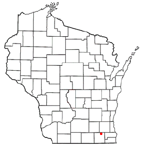
Troy is a town in Walworth County, Wisconsin, United States. The population was 2,355 at the 2020 census. The unincorporated communities of Adams, Little Prairie, and Troy Center are located in the town. The ghost town of Mayhews was also located in the town.

<span class="mw-page-title-main">Montgomery, West Virginia</span> City in West Virginia

Montgomery is a city in West Virginia, United States, along the Kanawha River. Most of the city is in Fayette County, with the remainder in Kanawha County. The population was 1,280 at the 2020 census.

<span class="mw-page-title-main">East Troy, Wisconsin</span> Village in Wisconsin, United States

East Troy is a Village in Walworth County, Wisconsin, United States. The population was 5,673 at the 2020 census. The Village is located southwest of the Town of East Troy. A small portion extends into the adjacent Town of Troy.

<span class="mw-page-title-main">East Troy (town), Wisconsin</span> Civil town in Walworth County, Wisconsin

East Troy is a town in Walworth County, Wisconsin, United States. The population was 3,392 as of the 2020 census. The unincorporated communities of Hilburn, Lake Beulah, and Potter Lake are located in the town, as was the ghost town of Army Lake. East Troy is also home to several summer camps.

References

  1. "ArcGIS REST Services Directory". United States Census Bureau. Retrieved September 20, 2022.
  2. 1 2 U.S. Geological Survey Geographic Names Information System: Troy, North Carolina
  3. 1 2 "U.S. Census website". United States Census Bureau . Retrieved January 31, 2008.
  4. "Find a County". National Association of Counties. Retrieved June 7, 2011.
  5. "National Register Information System". National Register of Historic Places . National Park Service. July 9, 2010.
  6. "Census of Population and Housing". Census.gov. Retrieved June 4, 2015.
  7. "Explore Census Data". data.census.gov. Retrieved December 22, 2021.
  8. CPL Henry F. Warner | First Division Museum. Retrieved October 25, 2020.