Erie County is a county along the shore of Lake Erie in western New York State. As of the 2020 census, the population was 954,236. The county seat is Buffalo, which makes up about 28% of the county's population. Both the county and Lake Erie were named for the regional Iroquoian language-speaking Erie tribe of Native Americans, who lived in the area before 1654. They were later pushed out by the more powerful Iroquoian nations tribes.
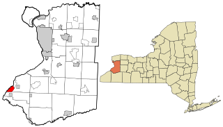
Ashford is a town in Cattaraugus County, New York, United States. The population was 1,974 at the 2020 census. The town is on the county's northern border.

Harris Hill is a hamlet and census-designated place (CDP) located in the town of Clarence in Erie County, New York, United States. The population was 5,508 at the 2010 census. It is part of the Buffalo-Niagara Falls metropolitan area. The region is named after Asa Harris, a former officer in the American Colonial Army, who established a tavern near the top of a low hill northeast of Buffalo.
Lake Erie Beach is a hamlet and census-designated place (CDP) in the town of Evans, Erie County, New York, United States. The population was 3,872 at the 2010 census. It is part of the Buffalo–Niagara Falls Metropolitan Statistical Area.

North Boston is a hamlet and census-designated place (CDP) in the town of Boston in Erie County, New York, United States. As of the 2010 census, the CDP population was 2,521. It is part of the Buffalo–Niagara Falls Metropolitan Statistical Area.

Town Line is a hamlet and census-designated place (CDP) in Erie County, New York, United States. The population was 2,367 at the 2010 census. It is part of the Buffalo–Niagara Falls Metropolitan Statistical Area. The community is located on the boundary between the towns of Lancaster and Alden. Town Line is notable for having held a nonbinding vote to secede from the United States in 1861, and for having held a ceremonial vote to rejoin the United States in 1946.

Darien is a town in Genesee County, New York, United States. The population was 3,158 at the 2010 census. Darien lies in the southwestern part of Genesee County, southwest of Batavia.

Cheektowaga is a suburban community and census-designated place (CDP) in Erie County, New York, United States. The population was 75,178 at the 2010 census, making it the most populous census-designated place in New York. It is within the town of Cheektowaga. The CDP includes Buffalo Niagara International Airport.

Cheektowaga is a town in Erie County, New York, United States. As of the 2020 census, the town has grown to a population of 89,877. The town is in the north-central part of the county, and is an inner ring suburb of Buffalo. The town is the second-largest suburb of Buffalo, after the Town of Amherst.

Eden is a hamlet and census-designated place (CDP) in Erie County, New York, United States. The population was 3,516 at the 2010 census. It is part of the Buffalo–Niagara Falls Metropolitan Statistical Area.

Orchard Park is a village in Erie County, New York, United States. The population was 3,246 at the 2010 census. The name is derived from a description of the local landscape, which abounded with orchards. It is part of the Buffalo–Niagara Falls Metropolitan Statistical Area.

Orchard Park is an incorporated town in Erie County, New York. It is an outer ring suburb southeast of Buffalo. As of the 2010 census, the population was 29,054, representing an increase of 5.13% from the 2000 census figure. The town contains a village also named Orchard Park. Orchard Park is one of the Southtowns of Erie County and is best known as the site of Highmark Stadium, home of the National Football League's Buffalo Bills.
The University Heights District is a neighborhood in Buffalo, New York.
Snyder is a hamlet within the town of Amherst in Erie County, New York, that is part of the Buffalo–Niagara Falls metropolitan area. The hamlet was established in 1837. It was named for Michael Snyder, its first postmaster, who also operated a store at the corner of Harlem Road, which is also known as New York State Route 240, and Main Street, which is also known as New York State Route 5. The hamlet blossomed due to retail activity demand created along the Main Street transportation route between Buffalo and points to the east in the 19th and early 20th century.
The Buffalo–Niagara Falls Metropolitan Statistical Area is a metropolitan area, designated by the United States Census Bureau, encompassing two counties — Erie and Niagara in Western New York. It has a population of almost 1.2 million people. It is the second-largest metropolitan area in the state of New York, centering on the urbanized area of Buffalo. As of April 1, 2020, the metropolitan statistical area (MSA) had a population of 1,166,902. The larger Buffalo Niagara Region is an economic zone consisting of eight counties in Western New York.

Grandyle Village is a hamlet and census-designated place (CDP) in the town of Grand Island in Erie County, New York, United States. As of the 2010 census, it had a population of 4,629.

Wanakah is a hamlet in the town of Hamburg in Erie County, New York, United States. As of the 2010 census, it had a population of 3,199.
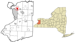
Lime Lake is a hamlet and census-designated place (CDP) in the northeast part of the town of Machias, in Cattaraugus County, New York, United States. As of the 2010 census, it had a population of 867. Prior to the 2010 census, the area was delineated as part of the Lime Lake-Machias CDP.

Clarence is a hamlet and census-designated place (CDP) within the town of Clarence in Erie County, New York, United States. The population was 2,646 at the 2010 census.
Cheektowaga Northwest was a census-designated place within the northwestern part of the town of Cheektowaga in Erie County, New York during the 1960 United States Census. The population recorded was 52,362. The census area dissolved in 1970, however the census area became part of Cheektowaga CDP in 1980, when the CDP recorded a population of 92,145. The ZIP code serving the area is 14225.