
The New York City Subway is a rapid transit system in the New York City boroughs of Manhattan, Brooklyn, Queens, and the Bronx. It is owned by the government of New York City and leased to the New York City Transit Authority, an affiliate agency of the state-run Metropolitan Transportation Authority (MTA). Opened on October 27, 1904, the New York City Subway is one of the world's oldest public transit systems, one of the most-used, and the one with the most stations, with 472 stations in operation.

The Maryland Transit Administration (MTA) is a state-operated mass transit administration in Maryland, and is part of the Maryland Department of Transportation. The MTA operates a comprehensive transit system throughout the Baltimore-Washington Metropolitan Area. There are 80 bus lines serving the Baltimore Metropolitan Area, along with rail services that include the Light Rail, Metro Subway, and MARC Train. In 2022, the system had a ridership of 52,922,000, or about 164,000 per weekday as of the fourth quarter of 2022. With nearly half the population of Baltimore residents lacking access to a car, the MTA is an important part of the regional transit picture. The system has many connections to other transit agencies of Central Maryland, Washington, D.C., Northern Virginia, and south-central Pennsylvania : WMATA, Charm City Circulator, Regional Transportation Agency of Central Maryland, Annapolis Transit, Rabbit Transit, Ride-On, and TransIT.

Greenbelt station is a Washington Metro and MARC station in Prince George's County, Maryland. The station is the northeastern terminus of the Green Line of the Washington Metro. MARC commuter rail trains on the Camden Line also stop at Greenbelt on a set of tracks parallel to the Metro tracks.
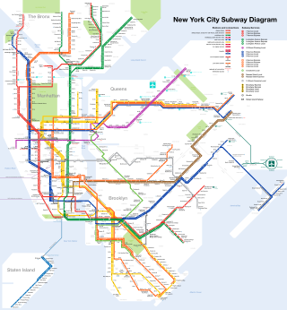
The New York City Subway is a rapid transit system that serves four of the five boroughs of New York City, New York: the Bronx, Brooklyn, Manhattan, and Queens. Its operator is the New York City Transit Authority, which is itself controlled by the Metropolitan Transportation Authority of New York. In 2015, an average of 5.65 million passengers used the system daily, making it the busiest rapid transit system in the United States and the 11th busiest in the world.

The Metro SubwayLink is a rapid transit line serving the greater area of Baltimore, Maryland, in the United States, and is operated by the Maryland Transit Administration. The segment in Downtown Baltimore is underground, and most of the line outside the central city is elevated or at surface grade. In 2022, the line had a ridership of 1,988,300, or about 6,200 per weekday as of the fourth quarter of 2022.

The Green Line is a proposed mass transit line for the Baltimore, Maryland area in the United States. It is still in the planning stages and its construction is not guaranteed.
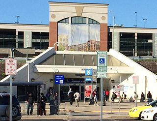
Owings Mills station is a Metro SubwayLink station in Owings Mills, Maryland. The station is experiencing transit-oriented development from Metro Centre at Owings Mills, bringing many apartments, office space, retail, restaurants, and condominiums to the area adjacent to the station. It has more parking spaces than all other stops along the line. The station is located in the center median of Interstate 795 and is the northern terminus of the line.

Mondawmin station is a Metro SubwayLink station in Baltimore, Maryland. It is located under the intersection of Reisterstown Road and Liberty Heights Avenue in the Mondawmin neighborhood, adjacent to the Mondawmin Mall. It is the northernmost underground station on the line, and a major transfer point to many bus routes.

Milford Mill station is a Metro SubwayLink station in Lochearn, Maryland. It is the twelfth station on the line going outbound and the third going inbound, and has approximately 1300 parking spaces.

Reisterstown Plaza station is a Metro SubwayLink station in Baltimore, Maryland. It is located at the intersection of Patterson and Wabash Avenues, and is the fourth most northern and western station on the line, with approximately 700 parking spaces. It is within a close distance to the Reisterstown Road Plaza, for which it is named. It is also near the northwest division of the Maryland Transit Administration, where buses are stored.
Rogers Avenue station is a Metro SubwayLink station in Baltimore, Maryland. It is located in the Woodmere area, and is the fifth most northern and western station on the line, with approximately 900 parking spaces.

West Cold Spring station is a Metro SubwayLink station in Baltimore, Maryland. It is located at the intersection of Wabash Avenue and Cold Spring Lane in the Arlington neighborhood, adjacent to the Towanda-Grantley neighborhood. It is the sixth most northern and western station on the line, with approximately 300 parking spaces.

Penn-North station is an underground Metro SubwayLink station and transit hub serving many buses in West Baltimore, Maryland. Its name comes from its location and neighborhood it serves Penn-North, at the corner of Pennsylvania and North Avenues. It is the deepest underground station, eighth most northern and western station on the line, and the first station when starting from Owings Mills that does not have free parking.
Upton–Avenue Market station is an underground Metro SubwayLink station in West Baltimore, Maryland located near the intersection of Pennsylvania Avenue and Laurens Street. The station takes its name from the surrounding Upton neighborhood and the nearby Avenue Market at 1700 Pennsylvania Avenue. It is the ninth most northern and western station on the line.
State Center / Cultural Center station is an underground Metro SubwayLink station in Baltimore, Maryland. It is a transit hub offering connections to Light RailLink, the tenth most northern and western station on the line, the first one in the area viewed by many as "downtown Baltimore," and is within a 2 block walk of the Cultural Center / State Center station on the Baltimore Light Rail via Preston Street, and many area landmarks.

Lexington Market station is an underground Metro SubwayLink station in Baltimore, Maryland. It is one of 14 stops in the downtown Baltimore area. The station is a transportation hub, a designated transfer station to the Light RailLink Lexington Market station. The station is also served by a number of bus lines.

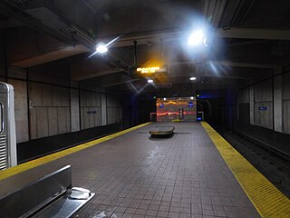
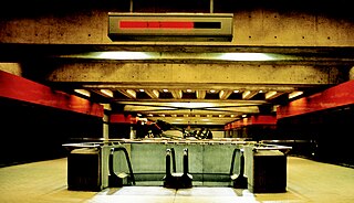
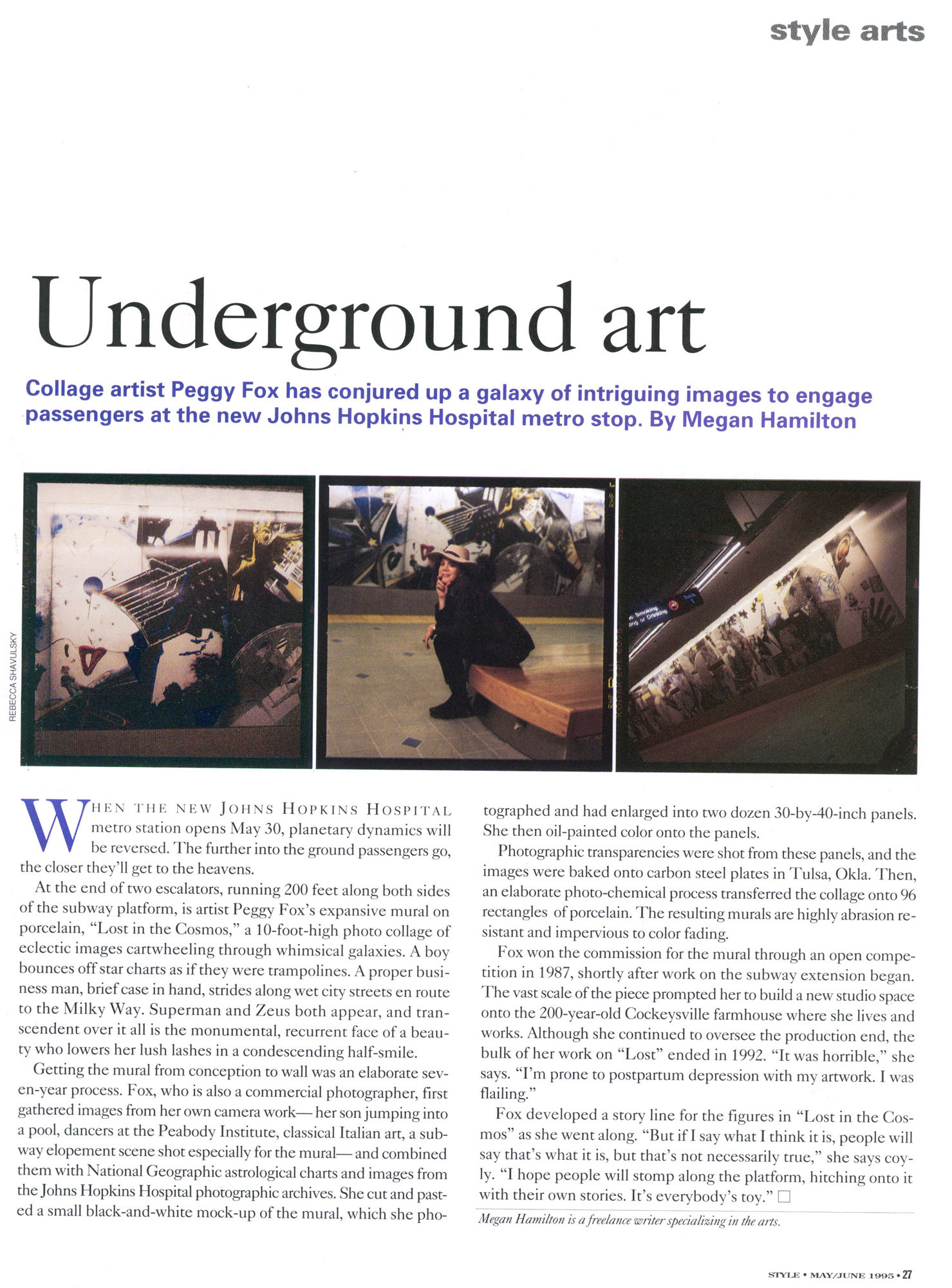
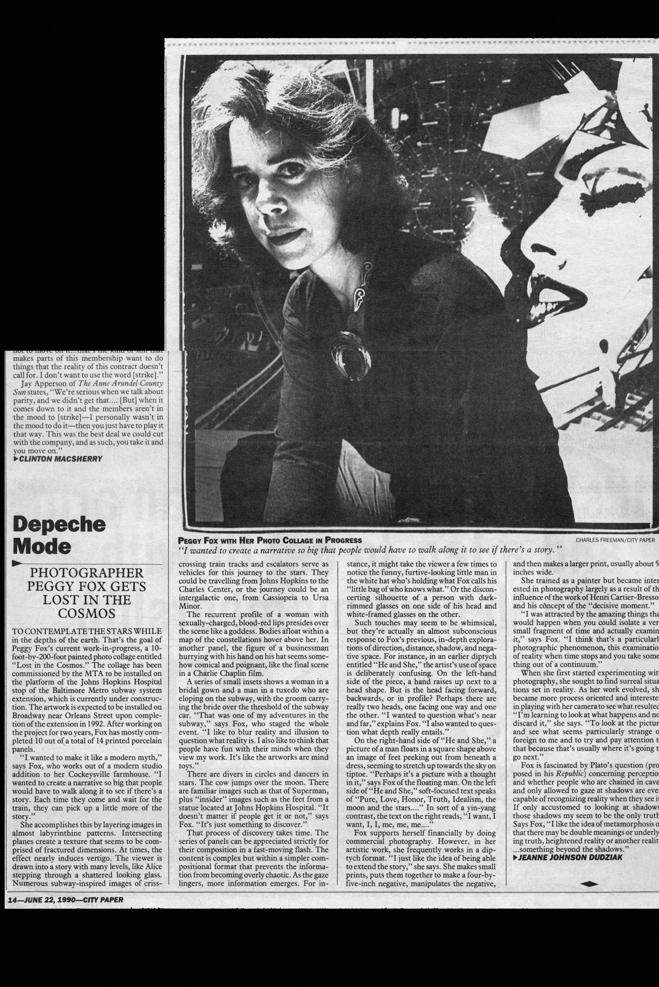
Charles Center station is an underground 2 floor Metro SubwayLink station in Baltimore, Maryland making it the largest station on the line. Located at the Charles Center in Downtown Baltimore, it is a downtown transportation hub serving many bus lines, nearby various landmarks, and bus transfers. It was the final stop of the line until 1995, when the extension to Johns Hopkins Hospital opened. The station is in close proximity to CFG Bank Arena as well as the Baltimore Arena station on the Light RailLink. The station has two street level entrances via escalators and elevators and is the center most station on the line serving Central Downtown Baltimore.

Shot Tower station is an underground Metro SubwayLink station in Baltimore, Maryland. It is in the central part of the city, in close proximity to many well-known landmarks, including the Shot Tower for which it is named, Port Discovery, Power Plant Live!, the Harbor campus of Baltimore City Community College, the National Aquarium, the Flag House, and Little Italy. The station has two street-level entrances, but unlike other Baltimore Metro stations that do, both these entrances share a common gate inside the station. The Shot Tower station is one of two stops in the third phase of the Baltimore Metro, having opened in 1995. Originally named Shot Tower/Market Place to showcase the proximity to the Market Place development, MTA Maryland dropped Market Place from its title with the 2017 rebranding of BaltimoreLink.
Southern Maryland Rapid Transit, abbreviated as SMRT, is a proposed mass transit line along the Maryland Route 5 and U.S. Route 301 highway corridors in between Washington, D.C. and Waldorf, Maryland. The project would link the heavily populated suburbs of northwestern Southern Maryland with Washington via a direct transit connection to the Washington Metro at Branch Avenue station.

