Mondawmin station

Last updated
Mondawmin
Metro SubwayLink station
Mondawmin station - April 2019.jpg
Mondawmin station in April 2019.
General information
Location2307 Liberty Heights Avenue
Baltimore, Maryland 21215
Coordinates 39°19′05″N76°39′10″W / 39.318170°N 76.652695°W / 39.318170; -76.652695
Owned by Maryland Transit Administration
Platforms1 island platform
Tracks2
Construction
Parking175 spaces
AccessibleYes
History
OpenedNovember 21, 1983
Passengers
20173,902 daily [1]
Services
Preceding station MDOT-MTA Logo.svg Maryland Transit Administration Following station
West Cold Spring
toward Owings Mills
Metro SubwayLink Penn–North
Location
Mondawmin station

Mondawmin station is a Metro SubwayLink station in Baltimore, Maryland. It is located under the intersection of Reisterstown Road and Liberty Heights Avenue in the Mondawmin neighborhood, adjacent to the Mondawmin Mall. It is the northernmost underground station on the line, and a major transfer point to many bus routes.

Contents

Mondawmin station serves Mondawmin Mall, Coppin State University, Druid Hill Park, The Maryland Zoo in Baltimore, and the Lower Park Heights neighborhood.

The station's location next to Mondawmin Mall, Baltimore's oldest mall, has led its owners to plan an expansion. [2]

On the surface, a bus loop connects to Reisterstown Road and Liberty Heights Avenue. This loop and the adjacent streets are used by a number of bus routes, many of which terminate in it.

Several routes were cut back to Mondawmin on June 18, 1984, about seven months after the station opened, and Routes M-1, M-2, and M-3 were formed at that time to replace the portions of those routes beyond Mondawmin. Specifically, Route M-1 was split from Route 28 (now Route 5 near Mondawmin), Route M-2 was split from Route 7, and Route M-3 was split from Route 5. [3]

Station features

In July 2021, the MTA announced the installation of digital bus arrival signage at the Mondawmin station bus loop as part of a pilot program which also includes Rogers Avenue station and the Patapsco light rail station. [4] A 2010 renovation to the station area which included the repavement of the bus loop had been accompanied by an announcement about the installation of digital signage, but the implementation of real time bus tracking for local MTA buses did not until later. [5] The current iteration of real time bus tracking used to update the digital signage was launched by the MTA in partnership with the Transit app in 2018. [6]

In the summer of 2021, the MTA confirmed a contract for the replacement and removal of two elevators at Mondawmin station, which provide access to the mezzanine level from the street level and connect the platform to the mezzanine level respectively. The extensive overhaul of the elevators and elevator enclosures at the station follows a determination that currently installed equipment has outlived its useful life, and is expected to take 20 months, from January 2022 to August 2023. [7] [8]

Artwork

A back-lit photographic montage entitled "Archetype" by Baltimore artist R. Thomas Gregory is installed along the end wall of the station's upper level. The artwork was commissioned by the MTA for $85,000 in 1983. [9]

History

Excavation and construction

Mondawmin station was constructed in residual soils and rock using the cut-and-cover technique. The excavation was conducted differently from the other underground stations in the Baltimore Metro system; while other station excavations were supported by soldier piles extending below their depth, the Mondawmin excavation was supported by a composite system consisting of soldier piles through the upper decomposed formations, and rock bolts, wire mesh, and shotcrete through the lower more rigid materials. This method decreased the time and cost of construction, and provided more open working space for the contractor. Extensive instrumentation was used to identify where additional support was required as the excavation proceeded. The excavation was 183 meters long, 16 meters wide, and reached depths to bottom between 27 and 29 meters. [10]

The excavation was informed by an investigation of the weathering profile of the underlying material in which 24 vertical and inclined borings were conducted. A series of residual materials were characterized and classified in the upper portions of the profile, underlain by more competent material and the parent amphibolite and intrusive gneiss bedrock. Shear zones frequently identified with the contacts between the amphibolite and the gneiss were identified as important for the design of the support system for the excavation. [11]

Two sets of tunnels were constructed underground at a site which could be entered through a portal near the intersection of Druid Park Drive and Liberty Heights Avenue, and which extended across an area beneath the 2600 block of Liberty Heights Avenue. Construction of the tunnels was overseen by Cleveland-based contractor Clevecon-au-Vianini for a cost of $40.7 million. The Mondawmin tunnels are unique among those that make up the Baltimore Metro subway line in that they were driven through competent rock rather than weathered or residual material. [12]

Mondawmin Shuttle

MTA Line 21 Bus outside of Mondawmin station MTA MD 9053 21 Mondawmin.jpg
MTA Line 21 Bus outside of Mondawmin station

MTA Route 97, also known as the Mondawmin Shuttle Bug or Mondawmin Shuttle, was the second and is so far the final in the series of shuttle bugs to be introduced in the 2000s. The route serves Baltimore City Community College, Coppin State College, and various nearby streets, some served by regular bus routes, and some not. But the full route is within a close walk of one or more other MTA bus routes. The route operates at 20-minute intervals.

In 2005, as part of the Greater Baltimore Bus Initiative, it was initially proposed that the shuttle's frequency would be reduced to one bus an hour, and riders were encouraged to use other regular bus routes that shared common routing. However, after community meetings, it was ultimately decided that the schedule would remain the same. [13]

In 2006, MTA proposed that the route would be modified to serve Reservoir Hill in order to replace a portion of Route 5 that was at the time proposed for modification away from this area. But it was later decided that Route 5 would continue to serve Reservoir Hill.

April 27, 2015 protests and shutdown

On Monday, April 27, 2015, riots broke out around Mondawmin station in a clash between police officers and demonstrators protesting the death of Freddie Gray. Details of the origins of the clashes and response from local officials have remained unclear since they occurred. In the early afternoon, law enforcement officials arrived at the transit hub in riot gear, allegedly in response to memes about a "purge" around school dismissal time which were being circulated on social media. At 2:45 P.M., police officers, MTA officials, and school officials were gathered at Mondawmin station for a roll call, and minute later at 2:46 P.M., the MTA issued a dispatch about a rock being thrown. Baltimore police officers formed a skirmish line across the bus loop, blocking access to buses, within the next 10 minutes. Many students at the nearby Frederick Douglas High School were left stranded as they left the school. A growing number people had been arriving on the scene prior to the shut down of Mondawmin station. At first, MTA officials tried to get some students and other patrons onto departing trains while blocking passengers from alighting at Mondawmin, and some buses were still stopping in the area. At 3:21 P.M., Baltimore police closed the intersection of Reisterstown Road and Liberty Heights Avenue, forcing the diversion of all bus traffic from the area. [14]

The MTA subsequently announced that the Metro subway was operating on Tuesday, April 28, but that Mondawmin, Upton, and Penn-North stations would be temporarily closed, and that bus diversions around the Mondawmin bus loop were in place. [15] On Wednesday, April 29, the MTA announced the continuation of the temporary station closures and bus diversions. [16] On Thursday, April 30, the MTA reopened the stations to resume regularly scheduled service. [17]

Notably, it remains unclear who ordered the shutdown of transit at Mondawmin on April 27, 2015. Mayor Stephanie Rawlings-Blake stated that she was not sure where the order came from, and that MTA officials attributed it to school officials, while school officials attributed it to the police. A spokesman for the MTA said that the police requested the shut down, and city police referred questions about the shutdown to the MTA. Baltimore City Public Schools CEO Gregory Thornton said that he was amid key meetings with the mayor and the governor and was "completely caught off guard" by the decision to shut down transit. [18] [14]

Transit-oriented development

In November 2018, a mixed-income affordable housing community named Metro Heights opened at the intersection of Liberty Heights Avenue and Reisterstown Road near the Mondawmin Metro station due to the site's advantageous location within Baltimore City's regional transportation network. The 15.9 million dollar four-story development of 70 units replaced a block of vacant row homes and was financed by a combination of state, city, and private investment organizations. [19] [20] [21]

Local politicians including Mayor Catherine Pugh gather for an opening ceremony for Metro Heights at Mondawmin in November 2018. Grand Opening for Metro Heights at Mondawmin.jpg
Local politicians including Mayor Catherine Pugh gather for an opening ceremony for Metro Heights at Mondawmin in November 2018.

Related Research Articles

<span class="mw-page-title-main">Maryland Transit Administration</span> Public transit authority of the state of Maryland

The Maryland Transit Administration (MTA) is a state-operated mass transit administration in Maryland, and is part of the Maryland Department of Transportation. The MTA operates a comprehensive transit system throughout the Washington-Baltimore metropolitan area. There are 80 bus lines serving the Baltimore Metropolitan Area, along with rail services that include the Light Rail, Metro Subway, and MARC Train. In 2023, the system had a ridership of 52,922,000, or about per weekday as of the fourth quarter of 2023.

<span class="mw-page-title-main">Baltimore Metro SubwayLink</span> Rapid transit line in Baltimore, Maryland, US

The Baltimore Metro SubwayLink is a rapid transit line serving Baltimore, Maryland, and its northwestern suburbs, operated by the Maryland Transit Administration. The segment in Downtown Baltimore is underground, while most of the line outside the central city is elevated or at surface grade. In 2023, the line had a ridership of 1,988,300, or about 7,953 per weekday as of the fourth quarter of 2023.

<span class="mw-page-title-main">Route 7 (MTA Maryland)</span> Bus route operated by the Maryland Transit Administration

Route 7 was a bus route operated by the Maryland Transit Administration in Baltimore. The line, which operated between 1959 and 2017, ran from Canton, Baltimore to the Mondawmin Metro Subway Station, serving the communities of Butcher's Hill, Little Italy, and Sandtown-Winchester.

<span class="mw-page-title-main">CityLink Pink (BaltimoreLink)</span> Bus route operated by the Maryland Transit Administration

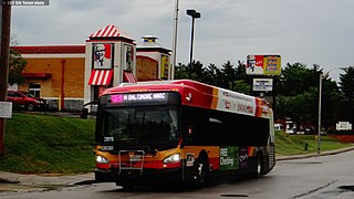
CityLink Pink is a bus route operated by the Maryland Transit Administration in Baltimore. The line currently runs from Cedonia in northeast Baltimore to the West Baltimore MARC station.

<span class="mw-page-title-main">MTA BaltimoreLink</span> Bus transit service in Maryland

The Maryland Transit Administration provides the primary public bus service for the Baltimore metropolitan area and commuter bus service in other parts of the state of Maryland. There are currently 76 bus routes, which include 45 LocalLink routes, 12 High Frequency CityLink Routes routes, 8 express bus routes, 19 commuter bus routes, and 5 Intercounty Connector or "ICC" routes. The local and commuter bus routes operate in conjunction with one subway line, three light rail lines, MARC train service, and various connections to other transit agencies.

Mondawmin Mall is a three-level shopping mall in West Baltimore, Maryland, United States. The mall was a development of the Mondawmin Corporation, a firm set up in 1952 by James Rouse and Hunter Moss under the Moss-Rouse Company. When it first opened in October 1956, it had an open-air plan and was called the Mondawmin Center. It was later enclosed and renamed the Mondawmin Mall.

<span class="mw-page-title-main">Penn-North station</span> Metro SubwayLink station

Penn-North station is an underground Baltimore Metro SubwayLink station and transit hub serving many buses in West Baltimore, Maryland. Its name comes from its location and neighborhood it serves Penn-North, at the corner of Pennsylvania and North Avenues. It is the deepest underground station, eighth most northern and western station on the line, and the first station when starting from Owings Mills that does not have free parking.

<span class="mw-page-title-main">LocalLink 73 (BaltimoreLink)</span> Bus route in Baltimore, Maryland and its suburbs

Route 51 is a bus route operated by the Maryland Transit Administration in Baltimore and its suburbs. The line currently runs from the Rogers Avenue Metro Subway Station to the Patapsco Light Rail Stop, serving the communities of Arlington, Ashburton, Mondawmin, Rosemont, Baltimore, Cherry Hill, and Mt. Winans, and the suburb of Baltimore Highlands.

<span class="mw-page-title-main">LocalLink 30 (BaltimoreLink)</span> Bus route operated by the Maryland Transit Administration

LocalLink 30 is a bus route operated by the Maryland Transit Administration in Baltimore and its suburbs. It replaced route 44 following the 2017 BaltimoreLink overhaul of the bus network. The line currently runs from Rosedale Industrial Park near Pulaski Highway just outside the Baltimore city limits on the east side of the city across the northern portion of the city to Security Square Mall, with selected peak hour trips to the Social Security Administration. Some early morning trips before 7 AM lay over at the Centers for Medicare and Medicaid Services (CMS) headquarters. The line operates mostly along Frankford Avenue, Echodale Avenue, East Belvedere Avenue, Northern Parkway, Rogers Avenue, and Gwynn Oak Avenue, serving the communities of Gardenville, Hamilton, Belvedere Park, Homeland, Roland Park, Pimlico, and Arlington, and the western suburb of Woodlawn.

<span class="mw-page-title-main">Wabash Avenue (Baltimore, Maryland)</span>

Wabash Avenue is a six-lane boulevard in northwest Baltimore, Maryland, that runs from Patterson Avenue to Hilton Street, mostly through the Arlington community, crossing over Northern Parkway and Cold Spring Lane along the way. The road starts near the Reisterstown Plaza Metro Subway Station and continues to just past the West Coldspring Metro Subway Station, where it narrows and becomes a one-way pair with Dorithan Road, which ends several blocks later at Hilton Street.

LocalLink 85 is a bus route that operates in Baltimore and its suburbs. All trips operate from the Penn-North Metro Subway Station in Baltimore City to the Milford Mill Metro Subway Station in Pikesville. The route, which started operating on August 24, 2008, is a combination of the most recent versions of the former routes M-3 and M-8, which had been operating since 1984 and 1987 respectively. Prior to these dates, the routes had been served by other buses and streetcars.

<span class="mw-page-title-main">LocalLink 33 (BaltimoreLink)</span> Bus route in Baltimore, Maryland and its suburbs

Route 58 is a bus route operated by the Maryland Transit Administration in Baltimore and its suburbs. The line's western terminus is the Reisterstown Plaza Metro Subway Station, and its eastern terminus is White Marsh Mall, though some peak hour trips make short turns in Overlea. Route 58 serves the communities of Glen, Cheswolde, Fallstaff, a large section of Northern Parkway, and a portion of Belair Road in Baltimore County.

<span class="mw-page-title-main">LocalLink 89 (BaltimoreLink)</span> Bus route operated by the Maryland Transit Administration

LocalLink 89 is a bus route operated by the Maryland Transit Administration in Baltimore and its suburbs, mostly along Reisterstown Road. The line currently runs from the Reisterstown Plaza Metro Subway Station to the Owings Mills Town Center. The line replaced original Route 59 under BaltimoreLink, and was a split-off from Route M-9, and resembles the pre-1997 route of Route M-9. It is the successor to several other bus routes and streetcars.

<span class="mw-page-title-main">LocalLink 87 (BaltimoreLink)</span> Bus route operated by the Maryland Transit Administration

LocalLink 87 is a bus route operated by the Maryland Transit Administration in the suburbs of Baltimore. The route currently runs from the Owings Mills Town Center to Glyndon via Reisterstown Road and the Owings Mills Metro Subway Station. The line, which was a split-off from the final version of the now defunct Route M-9, and resembles the former Route M-16 that operated from 1987 to 1998. The route was previously named No. 56 before BaltimoreLink, when it was replaced in its entirety by Route 87.

<span class="mw-page-title-main">CityLink Lime (BaltimoreLink)</span> Bus route operated by the Maryland Transit Administration

CityLink Lime is a CityLink bus route operated by the Maryland Transit Administration in Baltimore and its suburbs. The line currently runs from the Mondawmin Metro Subway Station along Liberty Heights Avenue and Liberty Road to a loop known as in Milford Mill with buses marked as "Milford Mill". The loop is composed of a square block, consisting of Liberty Road, Rolling Road, Church Lane, and Milford Mill Road. The spot of the layover depends on the time of day.

<span class="mw-page-title-main">LocalLink 31 (BaltimoreLink)</span> Bus route operated by the Maryland Transit Administration

Route 57 is a bus route operated by the Maryland Transit Administration in Baltimore and its suburbs. The line currently runs from the Rogers Avenue Metro Subway Station in Northwest Baltimore to Security Square Mall, with selected trips to the Social Security Administration headquarters in Woodlawn. The line serves the corridor of Gwynn Oak Avenue and the communities of Howard Park, Gwynn Oak, and Windsor Mill.

<span class="mw-page-title-main">LocalLink 83 (BaltimoreLink)</span> Bus route operated by the Maryland Transit Administration

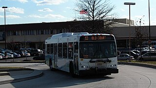
LocalLink 83 is a bus route in Baltimore and its suburbs. The line currently runs from the Old Court Metro Subway Station in Pikesville, Maryland to the Mondawmin Metro Subway Station in Northwest Baltimore along Old Court Road and Reisterstown Road, serving the communities of Park Heights and the Reisterstown Road Plaza. The line is the successor to Bus Route 7, which still operates south of Mondawmin. Route 7 operated along Reisterstown Road outside the Metro's hours of operation until 2001.

Dorchester is a neighborhood in the Northwest District of Baltimore. It is located between the neighborhoods of Arlington (north), Central Forest Park (south), Howard Park (west) and Gallway-Garrison (east). Maryland Route 26 draws boundary between Dorchester and Central Forest Park. Dorchester's other boundaries are marked by Oakford Avenue, Eldorado Avenue and Garrison Boulevard.

Callaway-Garrison is a neighborhood in the Northwest district of Baltimore, located between the neighborhoods of Dorchester (west) and Ashburton (east). Its boundaries are marked by West Cold Spring Lane (north), Liberty Heights Avenue (south), Callaway Avenue (east) and Garrison Boulevard (west).

LocalLink 26 is a bus route operated by the Maryland Transit Administration in Baltimore between Mondawmin and Brooklyn. On southbound trips, the route departs from Mondawmin Metro Bus Bay 2, near the intersection of Reisterstown Road and Liberty Heights Avenue north of Mondawmin Mall in West Baltimore, and terminates at the South Baltimore Park & Ride near the intersection of South Hanover Street and Baltic Avenue. Northbound trips run in the opposite direction between these terminal stops.

References

  1. Metro SubwayLink Cornerstone Plan (PDF) (Report). Maryland Department of Transportation, Maryland Transit Administration. August 28, 2019. p. 15. Retrieved November 18, 2021.
  2. Walker, Andrea K. (February 15, 2006). "Bigger stores in works for Mondawmin Mall". The Baltimore Sun .
  3. Paul, Adam. "The routes of Baltimore transit: 1900 to today - Metro connection bus routes". Archived from the original on July 17, 2011. Retrieved November 18, 2021.
  4. Luczak, Marybeth (July 6, 2021). "Transit Briefs: Metrolinx, MDOT MTA, UTA, VIA Rail". Railway Age. Retrieved November 18, 2021.
  5. Dresser, Michael (June 18, 2010). "MTA begins upgrades at Mondawmin hub". The Baltimore Sun . Retrieved November 18, 2021.
  6. "Enhancing the customer experience with real-time signage at Metro subway and light rail stations" (Press release). Baltimore, MD. Maryland Department of Transportation, Maryland Transit Administration. July 1, 2021. Retrieved November 18, 2021.
  7. Arnold, Holly (June 29, 2021). Franchise Agreement Report: Summary of Service Disruptions & Asset Conditions - Metro SubwayLink and Light RailLink (Report). Maryland Department of Transportation, Maryland Transit Administration. p. 5. Retrieved November 18, 2021.
  8. Mondawmin Elevator Replacement (Report). Construction Journal. June 28, 2021. Retrieved November 18, 2021.
  9. Dorsey, John (November 20, 1983). "The art & architecture of the new subway: tunnel visions". The Sun . Photos by David Harp. p. 313.
  10. Leca, E.; Clough, G. W. (1994). "Construction and instrumentation of underground excavations". Thirteenth International Conference on Soil Mechanics and Foundation Engineering: 303–310.
  11. McRae, Michael Townsened (1994). The behavior of deep excavations in weathered rock (Doctoral). University of California, Berkeley.
  12. Winternitz, Helen (August 27, 1978). "Unnoticed above, 2 tunnels creep noisily toward Mondawmin station". The Baltimore Sun . p. A1.
  13. Baltimore Sun (29 July 2005). "State unveils bus route changes less sweeping than prior proposal". Los Angeles Times. Retrieved 1 July 2015.
  14. 1 2 Rector, Kevin (April 20, 2019). "What happened at Mondawmin? Newly obtained documents shed light on start of Baltimore riot". The Baltimore Sun . Retrieved November 18, 2021.
  15. "MTA: some subway stations are closed, including Mondawmin Mall and Penn-North". WBAL NewsRadio 1090. April 28, 2015. Retrieved November 18, 2021.
  16. "MTA suspends some subway & bus service at request of police". WUSA9. April 29, 2015. Retrieved November 18, 2021.
  17. Rector, Kevin (April 30, 2015). "Latest updates on Baltimore unrest and Freddie Gray case". p. 55. Retrieved November 18, 2021.
  18. Broadwater, Luke (July 22, 2015). "Rawlings-Blake: 'Confusion' remains over who ordered buses shut down before riot". The Baltimore Sun . Retrieved November 18, 2021.
  19. Bednar, Adam (November 29, 2018). "Metro Heights replaces 'corner of chaos and mayhem'". The Daily Record. Retrieved November 18, 2021.
  20. Kimura, Donna (June 30, 2017). "Enterprise Homes closes on financing for Baltimore development". Affordable Housing Finance. Retrieved November 18, 2021.
  21. "HABC celebrates the opening of Metro Heights at Mondawmin" (Press release). Baltimore, MD. Housing Authority of Baltimore City. November 29, 2018. Retrieved November 18, 2021.