Camden, South Carolina

Last updated

Camden, South Carolina
Camden, SC City Hall.jpg
Camden City Hall
Camden, SC City Seal.gif
Nickname: 
Steeplechase Capital of the World
Motto: 
"Classically Carolina"
SCMap-doton-Camden.PNG
Coordinates: 34°15′33″N80°36′33″W / 34.25917°N 80.60917°W / 34.25917; -80.60917
CountryUnited States
State South Carolina
County Kershaw
FoundedMarch 22, 1786
Government
  TypeCity manager-council
  MayorAlfred Mae Drakeford
Area
[1]
  Total11.90 sq mi (30.82 km2)
  Land11.11 sq mi (28.77 km2)
  Water0.79 sq mi (2.05 km2)
Elevation
187 ft (57 m)
Population
 (2020) [2]
  Total7,788
  Density701.18/sq mi (270.72/km2)
Time zone UTC−5 (Eastern)
  Summer (DST) UTC−4 (Eastern)
ZIP codes
29020 & 29021
Area code(s) 803, 839
FIPS code 45-10855 [3]
GNIS feature ID1247113 [4]
Website experiencecamdensc.com

Camden is the largest city and county seat of Kershaw County, South Carolina. The population was 7,764 in the 2020 census, [5] and the 2022 population estimate is 8,213. [6] It is part of the Columbia, South Carolina, Metropolitan Statistical Area. Camden is the oldest inland city in South Carolina, and home to the Carolina Cup and the National Steeplechase Museum. [7]

Contents

Geography

Original Kershaw County courthouse in Camden Kershaw courthouse 0077.jpg
Original Kershaw County courthouse in Camden
Downtown Camden, SC Downtown Camden, SC.jpg
Downtown Camden, SC

Camden is located in the Midlands of South Carolina, in the south-central part of Kershaw County. It sits on the northeast side of the Wateree River, a south-flowing tributary of the Santee River. According to the United States Census Bureau, Camden has a total area of 11.39 square miles (29.49 km2), of which 10.68 square miles (27.66 km2) are land and 0.71 square miles (1.83 km2), or 6.21%, are water. [8]

U.S. Route 521 runs through downtown as Broad Street, leading 29 miles (47 km) southeast to Sumter, and 76 miles (122 km) north to Charlotte, North Carolina. US 601 runs with US 521 through downtown, leading 21 miles (34 km) north with US 521 to Kershaw, and south on its own 50 miles (80 km) to St. Matthews and 63 miles (101 km) to Orangeburg. US Route 1 (DeKalb Street) intersects with US 521 and 601 in downtown, leading 32 miles (51 km) southwest to the state capital, Columbia, and 61 miles (98 km) northeast to Cheraw. Interstate 20 passes 2 miles (3 km) south of the city's center; it leads east 50 miles (80 km) to Florence and southwest to Columbia.

Neighborhoods

History

Colonial years

Camden is the oldest inland city and the fourth oldest city in South Carolina. It is near the center of the Cofitachequi chiefdom that existed in the 1500s. [9] In 1730, Camden became part of a township plan ordered by King George II. Kershaw County's official website states, "Originally laid out in 1732 as the town of Fredericksburg in the Wateree River swamp (south of the present town) when King George II ordered eleven inland townships established along South Carolina's rivers, few of the area settlers chose to take lots surveyed in the town, choosing the higher ground to the north. The township soon disappeared." In 1758, Joseph Kershaw from Yorkshire, England, came into the township, established a store and renamed the town "Pine Tree Hill". Camden became the main inland trade center in the colony. Kershaw suggested that the town be renamed Camden, in honor of Lord Camden, a champion of colonial rights in the British Parliament. [10] In the 1770s it was the site of an early American porcelain factory, established by John Bartlam.

American Revolution and antebellum era

Flag of Great Britain in Camden, representing the city's connection to the Revolutionary War period. British empire flag in Camden, SC.png
Flag of Great Britain in Camden, representing the city's connection to the Revolutionary War period.

May 1780 brought the American Revolution to Charleston, South Carolina, when it fell under the Crown's control. Lord Charles Cornwallis and 2,500 of his Loyalist and British troops marched to Camden and established there the main British supply post for the Southern campaign. The Battle of Camden, the worst American defeat of the Revolution, was fought on August 16, 1780, near Camden, and on April 25, 1781, the Battle of Hobkirk's Hill was fought between about 1,400 troops led by General Nathanael Greene and 950 Loyalists and British soldiers led by Lord Francis Rawdon. The latter battle was a costly win for the British and forced them to leave Camden and retreat to the coast.

After the Revolution, Camden's prominence and wealth grew as a major interior trading town with direct ties to Charleston and the world. Regional products, augmented with goods from the interior of North Carolina and far lands to the west were transported from Camden to Charleston on flat-bottom riverboats that plied the adjacent Wateree River before the railroad arrived in 1842. An Episcopal seminary opened in the town in 1857, but the campus burned during Sherman's invasion. The school did not reopen. [11]

American Civil War and later years

American Revolutionary War reenactment. Camden, SC Revolutionary War reenactment.png
American Revolutionary War reenactment.

Camden was the source of six Confederate generals during the American Civil War. Richard Rowland Kirkland – "The Angel of Marye's Heights" – is interred in the Old Quaker Cemetery. At the end of the war, components of Sherman's army burned Confederate and nearby properties, including a full block of downtown buildings. The last Federal officer killed in the Civil War was 1st Lt E.L. Stevens of the 54th Massachusetts Infantry who died in a skirmish 9 miles south of Camden at the Battle of Boykin's Mill on April 18, 1865.

Starting in the mid-1880s the Camden area became an increasingly popular destination for wealthy northern families to spend the winter. Eventually, three resort hotels provided winter tourism activities well into the 1930s and beyond. The town became associated with many equestrian activities and is now the home of the third oldest active polo field in America. In the winter, more than 1,500 thoroughbreds call the area home. According to Kershaw County's web site, "Horse-related activities became very popular. That interest in equine activities has continued and today the horse industry is a major part of the county's economy. For that reason, the city is known as the 'Steeplechase Capital of the World'."

Aerial view of the Orlon Plant in Camden. Aerial view of Duponts "Orlon" Plant, Camden, S. C.jpg
Aerial view of the Orlon Plant in Camden.

In 1950, Dupont opened the Dupont May Plant in Camden which manufactured Orlon. The plant was located on five miles of land and employed over 2,000 people. [12] [13] For many years it was the town's largest employer. [14] In 1977, DuPont notified the National Institute for Occupational Safety and Health of a study the company conducted which showed an "excessive incidence and cancer mortality" rate among a cohort of workers who worked at the plant from 1950 to 1955. [15] The findings were liked to a major chemical component of Orlon, acrylonitrile. [16] Citing issues with foreign competition, Dupont ended the production of Orlon in 1990. [17] Since the closure of the Orlon plant, the town has attracted a number of manufacturing companies such as Hengst GmbH & Co. and Haier. [18] In 2003, Target opened an $85 million distribution center in the town. [17]


Jewish community

Camden has long had a Jewish community. Members of the community have included David Camden de Leon, Mordecai M. Levy, Chapman Levy, and Bernard Baruch. [19]

Demographics

Historical population
CensusPop.Note
1850 1,133
1860 1,62143.1%
1870 1,007−37.9%
1880 1,78076.8%
1890 3,53398.5%
1900 2,441−30.9%
1910 3,56946.2%
1920 3,93010.1%
1930 5,18331.9%
1940 5,74710.9%
1950 6,98621.6%
1960 6,842−2.1%
1970 8,53224.7%
1980 7,462−12.5%
1990 6,696−10.3%
2000 6,682−0.2%
2010 6,8382.3%
2020 7,78813.9%
U.S. Decennial Census [2]

2020 census

Camden racial composition [20]
RaceNum.Perc.
White (non-Hispanic)4,74460.91%
Black or African American (non-Hispanic)2,36730.39%
Native American 130.17%
Asian 680.87%
Pacific Islander 10.01%
Other/Mixed 2573.3%
Hispanic or Latino 3384.34%

As of the 2020 United States census, there were 7,788 people, 2,905 households, and 1,810 families residing in the city.

2010 census

As of the census [3] of 2010, there were 6,838 people living in the city limits, in 2,967 households and 1,800 families. The population density was 692.2 inhabitants per square mile (267.3/km2). There were 3,544 housing units at an average density of 331.8 per square mile (128.1/km2). The racial makeup of the city was 62.2% White, 35.1% African American, 0.20% Native American, 0.7% Asian, 0% Pacific Islander, 2.7% from other races, and 1.1% from two or more races. Hispanic or Latino people of any race were 2.4% of the population.

There were 2,967 households, out of which 27.7% had children under the age of 18 living with them, 41.1% were married couples living together, 16.5% had a female householder with no husband present, and 36.3% were non-families. 35.6% of all households were made up of individuals, and 18.9% had someone living alone who was 65 years of age or older. The average household size was 2.26 and the average family size was 2.94.

In the city, the population was spread out, with 21.9% under the age of 18, 20.1% from 18 to 39, 34.5% from 40 to 64, 17.3% from 65 to 84, and 4.3% who were 85 years of age or older. The median age was 45.3 years. 45.0% of the population was male and 55.0% of the population was female.

The Kershaw House, Georgian mansion first built, 1775-1780, by Joseph Kershaw, merchant and leading citizen of Camden became the headquarters for the occupying British army, 1780-1781. It burned in 1865, and was the object of an archaeological dig in 1968. Then it was rebuilt from 1974 to 1977. Joseph Kershaw Mansion.jpg
The Kershaw House, Georgian mansion first built, 1775–1780, by Joseph Kershaw, merchant and leading citizen of Camden became the headquarters for the occupying British army, 1780–1781. It burned in 1865, and was the object of an archaeological dig in 1968. Then it was rebuilt from 1974 to 1977.

The median income for a household in the city was $48,313, and the median income for a family was $62,140. Males had a median income of $42,597 versus $32,524 for females. The per capita income for the city was $26,385. About 13.7% of families and 15.4% of the population were below the poverty line, including 19.3% of those under age 18 and 13.2% of those aged 65 or over.


Government

Camden has a city manager–council form of government. Alfred Mae Drakeford, an African American woman, was elected mayor of Camden in November 2016. Camden is represented in the South Carolina Senate by Vincent Sheheen, who was born in Camden. It is part of South Carolina's 5th Congressional District, which is represented by Ralph Norman.

Education

Cadets from Camden Military Academy perform in a parade. Camden Military Academy BC and Color Guard, Graduation 2018.png
Cadets from Camden Military Academy perform in a parade.

The Kershaw County School District is the governing body of the public schools in the area. The district operates Pine Tree Hill Elementary School, Jackson Elementary School, Camden Elementary School, Woolard Technology Center (WTC), Camden Middle School, and Camden High School.

Camden Military Academy, the Montessori School of Camden, and Cornerstone Christian School are private institutions.

Central Carolina Technical College has two branches located in Camden.

Camden has a public library, a branch of the Kershaw County Library. [21]

Arts and culture

Kendall Lake in Camden, SC Kendall Lake in Camden, SC.png
Kendall Lake in Camden, SC

The Carolina Cup is an annual event held on either the final Saturday in March or the first Saturday of April. The first race was held on March 22, 1930, and has been held every year since, with the exception of 1943 and 1945 during World War II and 2020 due to the coronavirus. The races have become a South Carolina tradition, and normally draw a crowd of over 70,000 spectators. "The Cup" has become a premier social sporting event in Camden and in South Carolina. The race is held at the Springdale Race Course, just north of Camden. The National Steeplechase Museum is located near the course. Among major steeplechase horse races, the Carolina Cup is unique that in South Carolina state law prohibits gambling on horse racing.

Held annually on the first Saturday of March, Irish Fest Camden draws over 2,000 visitors to its celebration of Saint Patrick's Day and Irish and Celtic culture. Founded in 2017, the festival features live Irish music and dancing, the Lucky Leprechaun 5K race, heavy event athletics, a kids zone, arts & crafts, a Medieval/Renaissance encampment, Irish wolfhounds, Gypsy Vanner horses, exotic birds, food trucks, and festive green beer. [22]

Revolutionary War Field Days are the signature event of Historic Camden, held the first full weekend of November since 1970. [23] Hundreds of reenactors from across the country converge on the grounds to camp, battle, and celebrate over the weekend. Visitors have a chance to be a spectator for a battle each day, and they will be able to walk through the camps of the combatants while seeing demonstrations of Colonial crafts and skills. Colonial sutlers (merchants) and scholars giving talks about the war are on site as well. More than 3,400 spectators and 350 reenactors and demonstrators attended the 2017 event.

Transportation

Media

The Chronicle-Independent has served as the local newspaper of Camden since 1889. WPUB-FM is a radio station licensed to Camden that broadcasts oldies format. WCAM 1590 is another radio station licensed to Camden, which broadcasts in adult standards format.

Notable people

See also

Related Research Articles

<span class="mw-page-title-main">Sumter County, South Carolina</span> County in South Carolina, United States

Sumter County is a county located in the U.S. state of South Carolina. As of the 2020 census, the population was 105,556. Its county seat is Sumter.

<span class="mw-page-title-main">Richland County, South Carolina</span> County in South Carolina, United States

Richland County is located in the U.S. state of South Carolina. As of the 2020 census, its population was 416,147, making it the second-most populous county in South Carolina, behind only Greenville County. The county seat and largest community is Columbia, the state capital. The county was established on March 12, 1785. Richland County is part of the Columbia, SC Metropolitan Statistical Area. In 2020, the center of population of South Carolina was located in Richland County, in the city of Columbia. The county is also the location of the geographic center of South Carolina, southeast of Columbia.

<span class="mw-page-title-main">Lancaster County, South Carolina</span> County in South Carolina, United States

Lancaster County is a county located in the U.S. state of South Carolina. As of the 2020 census, its population was 96,016, Its county seat is Lancaster, which has an urban population of 23,979. The county was created in 1785.

<span class="mw-page-title-main">Kershaw County, South Carolina</span> County in South Carolina, United States

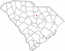
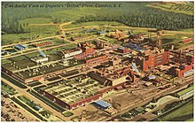
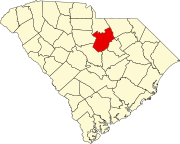
Kershaw County is a county located in the U.S. state of South Carolina. As of the 2020 census, its population was 65,403. The county seat and largest community is Camden. The county was created in 1791 from parts of Claremont, Lancaster, Fairfield, and Richland counties. It is named for Col. Joseph Kershaw (1727–1791), an early settler and American Revolutionary War patriot.

<span class="mw-page-title-main">Fairfield County, South Carolina</span> County in South Carolina, United States

Fairfield County is a county located in the U.S. state of South Carolina. As of the 2020 census, its population was 20,948. Its county seat is Winnsboro.

<span class="mw-page-title-main">Aiken, South Carolina</span> City in South Carolina, United States

Aiken is the most populous city in, and the county seat of, Aiken County, South Carolina, United States. According to 2020 census, the population was 32,025, making it the 15th-most populous city in South Carolina, and one of the two largest cities of the Central Savannah River Area.

<span class="mw-page-title-main">Blacksburg, South Carolina</span> Town in South Carolina, United States

Blacksburg is a small town in Cherokee County, South Carolina, United States. The population was 1,848 at the 2010 census. The communities of Cherokee Falls, Kings Creek, Cashion Crossroads, Buffalo, and Mount Paran are located near the town.

<span class="mw-page-title-main">Cheraw, South Carolina</span> Town in South Carolina, United States

Cheraw is a town on the Pee Dee River in Chesterfield County, South Carolina, United States. The population was 5,040 at the 2020 census. The greater Cheraw area in the zip code 29520 has a population of 13,689 according to the 2019 ACS data. It has been nicknamed "The Prettiest Town in Dixie".

<span class="mw-page-title-main">Jefferson, South Carolina</span> Town in South Carolina, United States

Jefferson is a town in western Chesterfield County, South Carolina, United States at the junction of SC routes 265 and 151. Jefferson is located in the Piedmont region of South Carolina just in the edge meeting the Sandhills region. Jefferson is located 16 miles northwest of McBee, 8 miles south of Pageland, 50 miles southeast of Charlotte, North Carolina, and 70 miles north-northeast of the state capitol Columbia. As of the 2010 census, the city population was 753.

<span class="mw-page-title-main">McBee, South Carolina</span> Town in South Carolina, United States

McBee is a town in Chesterfield County, South Carolina, United States. As of the 2010 census, the population was 867. McBee is approximately 36 miles (58 km) northwest of Florence and 62 miles (100 km) northeast of Columbia.

<span class="mw-page-title-main">Pageland, South Carolina</span> Town in South Carolina, United States

Pageland is a town in Chesterfield County, South Carolina, United States. It is the second largest town in Chesterfield County. The population was 2,760 at the 2010 census.

<span class="mw-page-title-main">Mauldin, South Carolina</span> City in South Carolina, United States

Mauldin is a city in Greenville County, South Carolina, United States. The population was 24,724 at the 2020 census, making it the 19th-most populous city in South Carolina. It is located in the Greenville-Anderson-Greer, SC Metropolitan Statistical Area.

<span class="mw-page-title-main">Bethune, South Carolina</span> Town in South Carolina, United States

Bethune is a small town in Kershaw County, South Carolina, United States. The population was 334 at the 2010 census. It is part of the Columbia, South Carolina Metropolitan Statistical Area.

Elgin is an incorporated town in Kershaw County, South Carolina, United States. Some portions of the town are in adjacent Richland County, South Carolina. It is located approximately 20 miles (32 km) northeast of the center of Columbia, the state's capital, and is the center of one of the ten townships that make up Kershaw County. As of the 2010 census, the town's population was 1,311, and in 2018 the estimated population was 1,579. It is part of the Columbia, South Carolina Metropolitan Statistical Area.

<span class="mw-page-title-main">Lugoff, South Carolina</span> Census-designated place in South Carolina, United States

Lugoff is an unincorporated community and census-designated place (CDP) in Kershaw County, South Carolina, United States. The population was 9,990 at the 2020 census, up from 7,434 at the 2010 census. It is part of the Columbia, South Carolina Metropolitan Statistical Area.

<span class="mw-page-title-main">Kershaw, South Carolina</span> Town in South Carolina, United States

Kershaw is a town in Lancaster County, South Carolina, United States. It was incorporated in 1888. As of the 2010 census, the population was 1,803, and as of 2019 the estimated population was 2,321. The Haile Gold Mine, where gold was discovered in 1825, is 3 miles (5 km) from town and was at one time the largest single producer of gold in the Appalachian region.

<span class="mw-page-title-main">Camden, Tennessee</span> City in Tennessee, United States

Camden is a city in Benton County, Tennessee. The population was 3,674 at the 2020 census. It is the county seat of Benton County.

<span class="mw-page-title-main">Wateree River</span> River in South Carolina, United States

The Wateree River, about 75 mi (120 km) long, is a tributary of the Santee River in central South Carolina in the United States, which flows to the Atlantic Ocean. It was named for the Wateree Native Americans, a tribe who had migrated to this area from western North Carolina. They lived here until the early 18th century, when they were set upon and displaced by mostly English settlers during the Yamasee War. Survivors merged with the larger Catawba people, becoming extinct as a tribe.

<span class="mw-page-title-main">Columbia metropolitan area, South Carolina</span>

As defined by the U.S. Office of Management and Budget, and used by the U.S. Census Bureau for statistical purposes only, the Columbia, SC Metropolitan Statistical Area, is an area consisting of six counties in central South Carolina, anchored by the city of Columbia. The current population has an estimation of 837,092. It is the second-largest metropolitan statistical area in the state of South Carolina, since the Anderson metropolitan statistical area was combined with Greenville's following the 2010 census.

East Camden is an unincorporated area and census-designated place (CDP) in Kershaw County, South Carolina, United States. It was first listed as a CDP prior to the 2020 census with a population of 3,215.

References

  1. "ArcGIS REST Services Directory". United States Census Bureau. Retrieved October 15, 2022.
  2. 1 2 "Census Population API". United States Census Bureau. Retrieved October 15, 2022.
  3. 1 2 "U.S. Census website". United States Census Bureau . Retrieved January 31, 2008.
  4. "US Board on Geographic Names". United States Geological Survey. October 25, 2007. Retrieved January 31, 2008.
  5. "Camden City, South Carolina Census Quick Facts". census.gov.
  6. "Camden city, South Carolina; United States". census.gov. United States Census Bureau. Retrieved June 3, 2023.
  7. "History of Camden, South Carolina". historiccamden.org. Archived from the original on June 26, 2022. Retrieved July 7, 2022.
  8. "Geographic Identifiers: 2010 Census Summary File 1 (G001), Camden city, South Carolina". American FactFinder. U.S. Census Bureau. Archived from the original on February 13, 2020. Retrieved April 17, 2019.
  9. Charles Hudson (September 1998). Knights of Spain, Warriors of the Sun: Hernando de Soto and the South's Ancient Chiefdoms. University of Georgia Press. pp. 234–238. ISBN   978-0-8203-2062-5 . Retrieved February 16, 2012.
  10. Federal Writers' Project (1941). Palmetto Place Names. Sloane Printing Co. p. 31.
  11. Meriwether, Colyer (1972) [1889]. History of Higher Education in South Carolina (Reprinted from original ed.). Spartanburg, South Carolina: The Reprint Company. pp. 54–55. ISBN   0871520974.
  12. "History of Orion, Details Of Camden Plant." The State. June 16, 1950. Received from https://dspace.ychistory.org/bitstream/handle/11030/71910/00000929.pdf?sequence=1
  13. "DuPont May Plant in Camden, South Carolina". Hagley Digital Archives . Retrieved June 26, 2020.
  14. Iritani, Evelyn (July 31, 2005). "Fostering Goodwill With Jobs". Los Angeles Times. Retrieved June 14, 2023.
  15. "Current intelligence bulletin 18 - acrylonitrile". October 16, 2018. doi:10.26616/NIOSHPUB7812718 (inactive April 19, 2024).{{cite journal}}: Cite journal requires |journal= (help)CS1 maint: DOI inactive as of April 2024 (link)
  16. Colby, Gerard, 1945- (1984). Du Pont dynasty. Colby, Gerard, 1945-. Secaucus, N.J.: L. Stuart. ISBN   0-8184-0352-7. OCLC   10725106.{{cite book}}: CS1 maint: multiple names: authors list (link) CS1 maint: numeric names: authors list (link)
  17. 1 2 "Du Pont plans to discontinue Orlon fiber". UPI. Retrieved June 26, 2020.
  18. "Haier Group — Camden, South Carolina | Trade and Industry Development". www.tradeandindustrydev.com. Retrieved June 14, 2023.
  19. Kirkland, Thomas J.; Kennedy, Robert Macmillan (1965). "Historic Camden: Nineteenth century".
  20. "Explore Census Data". data.census.gov. Retrieved December 13, 2021.
  21. "Locations & Hours". Greenville County Library System. Retrieved June 8, 2019.
  22. "Irish Fest Camden". IrishFest Camden. Retrieved January 10, 2022.
  23. "Revolutionary War Field Days – Historic Camden Foundation" . Retrieved January 10, 2022.
  24. O'Mara, Dan (May 6, 2014). "Winthrop alum Lois Rhame West, former SC first lady and 'bright light,' dies". The Herald (Rock Hill) . Archived from the original on July 14, 2014. Retrieved July 13, 2014.

Further reading