Suitland-Silver Hill, Maryland

Last updated
Suitland-Silver Hill, Maryland
Census Bureau headquarters, Suitland, Maryland, 2007.jpg
The United States Census Bureau headquarters in March 2007.
Prince George's County Maryland Incorporated and Unincorporated areas Suitland-Silver Hill Highlighted.svg
Location of Suitland-Silver Hill, Maryland
Coordinates: 38°51′2″N76°55′25″W / 38.85056°N 76.92361°W / 38.85056; -76.92361
Country Flag of the United States.svg United States
State Flag of Maryland.svg  Maryland
County Flag of Prince George's County, Maryland (1963-present).svg Prince George's
Area
  Total5.6 sq mi (14.4 km2)
  Land5.6 sq mi (14.4 km2)
  Water0.0 sq mi (0.0 km2)
Population
 (2000)
  Total33,515
  Density6,008.0/sq mi (2,319.7/km2)
Time zone UTC−5 (Eastern (EST))
  Summer (DST) UTC−4 (EDT)
FIPS code 24-75762

Suitland is a suburb of Prince George's County, Maryland, approximately one mile (1.6 km) southeast of Washington, D.C., 10 miles from Alexandria, Virginia and 8.3 miles from National Harbor, Maryland . Rich in history and culture, Suitland offers plenty for residents and visitors to explore. Suitland is a census designated place (CDP) and as of the 2020 census, its population was 25,839. Prior to 2010, it was part of the Suitland-Silver Hill census-designated place.

Contents

Additionally, Suitland Federal Center houses the national headquarters of the United States Census Bureau, among other government agencies.

Committed to elevating the quality of life for residents, Suitland Citizens Association has made great strides in building trust within the community and the Suitlandfest Community Development Corporation create engaging recreational opportunities, fostering cultural enrichment, and driving socio-economic advancement.

Geography

Suitland-Silver Hill is located at 38°51′2″N76°55′25″W / 38.85056°N 76.92361°W / 38.85056; -76.92361 (38.850462, 76.923742). [1]

According to the United States Census Bureau, the CDP had a total area of 5.6 square miles (15 km2), all of it land.

Demographics

Historical population
CensusPop.Note
1970 30,355
1980 32,1646.0%
1990 35,1119.2%
2000 33,515−4.5%
2010 31,775−5.2%
source: [2]

As of the census [3] of 2000, there were 33,515 people, 13,149 households, and 8,652 families residing in the CDP. The population density was 6,008.0 inhabitants per square mile (2,319.7/km2). There were 14,379 housing units at an average density of 2,577.6 per square mile (995.2/km2). The racial makeup of the CDP was 3.86% White, 93.01% African American, 0.31% Native American, 0.60% Asian, 0.03% Pacific Islander, 0.64% from other races, and 1.56% from two or more races. Hispanic or Latino of any race were 1.86% of the population.

There were 13,149 households, out of which 39.9% had children under the age of 18 living with them, 25.8% were married couples living together, 33.5% had a female householder with no husband present, and 34.2% were non-families. 27.5% of all households were made up of individuals, and 4.4% had someone living alone who was 65 years of age or older. The average household size was 2.55 and the average family size was 3.08.

In the CDP, the population was spread out, with 32.2% under the age of 18, 9.8% from 18 to 24, 34.8% from 25 to 44, 18.3% from 45 to 64, and 5.0% who were 65 years of age or older. The median age was 30 years. For every 100 females, there were 78.7 males. For every 100 females age 18 and over, there were 70.0 males.

The median income for a household in the CDP was $41,870, and the median income for a family was $43,635. Males had a median income of $33,633 versus $31,460 for females. The per capita income for the CDP was $19,031. About 9.3% of families and 10.7% of the population were below the poverty line, including 14.2% of those under age 18 and 9.5% of those age 65 or over.

Transportation

The community is served by three Washington Metro stations Naylor Road , Suitland and Branch Avenue on the Green Line (Washington Metro).

Education

The area is served by Prince George's County Public Schools, and zoned to Suitland High School, Drew Freeman Middle School, Suitland Elementary School.

Related Research Articles

<span class="mw-page-title-main">Brooklyn Park, Maryland</span> Census-designated place in Maryland, United States

Brooklyn Park is a census-designated place (CDP) in Anne Arundel County, Maryland, United States. The population was 14,373 at the 2010 census.

<span class="mw-page-title-main">Hillsmere Shores, Maryland</span> Former census-designated place in Maryland, United States

Hillsmere Shores was a census-designated place (CDP) in Anne Arundel County, Maryland, United States. It is a suburb of Annapolis. The population was 2,977 at the 2000 census. It was included in the Annapolis Neck CDP at the 2010 census. Built in phases, beginning in 1960, the community has been home to The Key School, a non-sectarian private school, since the 1960s.

<span class="mw-page-title-main">Selby-on-the-Bay, Maryland</span> Former census-designated place in Maryland, United States

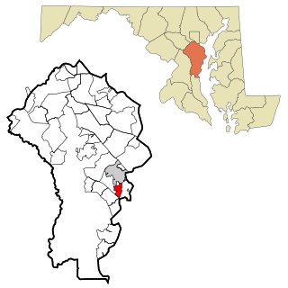
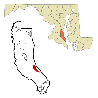
Selby-on-the-Bay is a census-designated place (CDP) in Anne Arundel County, Maryland, United States, for the 2000 census, at which time its population was 3,674. It was added to the Mayo CDP for the 2010 census.

<span class="mw-page-title-main">Rossville, Maryland</span> Census-designated place in Maryland, United States

Rossville is an unincorporated community and census-designated place in Baltimore County, Maryland, United States. The population was 15,147 at the 2010 census.

<span class="mw-page-title-main">St. Leonard, Maryland</span> Census-designated place in Maryland

St. Leonard is a census-designated place (CDP) in Calvert County, Maryland, United States. The population was 742 at the 2010 census. Residents of the Calvert Beach and Long Beach communities also use the St. Leonard ZIP code designation.

<span class="mw-page-title-main">Bennsville, Maryland</span> Census-designated place in Maryland, United States

Bennsville is a census-designated place (CDP) in Charles County, Maryland, United States. Per the 2020 census, the population was 15,288. The area is not an official postal designation, but is part of the Waldorf or Pomfret postal area. The Bennsville area is growing with new residential development, encouraged by the extension in the 1990s of Maryland Route 228 which provides quick access to Maryland Route 210. Bennsville has experienced the 2006 opening of North Point High School and the straightening of Middletown Road in 2008.

<span class="mw-page-title-main">Camp Springs, Maryland</span> Census-designated place in Maryland

Camp Springs is an unincorporated area and census-designated place (CDP) in Prince George's County, Maryland, United States. The population was 22,734 at the 2020 census. Camp Springs is not an official post office designation; the area is divided among the surrounding mailing addresses of Temple Hills, Fort Washington, Clinton, and Suitland.

<span class="mw-page-title-main">Coral Hills, Maryland</span> Census-designated place in Maryland

Coral Hills is an unincorporated area and census-designated place (CDP) in Prince George's County, Maryland, United States. As of the 2020 census, the population was 9,997.

<span class="mw-page-title-main">East Riverdale, Maryland</span> Census-designated place in Maryland, United States

East Riverdale is an unincorporated area and census-designated place (CDP) in Prince George's County, Maryland, United States. The population was 18,459 at the 2020 census.

<span class="mw-page-title-main">Forestville, Maryland</span> CDP in Maryland

Forestville is an unincorporated area and census-designated place (CDP) in Prince George's County, Maryland, United States. Per the 2020 census, the population was 12,831. The community is a mixture of garden apartments, single-family homes, and shopping centers built mostly from the 1930s through 1970s, adjacent to the communities of District Heights, Suitland, Morningside, Westphalia and Camp Springs.

<span class="mw-page-title-main">Friendly, Maryland</span> Census-designated place in Maryland

Friendly is an unincorporated area and census-designated place (CDP) in Prince George's County, Maryland, United States, with an African-American majority population, located a few miles south of Washington, D.C. The population was 9,937 at the 2020 census.

<span class="mw-page-title-main">Goddard, Maryland</span> Unincorporated community in Maryland

Goddard is an unincorporated community and former census-designated place (CDP) in Prince George's County, Maryland, United States. It was named after the physicist Robert H. Goddard. The population was 5,554 in the 2000 census. The area was no longer a census-designated place as of the 2010 census.

<span class="mw-page-title-main">Hillcrest Heights, Maryland</span> CDP in Maryland

Hillcrest Heights is an unincorporated area and census-designated place (CDP) in Prince George's County, Maryland, United States. The population was 15,793 at the 2020 census. For mailing address purposes, it is part of the smaller community of Temple Hills and is also near Suitland.

<span class="mw-page-title-main">Marlow Heights, Maryland</span> Census-designated place in Maryland, United States

Marlow Heights is an unincorporated area and census-designated place (CDP) in Prince George's County, Maryland, United States. The population was 6,169 at the 2020 census. The Marlow Heights Shopping Center first opened in 1957, adjacent to the large community of Hillcrest Heights. It was joined ten years later, in 1967, by the two-level Iverson Mall, the Washington metropolitan area's first enclosed mall.

<span class="mw-page-title-main">South Laurel, Maryland</span> Census-designated place in Maryland

South Laurel is an unincorporated area and census-designated place (CDP) in Prince George's County, Maryland, United States. Per the 2020 census, the population was 29,602.

<span class="mw-page-title-main">Walker Mill, Maryland</span> Census-designated place in Maryland

Walker Mill is an unincorporated area and census-designated place (CDP) in Prince George's County, Maryland, United States. Per the 2020 census, the population was 12,187.

<span class="mw-page-title-main">Woodlawn, Prince George's County, Maryland</span> Census-designated place in Maryland

Woodlawn is an unincorporated area and census-designated place (CDP) in Prince George's County, Maryland, United States. As of the 2020 census it had a population of 7,541.

<span class="mw-page-title-main">Charlotte Hall, Maryland</span> CDP in Maryland, United States

Charlotte Hall is a census-designated place (CDP) in Charles and St. Mary's counties, Maryland, United States. The population was 1,420 at the 2010 census. The Maryland Veterans Home for disabled veterans, is located on the site of the former Charlotte Hall Military Academy. The Academy site was declared the Charlotte Hall Historic District, and listed on the National Register of Historic Places in 1975. Since 1940, a sizable Amish farming community has existed nearby, along with a farmers' market and large flea market complex on Maryland Route 5, which is also the site of numerous strip-mall businesses continuing into the adjacent community of Mechanicsville. A U.S. Veterans Affairs clinic is across the highway from the Veterans Home.

<span class="mw-page-title-main">Tilghman Island, Maryland</span> CDP in Maryland, United States

Tilghman Island is an island in the Chesapeake Bay. It is part of Talbot County, Maryland, United States.

<span class="mw-page-title-main">Newark, Maryland</span> CDP in Maryland, United States

Newark is a census-designated place (CDP) in Worcester County, Maryland, United States. The population was 339 at the 2000 census. It is part of the Salisbury, Maryland-Delaware Metropolitan Statistical Area.

References

  1. "US Gazetteer files: 2010, 2000, and 1990". United States Census Bureau. 2011-02-12. Retrieved 2011-04-23.
  2. "CENSUS OF POPULATION AND HOUSING (1790-2000)". U.S. Census Bureau . Retrieved 2010-07-18.
  3. "U.S. Census website". United States Census Bureau . Retrieved 2008-01-31.