
The Hubert H. Humphrey Metrodome was a domed sports stadium located in downtown Minneapolis, Minnesota. It opened in 1982 as a replacement for Metropolitan Stadium, the former home of the National Football League's (NFL) Minnesota Vikings and Major League Baseball's (MLB) Minnesota Twins, and Memorial Stadium, the former home of the Minnesota Golden Gophers football team.

Memorial Stadium, also known as the "Brick House", was an outdoor athletic stadium in the north central United States, located on the campus of the University of Minnesota in Minneapolis. It was the home of the Minnesota Golden Gophers football team for 58 seasons, from 1924 through 1981. Prior to 1924, the Gophers played at Northrop Field.

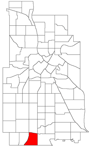
The Central neighborhood of Minneapolis, Minnesota, United States is located south of the downtown region of the city. It is bounded by Lake Street on the north, Chicago Avenue on the east, 38th Street on the south, and Interstate 35W on the west. It should not be confused with the Central community, which covers Downtown and some surrounding neighborhoods.

U.S. Bank Stadium station station is a light rail station on the Metro Blue Line and Green Line in Minneapolis, Minnesota.

The Diamond Lake neighborhood is in the Nokomis community in Minneapolis. It is bounded by Diamond Lake Road and 55th Street on the north, Cedar Avenue on the east, 62nd Street on the south, and Interstate 35W on the west. It is a part of Ward 11, currently represented by city council member Emily Koski.
The Windom neighborhood is located in the Southwest community of Minneapolis. Its borders are Diamond Lake Road and West 54th Street to the north, Interstate 35W to the east, West 62nd Street to the south, and Lyndale Avenue South and Highway 121 to the west. Windom is a part of Ward 11, currently represented by Minneapolis City Council member Emily Koski.

Interstate 35E (I-35E) is an Interstate Highway in the US state of Minnesota, passing through downtown Saint Paul. It is one of two through routes for I-35 through the Twin Cities of Minneapolis and Saint Paul, the other being I-35W through Minneapolis. Thus, both ends of I-35E are shared with I-35W and I-35.

Interstate 35W (I-35W) is an Interstate Highway in the US state of Minnesota, passing through downtown Minneapolis. It is one of two through routes for I-35 through the Twin Cities of Minneapolis and Saint Paul, the other being I-35E through downtown Saint Paul.

Bancroft is a neighborhood within the Powderhorn community in Minneapolis, Minnesota, United States. Its boundaries are East 38th Street to the north, Chicago Avenue to the west, East 42nd Street to the south and Cedar Avenue to the east. It is entirely located within Minneapolis City Council Ward 8, represented by Andrea Jenkins.

Stadium Village is an area of Minneapolis, Minnesota near the East Bank campus of the University of Minnesota. While not an official neighborhood of Minneapolis, the area is an important commercial district that serves university students with many bars and restaurants. There are plans to incorporate it into an official neighborhood of Minneapolis along with the surrounding area. It is part of Southeast Minneapolis, that part of Minneapolis on the East Bank of the Mississippi River and south of Hennepin Avenue
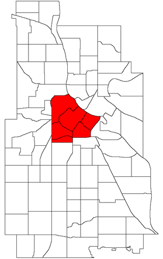
Central is a defined community in Minneapolis that consists of six smaller official neighborhoods around the downtown and central business core. It also includes the many old flour mills, the Mill District, and other historical and industrial areas of downtown Minneapolis. It also includes some high-density residential areas surrounding it, excluding areas east of the Mississippi River. Businesses and government buildings are based in the Central area include the corporate headquarters of the Star Tribune, Target, US Bancorp, the Hennepin County Government Center, Minneapolis Central Library, Minneapolis City Hall, and the broadcast facilities of the Minnesota CBS station WCCO-TV.

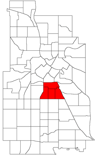
Downtown West is an official neighborhood in Minneapolis, part of the larger Central community. It is the heart of downtown Minneapolis, containing the bulk of high-rise office buildings in the city, and is what comes to mind when most Minneapolitans think of "downtown". The neighborhood is split between Wards 3 and 7 of the Minneapolis City Council, represented by Michael Rainville and Katie Cashman, respectively.
Phillips is a community in Minneapolis, just south of downtown. Traditionally, it was both a community and a neighborhood. Phillips is a diverse area in many ways: its population includes people of many nationalities; it has a mix of residential, commercial and industrial uses; and it is home to several large employers such as Abbott Northwestern Hospital, Wells Fargo Mortgage and Allina Health Care Services, along with small neighborhood businesses.

Marcy-Holmes is a neighborhood in the University community of Minneapolis. The majority of the area is residential and sits upon a bluff overlooking the river and the city skyline. A small section of the neighborhood along the river is an industrial zone.

Como is a neighborhood within the University community of Minneapolis. It is sometimes referred to as Southeast Como, due to many of its streets ending in SE, and possibly to differentiate it from the Como neighborhood in neighboring Saint Paul. Its boundaries are East Hennepin Avenue to the north, 33rd Avenue Southeast to the east, the Southeast Industrial Area to the south, and Interstate 35W to the west.

Lyndale is a neighborhood within the Powderhorn community in south Minneapolis, Minnesota, United States. Its boundaries are Lake Street to the north, Interstate 35W to the east, 36th Street to the south and Lyndale Avenue South to the west.

Page is a neighborhood in the Nokomis community in Minneapolis. Its boundaries are the Minnehaha Creek to the north, Chicago Avenue to the east, Diamond Lake Road and East 55th Street to the south, and Interstate 35W to the west. It is located within Ward 11, currently represented by city council member Emily Koski.

The Mill District is a neighborhood within Minneapolis, Minnesota, United States, and a part of the larger Downtown East neighborhood. The neighborhood contains several former flour mills left over from the days when Minneapolis was the flour milling capital of the world. With almost none of the mills still active, a number of these have been converted into condominiums leading to a revitalization of the neighborhood.

Powderhorn is a defined community in Minneapolis, that consists of eight neighborhoods. The greater Powderhorn community is named after Powderhorn Park.

Samatar Crossing is a 1,850-foot (560 m), shared-use path and innovative urban redesign project in Minneapolis, Minnesota, United States. Posthumously named after Somali-American politician and activist Hussein Samatar, the crossing connects the Downtown East/Elliot Park and Cedar-Riverside neighborhoods via a former interstate highway ramp. The Samatar Crossing redevelopment project received national recognition when it opened in 2018.

