Stevens Square, Minneapolis

Last updated

Stevens Square-Loring Heights
Stevens Community Apartments, 128 18th Street East.jpg
Stevens Court, the oldest contributing building in the Stevens Square Historic District, built in 1913.
MinneapolisStevensSquareLoringHeightsNeighborhood.PNG
Location of Stevens Square/Loring Heights within the U.S. city of Minneapolis
Coordinates: 44°57′53″N93°16′29″W / 44.96472°N 93.27472°W / 44.96472; -93.27472
Country United States
State Minnesota
County Hennepin
City Minneapolis
Community Central
City Council Wards6, 7
Government
  Council Member Jamal Osman
  Council Member Katie Cashman
Area
[1]
  Total0.187 sq mi (0.48 km2)
Elevation
863 ft (263 m)
Population
 (2020) [2]
  Total4,137
  Density22,000/sq mi (8,500/km2)
Time zone UTC-6 (CST)
  Summer (DST) UTC-5 (CDT)
ZIP code
55403, 55404, 55405
Area code 612
Stevens Square Historic District
Stevens Square HD.jpg
Two 1915 apartment buildings typical of Stevens Square
USA Minnesota location map.svg
Red pog.svg
Usa edcp location map.svg
Red pog.svg
Location Minneapolis, Minnesota
Built1912
ArchitectMultiple
Architectural styleLate 19th and 20th Century Revivals, Renaissance, Gothic Revival
NRHP reference No. 93000594 [3]
Added to NRHPJuly 1, 1993
Historical population
CensusPop.Note
1980 3,827
1990 4,43315.8%
2000 3,948−10.9%
2010 3,833−2.9%
2020 4,1377.9%

Stevens Square (officially Stevens Square-Loring Heights) is the southernmost neighborhood of the Central community in Minneapolis. It is bordered on Lyndale Avenue on the west, Franklin Avenue on the south, and Interstates 94 and 35W on the north and east, respectively. The portion west of Nicollet Avenue can be referred to as Loring Heights; the portion to the East as Stevens Square. [4]

Contents

Although it is one of the densest neighborhoods in Minneapolis today, Stevens Square-Loring Heights was originally occupied by a few large mansions. Today, the area is composed mostly of old brownstone apartment buildings or mansions that have been subdivided into apartments, giving the neighborhood a heavy population density within its small geographical area; a short and wide neighborhood, it is nearly a mile long but only three blocks tall. Much of the neighborhood is a National Historic District, and five of the apartment buildings were listed on the National Register of Historic Places in 1993. [5]

Although Stevens Square faced many of the same challenges which confronted other inner-city neighborhoods through the 1990s, the neighborhood has seen significant increases in safety and average income in recent years. These have been attributed both to a successful Neighborhood Revitalization Program and to limited gentrification, with many apartments buildings converted to condominiums or co-ops.

History

Before the arrival of European settlers, the area was inhabited by Dakota Sioux. Although the area was platted in 1856, it remained sparsely occupied for several decades. Most land in the area was purchased by Richard Mendenhall, who developed the land into a small number of large houses and several massive greenhouses, which supplied Mendenhall's floral business. However, the neighborhood's central location and the rapid growth of the city in the 1890s, facilitated by the introduction of horse-drawn and then electric streetcars which passed through the area on several streets, made the area an increasingly attractive area for redevelopment.

In 1907, the property owners, along with one of the biggest property developers in town, petitioned the Park Board to purchase the site of Stevens Square Park, whose irregular grade made development impractical. The Park Board quickly accepted the offer, purchasing the site for $41,820, financed partly by an assessment on local landowners. [6] The park was named in honor of Col. John H. Stevens, the first authorized settler on the west bank of what would eventually become Minneapolis. Construction on the Abbott Hospital, now converted to apartments, began in 1910. Apartment construction soon followed, largely in the Renaissance Revival style set by Stevens Court. Most buildings were constructed to the limits of fire codes at the time, maximizing land coverage and density while building to the three and a half story limits established for non-fire safe construction.

Most of the older buildings in the neighborhood were constructed by the mid-1920s, when a slump in the housing market combined with a lack of available land drastically slowed the pace of further construction. Although the neighborhood was originally inhabited primarily by middle-class office workers and single women, by the mid-century the rise of the automobile and white flight to the growing suburbs led to significant decline, as average incomes in the neighborhood dropped precipitously. Although spared from destruction by the construction of Interstate 35W, originally planned to pass directly through the center of the neighborhood, the two new Interstates isolated the neighborhood from downtown except by a few bridges on major arterials. Several large high-rise public housing projects were completed in the 1960s, which contributed to the reputation of the neighborhood as dangerous and low-income.

Starting in the 1970s, however, an active neighborhood organization and interested landowners began working actively to revitalize the neighborhood, renovating many buildings and addressing quality-of-life issues in the neighborhood. Much of that renovation was financed by General Mills, which believed there were significant profits to be made in revitalizing the inner city, although disappointing financial returns led the company to divest from the project in 1980. [7] A successful block patrol program was set up, and in 1994 the Emily Peake Memorial Garden was established at the corner of Third Avenue and 19th St, in part to discourage what was then a favorite location for drug sales. In recent decades, crime has declined precipitously, although some quality-of-life problems persist.

Transportation

Several important arterial streets pass through the neighborhood, including Nicollet Avenue (Eat Street), First Avenue, and Franklin Avenue. In addition, the neighborhood has easy access to nearby Interstate highways, and to downtown Minneapolis, located less than a mile to the north.

In addition, the neighborhood is served by several important transit lines, including the high-frequency 18 bus on Nicollet, as well as the 2 (on Franklin Ave), the 11 (on 3rd Ave S), and the 17 (also on Nicollet Ave). Although the neighborhood was considered as part of the routing for the METRO Green Line extension, an alternate route (bypassing the neighborhood) was chosen. The planned Nicollet-Central Streetcar would pass directly through the neighborhood.

In addition, there is a Nice Ride station located at the corner of Franklin and Nicollet, providing easy access to the city's bike sharing system.

Government

The half of the neighborhood east of Nicollet Avenue (Stevens Square) is part of City Council Ward 6, while the part to the west (Loring Heights) is in Ward 7. The whole neighborhood is represented in the Minnesota State House of Representatives in district 62A, in the Minnesota State Senate in district 62, and in the United States House of Representatives in Minnesota's 5th congressional district.

Representatives

Landmarks and attractions

Several buildings within the neighborhood are listed on the National Register of Historic Places. These include the historic Amos B. Coe House on Third Avenue, which is home to the Minnesota African American History Museum and Cultural Center; the Abbott Hospital, now apartments, displays an architectural view of the progression of the medical industry, and the George W. and Nancy B. Van Dusen House, a Richardsonian Romanesque mansion now used as an event space.

The bells of the historic Plymouth Congregational Church, located in the center of the neighborhood, can be heard by a wide radius in the area. There are several restaurants and coffee shops in the neighborhood and four small corner grocery stores. The neighborhood is in walking distance of the many restaurants of Eat Street in Whittier, as well as those in Loring Park.

See also

Related Research Articles

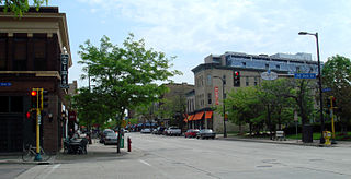
Nicollet Mall is a twelve-block portion of Nicollet Avenue running through Downtown Minneapolis, Minnesota, United States. It is a shopping and dining district of the city, and also a pedestrian mall and transit mall. Along with Hennepin Avenue to the west, Nicollet Mall forms the cultural and commercial center of Minneapolis.

<span class="mw-page-title-main">Nicollet Avenue</span>

Nicollet Avenue is a major street in Minneapolis, Richfield, Bloomington, and Burnsville in the U.S. state of Minnesota. It passes through a number of locally well-known neighborhoods and districts, notably Eat Street in south Minneapolis and the traffic-restricted Nicollet Mall in downtown Minneapolis.

<span class="mw-page-title-main">North Loop, Minneapolis</span> Neighborhood in Hennepin, Minnesota, United States

The North Loop is a neighborhood in the Central community of Minneapolis.

<span class="mw-page-title-main">Whittier, Minneapolis</span> Neighborhood in Hennepin, Minnesota, United States

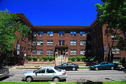
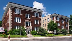
Whittier is a neighborhood within the Powderhorn community in the U.S. city of Minneapolis, Minnesota, bounded by Franklin Avenue on the north, Interstate 35W on the east, Lake Street on the south, and Lyndale Avenue on the west. It is known for its many diverse restaurants, coffee shops and Asian markets, especially along Nicollet Avenue. The neighborhood is home to the Minneapolis Institute of Art, the Minneapolis College of Art and Design, and the Children's Theatre Company.

<span class="mw-page-title-main">Neighborhoods of Minneapolis</span> Official communities and neighborhood of Minneapolis

Minneapolis is officially defined by its city council as divided into 83 neighborhoods. The neighborhoods are historically grouped into 11 communities. Informally, there are city areas with colloquial labels. Residents may also group themselves by their city street suffixes: North, Northeast, South, and Southeast.

<span class="mw-page-title-main">Nicollet Island</span> Island on the Mississippi River in central Minneapolis, Minnesota, USA

Nicollet Island is an island in the Mississippi River just north of Saint Anthony Falls in central Minneapolis, Minnesota. According to the United States Census Bureau the island has a land area of 194,407 square metres (0.075 sq mi) and a 2000 census population of 144 persons. The island makes up a large part of the city-designated Nicollet Island/East Bank neighborhood. The island is named for cartographer Joseph Nicollet, who mapped the Upper Mississippi in the 1830s.

<span class="mw-page-title-main">Lowry Hill East, Minneapolis</span> Neighborhood in Hennepin, Minnesota, United States

Lowry Hill East, also known as the Wedge because of its wedge-like shape, is a neighborhood in southwest Minneapolis, Minnesota, United States, part of the Calhoun Isles community. It is bounded on the east by Lyndale Avenue, on the west by Hennepin Avenue and on the south by Lake Street. Lyndale and Hennepin intersect on the northern side at Interstate 94. This creates a neighborhood roughly triangular in shape.

<span class="mw-page-title-main">Lake Street (Minneapolis)</span>

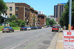
Lake Street is a major east-west thoroughfare between 29th and 31st streets in Minneapolis, Minnesota United States. From its western most end at the city's limits, Lake Street reaches the Chain of Lakes, passing over a small channel linking Bde Maka Ska and Lake of the Isles, and at its eastern most end it reaches the Mississippi River. In May 2020, the Lake Street corridor suffered extensive damage during local unrest following the murder of George Floyd. In August of the same year, city officials designated East Lake Street as one of seven cultural districts to promote racial equity, preserve cultural identity, and promote economic growth.

<span class="mw-page-title-main">Elliot Park, Minneapolis</span> Neighborhood in Hennepin, Minnesota, United States

Elliot Park is a neighborhood within the larger Central community in Minneapolis. It is part of Ward 6 of the Minneapolis City Council, represented by Jamal Osman.

<span class="mw-page-title-main">Saint Anthony Main</span> Commercial area in Minneapolis, Minnesota

Saint Anthony Main is an stretch of buildings on Main Street across from Saint Anthony Falls in the Nicollet Island/East Bank neighborhood of Minneapolis. Commonly the area is associated with Northeast, Minneapolis as it is actually northeast of downtown on the east side of the Mississippi River. It opened as a festival marketplace in the 1980s.

<span class="mw-page-title-main">Loring Park, Minneapolis</span> Neighborhood in Minneapolis, Minnesota, United States

Loring Park is a neighborhood in the Central Community of Minneapolis, Minnesota. Located on the southwest corner of downtown Minneapolis, it also lends its name to Loring Park, the largest park in the neighborhood. The official boundaries of the neighborhood are Lyndale Avenue to the west, Interstate 394 to the north, 12th Street to the northeast, Highway 65 to the east, and Interstate 94 to the south. It is located in Minneapolis City Council Ward 7, represented by Katie Cashman.

<span class="mw-page-title-main">Northeast, Minneapolis</span> Community of Minneapolis

Northeast is a defined community in the U.S. city of Minneapolis that is composed of 13 smaller neighborhoods whose street addresses end in "NE". Unofficially it also includes the neighborhoods of the University community which have "NE" addresses, and the entirety of the Old Saint Anthony business district, which sits on the dividing line of "NE" and "SE" addresses. In the wider community, this business district, which is the oldest settlement in the city, is often identified as the heart of Northeast, in part because it lies across the Mississippi River from Downtown Minneapolis. Northeast is sometimes referred to as "Nordeast", reflecting the history of northern and eastern European immigrants and their language influence.

<span class="mw-page-title-main">Downtown East, Minneapolis</span> Neighborhood in Hennepin, Minnesota, United States

Downtown East is an official neighborhood in Minneapolis, Minnesota, United States. It is in Ward 3, currently represented by council member Michael Rainville.

<span class="mw-page-title-main">Gateway District (Minneapolis)</span> Human settlement in Minneapolis, Minnesota, US

The Gateway District of Minneapolis is centered at the convergence of Hennepin Avenue, Nicollet Avenue, and Washington Avenue. Its borders are not officially designated or recognized, but are visible as the Mississippi River to the northeast, Cedar Lake Trail and the railroad tracks to the northwest, Fifth Avenue South to the southeast. and Fourth Street South to the southwest. The district includes a significant part of the Downtown West neighborhood and abuts the North Loop.

<span class="mw-page-title-main">Robert Lilligren</span> American politician

Robert Lilligren is an American politician and member of the Minnesota Democratic-Farmer-Labor Party. He was an elected member of the Minneapolis City Council. He was first elected in 2001, to represent the 8th Ward of the Minneapolis City Council. Following the defeat of Green Party member Dean Zimmermann, during the 2005 municipal elections, Lilligren represented the 6th Ward of the City of Minneapolis. When first elected to office, Lilligren was serving as a volunteer on eight different community boards and commissions including: vice-chair of Phillips West Neighborhood organization, the Midtown Greenway Coalition, the Hennepin County-appointed I-35W Project Advisory Committee, and as a board member for several affordable housing groups throughout South Minneapolis. He lost his re-election bid in 2013 to Abdi Warsame. He was appointed to the Metropolitan Council by Governor Tim Walz in March 2019.

<span class="mw-page-title-main">Mill District, Minneapolis</span> Area in Minneapolis, Minnesota, United States

The Mill District is an redeveloped former industrial within Minneapolis, Minnesota, United States, and a part of the larger Downtown East neighborhood. The area contains several former flour mills left over from the days when Minneapolis was the flour milling capital of the world. With almost none of the mills still active, a number of these have been converted into condominiums leading to a revitalization of the neighborhood.

<span class="mw-page-title-main">King Field, Minneapolis</span> Neighborhood in Hennepin, Minnesota, United States

King Field is a neighborhood in the Southwest community in Minneapolis, Minnesota. Its boundaries are 36th Street to the north, Interstate 35W to the east, 46th Street to the south, and Lyndale Avenue to the west. King Field, within the King Field neighborhood is a park named after Martin Luther King Jr.

<span class="mw-page-title-main">Healy Block Residential Historic District</span> Historic district in Minnesota, United States

The Healy Block is a historic district of 14 Queen Anne style houses in Minneapolis, Minnesota, United States. The district, listed on the National Register of Historic Places and as a Minneapolis Historic District, is bounded by Second Avenue South, 31st Street, Third Avenue South and 32nd Street. The houses are readily visible from the Lake Street exit off Interstate 35W. The district represents the most intact and concentrated example of Queen Anne style houses by a single builder in Minneapolis.

<span class="mw-page-title-main">Northwestern National Life Insurance Company Home Office</span> United States historic place

The Northwestern National Life Insurance Company Home Office, was also known as the Loring Park Office Building, and is now a 75 unit boutique apartment complex known as 430 Oak Grove located in Minneapolis, Minnesota. It was designed by the architecture firm of Hewitt and Brown in the Beaux-Arts style as the headquarters of the Northwestern National Life Insurance Company. The building was listed on the National Register of Historic Places on July 16, 2012.

<span class="mw-page-title-main">38th Street (Minneapolis)</span> Street in Minneapolis

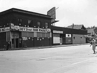
38th Street is a major east-west roadway in the U.S. city of Minneapolis and an officially designated cultural district in the Powderhorn community. The area developed into a residential zone when the Chicago Avenue street car line was extended to East 38th Street in 1880. Since the 1930s, the area has featured many Black-owned businesses, and the surrounding neighborhoods have had distinct histories from other neighborhoods in Minneapolis due to racial settlement patterns that concentrated Black residents there.

References

  1. "Stevens Square neighborhood in Minneapolis, Minnesota (MN), 55403, 55404 detailed profile". City-Data. 2011. Retrieved November 12, 2013.
  2. "Stevens Square-Loring Heights neighborhood data". Minnesota Compass. Retrieved February 19, 2023.
  3. "National Register Information System". National Register of Historic Places . National Park Service. March 15, 2006.
  4. Howard, Liddy J. (May 1997). "Stevens Square-Loring Heights: "A Community Defined"". Abbot's Surgical Hospital. Action Squad. Retrieved April 22, 2024.
  5. "Stevens Square NRP Phase II Neighborhood Action Plan" (PDF). March 5, 2005. Retrieved April 6, 2007.
  6. "History of Minneapolis Parks" (PDF). Archived from the original (PDF) on February 6, 2011.
  7. "History of the Stevens Square-Loring Heights Neighborhood". Stevens Square Community Organization. Retrieved October 5, 2015.

Commons-logo.svg Media related to Stevens Square-Loring Heights, Minneapolis at Wikimedia Commons