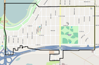
Whittier is a neighborhood within the Powderhorn community in the U.S. city of Minneapolis, Minnesota, bounded by Franklin Avenue on the north, Interstate 35W on the east, Lake Street on the south, and Lyndale Avenue on the west. It is known for its many diverse restaurants, coffee shops and Asian markets, especially along Nicollet Avenue. The neighborhood is home to the Minneapolis Institute of Art, the Minneapolis College of Art and Design, and the Children's Theatre Company.

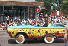
Uptown is a commercial district in southwestern Minneapolis in the U.S. state of Minnesota, that is centered at the intersection of Hennepin Avenue and West Lake Street. It has traditionally spanned the corners of four neighborhoods, Lowry Hill East, East Bde Maka Ska, South Uptown and East Isles neighborhoods, which are all within the Calhoun Isles community. Historically, the boundaries of Uptown are Bde Maka Ska to the west, Dupont Avenue to the east, 31st Street to the south, and 28th Street to the north; though these borders often vary. Uptown is a popular destination for retail, nightlife, and cultural events, and the district was famously written about by recording artist Prince.

The U.S. city of Minneapolis is officially defined by the Minneapolis City Council as divided into eleven communities, each containing multiple official neighborhoods. Informally, there are city areas with colloquial labels. Residents may also group themselves by their city street suffixes, North, Northeast, South, Southeast, and Southwest.

Lowry Hill East is a neighborhood in southwest Minneapolis, Minnesota, United States, part of the Calhoun Isles community. Lowry Hill East developed in the 1880s along a horse-drawn streetcar line built by Thomas Lowry. The interior of the neighborhood is residential, with large early 20th century homes and multi-unit apartment buildings, while the border streets are lined with bars, restaurants, grocery stores, coffeeshops, and other small businesses. Most housing is renter-occupied.
The Southwest Journal was an American, English language free community paper covering 21 neighborhoods in Southwest Minneapolis. It was family owned and was founded in 1990. It covered the following neighborhoods:

South Uptown is a residential neighborhood of Minneapolis, Minnesota. In 2018, the neighborhood voted to change its name to South Uptown from its former name CARAG. Other potential names for the neighborhood included "Bryant Park" and "Bryant Square". The Minneapolis City Council approved the name change in November 2018.
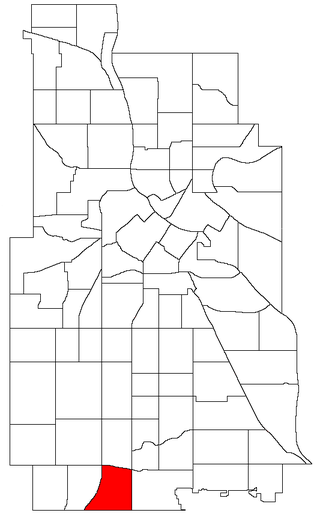
The Windom neighborhood is located in the Southwest community of Minneapolis. Its borders are Diamond Lake Road and West 54th Street to the north, Interstate 35W to the east, West 62nd Street to the south, and Lyndale Avenue South and Highway 121 to the west.

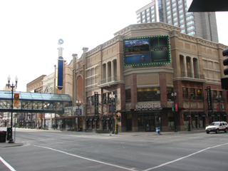
Lake Street is a major east-west thoroughfare between 29th and 31st streets in Minneapolis, Minnesota United States. From its western most end at the city's limits, Lake Street reaches the Chain of Lakes, passing over a small channel linking Bde Maka Ska and Lake of the Isles, and at its eastern most end it reaches the Mississippi River. In May 2020, the Lake Street corridor suffered extensive damage during local unrest over the murder of George Floyd. In August of the same year, city officials designated East Lake Street as one of seven cultural districts to promote racial equity, preserve cultural identity, and promote economic growth.

Lund Food Holdings, Inc is an American supermarket operator. Headquartered in Edina, it owns the upscale supermarket chain Lunds & Byerlys. The company opened its first supermarkets in the Uptown area of Minneapolis. In 2015, it changed its name from Lunds to Lunds & Byerlys. It operates 28 stores in Minneapolis-St. Paul metro area of Minnesota.

Stadium Village is an area of Minneapolis, Minnesota near the East Bank campus of the University of Minnesota. While not an official neighborhood of Minneapolis, the area is an important commercial district that serves university students with many bars and restaurants. There are plans to incorporate it into an official neighborhood of Minneapolis along with the surrounding area. It is part of Southeast Minneapolis, that part of Minneapolis on the East Bank of the Mississippi River and south of Hennepin Avenue

Como is a neighborhood within the University community of Minneapolis. It is sometimes referred to as Southeast Como, due to many of its streets ending in SE, and possibly to differentiate it from the Como neighborhood in neighboring Saint Paul. Its boundaries are East Hennepin Avenue to the north, 33rd Avenue Southeast to the east, the Southeast Industrial Area to the south, and Interstate 35W to the west.
East Harriet is a neighborhood in the Southwest community in Minneapolis. Its boundaries are West 36th Street to the north, Lyndale Avenue South to the east, West 46th Street to the south, and Lake Harriet, Lakewood Cemetery, and William Berry Parkway to the west.
Wenonah is a neighborhood on the southeast side of Minneapolis, Minnesota. Its boundaries are 54th Street to the north, 34th Avenue to the east, the Minneapolis-Saint Paul International Airport to the south, and Cedar Avenue to the west. The neighborhood contains a portion of Lake Nokomis. It shares a neighborhood organization with the Keewaydin, Minnehaha, and Morris Park neighborhoods, which are collectively referred to as Nokomis East and are served by the Nokomis East Neighborhood Association (NENA).

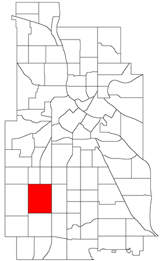
King Field is a neighborhood in the Southwest community in Minneapolis, Minnesota. Its boundaries are 36th Street to the north, Interstate 35W to the east, 46th Street to the south, and Lyndale Avenue to the west. King Field, within the King Field neighborhood is a park named after Martin Luther King Jr.
Lyndale Avenue is a major street in the U.S. state of Minnesota that traverses the cities of Minneapolis, Brooklyn Center, Richfield, and Bloomington. A noncontiguous portion also exists in Faribault, part of Highway 21. There are several commercial districts along the street, including Lyn-Lake in South Minneapolis, Shops at Lyndale in Richfield, and the Oxboro area in Bloomington. Portions of both Interstate 94 and Interstate 35 run on the right-of-way of Lyndale Avenue.

Selby Avenue is a street in Saint Paul, Minnesota, United States, that runs east–west from Summit Avenue near downtown toward the Mississippi River. The street runs through the Summit-University and Union Park neighborhoods. The street, especially between Dale Street and Snelling Avenue, has been associated with Saint Paul's black community. The far eastern end of the street has historically been more densely developed and architecturally significant.

Powderhorn is a community in Minneapolis, which consists of eight different neighborhoods.