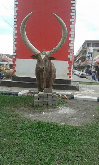
Rukungiri District is a district in the Western Region of Uganda. The town of Rukungiri is the site of the district headquarters.

Kanungu District is a district in the Western Region of Uganda. The town of Kanungu is the site of the district headquarters. The Bwindi Impenetrable Forest in Kanungu District is among the sites shown in aerial footage in the movie Black Panther.

Mbarara City is a city in the Western Region of Uganda and the second largest city in Uganda after Kampala. The city is divided into 6 boroughs of Kakoba Division, Kamukuzi Division, Nyamitanga Division, Biharwe Division, Kakiika Division, Nyakayojo Division. It is the main commercial centre of most of south western districts of Uganda and the site of the district headquarters. In May 2019, the Uganda's cabinet granted Mbarara a city status, which started on 1 July 2020.
Kisoro is a town in the Western Region of Uganda. It is the chief town of Kisoro District and the site of the district headquarters.

Kabale is a town in the Western Region of Uganda. It is the chief town of Kabale District, and the district headquarters are located there.

Kigezi District once covered what are now Kabale District, Kanungu District, Kisoro District and Rukungiri District, in southwest Uganda. Its terraced fields are what gives this part of Uganda its distinctive character. Kigezi was popularly known as the Switzerland of Africa. The coordinates for the region are: Latitude:01 13 20S, 29 53 20E.
Rukungiri is a town in Rukungiri District of the Western Region of Uganda. It is the site of the district headquarters.
Kanungu is a town in the Western Region of Uganda. It is the location of the district headquarters for Kanungu District.
Ntungamo is a town in the Western Region of Uganda. It is the largest town in Ntungamo District and the site of the district headquarters.
Kabale Regional Referral Hospital, commonly known as Kabale Hospital, is a hospital in the town of Kabale in Kabale District, in south-western Uganda. It is the referral hospital for the districts of Kabale, Kanungu, Rubanda, Rukiga, Kisoro and Rukungiri. It is proposed that the hospital will become the teaching hospital of Kabale University once its medical school is established.
Kihihi, also spelt Kihiihi, is a town in Southwestern Uganda. It is the second-largest metropolitan area in Kanungu District, after Kanungu, where the district headquarters are located.
Ankole sub-region is a region in the Western Region of Uganda that consists of the following districts:
Katuna is a town in the Kabale District of Uganda at the border with Rwanda. The town is also called "Gatuna" in the Kinyarwanda language.
Sanga, is an urban center in the Kiruhura District, Ankole sub-region, in the Western Region of Uganda.

Kigezi College Butobere is the first boys-only, boarding, senior secondary school located in Kabale District in the Western Region of Uganda.
The Mbarara–Ntungamo–Kabale–Katuna Road in Western Uganda connects the city of Mbarara, in Mbarara District, with the towns of Ntungamo, Kabale and Katuna at the international border with the Republic of Rwanda.

Rubanda District is a district in the Western Region of Uganda. The largest town in the district, Rubanda, serves as the main administrative and commercial center in the district.
Rukiga District is a district in Western Uganda. Its capital is Mparo. However, the largest urban center in the district is Muhanga.
Muhanga is a town in the Western Region of Uganda. It is the main commercial centre and largest town of Rukiga District. However, the district headquarters are located at Mparo.
The Katuna–Muko Road in the Western Region of Uganda connects the towns of Katuna and Muko, both in Kabale District.


